


National Hurricane Center director talks bout Beryl
The National Hurricane Center is closely monitoring Tropical Storm Beryl as it approaches the Texas Gulf Coastline. FOX 26 Meteorologist John Dawson spoke with the Director of the NOAA National Hurricane Center, Michael Brennan, to get the latest update on the storm.
The National Hurricane Center is closely monitoring Tropical Storm Beryl as it approaches the Texas Gulf Coastline. FOX 26 Meteorologist John Dawson spoke with the Director of the NOAA National Hurricane Center, Michael Brennan, to get the latest update on the storm.

Disaster declaration for Galveston County
A disaster declaration was declared in Galveston as the County prepares for Tropical Storm Beryl to make its way to the Texas coast. FOX 26's Jonathan Mejia has the latest after visiting the island.
A disaster declaration was declared in Galveston as the County prepares for Tropical Storm Beryl to make its way to the Texas coast. FOX 26's Jonathan Mejia has the latest after visiting the island.


Tropical Storm Beryl Texas impact: 81 counties added to disaster declaration
Acting Governor Dan Patrick has added 81 more Texas counties to the state's disaster declaration for Tropical Storm Beryl, bringing the total counties under the alert to 121.
Acting Governor Dan Patrick has added 81 more Texas counties to the state's disaster declaration for Tropical Storm Beryl, bringing the total counties under the alert to 121.


Galveston County under Disaster Declaration as Tropical Storm Beryl approaches
Galveston County Judge Mark Henry has issued a disaster declaration for the county as Tropical Storm Beryl continues its path to the Texas coast.
Galveston County Judge Mark Henry has issued a disaster declaration for the county as Tropical Storm Beryl continues its path to the Texas coast.


Flood Advisory issued for Harris, Fort Bend County
A flood advisory is in effect for Houston area counties including, Harris and Fort Bend, as heavy rain fall begins due to thunderstorms.
A flood advisory is in effect for Houston area counties including, Harris and Fort Bend, as heavy rain fall begins due to thunderstorms.
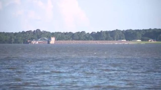

Lake Houston to be lowered ahead of Tropical Storm Beryl
Tropical Storm Beryl is expected to bring heavy rain to the Houston area on Monday leading officials to begin lowering the levels of Lake Houston.
Tropical Storm Beryl is expected to bring heavy rain to the Houston area on Monday leading officials to begin lowering the levels of Lake Houston.


Tropical Storm Beryl tracker: Update on Texas, Houston impacts, path, hurricane warning
Tropical Storm Beryl tracker including the latest update on path, location, a tracking map, hurricane watch and how it may impact Texas and Houston.
Tropical Storm Beryl tracker including the latest update on path, location, a tracking map, hurricane watch and how it may impact Texas and Houston.


Tropical Storm Beryl: Hurricane Watch issued for Texas Coast; watches, warnings
The National Hurricane Center has issued a Hurricane Watch for the Texas coast, extending from the mouth of the Rio Grande River all the way north to Sargent, Texas in Matagorda County. A tropical storm warning and storm surge warning are also in effect.
The National Hurricane Center has issued a Hurricane Watch for the Texas coast, extending from the mouth of the Rio Grande River all the way north to Sargent, Texas in Matagorda County. A tropical storm warning and storm surge warning are also in effect.

Tropical Storm Beryl update: Path, Texas impacts
FOX 26 Chief Meteorologist Mike Iscovitz has the latest update on Tropical Storm Beryl, its path and impacts to the Texas and Houston area.
FOX 26 Chief Meteorologist Mike Iscovitz has the latest update on Tropical Storm Beryl, its path and impacts to the Texas and Houston area.

FOX 26 Houston Weather Forecast
Stay connected over the weekend as Beryl is headed to the Texas coast. Scattered showers/storms on Saturday and Sunday with warm temperatures before Beryl makes impacts late on Sunday. Look for strong winds near that landfall with heavy rainfall a concern for everyone Monday, Tuesday, and Wednesday. Check in with FOX LOCAL the app for your smart TV for the latest updates on this tropical system.
Stay connected over the weekend as Beryl is headed to the Texas coast. Scattered showers/storms on Saturday and Sunday with warm temperatures before Beryl makes impacts late on Sunday. Look for strong winds near that landfall with heavy rainfall a concern for everyone Monday, Tuesday, and Wednesday. Check in with FOX LOCAL the app for your smart TV for the latest updates on this tropical system.

Houston first responders monitor weather
Though there's still some uncertainty with Beryl, Houston firefighters have a plan and encourage residents to make one as well. FOX 26's Sherman Desselle spoke with officials about how they're preparing.
Though there's still some uncertainty with Beryl, Houston firefighters have a plan and encourage residents to make one as well. FOX 26's Sherman Desselle spoke with officials about how they're preparing.

Residents enjoy beach despite Beryl approaching
Galveston residents continue enjoying the beach while they can as the leaders prepare for Tropical Storm Beryl approaches the coast. FOX 26's Jonathan Mejia spoke with officials in Galveston to hear more.
Galveston residents continue enjoying the beach while they can as the leaders prepare for Tropical Storm Beryl approaches the coast. FOX 26's Jonathan Mejia spoke with officials in Galveston to hear more.


Matagorda County issues voluntary evacuation amid Hurricane Watch
A voluntary evacuation notice has been issued for areas in Matagorda County as Tropical Storm Beryl makes its way to the Texas coast.
A voluntary evacuation notice has been issued for areas in Matagorda County as Tropical Storm Beryl makes its way to the Texas coast.


Tracking Beryl: Galveston leaders prepare as storm heads to Texas coast
Weather conditions in Galveston are calm but leaders are on alert as it could all change over the weekend after a Hurricane Watch was issued for the Texas coast.
Weather conditions in Galveston are calm but leaders are on alert as it could all change over the weekend after a Hurricane Watch was issued for the Texas coast.

Tropical update: Hurricane watch for Texas coast
There is now a hurricane watch and storm surge watch for parts of the Texas coast. Beryl is a tropical storm now but will strengthen back to hurricane status before making landfall along the Texas coast at the end of the weekend.
There is now a hurricane watch and storm surge watch for parts of the Texas coast. Beryl is a tropical storm now but will strengthen back to hurricane status before making landfall along the Texas coast at the end of the weekend.

FOX 26 Houston Weather Forecast
Stay connected over the weekend as Beryl is headed to the Texas coast. Scattered showers/storms on Saturday and Sunday with warm temperatures before Beryl makes impacts late on Sunday. Look for strong winds near that landfall with heavy rainfall a concern for everyone Monday, Tuesday, and Wednesday. Check-in with FOX LOCAL the app for your smart TV for the latest updates on this tropical system.
Stay connected over the weekend as Beryl is headed to the Texas coast. Scattered showers/storms on Saturday and Sunday with warm temperatures before Beryl makes impacts late on Sunday. Look for strong winds near that landfall with heavy rainfall a concern for everyone Monday, Tuesday, and Wednesday. Check-in with FOX LOCAL the app for your smart TV for the latest updates on this tropical system.
Tropical Storm Beryl: Severe weather disaster declaration issued for Texas counties
Governor Greg Abbott announced a severe weather disaster declaration was issued by acting governor, Lt. Gov Dan Patrick, for 40 counties in Texas as Beryl approached the Texas coast.
Governor Greg Abbott announced a severe weather disaster declaration was issued by acting governor, Lt. Gov Dan Patrick, for 40 counties in Texas as Beryl approached the Texas coast.


Tropical Storm Beryl: Determine generator needs before power goes out
With the threat of severe weather and based on recent storms, we've learned it doesn't take a hurricane to knock the power out so review your generator options to keep the power on.
With the threat of severe weather and based on recent storms, we've learned it doesn't take a hurricane to knock the power out so review your generator options to keep the power on.

Matagorda County leaders on Hurricane Watch
Mitch Thames with the Emergency Management team in Matagorda County joins FOX 26 to share how they're preparing after a Hurricane Watch was issued for the area.
Mitch Thames with the Emergency Management team in Matagorda County joins FOX 26 to share how they're preparing after a Hurricane Watch was issued for the area.

How to choose generator for severe weather
With the threat of severe weather and based on recent storms, we've learned it takes less than a hurricane to knock the power out. FOX 26 Business Reporter Tom Zizka reviews some generator options that could help keep the lights on at home.
With the threat of severe weather and based on recent storms, we've learned it takes less than a hurricane to knock the power out. FOX 26 Business Reporter Tom Zizka reviews some generator options that could help keep the lights on at home.