


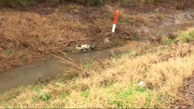
Flooding near the San Jacinto River West and East Forks expected
Officials are closely watching the lake levels of the San Jacinto River after several days of rainfall in the area.


Red Cross shelter set up in San Jacinto County
Some parts of San Jacinto County have received up to 7 inches of rain in the last two days. FOX 26's Sherman Desselle is in Cold Spring from where they have set up a Red Cross shelter.


San Jacinto River expected to flood
Continued heavy rain is expected to cause San Jacinto River to spill from it's banks. FOX 26's Damali Keith reports from the West Fork of the river in Humble.


Lake Conroe two feet above normal
Lake Conroe is two feet above normal and releasing the dam has caused flooding and water rescues. FOX 26's Randy Wallace has more details.


FOX 26 Houston Weather Forecast
Flood Watch has been extended until Noon Thursday for the entire area. An additional 1-3" of rain is still possible through Thursday morning. Some areas north and west of Houston like Brenham and La Grange have picked up 7-13" of rain over the last 4 days. Parts of Huntsville have picked up close to 10" of rain since Sunday and Cypress and Katy have picked up around 5-7" of rain. So the ground is saturated and many creeks, rivers and streams have surpassed the flood stage and are still rising. Areal Flood Warning continues until midnight for several counties N/NW of Houston for street flooding caused by excessive rain. Numerous roads are still flooded and closed. So remember, turn around, don't drown! Always find an alternate route. Rain will remain widespread through this evening with another round of rain & a few rumbles of thunder expected late tonight through early Thursday. Severe storms are not expected. But watch out for some additional flooding that might develop along with lightning and wind gusts up to 40 mph. We should dry out for the rest of Thursday with another round of spotty rain and storms with our next front on Friday evening. Then our pattern shifts as we dry things out for an awesome-looking weekend. Remember to check out exclusive content and extra coverage of this flooding event by downloading our Fox Local app on your smart TV!


Houston weather: Red Cross shelters now open in San Jacinto, Montgomery County
Due to continued flooded roadways in San Jacinto and Montgomery County, the Texas Gulf Coast Region Red Cross has opened shelters for anyone who needs it.

Red Cross opens shelter in San Jacinto County after voluntary evacuation issued
The San Jacinto County Office of Emergency Management has announced a voluntary evacuation due to weather conditions.


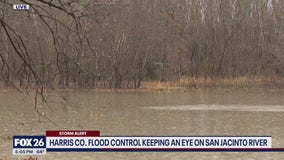
Elevated water levels along San Jacinto River
Elevated water levels are underway along both the East and West Forks of the San Jacinto River. Projections indicate the likelihood of moderate lowland flooding in areas, specifically impacting Humble (West Fork) and New Caney (East Fork) as early as this evening, persisting throughout the week. It is advised to stay vigilant and stay informed about updates.


FOX 26 Houston Weather Forecast
Rainfall will continue to move northeast across the viewing area this afternoon. Allow yourself some extra time if you're heading out today in case of road conditions or flooding. Harris County seemed to have more reasonable numbers. We're beginning to see more rounds of heavy rain Wednesday afternoon and we'll see the last batch of heavy rain roll through early Thursday morning.


Houston weather: Flood & severe storm threat increasing for Houston Wednesday
Today is a FOX 26 Storm Alert Day. A flood watch is in effect for Houston until noon Thursday.


Louisiana's drought is fueling the ‘unprecedented’ crawfish prices this season
Prices over $13 a pound are causing the Louisiana staple to become unaffordable.


Lake Conroe closed after Houston-area rain
Lake Conroe has been temporarily closed due to high lake levels and the possibility of submerged objects and other debris, officials say.


Weather in Houston: Power outage tracker for Centerpoint, Entergy
Along with severe weather comes the potential for power outages. Here’s how you can view outages in your area and report them.


FOX 26 Houston Weather Forecast
A flood watch is in effect until noon. Expect several rounds of heavy rain, lightning and street flooding through the day with temperatures in the 60s.


FOX 26 Houston Weather Forecast
Today and Wednesday are once again FOX 26 Storm Alert Days as the threat for flooding remains higher across the Houston area. Houston and surrounding areas are now under a Flood Watch until 9 AM Wednesday with an additional 2-4 inches of rain possible. Some north and west of Houston picked up around 2-4 inches of rain yesterday with an additional 2-4" possible for the entire area through Wednesday PM. Heaviest rain should remain north and west of Houston through early tonight. But between 1-2 AM, models are showing a big line of heavy rain and strong storms rolling right into Houston. There could also be a few strong wind gusts near 60 mph and some hail. We remain in a marginal risk for severe weather tonight and Wednesday. Rounds of heavy rain will continue through Wednesday evening. Rain & storms will become less widespread Thursday and Friday with a 40% chance. We are finally drying things out as we slide into the weekend with bright sunshine for your outdoor plans


Polk County weather: Access road to Crystal Lakes Subdivision washed out
Crystal Lakes Subdivision residents in Polk County are being asked to shelter in place for the night.


FOX 26 Houston Weather Forecast
Today and Wednesday are once again FOX 26 Storm Alert Days as the threat for flooding remains higher across the Houston area. Houston and surrounding areas are now under a Flood Watch until 9 AM Wednesday with an additional 2-4 inches of rain possible. Some north and west of Houston picked up around 2-4 inches of rain yesterday with an additional 2-4" possible for the entire area through Wednesday PM. Heaviest rain should remain north and west of Houston through early tonight. But between 1-2 AM, models are showing a big line of heavy rain and strong storms rolling right into Houston. There could also be a few strong wind gusts near 60 mph and some hail. We remain in a marginal risk for severe weather tonight and Wednesday. Rounds of heavy rain will continue through Wednesday evening. Rain & storms will become less widespread Thursday and Friday with a 40% chance. We are finally drying things out as we slide into the weekend with bright sunshine for your outdoor plans


NWS issues flood watch for Houston and SE Texas until Wednesday, drivers beware
The National Weather Service has issued a flood watch for Houston and Southeast Texas until Wednesday morning.


FOX 26 Houston Weather Forecast
Today and Wednesday are once again FOX 26 Storm Alert Days as the threat of flooding remains higher across the Houston area. Houston and surrounding areas are now under a Flood Watch until 9 a.m. Wednesday with an additional 2-4 inches of rain possible. Some north and west of Houston picked up around 2-4 inches of rain yesterday with an additional 2-4" possible for the entire area through Wednesday evening. The heaviest rain should remain north and west of Houston through early tonight. But between 1-2 a.m., models are showing a big line of heavy rain and strong storms rolling right into Houston. There could also be a few strong wind gusts near 60 mph and some hail. We remain at a marginal risk for severe weather tonight and Wednesday. Rounds of heavy rain will continue through Wednesday evening. Rain & storms will become less widespread on Thursday and Friday with a 40% chance. We are finally drying things out as we slide into the weekend with bright sunshine for your outdoor plans.


Caution for commuters throughout Houston as flood chances increase
The National Weather Service has issued a Flood Watch for Houston and Southeast Texas until Wednesday morning which means taking extra precautions when driving. FOX 26's Natalie Hee spoke with experts at the Houston Auto-Boative Show for advice.