

Houston weather: Major winter storm pushes through Houston, leaving behind icy road conditions
HOUSTON - A major winter storm system has pushed into Houston bringing some of the coldest air in about 13 months, along with light freezing rain and sleet that caused several roads to ice over.
Several schools are closed Tuesday, including HISD, and you can get the complete list of school closures by clicking here.
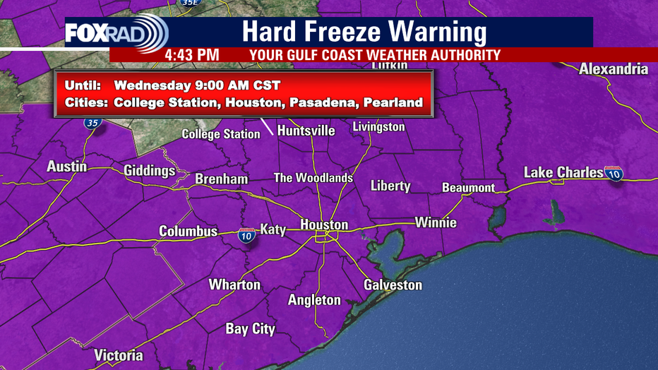
Even though the frozen precipitation is pushing out, icy streets will remain with several roads and highways still closed until further notice. So be extremely careful if you must travel tonight & early Tuesday.
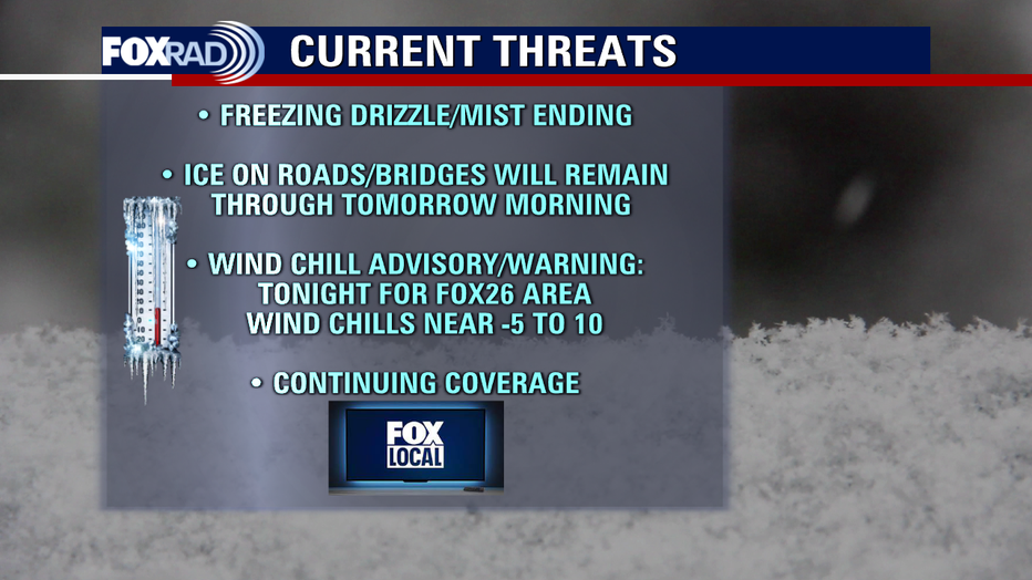
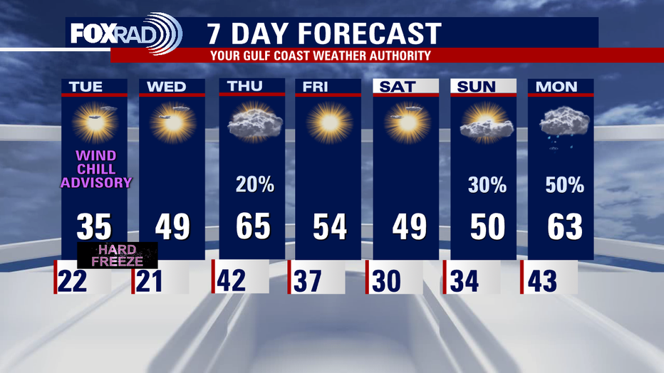
Temperatures will dip to the teens and low 20s overnight which means a HARD FREEZE is likely. That is when temperatures are around 24 degrees or lower for two or more hours. Wind gusts from 20-30 mph are also possible, so wind chills could be in the single digits for Houston early Tuesday.
Wind chills combine air temperatures with wind speeds to give you an idea of what it will really feel like when you step outside.
A Wind Chill Advisory is in effect for Houston until noon Tuesday. Wind chills could dip as low as 5 below zero for Walker, Grimes, and Washington counties and a Wind Chill Warning is in effect for these counties until noon Tuesday. This is more severe, so be careful and dress in layers!
We should make it above freezing for a few hours Tuesday afternoon, which should help to melt some of the ice. But another hard freeze in the teens and 20s is likely Wednesday morning.
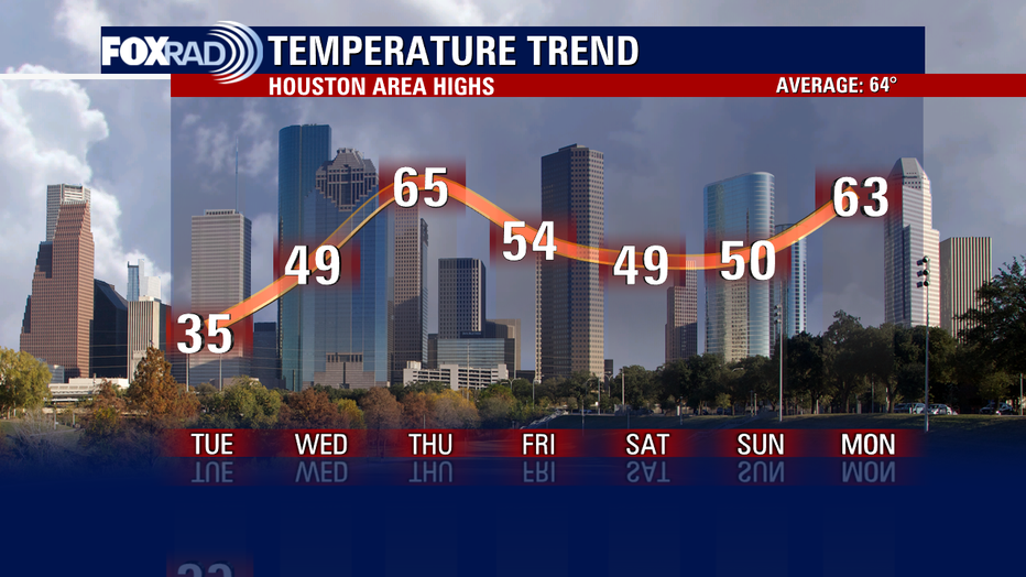
All of the ice should melt by Wednesday afternoon as temperatures climb close to 50. We'll jump up close to 70 Thursday ahead of our next front.
Stay warm & safe and remember we've got all angles of this winter storm system covered on all of our platforms. Make sure to check us out also on our smart TV app, FOX Local, where you can get exclusive continuous coverage and other special features!