

Thursday night leading into Christmas morning weather forecast
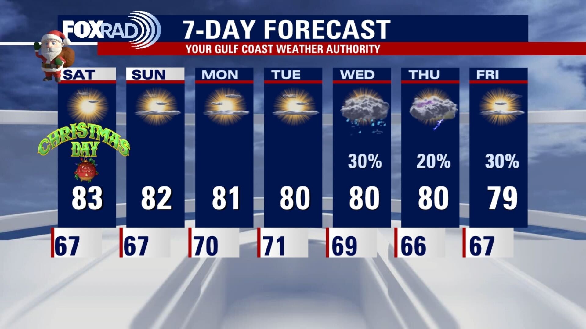
Christmas Day will have highs near record levels and it will remain on the hot side well into the coming week. There may be a few chances for some rain next week, but nothing is looking too steady, so we will have to wait and see.
Christmas Day will have highs near record levels and it will remain on the hot side well into the coming week. There may be a few chances for some rain next week, but nothing is looking too steady, so we will have to wait and see.

Christmas eve weather forecast with Chief Meteorologist Dr. Jim Siebert
Christmas Day will have highs near record levels and it will remain on the hot side well into the coming week. There may be a few chances for some rain next week, but nothing is looking too steady, so we will have to wait and see.
Christmas Day will have highs near record levels and it will remain on the hot side well into the coming week. There may be a few chances for some rain next week, but nothing is looking too steady, so we will have to wait and see.
Warm, sunny & breezy Christmas Eve
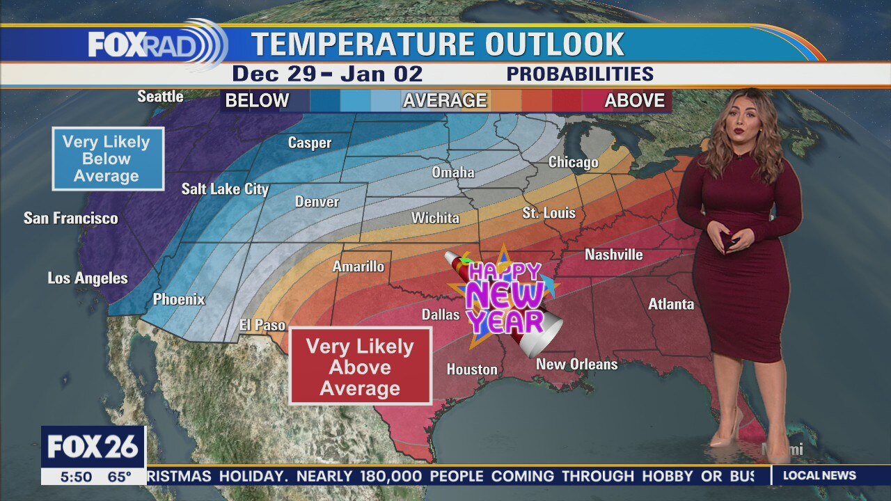
Sunny, warm but a bit breezy for Christmas Eve and Christmas Day. It's possible that we stay at, or above 80 for the next seven days in a row. Rain chances aren't looking overly promising over the next week. On Tuesday, a few disturbances may kick some showers our way. Wednesday-Thursday we may see a front, but it also may not make it all the way to us.
Sunny, warm but a bit breezy for Christmas Eve and Christmas Day. It's possible that we stay at, or above 80 for the next seven days in a row. Rain chances aren't looking overly promising over the next week. On Tuesday, a few disturbances may kick some showers our way. Wednesday-Thursday we may see a front, but it also may not make it all the way to us.
Thursday night leading into Christmas Eve morning weather forecast
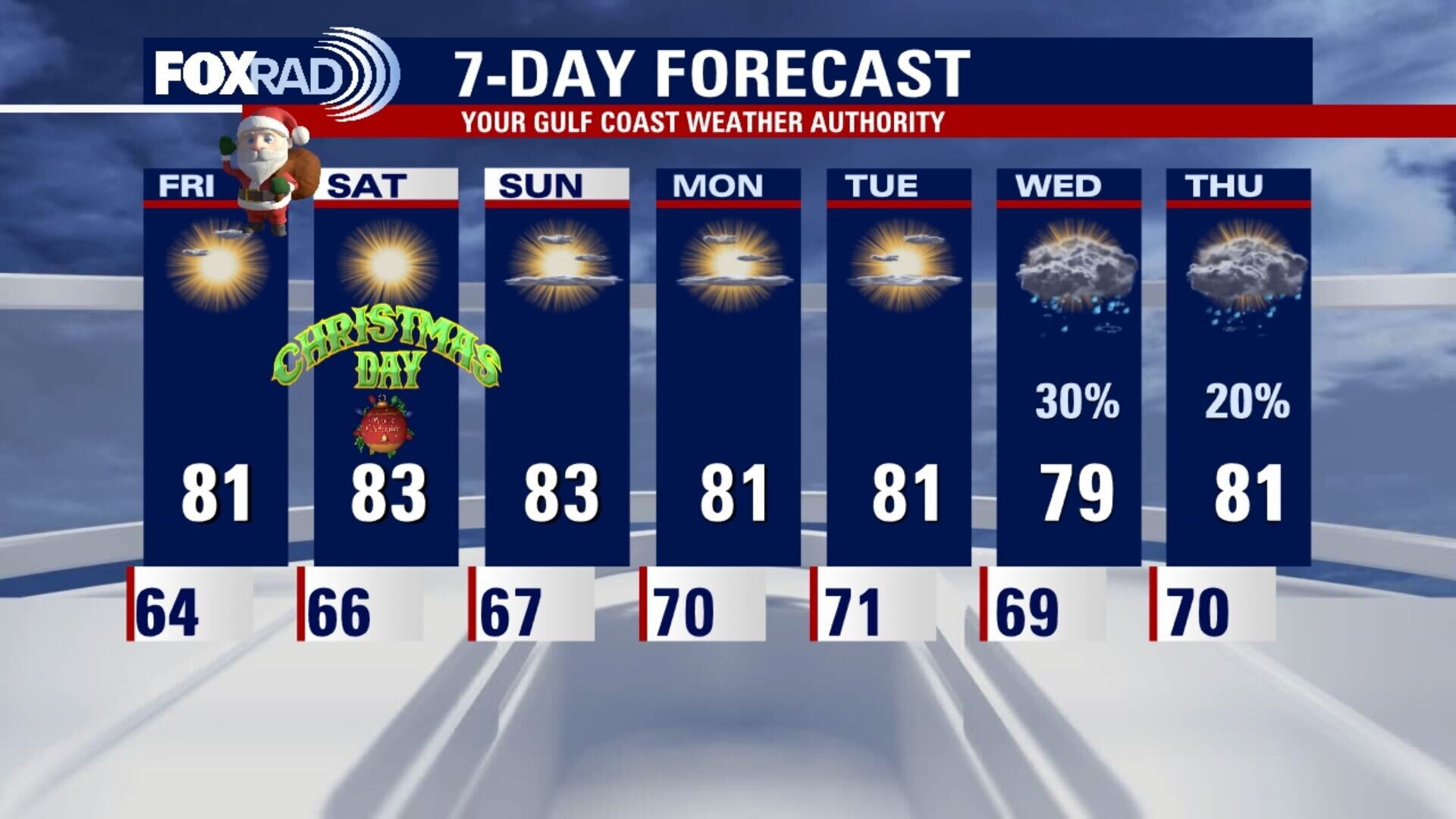
The 80s are back and it looks like a record warm Christmas this year. It remains hot through the weekend and we don't have a chance for any rainfall until the middle of next week. At least we can work on our Christmas tan over the holiday.
The 80s are back and it looks like a record warm Christmas this year. It remains hot through the weekend and we don't have a chance for any rainfall until the middle of next week. At least we can work on our Christmas tan over the holiday.
Thursday evening weather forecast with Chief Meteorologist Dr. Jim Siebert
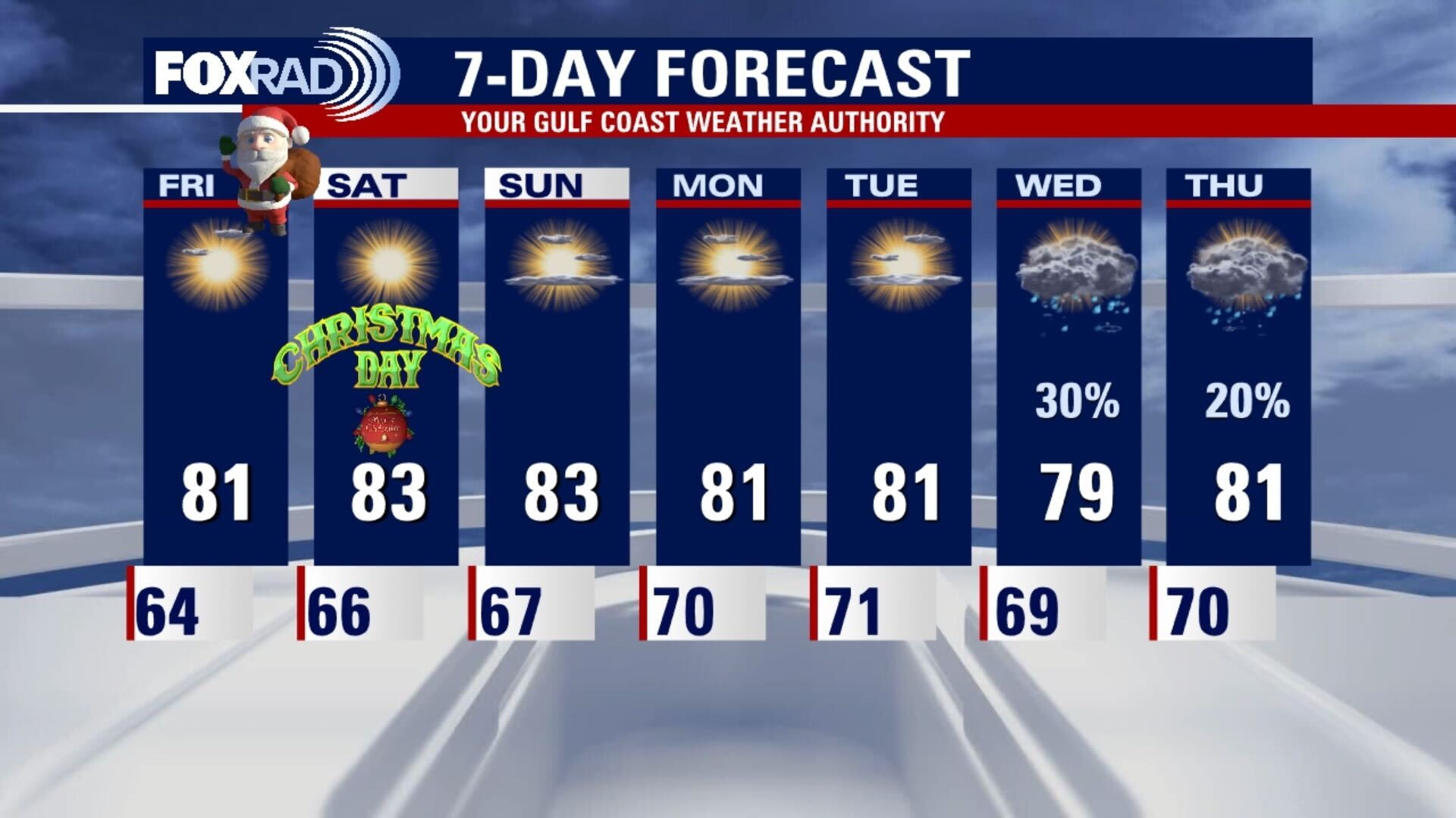
The 80s are back and it looks like a record warm Christmas this year. It remains hot through the weekend and we don't have a chance for any rainfall until the middle of next week. At least we can work on our Christmas tan over the holiday.
The 80s are back and it looks like a record warm Christmas this year. It remains hot through the weekend and we don't have a chance for any rainfall until the middle of next week. At least we can work on our Christmas tan over the holiday.
Thursday weather forecast
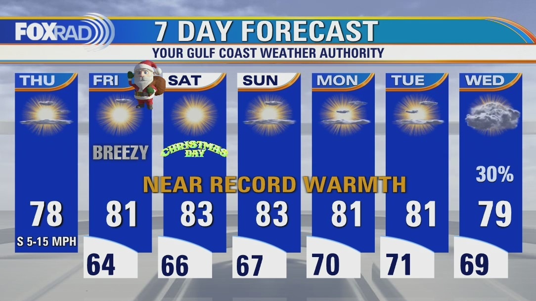
Warmth moves into the region for the extended period, putting many records in jeopardy of falling. At least there's no rain to worry about until the middle of next week! It'll be a bit breezy through Friday evening, but a warm breeze out of the south.
Warmth moves into the region for the extended period, putting many records in jeopardy of falling. At least there's no rain to worry about until the middle of next week! It'll be a bit breezy through Friday evening, but a warm breeze out of the south.
Thursday Morning Weather Forecast
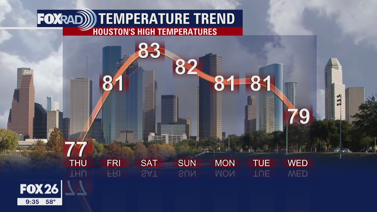
The temps will continue to warm over the next couple of days with highs back into the 80s by Christmas Eve Day. It will be a hot Christmas, but at least we can do outdoor activities all we want. The next rain chances come next Wednesday.
The temps will continue to warm over the next couple of days with highs back into the 80s by Christmas Eve Day. It will be a hot Christmas, but at least we can do outdoor activities all we want. The next rain chances come next Wednesday.
Wednesday Evening Weather Forecast
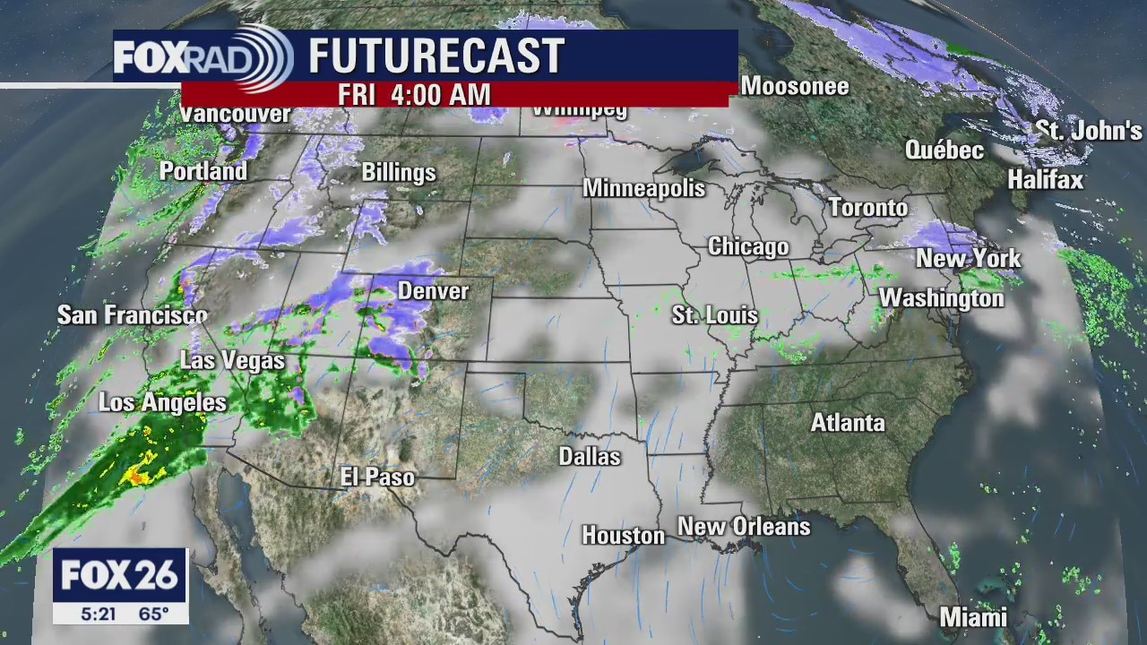
The temps will continue to warm over the next couple of days with highs back into the 80s by Christmas Eve Day. It will be a hot Christmas, but at least we can do outdoor activities all we want. The next rain chances come next Wednesday.
The temps will continue to warm over the next couple of days with highs back into the 80s by Christmas Eve Day. It will be a hot Christmas, but at least we can do outdoor activities all we want. The next rain chances come next Wednesday.
Wednesday morning weather forecast with Meteorologist Lena Maria Arango
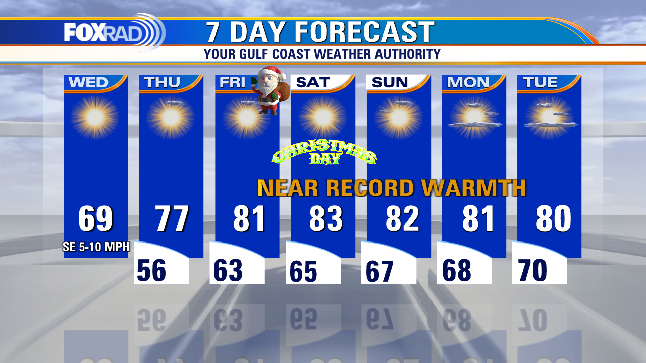
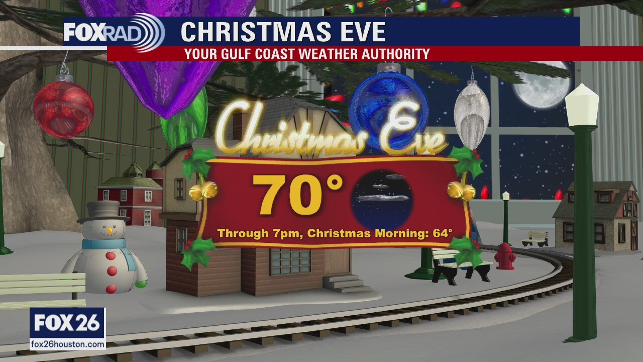
With the return of onshore flow, gradual quiet warming begins today. Sunshine all the way through Christmas and beyond, keep those shades handy! Very likely that we at least tie, if not break several records for warmth this weekend with both highs and lows. Rain chances may start to reintroduce themselves mid-next week.
With the return of onshore flow, gradual quiet warming begins today. Sunshine all the way through Christmas and beyond, keep those shades handy! Very likely that we at least tie, if not break several records for warmth this weekend with both highs and lows. Rain chances may start to reintroduce themselves mid-next week.
Wednesday Morning Weather Forecast
Highs will be in the 80s by Christmas Day and stay that way into the coming week. Winter officially started today, but it won't feel like it for a while.
Highs will be in the 80s by Christmas Day and stay that way into the coming week. Winter officially started today, but it won't feel like it for a while.
Tuesday Evening Weather Forecast
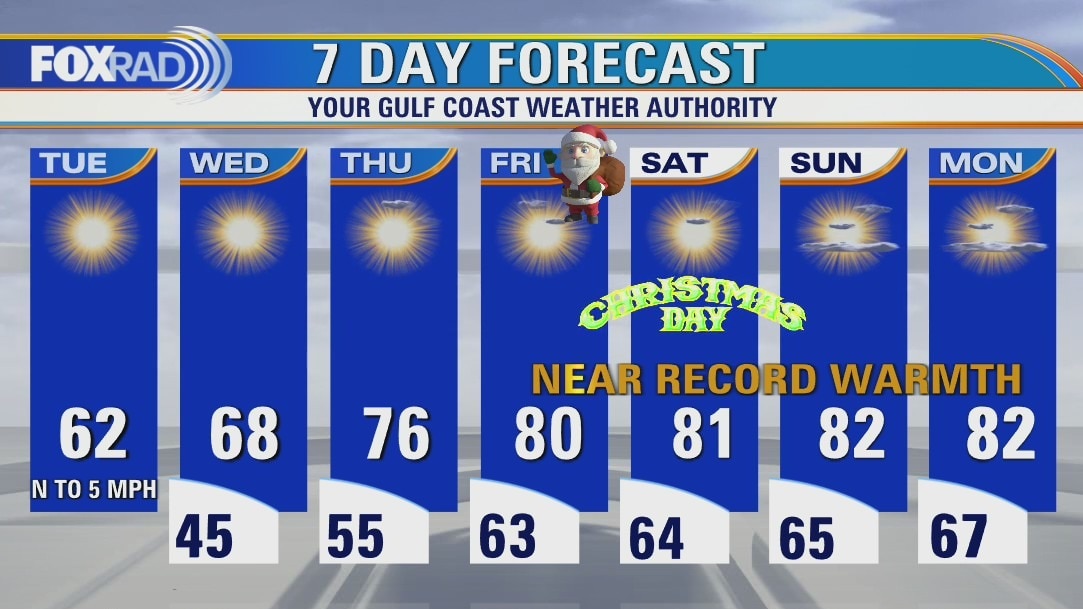
It will be cool again tonight, but will get warmer each day for the rest of the week. Highs will be in the 80s by Christmas Day and stay that way into the coming week. Winter officially started today, but it won't feel like it for a while.
It will be cool again tonight, but will get warmer each day for the rest of the week. Highs will be in the 80s by Christmas Day and stay that way into the coming week. Winter officially started today, but it won't feel like it for a while.
Tuesday weather forecast
Happy First Day of Winter! It's the shortest day of the year for us. Our quiet, dry weather pattern also begins today. Sunshine from here on out as the days get longer with no rain in sight. Tuesday and Wednesday will be roughly seasonable in terms of temperatures, but then away we go. We'll be flirting with record highs, and lows for Christmas weekend. Happy Holidays!
Happy First Day of Winter! It's the shortest day of the year for us. Our quiet, dry weather pattern also begins today. Sunshine from here on out as the days get longer with no rain in sight. Tuesday and Wednesday will be roughly seasonable in terms of temperatures, but then away we go. We'll be flirting with record highs, and lows for Christmas weekend. Happy Holidays!
Tuesday morning weather forecast
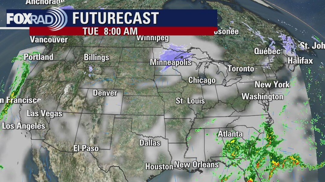
The skies are clearing and will remain that way for the rest of the week. By Christmas Eve Day highs will be back into the low 80s and will remain very warm into next week. There will be nice travel weather throughout the whole holiday weekend.
The skies are clearing and will remain that way for the rest of the week. By Christmas Eve Day highs will be back into the low 80s and will remain very warm into next week. There will be nice travel weather throughout the whole holiday weekend.
Monday evening weather forecast
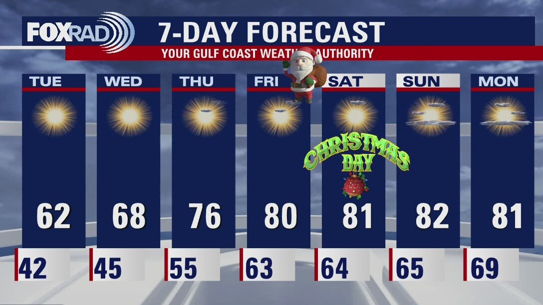
The skies are clearing and will remain that way for the rest of the week. By Christmas Eve Day highs will be back into the low 80s and will remain very warm into next week. There will be nice travel weather throughout the whole holiday weekend.
The skies are clearing and will remain that way for the rest of the week. By Christmas Eve Day highs will be back into the low 80s and will remain very warm into next week. There will be nice travel weather throughout the whole holiday weekend.
Monday weather forecast
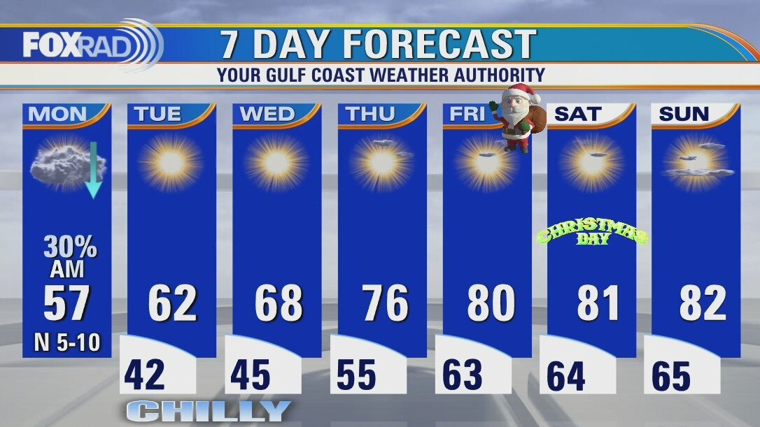
After Monday, it's smooth sailing from here on out with no rain in the forecast and a gradual warming trend due to the return of onshore flow. Look for a dry week, with plenty of sunshine and highs near 80 for Christmas weekend.
After Monday, it's smooth sailing from here on out with no rain in the forecast and a gradual warming trend due to the return of onshore flow. Look for a dry week, with plenty of sunshine and highs near 80 for Christmas weekend.
Sunday Morning Forecast with Meteorologist Lena Maria
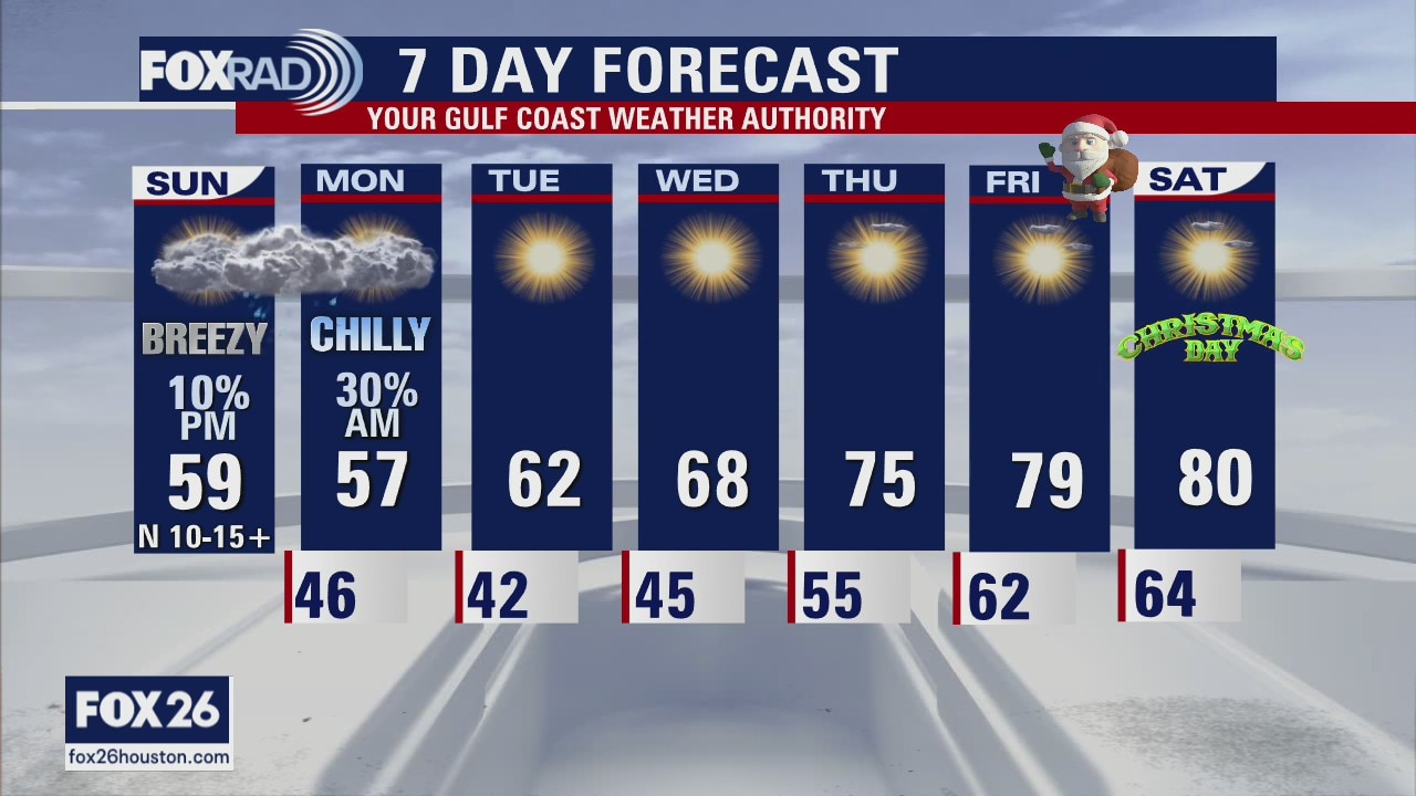
Saturday's cold front brought a chill to the air, but it will only last a couple of days. A coastal low will bring some light, spotty showers to the area overnight Sunday into the start of the day on Monday, but accumulation will be light if anything. A warm, dry stretch starts on Tuesday. Santa will be delivering gifts to southeast Texas in shorts!
Saturday's cold front brought a chill to the air, but it will only last a couple of days. A coastal low will bring some light, spotty showers to the area overnight Sunday into the start of the day on Monday, but accumulation will be light if anything. A warm, dry stretch starts on Tuesday. Santa will be delivering gifts to southeast Texas in shorts!
Saturday Morning Forecast with Meteorologist Lena Maria
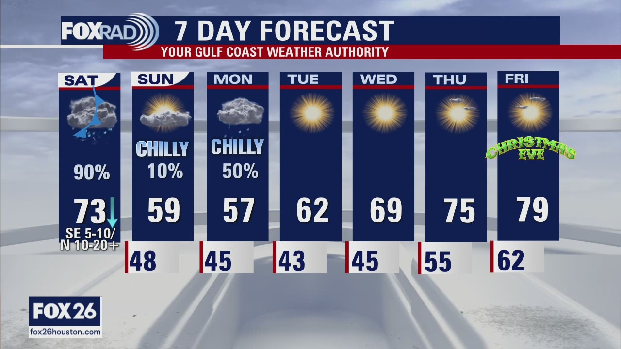
A cold front will bring rainy, stormy conditions to southeast Texas Saturday followed by a few chilly days. Another round of less impressive rain is on the way overnight Sunday into Monday. Then Santa delivers sunshine, and dry conditions with a warming trend right up through Christmas day.
A cold front will bring rainy, stormy conditions to southeast Texas Saturday followed by a few chilly days. Another round of less impressive rain is on the way overnight Sunday into Monday. Then Santa delivers sunshine, and dry conditions with a warming trend right up through Christmas day.
Saturday morning weather forecast
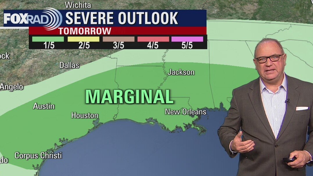
A front will arrive early on Saturday and it will bring rain along with some storms. The rain will mostly be east of our area around noon. It will be much cooler over the next couple of days, but will warm as we near Christmas Day.
A front will arrive early on Saturday and it will bring rain along with some storms. The rain will mostly be east of our area around noon. It will be much cooler over the next couple of days, but will warm as we near Christmas Day.
Friday evening weather forecast with Chief Meteorologist Dr. Jim Siebert
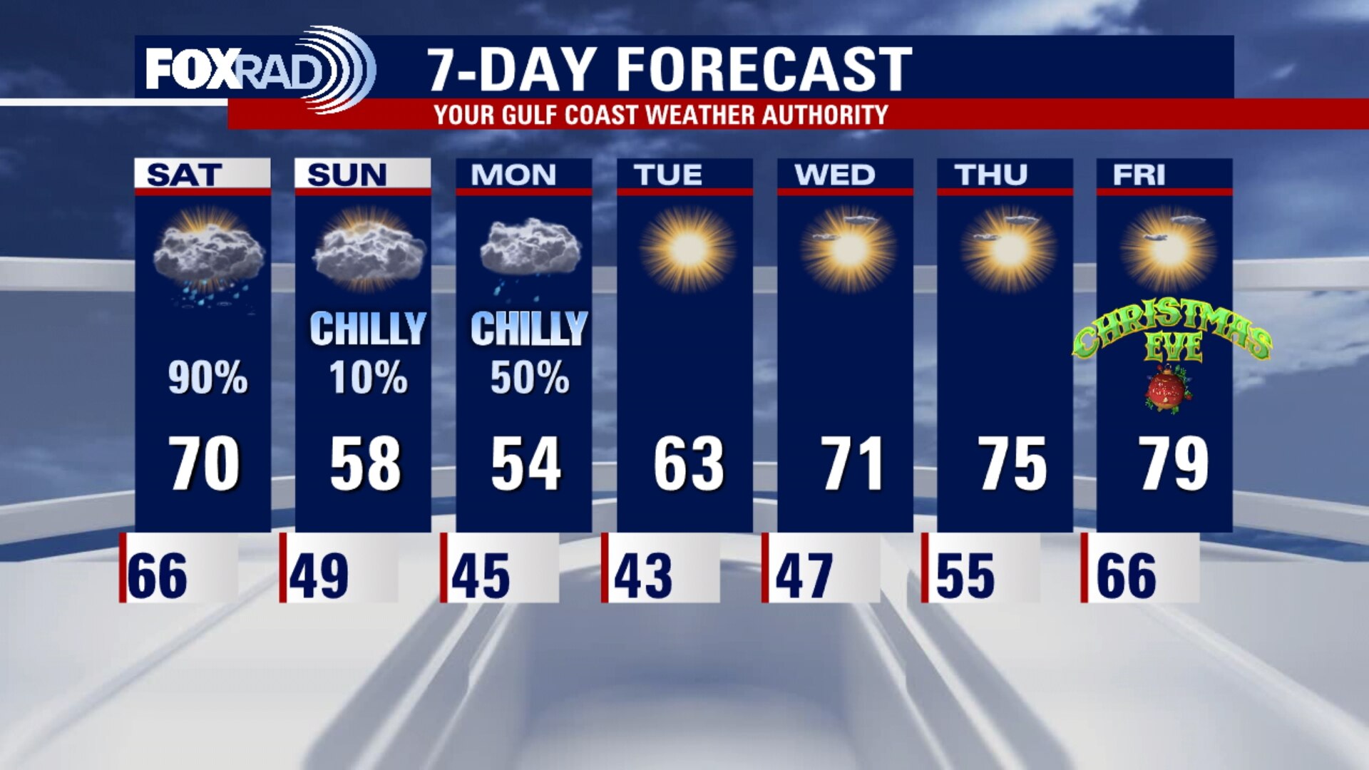
A front will arrive early on Saturday and it will bring rain along with some storms. The rain will mostly be east of our area around noon. It will be much cooler over the next couple of days, but will warm as we near Christmas Day.
A front will arrive early on Saturday and it will bring rain along with some storms. The rain will mostly be east of our area around noon. It will be much cooler over the next couple of days, but will warm as we near Christmas Day.
Friday weather forecast
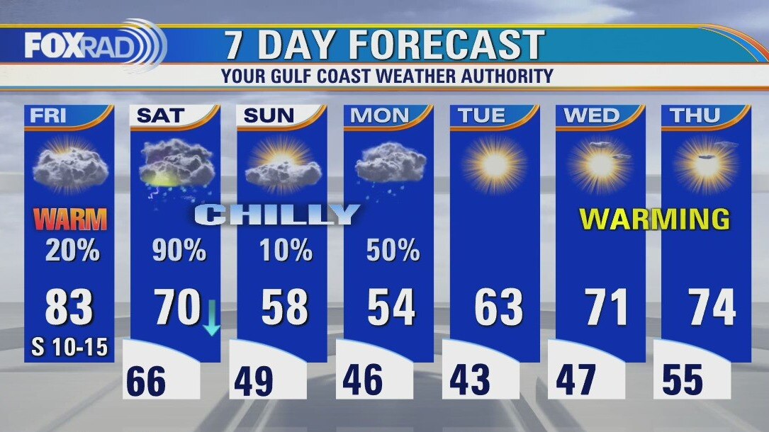
After four days of record warmth, a cold front on Saturday will bring heavy storms followed by much colder air. Look for more records today with highs in the low to mid 80s. Stormy weather on Saturday will bring 3 to 4 days of chilly air with Monday looking cold and wet. A warming trend is expected for the days leading up to Christmas and so far, the holiday is looking warm.
After four days of record warmth, a cold front on Saturday will bring heavy storms followed by much colder air. Look for more records today with highs in the low to mid 80s. Stormy weather on Saturday will bring 3 to 4 days of chilly air with Monday looking cold and wet. A warming trend is expected for the days leading up to Christmas and so far, the holiday is looking warm.