

Houston weather: Rain chances return starting Wednesday
Houston weather: Rain chances returning on Wednesday
Storm chances increase beginning Wednesday and continue through Friday as a front approaches. Expect scattered showers and thunderstorms, with the best chances for more widespread rain Thursday into Friday. There is a chance of afternoon and evening storms Wednesday as well, but models are mixed, so confidence is lower. We are under a low 1 out of 5 risk for storms Wednesday that could produce some high winds and larger hail. Stay alert and keep checking back for updates.
HOUSTON - Storms will be across the Houston area starting on Wednesday through Friday.
Houston weather: Rain chances return starting Wednesday
FEW STRONG STORMS POSSIBLE LATE
Very warm breezy and humid weather continues through Tuesday and Wednesday. A line of strong storms is expected to approach our northern counties tonight from College Station to Huntsville to Livingston. Watch out for brief, strong wind gusts and the threat for brief, heavy rain & hail with these storms. These storms will likely brush our northern counties before weakening & are not expected to reach Houston. A better chance for more widespread storms arrives Wednesday.
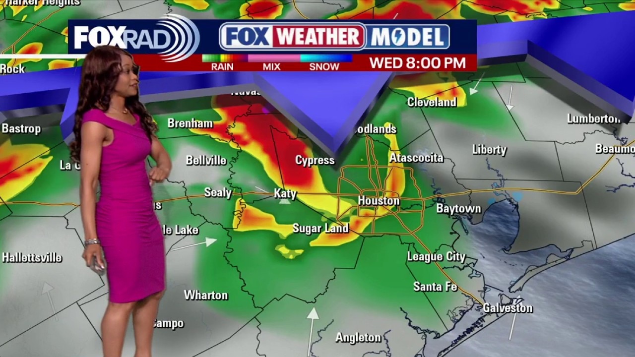
BETTER RAIN CHANCES WEDNESDAY, HIGHEST FRIDAY
Storm chances increase beginning Wednesday and continue through Friday as a front approaches. Expect scattered showers and thunderstorms, with the best chances for more widespread rain Thursday into Friday. There is a chance of afternoon and evening storms Wednesday as well, but models are mixed, so confidence is lower. We are under a low 1 out of 5 risk for storms Wednesday that could produce some high winds and larger hail. Stay alert and keep checking back for updates.
COOLER AIR ARRIVES THIS WEEKEND
A front brings a refreshing cooldown this weekend with highs in the 70s and morning lows in the 50s. Humidity drops as well, making for a nice, comfortable start to the month of May. Enjoy because these cold fronts will make less appearances as we get closer to the summer months.

The Source: Your Gulf Coast Weather Authority Team