

Tropical Storm Harold makes landfall in South Texas: What impacts will Houston see?
HOUSTON - Tropical Storm Harold made landfall on Padre Island along the South Texas coast on Tuesday morning.
According to the National Hurricane Center, Harold made landfall around 10 a.m. with maximum sustained winds near 50 mph.
As of 1 p.m., the center of Harold was located about 20 miles east-southeast of Hebronville, and was continuing to move west-northwest at 21 mph. Maximum sustained winds were near 45 mph.
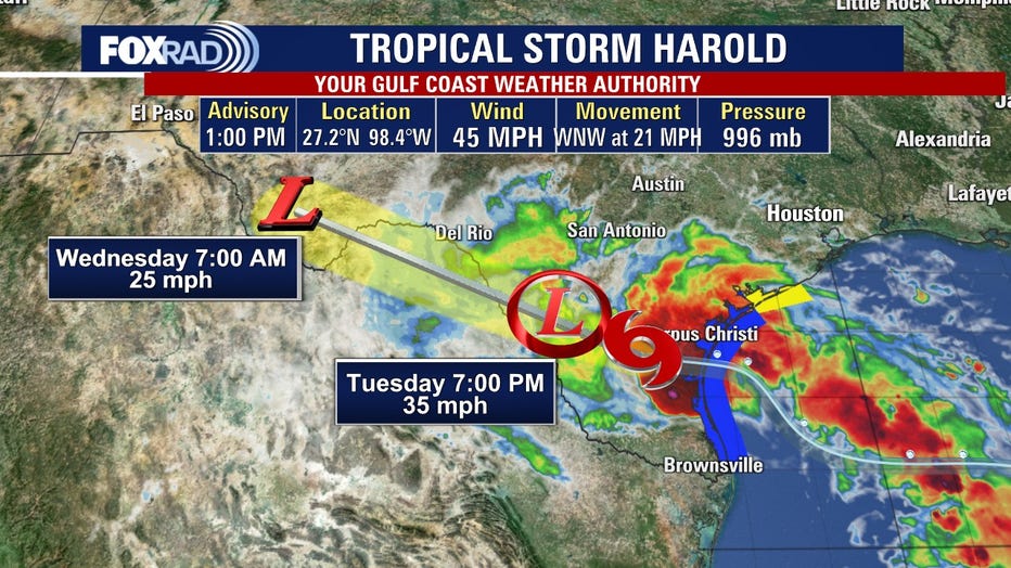
Harold is expected to continue to move inland over South Texas and northern Mexico and weaken into a tropical depression later on Tuesday.
A Tropical Storm Warning is in effect from the mouth of the Rio Grande to Port O’Connor, while a Tropical Storm Watch extends from Port O’Connor to Sargent in Matagorda County.
According to the National Hurricane Center, Harold is expected to produce 2 to 4 inches of rainfall in South Texas through early Wednesday, with isolated areas seeing higher amounts. Scattered instances of flash flooding are possible, the NHC says.
Parts of northern Mexico are also expected to see multiple inches of rain, with some scattered instances of flash flooding.
Will Houston be impacted by Tropical Storm Harold?

FOX 26 Houston Weather Forecast
Breezy, hot and humid with scattered storms. Windier south and near the coast. Highs in the upper 90s.
Tropical Storm Harold will pass more than 200 miles south of Houston Tuesday, but we'll still feel some effects. Fast-moving storms are likely today, but they will be hit-and-miss.
The main threats will be gusty winds and lightning. There will also be dangerous swimming conditions at our beaches.
Otherwise, expect a windy and very warm and humid day.
Tomorrow through the end of the week will bring more hot days with high temperatures well above 100.