

Houston weather: Slightly severe storm chances Sunday night
Houston weather: March 14 evening forecast
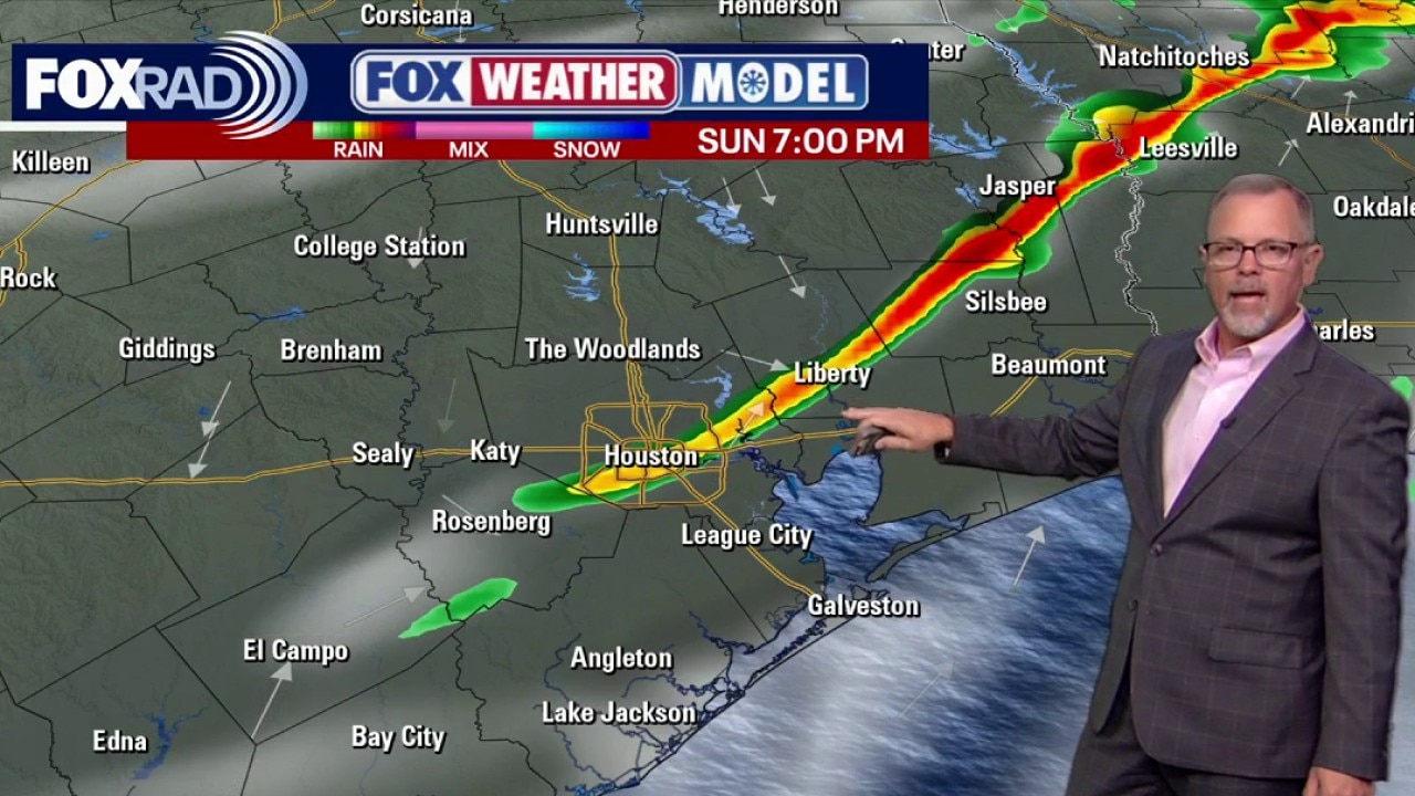
A strong cold front moves through Sunday night with a quick line of strong storms that could bring gusty winds.
HOUSTON - It's been a warm and sunny weekend, but a strong Sunday front will bring a cool down for part of next week.
Warm days this weekend
The weekend brings a big warming trend with lots of sunshine and a spring feel. It’s a great stretch for the rodeo and nice, but breezy at the beach before the next system approaches late on Sunday.
Humidity will also be on the rise. So get ready to feel that sticky steamy air that we are so used to in H-Town.
Storms Sunday night, then a sharp change
A strong cold front moves through Sunday night with a quick line of strong storms that could bring gusty winds.
There's a low 1/5 risk for a few severe storms Sunday evening and Sunday night for Houston, with a slightly higher 2 out of 5 risk clipping parts of Walker, Polk & San Jacinto counties.
The main weather threats with the front will be the potential for damaging wind gusts and brief heavy rain.
Once the front clears, colder air rushes in and winds turn brisk, setting up a blustery start to next week.
Alerts from National Weather Service
In addition to the Severe Weather Outlook from the Storm Prediction Center, the local Houston/Galveston Office of the National Weather Service has issued several alerts.
A WIND ADVISORY will be in effect from Sunday morning through Monday afternoon for all of Southeast Texas.
A FIRE WEATHER WATCH has been issued for counties generally along and west of the I-45 corridor and along the coast on Monday.
A SMALL CRAFT ADVISORY goes into effect Sunday morning for both bays and Gulf waters through Sunday evening and then transitions to a GALE WATCH into Monday afternoon.
Another surge of chilly air
Behind Sunday night's front, the return to work and school on Monday will be a chilly one across southeast Texas.
Jackets and coats may be needed as high temperatures make a whopping 25° drop from where they were Sunday.
Look for highs only near 60 Monday afternoon with overnight lows in the 30s and 40s. We should escape a freeze, but extra layers will be needed. But this time of the year, cold air doesn't last long.
We'll be back to the 80s by next Thursday.
The Source: Your Gulf Coast Weather Authority