Houston weather: Timeline of late week heavy rain, strong storms possible
HOUSTON - Strong to severe storms and locally heavy rainfall are possible as we close out the work week in southeast Texas. Per usual, the set-up is complex and comes with a lot of conditions: if this, then that. So, let's dive into the nuances of the potential outcomes and how they will affect how the forecast plays out over time.
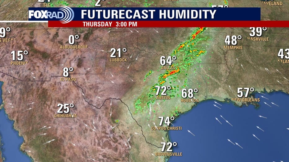
Setting the scene, on Thursday afternoon we can see that we have a very warm, humid (and therefore unstable) air mass in place. Remember that the dew point is the measure of how much moisture we have in the atmosphere. Where the dew points are in the 60s and 70s, you can see quite a bit of thunderstorm activity firing up ahead of the front and the much drier air in the panhandle behind the front and as such, dew points are 40-50 degrees lower.
RELATED: Houston air quality: Smoke from fires in Mexico reaching Texas
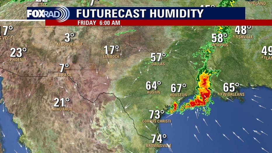
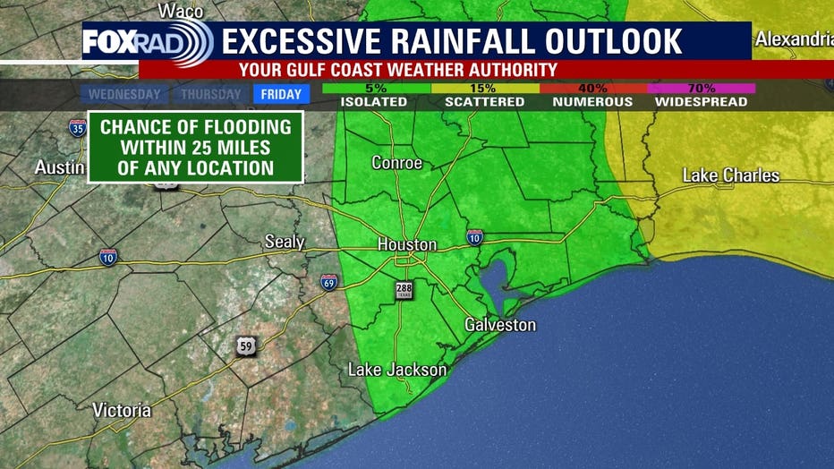
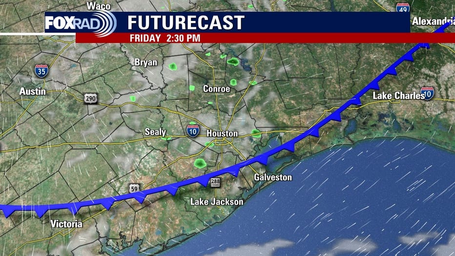
Fast-forward to Friday morning, do you notice the cluster of storms sitting right offshore? That will have passed through in the overnight hours, hence why we see the risk for locally heavy rainfall on the excessive rainfall outlook for Thursday into Friday.
KEEP UP WITH HOUSTON WEATHER - DOWNLOAD FOX 26 WEATHER APP
But, here's the thing, if we go back and look at that potential outcome for Friday morning, the front is stalled out off to our west back between Dallas and Austin. We know this, because of the direction of the winds. The arrows will be coming out of the north behind the front, but out of the south ahead of it.
MORE: Lyrid meteor shower: When it peaks and how to watch it
Some important things to note: this is only one run of one model. Frontal timing is always approximate as fronts speed up and slow down. But, as of right now models are hinting at a mesoscale convective complex forming ahead of the front (the cluster of storms) with the front lagging behind that and not arriving until Friday.
So the big question becomes, if the above-mentioned scenario plays out – will the front have enough instability and moisture left to work with to once again fire up more strong to severe storms, or will the atmosphere have had time to regenerate? Again, that all depends on the potency of the precursor event.
A lot of times what we see with these "blobs" of storms is that they stabilize the atmosphere, completely zapping it of potential available energy, moisture, etc. Back to the "if this, then that". If the above happens, we would likely clear out much faster on Friday and the threat of strong to severe storms would go down. If it doesn't, we'd have to keep our eyes on anything that fires up Friday afternoon and evening.

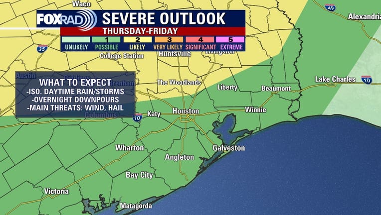
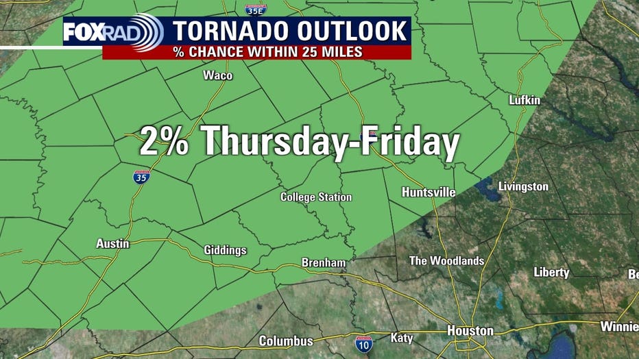
Bottom line is to expect things to get rowdy overnight Thursday into Friday and always be mindful of accumulating water, especially after dark. Have multiple ways to receive alerts in the event that they are issued, especially while sleeping. For most of our viewing area, a brief spin-up tornado is unlikely but cannot be ruled out in our far northern counties
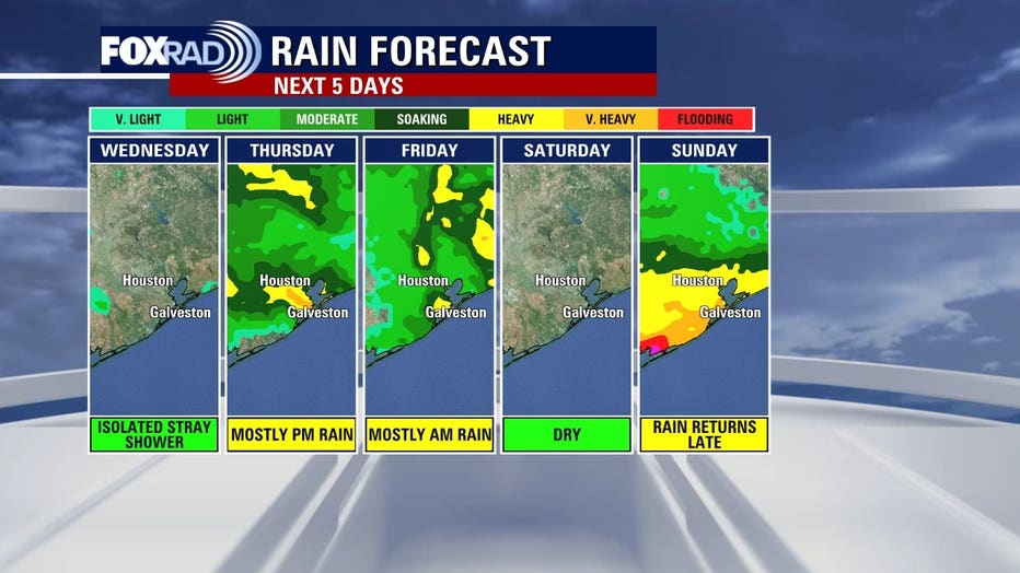
But in general, most of us look to pick up .5-1.5" of rainfall with isolated higher amounts, and in addition to frequent thunder and lightning gusty winds/hail may accompany any stronger storms that do develop.
WEATHER: El Niño returns; What impact will it have on hurricane season?
Regardless of the scenario, Saturday looks fantastic so feel free to fill your day with outdoor plans. Skies will be clear, with bright sunshine, reasonable temperatures, and low humidity. Sunday looks to start off on the dry side but look for a steady rain to develop by the afternoon with the potential for pockets of heavier rain closer to the Matagorda Bay area.