Houston, Texas heat wave weather forecast: What's ahead after weeks of above average temperatures?
HOUSTON - Houston has had 18 days in a row with above-average temperatures, and you should expect that trend to continue for the foreseeable future.
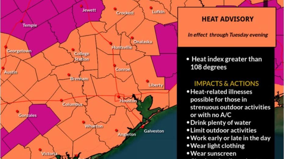
A Heat Advisory is in effect today to warn of the afternoon "feels like" temperatures near 108°

FOX 26 Houston Weather Forecast
More hot sunshine and stifling humidity is on the way and should stay with us through the end of the week. A heat advisory is in effect until 9 p.m. today to warn of the increased risk for heat exhaustion, so get in the AC as much as possible. Our next opportunity for rain may not arrive until early next week, so high temperatures could be a few degrees "cooler".
CLICK HERE TO DOWNLOAD THE FOX 26 WEATHER APP
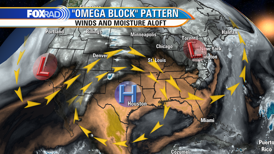
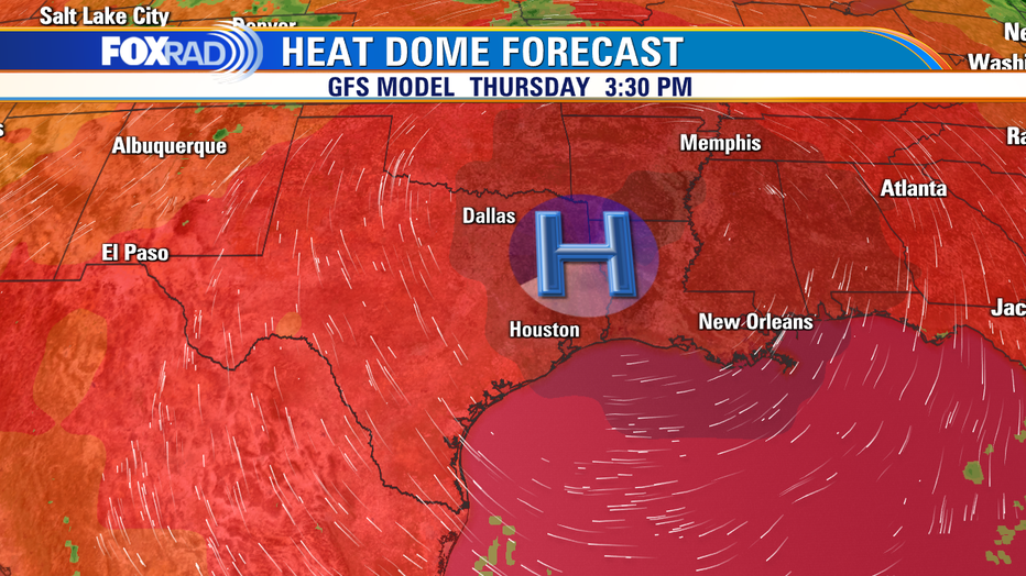
The heat dome of high pressure is very slow to move because of a complex jet stream flow known as an "omega block" because the pattern looks like the Greek letter omega Ω.
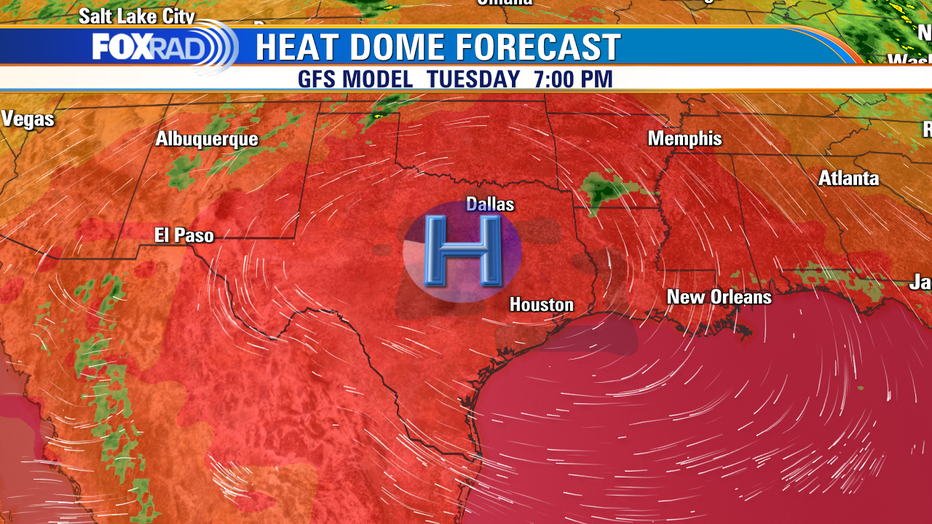
The center of the hottest air is expected to slowly move eastward over the next several days, so the heat dome will shift from central Texas today, to directly overhead Wednesday and Thursday, then shifting to our east by the weekend. Eventually, this should result in scattered showers and mid 90s early next week.
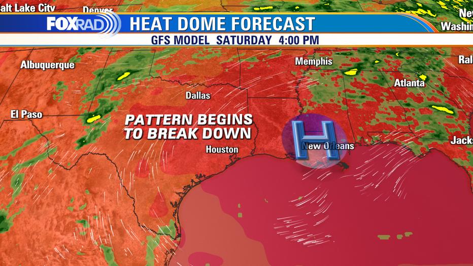
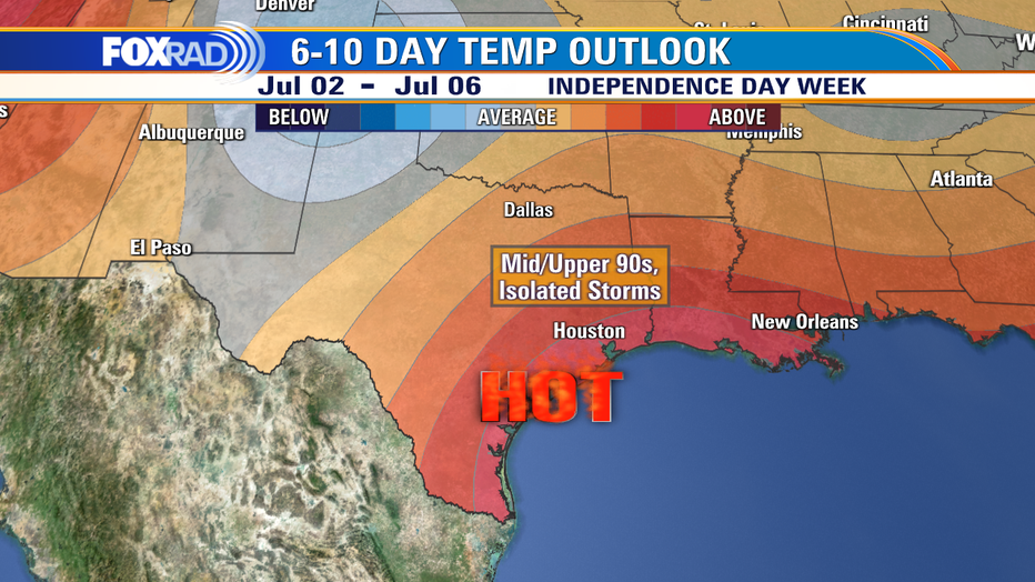
Even with this pattern change, our overall trend of temperatures could stay above average next week, but state-wide heat will subside. This is the outlook from NOAA for next week's temperature trend - there is still a high probability for above average temps for the Texas Gulf Coast.