

Houston evacuation routes, zones by zip code for 2026 hurricane season
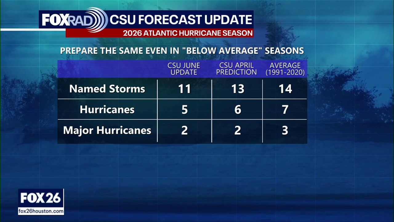
Colorado State University updates Atlantic hurricane season forecast
Colorado State University’s latest seasonal update trimmed its forecast from the April outlook.
HOUSTON - Residents living along the Gulf Coast should have a plan in place in case an evacuation is ordered.
In the Houston-Galveston region, officials will issue evacuation orders by zip code zone or "zones."
We have a map to help you identify your zone, your route and know when to evacuate.
When to evacuate
The Houston-Galveston Area Council says residents should only evacuate if they live in a storm surge evacuation zone and are ordered to do so.
There are two types of evacuation orders.
- A voluntary evacuation is a recommendation for residents to leave an area that could be affected by a disaster.
- A mandatory evacuation means you should leave the area without delay because there is immediate danger. Follow your evacuation route and instructions from local authorities.
If you are not ordered to evacuate, you should be prepared to shelter in place for a few days. Here's a list of supplies you should have on hand.
The zones
Zip-Zone Coastal
This is the zone closest to the Gulf of America, formerly known as the Gulf of Mexico. It includes 18 different zip codes which are in the Matagorda and Galveston Bay region, and it is represented by the color purple on the Hurricane Evacuation Map.
Zip-Zone A
This zone includes 14 zip codes and is mainly located north of Galveston in the Southeast area of Houston. It is represented by the color yellow on the Hurricane Evacuation Map.
Zip-Zone B
Zone B is the second-largest zone, which includes 28 zip codes. It is located between the coastal zone and zone B, and it is represented by the color green on the Hurricane Evacuation Map.
Zip-Zone C
This is the largest zone which includes 41 zip codes. It is the furthest inward zone in the Houston-Galveston region and goes into the heart of Houston. It is represented by the color orange on the Hurricane Evacuation Map.
Houston-Galveston evacuation routes
Along with the designated zones, there are corresponding routes that are set in place to help decrease traffic and congestion in the case of a hurricane and create a better flow of movement.
Knowing which zone you are located in will help you understand whether you will need to evacuate during a serious storm or hurricane.
The Source: The information in this article comes from the Houston-Galveston Area Council. This article includes previous reporting by Marilu Lopez.