

Live updates: Houston winter storm latest, Saturday timeline, icy roads

Houston winter storm: Latest timeline from John Dawson
FOX 26 Houston Meteorologist John Dawson provides an update on the timeline of the winter storm headed into the Houston area.
HOUSTON - Houston is bracing for a weekend winter storm that brings the risk of freezing temperatures, dangerous wind chills and icy road conditions.
Here are the latest updates on the forecast, what people need to do to prepare and the steps state and local leaders are taking ahead of the storm.
Watch live:
FOX 26 will bring you the latest updates on the winter storm, what you need to do to prepare and how local and state officials are getting ready. Watch in the live player above or on the free FOX Local app for your smart TV and phone.
LIVE UPDATES: Houston winter storm
11 p.m. - Harris County Judge Lina Hidalgo holds news conference
Late Saturday evening, Harris County Judge Lina Hidalgo held a news conference providing the latest updates on the winter storm.

FULL VIDEO: Harris County Judge provides update on winter storm
Harris County Judge Lina Hidalgo held a news conference to provide an update on the winter storm moving across the Houston area overnight.
8:20 p.m. - Houston Mayor John Whitmire talks with FOX 26
Houston Mayor John Whitmire joined FOX 26's Winter Weather Coverage on Saturday evening from a warming center in the Houston area.
He said anyone, regardless of any situations, is welcome at a warming center. No questions asked.

Houston winter storm: Mayor Whitmire speaks with FOX 26 from warming center
FOX 26's Anthony Antoine spoke with Houston Mayor John Whitmire about the city's homeless centers, why Houstonians shouldn't drip their pipes, and more.
8 p.m. - Bush, Hobby Airports remain open
Houston Airports continues winter weather preparations as conditions evolve across the region, with deicing operations underway at George Bush Intercontinental Airport (IAH) and William P. Hobby Airport (HOU).
- Bush and Hobby airports remain open and operational.
- All Houston Airports Tier 1 employees have been activated.
- Emergency Operations Centers at IAH & HOU were activated at 7 p.m.
Representatives from TSA, the Houston Police Department, the Houston Fire Department, and partner airlines are supporting coordinated, real-time response efforts. The USO at IAH will remain open overnight to support active-duty military members in transit.
At IAH:
- Deicing pre-treatment began at 11 a.m.
- Roadway overpasses and bridges are treated every 90 minutes
- Airport roads and the airfield are treated every three hours
At HOU:
- Pre-treatment operations began at 7 p.m.
- Crews will inspect airfield pavement overnight and continue treatment as needed.
Parking facilities at both airports are being routinely treated.
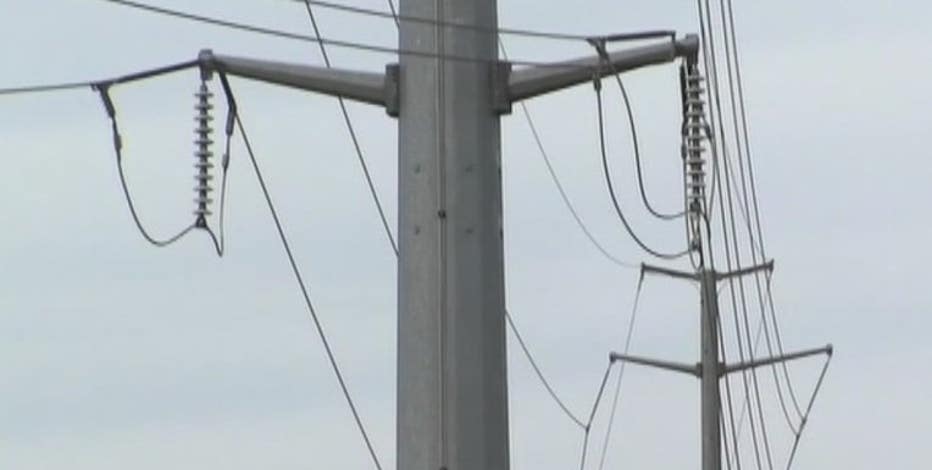
7:30 p.m. - CenterPoint projecting between 100,000 to 200,000 customers could experience power outages
During a news briefing on Saturday afternoon, CenterPoint Energy said they are projecting between 100,000 and 200,000 customers could be impacted during the course of the winter storm over the next few days.
Officials added in regards to restoration times, and with the extra crews that have been brought in, that CenterPoint says all customers within their system will be restored within 12 hours or less.
7 p.m. - TXDOT working to prep Houston-area roads
Our crews in the field captured Texas Department of Transportation crews out working and prepping roads in the area.
This was on Southwest Freeway southbound.

DPS and TxDOT De-Icing US-59 at Beltway 8 Ahead of Winter Storm
Texas DPS and TxDOT are currently de-icing the roadways at US-59 and Beltway 8 to prepare for the upcoming winter storm. Drive with caution and watch for slow-moving equipment.
6:15 p.m. - METRO HOV/HOT lanes to close at 8 p.m. Saturday night
Due to the incoming winter storm, all METRO HOV/HOT lanes, including the I-10 Katy–CBD ramp, will be closed starting at 8 p.m. Saturday night. Closures will remain in effect until Tuesday morning.
5:45 p.m. - Online-only service at Lakewood Church
Due to inclement weather, Lakewood Weekend Services will be ONLINE only this Sunday at 8:30 AM and 11:00 AM
In addition, Lakewood welcomes anyone who needs to get out of the cold, Saturday evening 7:00 PM through Tuesday morning.
5:43 p.m. - Harris County early-voting centers closed because of weather
Early-voting centers in Harris County that have been opened for the special runoff election for U.S. House District 18 will be closed Sunday and Monday because of weather, according to the Harris County Clerk’s Office.
The agency said all branches of the Clerk’s Office will also be closed on Monday.
5:35 p.m. - CenterPoint says they are ready for winter storm
Officials at CenterPoint Energy said Saturday that the power provider is prepared for the winter storm moving into the Houston area.
Meteorologists with the company said there are some promising signs in the forecast that make them optimistic that customers won’t be in the dark for too long if the power goes out.
They’re mostly concerned about ice weighing down trees and power lines, but said winds should be manageable.
As far as the cold, the company said temperatures are expected to be warmer than in 2021 and stay below freezing for a shorter amount of time.
Here's a replay of the press conference:
4:34 p.m.
FOX 26 photojournalist Doug Biggers saw out-of-town electrical crews leaving Buc-cee's along Highway 290 in Waller.
3:44 p.m.
Brazoria County shared photos of crews pretreating roads and bridges ahead of the storm.
2:29 p.m.
Power outages are nearing 60,000 for Texas homes, with northeast Texans being the most impacted.
FindEnergy.com has not reported any Houston-area outages at this time.
Featured
Texas winter storm: Power outages top 50K, ERCOT grid stable
Power outages in the state have topped 50,000, but the Electric Reliability Council of Texas' grid has remained stable with sufficient power reserves.
1:37 p.m.
"In anticipation of the need for State resources, Polk County Judge Sydney Murphy has issued a Disaster Declaration for Polk County in response to the forecasted ice storm. County officials will continue to monitor winter weather conditions and address the needs of the public as the situation develops. The Declaration of Disaster can be viewed on the Polk County Emergency Management website and Facebook page.
Residents are urged to complete all preparations by this afternoon. Please remain at the location where you plan to stay for the duration of the storm, as hazardous road conditions are expected."
Latest winter storm timeline
12:30 p.m. Update
CenterPoint has mobilized 4,000 workers to staging sites in north Houston, where the heaviest ice and wind impacts are expected. Residents are urged to stay off the roads from Saturday night through Monday as freezing rain makes travel hazardous.
Widespread power outages are possible, and the utility warns the public to stay at least 35 feet away from any downed lines.

Houston weather: Jan. 24 Noon winter storm update
According to the National Weather Service, temperatures will begin dropping late Saturday evening, with heavy rain expected to transition into winter precipitation early Sunday.
Harris Health to close all outpatient clinics through Monday due to winter storm
12 p.m. Update
Fort Bend County is under a winter storm warning and operating at Readiness Level 3 as officials brace for a quarter-inch of ice and subfreezing temperatures through Tuesday morning. Emergency Management Coordinator Greg Babst warned that travel may become "nearly impossible," particularly on bridges and overpasses, and urged residents to stay off the roads beginning at 6 p.m. Saturday.
Citizens are encouraged to track road closures via the county’s emergency app or contact the non-emergency line for resources.

Houston winter storm: Fort Bend County officials prepare for icy weather
Fort Bend County Judge K.P. George and other officials discussed how the county is preparing for the winter storm that's expected to hit Saturday night through Sunday.
If you don't absolutely need to be on the roads, please plan ahead and be off the roads before sunset today. Additionally, emergency generators and county facilities, including the jail and all EMS locations have been serviced and ready if needed, officials stated.
10 a.m.
A winter storm warning remains in effect from 6 p.m. Saturday until 6 p.m. Sunday. Significant icing is expected with ice accumulations between 1/10" to 3/10". Light sleet accumulations are possible. The warning is for the following counties: Liberty, Colorado, Austin, Waller, Harris, Wharton, Fort Bend, Jackson.
The National Weather Service says power outages and tree damage are likely due to the ice. Travel could be nearly impossible.
9 a.m.

Houston weather: Freezing rain, sleet, snow possible
Showers and thunderstorms likely. Cloudy, with a temperature falling to around 35 by 5pm. Breezy, with a north wind 15 to 20 mph, with gusts as high as 25 mph. Chance of precipitation is 60%. New precipitation amounts between a quarter and half of an inch possible.
Storms are rolling into Southeast Texas this morning along the leading edge of colder air. Saturday afternoon will bring more scattered showers near and south of I-10. But north of I-10 some sleet could start to mix in with the rain as temperatures will be falling from north to south throughout the day.
A strong Arctic front is expected to push through midday to late Saturday and all day Sunday, bringing a dramatic and rapid drop in temperatures along with gusty north winds.
The timing of when temperatures fall below freezing still varies across computer models, but the coldest air and highest ice risk will arrive late Saturday night and Sunday morning, ending Sunday afternoon.
Temperatures will likely fall sharply late Saturday night and remain near freezing all day Sunday with a major concern for ice accumulation Sunday morning. Some light snow is possible midday followed by clearing and colder air.

Have a way to get updates
Watch live coverage on your phone
With severe winter weather on the way this weekend, you should have a way to get important updates if the power goes out.
The FOX LOCAL app will allow you to stay up to date with livestreams, the latest forecasts, news stories and weather alerts in real time, all from your mobile phone or tablet.
Get county emergency alerts
You can also sign up to get alerts sent to your phone from your county’s emergency office.
Houston school closures
Several Houston-area school districts have opted to stay closed on Monday. The list includes Houston ISD, Spring ISD, Aldine ISD, Katy ISD, Cy-Fair ISD and many more.
Track icy road conditions
If the roads are icy, the best thing you can do is stay home. If you must drive in inclement weather, allow additional time to reach your destination and share your travel plans with a friend or family member, so someone knows the route you’re taking.
- Live Map: Check real-time Houston road conditions and closures.
- Safety: Read our winter driving guide.
How to check, report power outages
Eyes are on the Electric Reliability Council of Texas and the state's power grid ahead of this weekend's winter storm. ERCOT said earlier this week that it expects ample supply to meet power demands this winter.
Locally, CenterPoint Energy and Entergy Texas have both said that they have made preparations ahead of the winter storm and have resources in place to respond to potential restoration efforts.
Shelters and warming centers
If you need a place to warm up, city and county officials will open warming centers once the temperatures drop.
Protect the 4 Ps
As the winter storm bears down on Houston, it’s important to protect the four P’s: Pipes, Pets, Plants, and People.
Make sure you have enough food, water and medication in case you can’t leave your home for a few days.
Also, make sure you are heating your home safely and not creating a fire or carbon monoxide danger.
The Source: Forecast information in this article comes from the FOX 26 weather team. Information on how to prepare, and important resources comes from various state and local officials.