

As hot and dry conditions persist, what could future Houston summers look like?
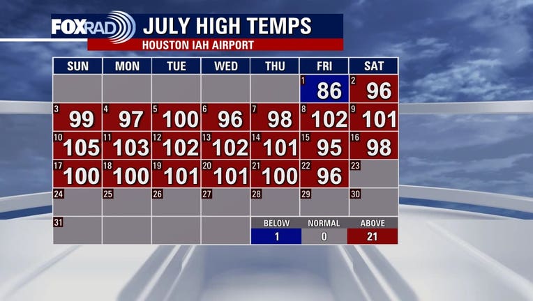
HOUSTON - As July 2022 nears its end, more than half of the month has featured daytime highs in the triple digits. That puts us on pace for our warmest July on record.
RELATED: As Texas drought worsens, is there any relief in sight?
This is in the wake of our warmest June on record and our second-warmest May on record.
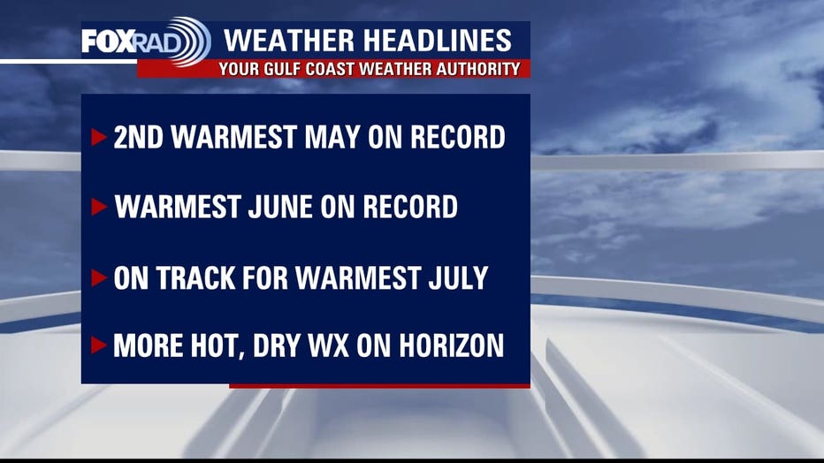
If this trend holds, it would be the first time in the historical record that the city of Houston experienced back-to-back record warm months -- yes, even beating out 2011.
While 2011 and 1980 (another notoriously hot year) both had record warm months, they did not occur consecutively.
RELATED: How common is Houston's dangerous heat, what is driving the triple digits?
Monthly temperatures are an average of both highs and lows, with records for the Houston area dating back to the late 1800s.
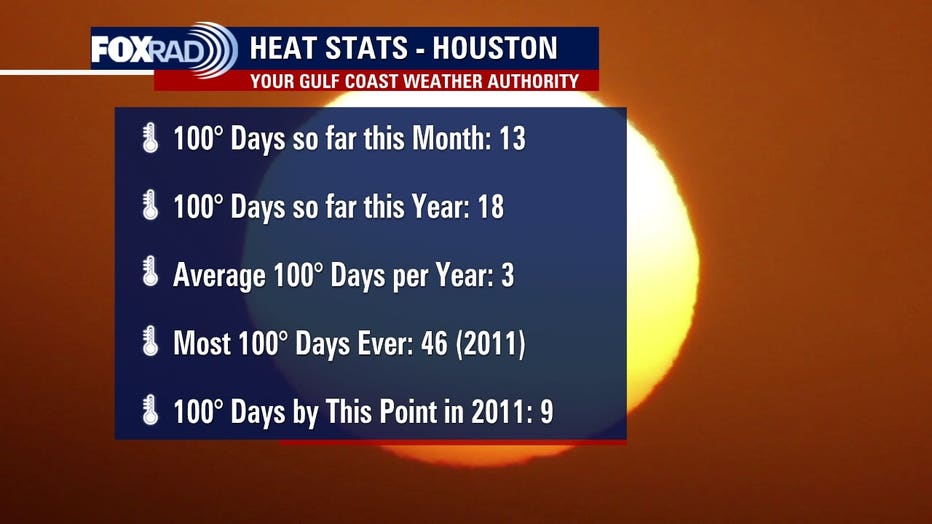
As of Friday, July 22nd, a total of 18 triple-digit temperatures have occurred at Bush Intercontinental, which is double the amount we had seen at this point in 2011.
It's also a staggering six times the number of triple-digit days we usually see in any given year.
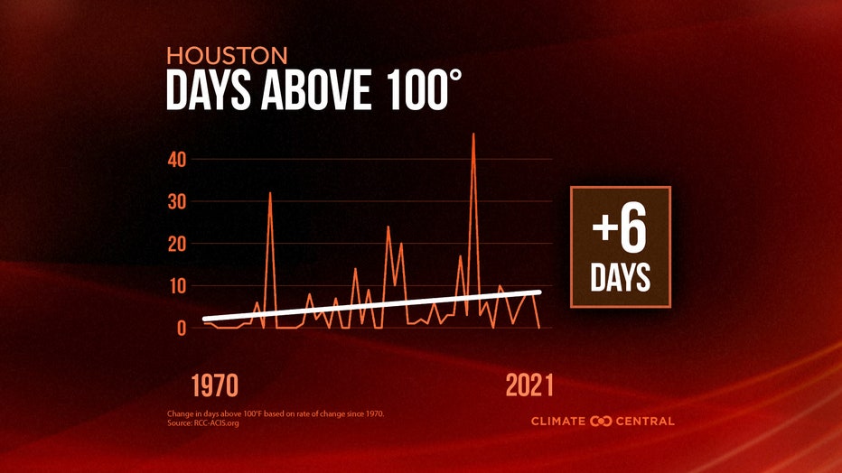
(Photo courtesy of Climate Central)
Last year, we saw none. So there is some variability. But the general trend is in an upward direction.
Over the last 50 years, we've seen the number of days above 100 grow to six more per year now than in 1970.
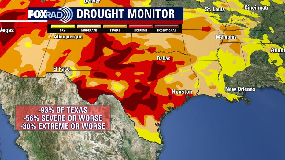
And, as the saying goes "where there's smoke there's fire". As we've seen, hot and dry conditions tend to go in tandem.
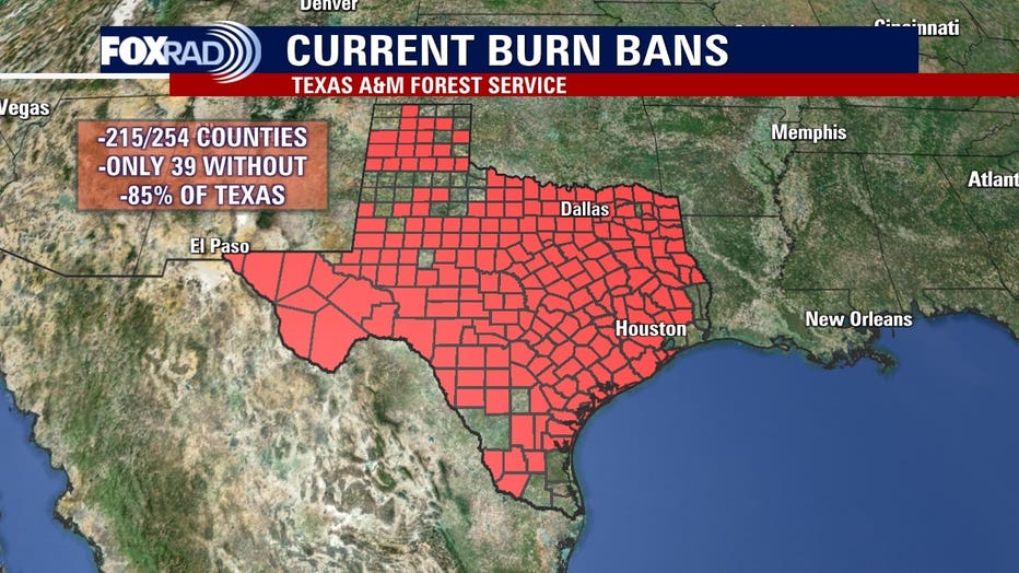
And it's a positive feedback cycle, where one exacerbates the other. 85% of the state of Texas currently has to burn bans in place. Nearly the entire state is at least moderately dry, with a third either in extreme or exceptional drought categories.
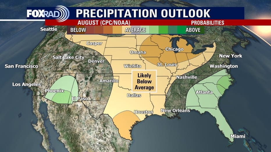
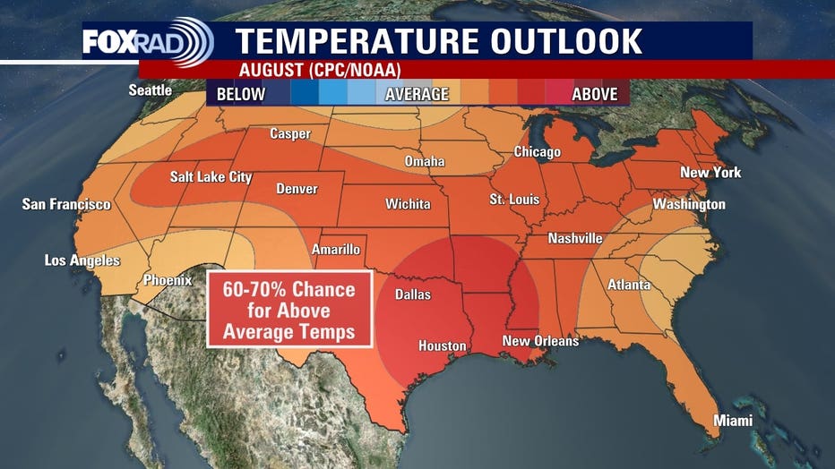
Medium to long-range temperature and precipitation outlooks keep us both hot and dry through the end of July, with a high probability of conditions persisting through August as well.
With Climate Change continuing on this trajectory, summers like this will become the norm.
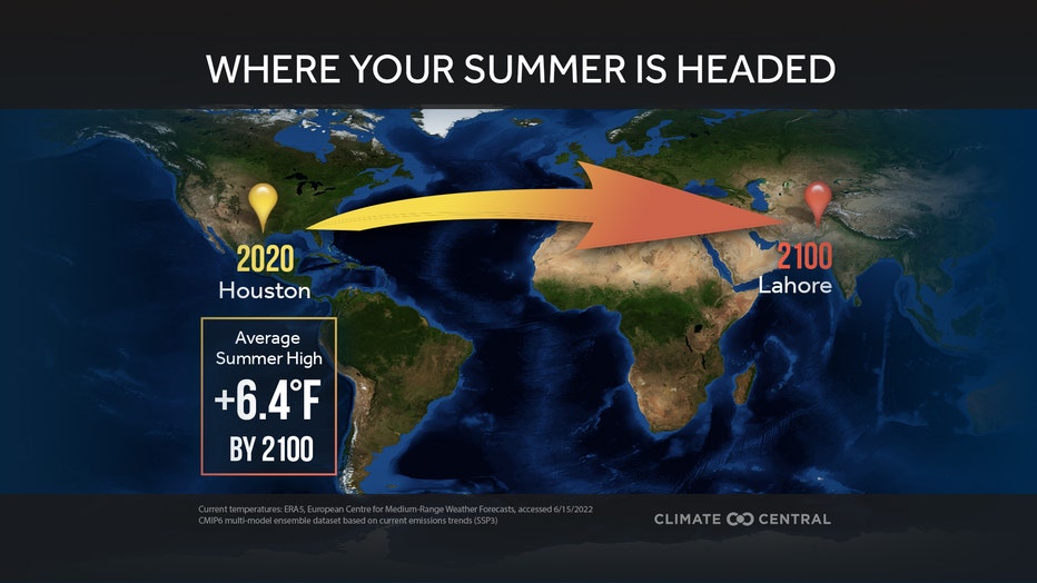
(Photo courtesy of Climate Central)
Data from Climate Central shows that our average summer highs are on trend to increase by 6.4 degrees by 2100.
With our average high currently sitting at 95, 101.4 would become the new norm. Houston is one of sixteen U.S. cities with no summer equivalent on the same continent by 2100. Lahore is in the Punjab region of Pakistan.
LATEST HOUSTON-AREA WEATHER FORECAST
An alarming statistic highlights the urgent need to take climate action now and underscores the potential local impacts if left unaddressed and ignored.