

Houston weather: Rain chances through the weekend
Houston weather: Rain repeats into the weekend
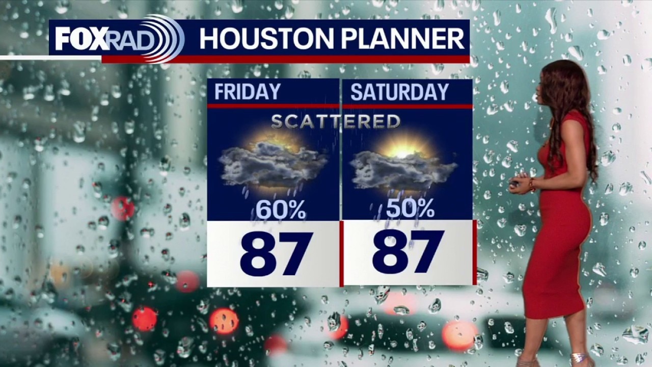
We're going into the weekend with continued rain chances. There will still be breaks in between, but pockets of heavy rain could lead to brief, isolated street flooding.
HOUSTON - We're going into the weekend with continued rain chances.
More rounds of rain develop today
Scattered showers and storms remain likely today across Southeast Texas thanks to an uncapped atmosphere and very high moisture levels.
Most areas will see rain, and a few stronger downpours could produce heavy rain, lightning, and gusty winds. Rain totals could exceed 3" in spots.
Wet pattern holds for several more days
The unsettled setup continues through the weekend with scattered showers and storms possible each day. There will still be breaks in between, but pockets of heavy rain could lead to brief, isolated street flooding.
Heat builds as rain chances
The forecast trends drier early next week as storm coverage becomes more isolated. That should allow temperatures to climb back into the low 90s, with humid conditions making it feel even hotter during the afternoon.
Tropical weather update
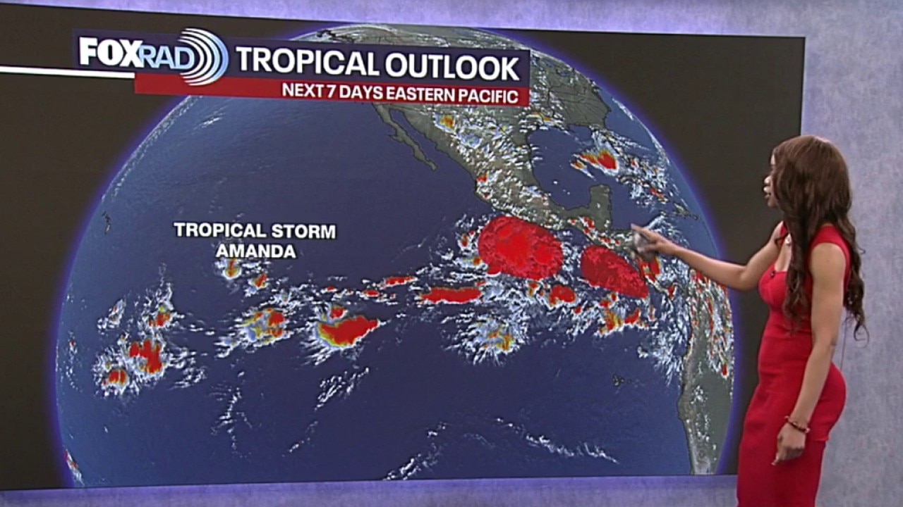
Tropical Weather Forecast - Watching Amanda in Pacific
There are no immediate tropical concerns for Houston, but tropical moisture from the Gulf will lead to more downpours this week. We're also continuing to monitor Amanda in the Pacific.
A disorganized area of showers and storms has developed near the edge of an old stalled front in the east-central Gulf. This disturbance will likely spread some tropical moisture and make landfall near New Orleans on Friday. But it's not going to become a tropical system.

Outside of that disturbance, the Gulf should remain quiet with no tropical systems expected over the next 7 days.
Keep in mind that hurricane season lasts through the end of November. So even when it's quiet, you should always be ready.

The Source: Your Gulf Coast Weather Authority