

Heat waves set records with more hot days ahead for the Houston area

Baking in the sun for another week
This is a rinse and repeat kind of forecast with only subtle changes day to day. The only chance for rain over the next several days would be if an unusually strong line of storms, which will be frequent from Oklahoma to Mississippi, were to just clip our northeast counties. Other than that, we're baking in the sun for the next week or longer.
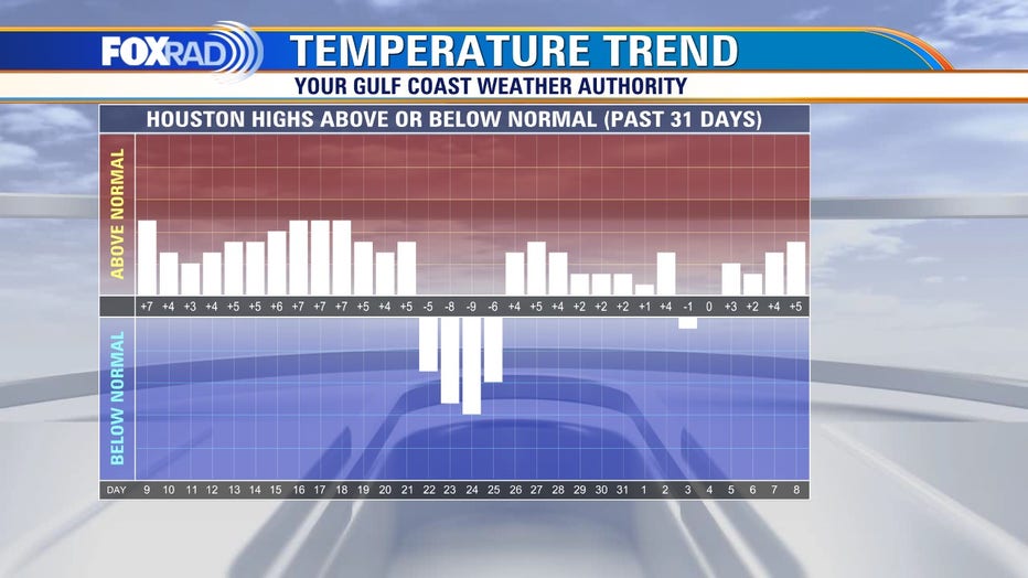
HOUSTON - Heat waves have been a familiar feeling over the past several weeks with dozens of records set, especially those for warmest low temperatures.
In fact, Galveston set an amazing 15 new record warm overnight lows in May and three more just this week. Twenty-five out of Houston's last 31 days have had above normal high temperatures.
MORE: Here’s how to prepare for hurricane season now
Our outlook for the next 7-10 days shows a high likelihood for temperatures to run 5-10° hotter than normal.
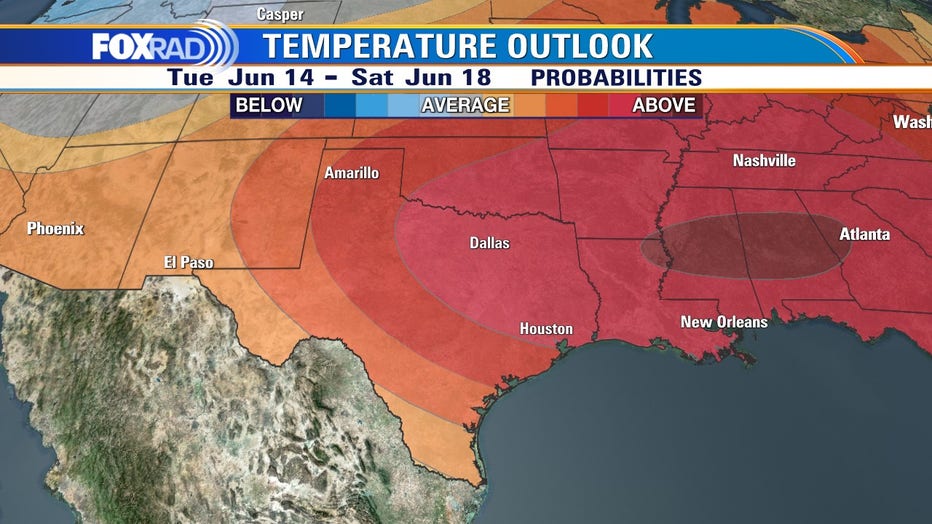
NOAA's Climate Prediction Center forecast shows that this pattern should continue through at least the next two weeks.
Rain chances will also be limited to isolated passing storms mainly east of our area.
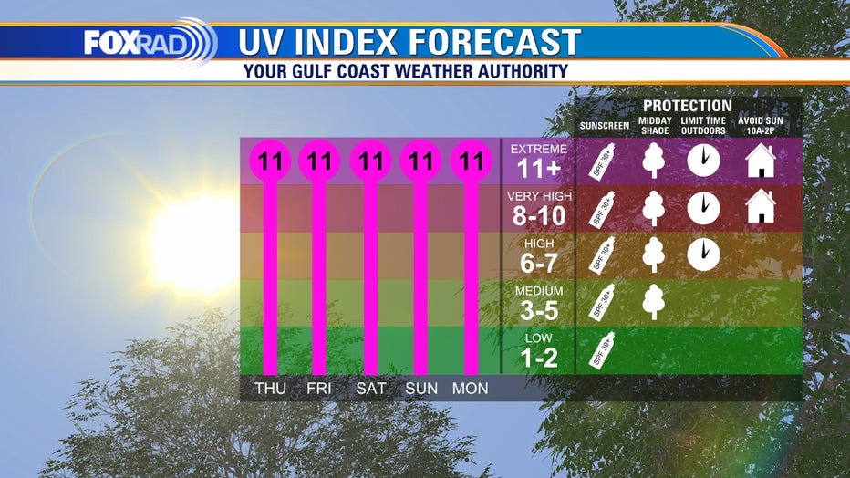
Finally, with the summer solstice approaching on June 21, the sun is at its most intense. Our ultraviolet (sunburn causing) light will remain at level 11 during the day, which is considered extreme. Protect yourself with sunscreen and stay in the shade whenever possible.