


At least 3 dead and dozens injured in tornado in Texas
Tornado strikes Perryton, Texas killing at least 3 people. Officials say at least up to 100 people are injured and thousands are still left without power.
Houston weather: Excessive heat warning as dangerous heatwave intensifies
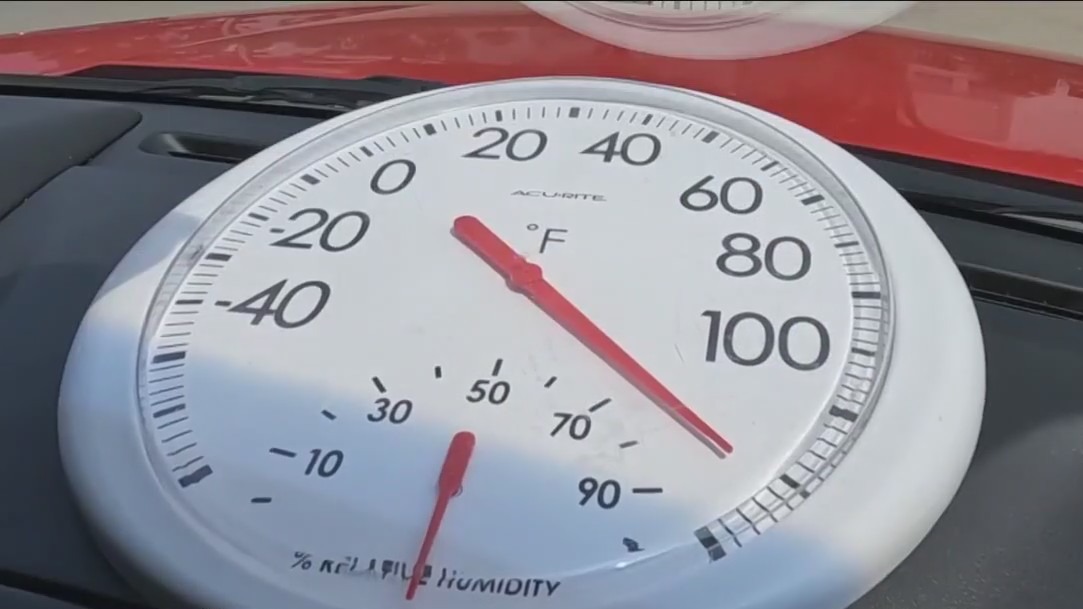
For the first time in nearly seven years, the Houston area has been placed under an Excessive Heat Warning to warn about highs near 100 and heat index values up to 115 degrees.


Dallas weather: Storms drop huge hail, tear roof off bank in Lavon
People are cleaning up Friday morning after another night of storms is leaving a trail of damage in North Texas.


Houston weather: Excessive heat warning Friday, Saturday
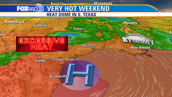
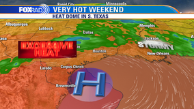
For the first time in nearly 7 years, the Houston area has been placed under an Excessive Heat Warning to warn about highs near 100 and heat index values up to 115 degrees. This advisory is in effect through at least Saturday as well. A "heat dome" of high pressure will dominate over the Rio Grande Valley for at least a week, so expect a slight chance for storms here along with very hot weather for Father's Day and Juneteenth.


Houston weather: Brutal heat continues across the area, excessive heat watch in effect
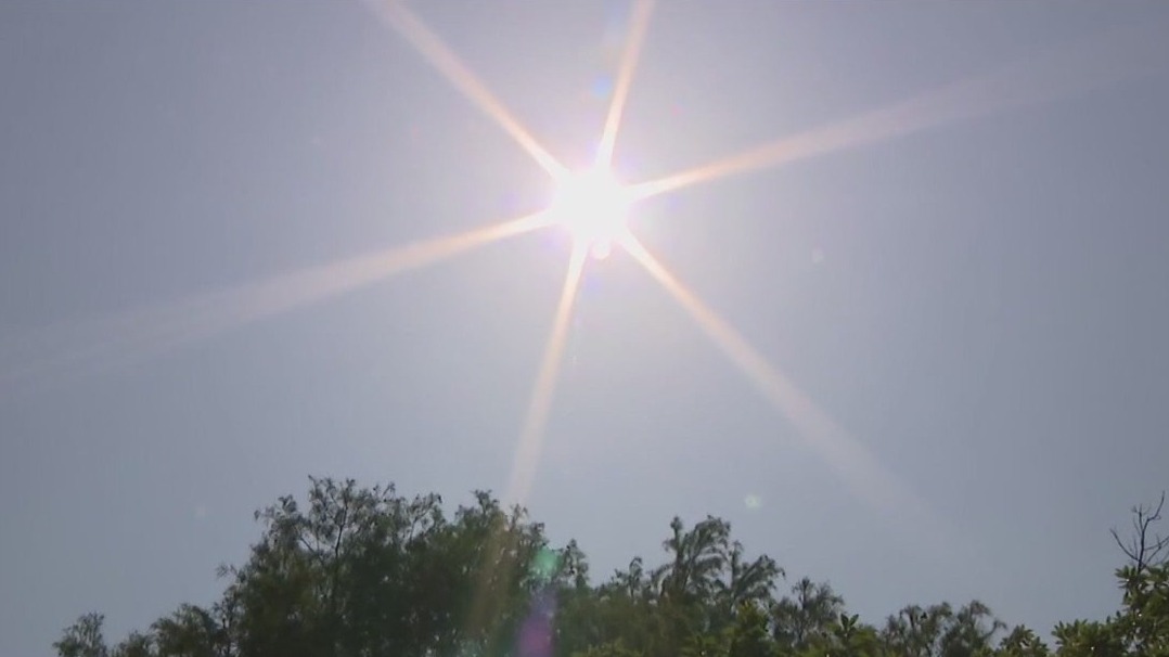
Dangerous heatwave will stick around the rest of this week as potentially record breaking heat rolls in. In fact, new record high temperatures could be set Friday and Saturday as many areas climb to triple digits. Humidity will also remain high and heat index values could soar to 113 or higher for parts of the area. For that reason, the National Weather Service has issued an Excessive Heat Watch for SE Texas from 11 AM Friday until 8 PM Saturday. This could be upgraded to an Excessive Heat Warning for the next few days. That means heat precautions are needed like drinking lots of water & trying to stay inside in the AC. Also try to wear light, loose clothing & avoid being outside during the hottest part of the day. Stretch of triple digit temperatures will continue through much of next week with no relief in sight. Storm track will remain to our north so that will mean little to no rain. Grab our FOX 26 weather app to keep track of the hot weather!

'Excessive Heat Watch' issued for much of Southeast Texas for Friday and Saturday
The Houston area is just baking in the heat and some Houstonians are sharing their thoughts.


Ways to protect your car during Houston heat, battery could pop
Meyerland Collision tells viewers how they can protect their cars during the extreme heat coming into the Houston area.


Houston weather: Excessive heat watch in effect Thursday evening, temps nearing 100s
Dangerous heatwave will stick around the rest of this week as potentially record breaking heat rolls in. In fact, new record high temperatures could be set Friday and Saturday as many areas climb to triple digits. Humidity will also remain high and heat index values could soar to 113 or higher for parts of the area. For that reason, the National Weather Service has issued an Excessive Heat Watch for SE Texas from 11 AM Friday until 8 PM Saturday. This could be upgraded to an Excessive Heat Warning for the next few days. That means heat precautions are needed like drinking lots of water & trying to stay inside in the AC. Also try to wear light, loose clothing & avoid being outside during the hottest part of the day. Stretch of triple digit temperatures will continue through much of next week with no relief in sight. Storm track will remain to our north so that will mean little to no rain. Grab our FOX 26 weather app to keep track of the hot weather!


Houston weather: Record-high temperatures put residents in jeopardy
Thursday is Day 2 of an heat advisory issued for Houston.
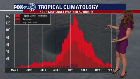

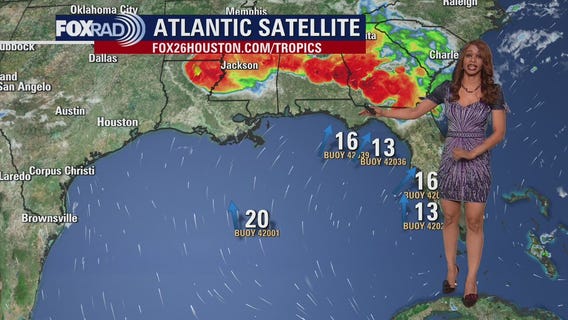
Tropical Weather Forecast - June 15, 2023
The tropics have been very quiet this week but we now have one system in the far east Atlantic we are monitoring for gradual development. A tropical wave along the west coast of Africa has a 20% chance for development over the next 7 days. So it will be several days before it could possibly impact the US.


El Tiempo 15 de Junio de 2023
#FOX26 Meteor?loga Lena Maria Arango tiene su pron?stico para el fin de semana.


Houston weather: Heat Advisory in effect Thursday afternoon, temps in 90s
Although Summer does not officially begin until next Wednesday, it already feels every bit like it in southeast Texas. A Heat Advisory is in effect through at least 8pm Friday for "Feels Like" values as hot as 112�. Heat Safety will be imperative over the next week, especially during the afternoons while daytime highs flatline in the low 100s. No rain in sight locally, and in the tropics a wave is forecast to move off the African coastline with low chances of gradual development for now.


How El Niño, 'freakish' warm oceans may impact hurricane season
It's the first El Niño year since 2019. The climate event can have significant impacts on the weather, including the Pacific and Atlantic hurricane seasons.


Houston weather: Another heat advisory Thursday
Today is Day 2 of a heat wave with a heat advisory in effect from noon through 8 p.m. Afternoon heat index temperatures could hit 110 and there is only a slight chance for an evening storm mainly northwest of our area. The next several days will remain very hot with record highs possible and a nasty heat index. The tropics are quiet for now.


Houston weather: Another excessively hot day ahead on Thursday
The first major heatwave of the season is upon us with triple digit temperatures expected for much of the next week! When you factor in the humidity, heat index values could soar higher than 110 Thursday! National Weather Service has also issued another HEAT ADVISORY from Noon until 8 PM Thursday for much of SE Texas including Houston. HEAT INDEX VALUES could get up to 112 for parts of the area. Make sure to stay out of the sun as much as possible, drink plenty of water & take frequent breaks while working outside. Also try to get work done early in the day or in the evening and avoid working outside in the middle of the day. Triple digit temperatures are forecast Thursday through the middle of next week with record breaking heat most likely on Friday and Saturday. An isolated storm could clip our northern counties but most will stay dry for much of the next week. Download our FOX 26 WX App for the latest on this dangerous heat event and stay safe!

Houston-area firefighters reminding people of dangers of locked cars, children in the heat
The scorching conditions in the Houston-area have prompted officials to sound the alarm on the perils of locked cars, particularly for children,


Galveston safety: Heat, water safety tips after 38-year-old dad drowns
Despite Galveston being under a heat advisory, many people are flocking to the beach to enjoy the summer sun. The heat wave has settled over the island, but Galveston has a unique advantage—a refreshing coastal breeze that provides some relief from the scorching temperatures.


Houston weather: Partly cloudy, hot Wednesday evening
The first major heatwave of the season is upon us with triple digit temperatures expected for much of the next week! When you factor in the humidity, heat index values could soar higher than 110 Thursday! HEAT ADVISORY continues until 7 PM this evening for Houston and surrounding areas. National Weather Service has also issued another HEAT ADVISORY from Noon until 8 PM Thursday for much of SE Texas including Houston. HEAT INDEX VALUES could get up to 112 for parts of the area. Make sure to stay out of the sun as much as possible, drink plenty of water & take frequent breaks while working outside. Also try to get work done early in the day or in the evening and avoid working outside in the middle of the day. Triple digit temperatures are forecast Thursday through the middle of next week with record breaking heat most likely on Friday and Saturday. An isolated storm could clip our northern counties but most will stay dry for much of the next week. Download our FOX 26 WX App for the latest on this dangerous heat event and stay safe!

Tropical Weather Forecast - June 14, 2023
There's a disturbance in the eastern Pacific south of Mexico that has a 20% chance for development into a tropical cyclone. But it is moving away from the United States as it tracks WNW. The Atlantic, Caribbean and Gulf of Mexico remain quiet with no tropical activity expected for the next few days.


City of Houston activates emergency heat plan: here's what you need to know
Houston often activates the plan when the heat index is expected to reach 108 degrees on two consecutive days. And our heat index values temperatures ranging between 108 and 114 starting Thursday and into the weekend.