

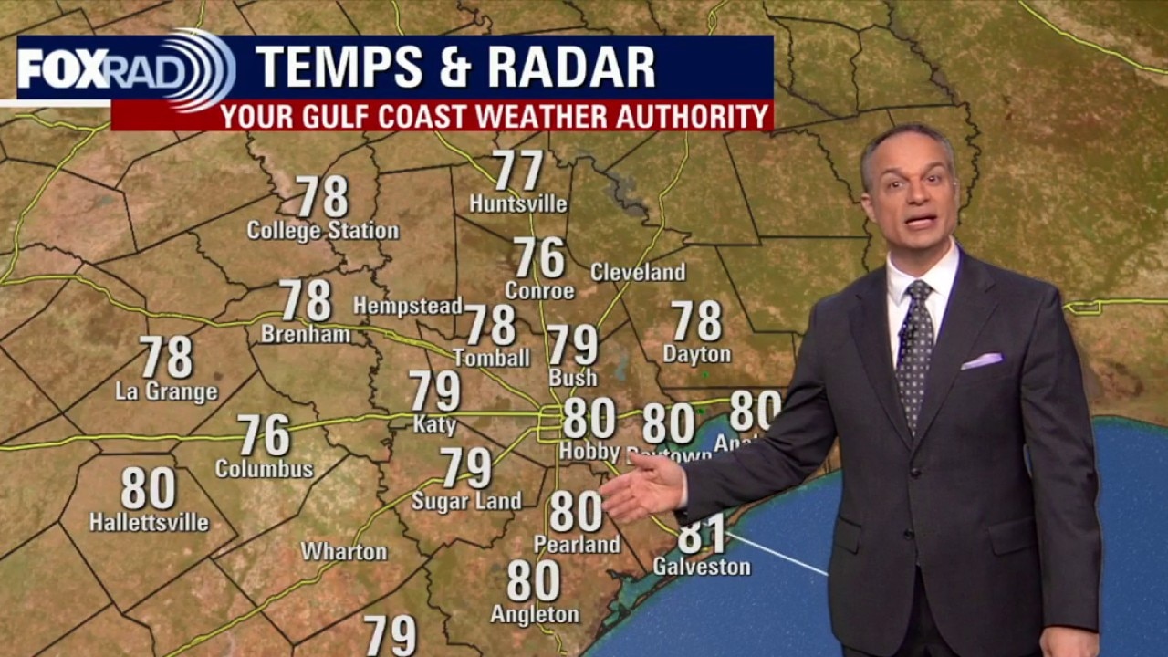
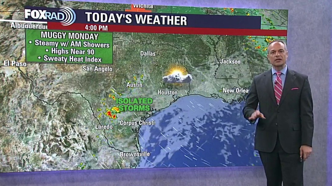
Houston weather: Muggy Thursday with highs in the 90s
Thursday will be another steamy and hot day with highs reaching into the 90s. There is a low chance of spotty showers.
Thursday will be another steamy and hot day with highs reaching into the 90s. There is a low chance of spotty showers.
Houston weather: Warm weather to remain for Thursday
Hot and humid weather continues across Southeast Texas through the weekend, with highs in the low to mid 90s and heat index values likely climbing above 100 at times. Some spotty storms will be possible, but the heat and humidity remain the main weather story.
Hot and humid weather continues across Southeast Texas through the weekend, with highs in the low to mid 90s and heat index values likely climbing above 100 at times. Some spotty storms will be possible, but the heat and humidity remain the main weather story.
Houston weather: Warm days ahead as World Cup begins Thursday
Hot and humid weather continues across Southeast Texas through the weekend, with highs in the low to mid 90s and heat index values likely climbing above 100 at times. Some spotty storms will be possible, but the heat and humidity remain the main weather story.
Hot and humid weather continues across Southeast Texas through the weekend, with highs in the low to mid 90s and heat index values likely climbing above 100 at times. Some spotty storms will be possible, but the heat and humidity remain the main weather story.
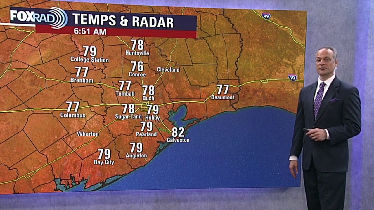
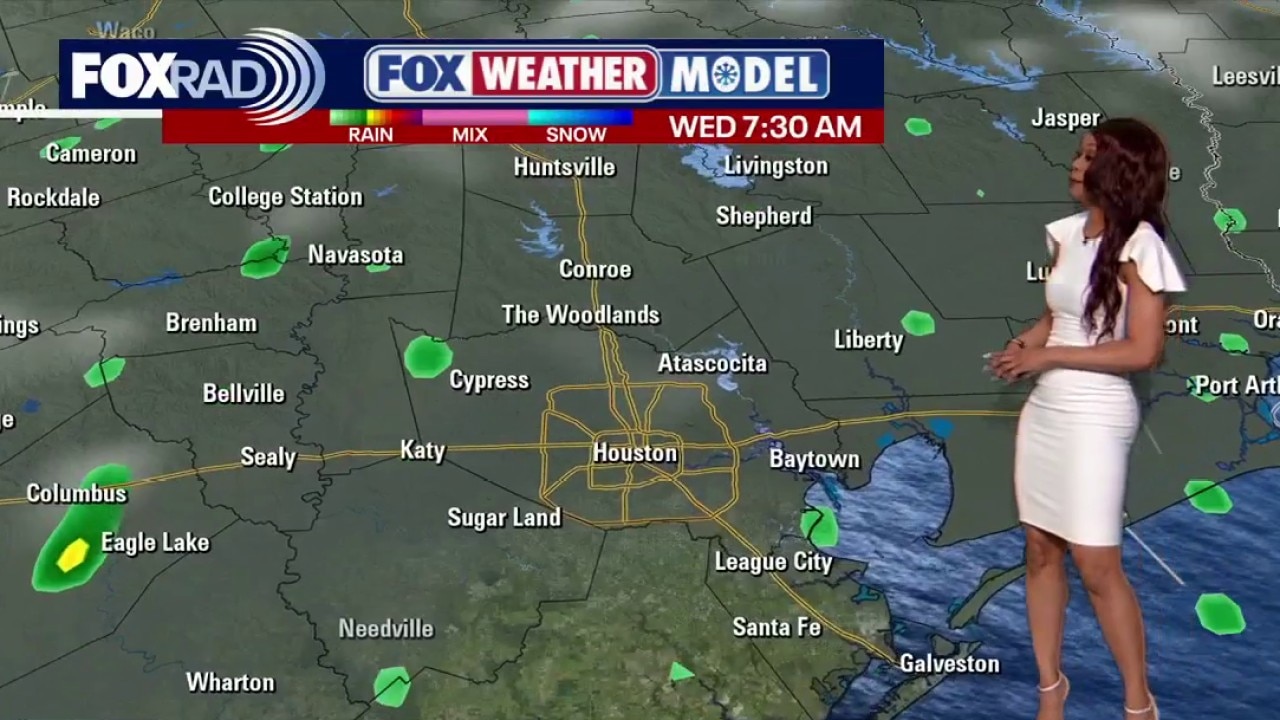
Houston weather: High humidity Wednesday, highs in 90s
Increase in humidity Wednesday with highs in the low 90s. There is a chance of spotty showers. Plus, Mike takes a look at weather during the upcoming, first FIFA World Cup matches.
Increase in humidity Wednesday with highs in the low 90s. There is a chance of spotty showers. Plus, Mike takes a look at weather during the upcoming, first FIFA World Cup matches.
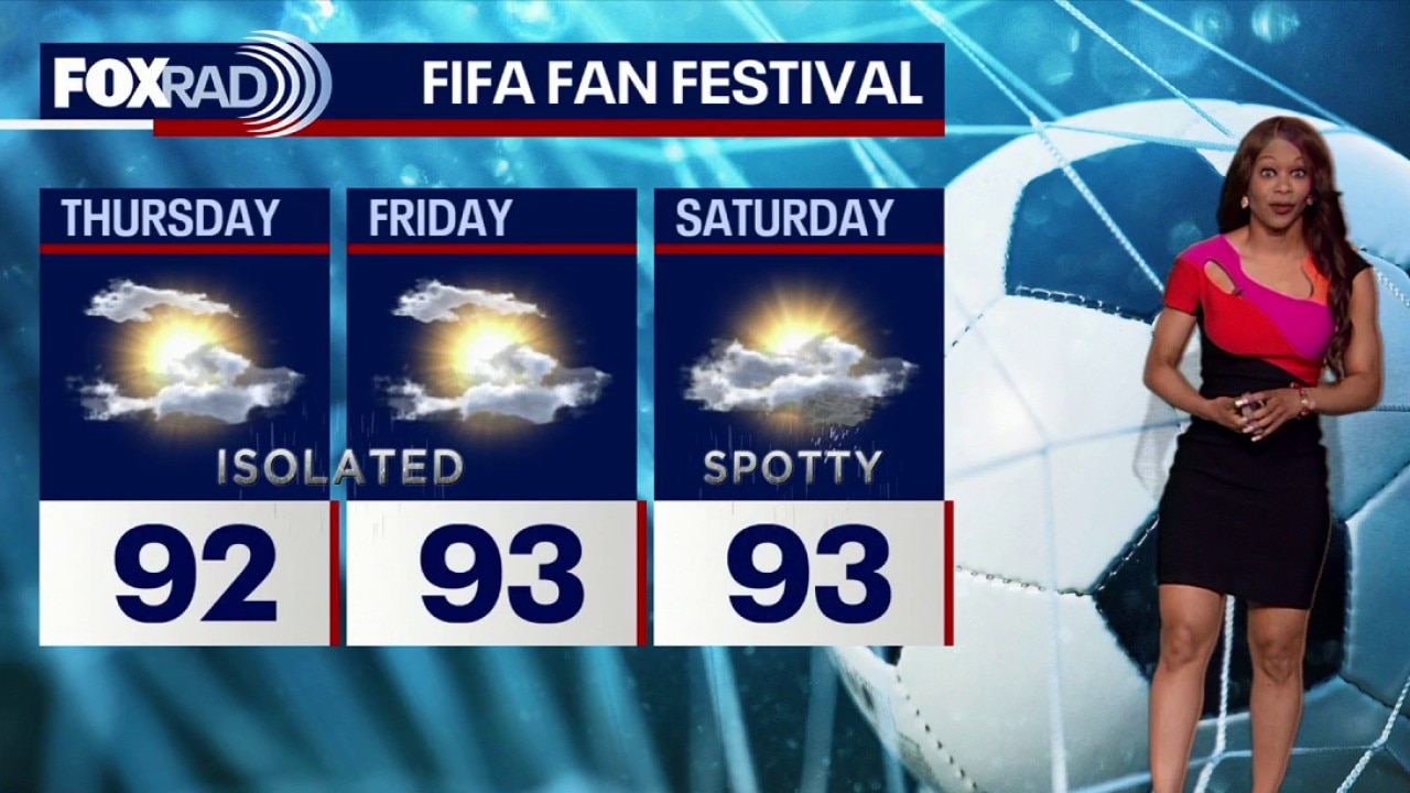
Houston weather: Heat, humidity returns to Houston weather pattern
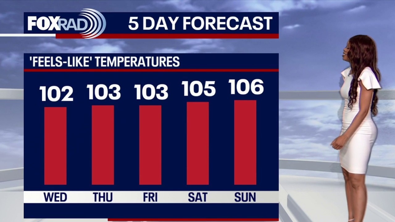
Humidity pushes the heat index above 100 leading into Houston’s FIFA Fan Festival. Anyone spending time outside should plan for steamy conditions, take breaks from the heat, and stay hydrated.
Humidity pushes the heat index above 100 leading into Houston’s FIFA Fan Festival. Anyone spending time outside should plan for steamy conditions, take breaks from the heat, and stay hydrated.
Houston weather: Summer-like sizzle returns
Hot and humid weather has taken control across Southeast Texas with highs in the low to middle 90s all week. A few showers and storms will be possible at times, but most of the week will feature more heat than rain.
Hot and humid weather has taken control across Southeast Texas with highs in the low to middle 90s all week. A few showers and storms will be possible at times, but most of the week will feature more heat than rain.
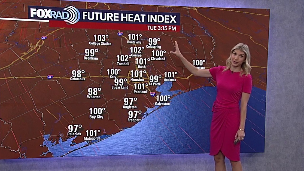
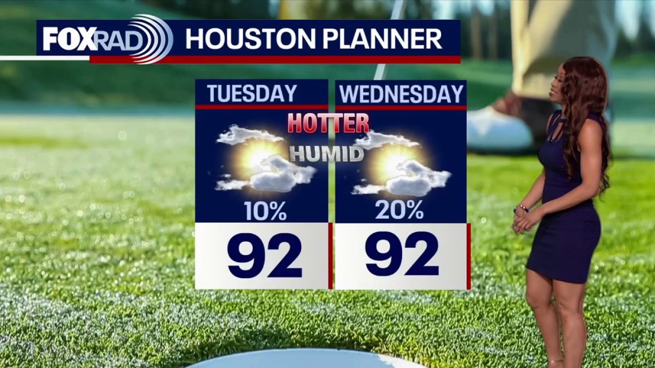
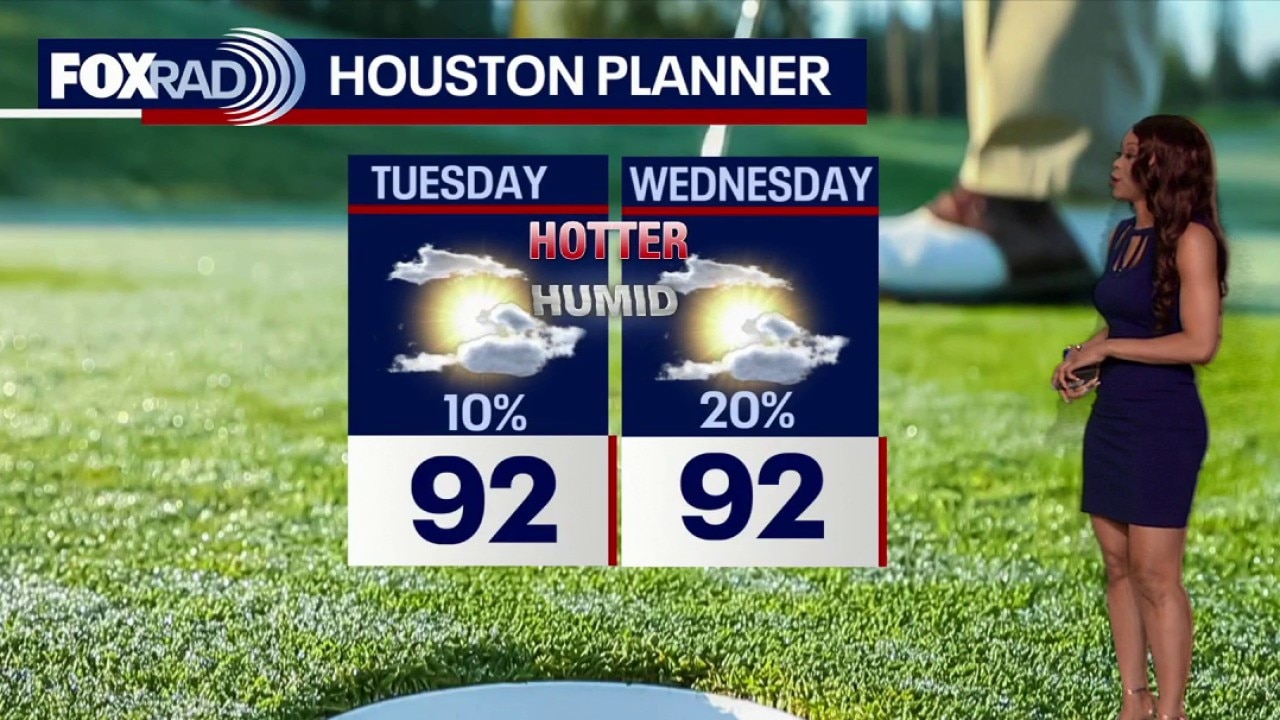
Houston weather: Hot, humid Tuesday, isolated shower possible
It will be a steamy Tuesday in the Houston area with the chance of isolated rain. Highs will be in the 90s for today and the rest of the week.
It will be a steamy Tuesday in the Houston area with the chance of isolated rain. Highs will be in the 90s for today and the rest of the week.
Houston weather: More heat expected for Tuesday
Hot and humid weather will take hold across Southeast Texas with highs in the low 90s all week. Spotty showers and storms will be possible at times, but most of the week will feature more heat than rain.
Hot and humid weather will take hold across Southeast Texas with highs in the low 90s all week. Spotty showers and storms will be possible at times, but most of the week will feature more heat than rain.
Houston weather: The heat is on for Tuesday
Hot and humid weather will take hold across Southeast Texas with highs in the low 90s all week. Spotty showers and storms will be possible at times, but most of the week will feature more heat than rain.
Hot and humid weather will take hold across Southeast Texas with highs in the low 90s all week. Spotty showers and storms will be possible at times, but most of the week will feature more heat than rain.
Houston weather: Hot and humid all week with spotty storms
Hot and humid weather will take hold across Southeast Texas with highs in the low 90s all week. Spotty showers and storms will be possible at times, but most of the week will feature more heat than rain.
Hot and humid weather will take hold across Southeast Texas with highs in the low 90s all week. Spotty showers and storms will be possible at times, but most of the week will feature more heat than rain.
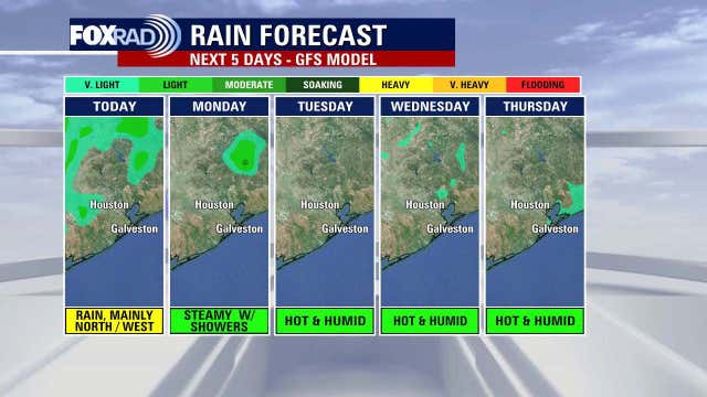

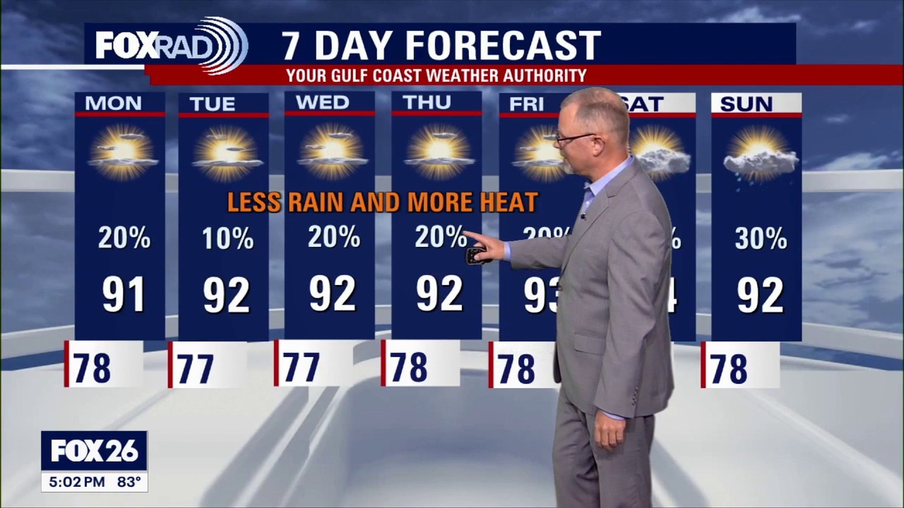
Houston weather: Less rain, more heat
Less rain will lead to some very warm days with a humid pattern still in place.
Less rain will lead to some very warm days with a humid pattern still in place.
Houston weather: June 7 evening forecast
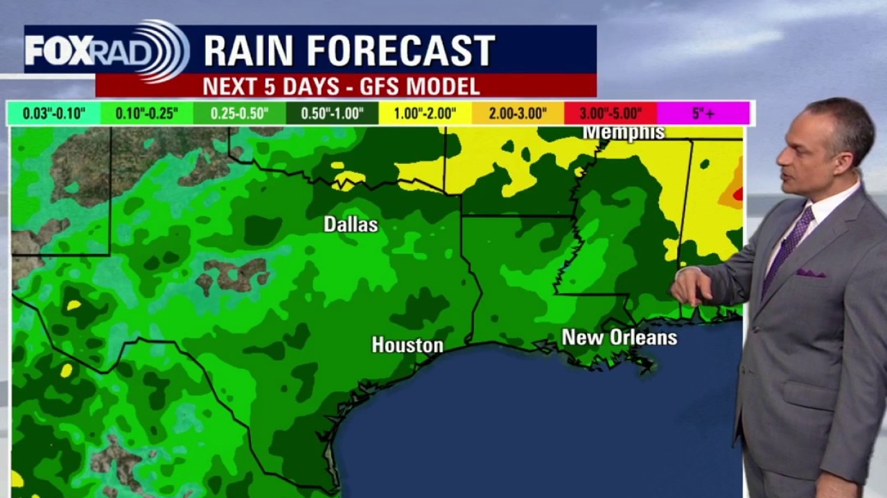
Southeast Texas is transitioning out of a rainy pattern into one that supports feel-like temps above 100 degrees.
Southeast Texas is transitioning out of a rainy pattern into one that supports feel-like temps above 100 degrees.
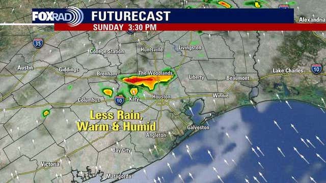

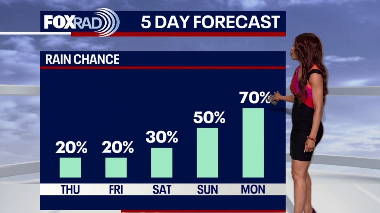
Houston weather: Less rain for Sunday
Scattered showers and storms will be possible today across Southeast Texas, with the best chance north and west of Houston.
Scattered showers and storms will be possible today across Southeast Texas, with the best chance north and west of Houston.
Houston weather: June 7 morning forecast
Scattered showers and storms will be possible today across Southeast Texas, with the best chance north and west of Houston. Any storms that develop could briefly produce heavy rain, lightning, and gusty winds, but coverage should be more hit-or-miss than widespread.
Scattered showers and storms will be possible today across Southeast Texas, with the best chance north and west of Houston. Any storms that develop could briefly produce heavy rain, lightning, and gusty winds, but coverage should be more hit-or-miss than widespread.
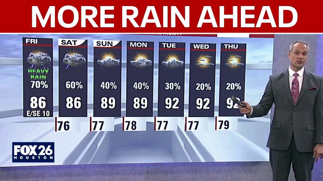
Houston weather: June 6 overnight forecast
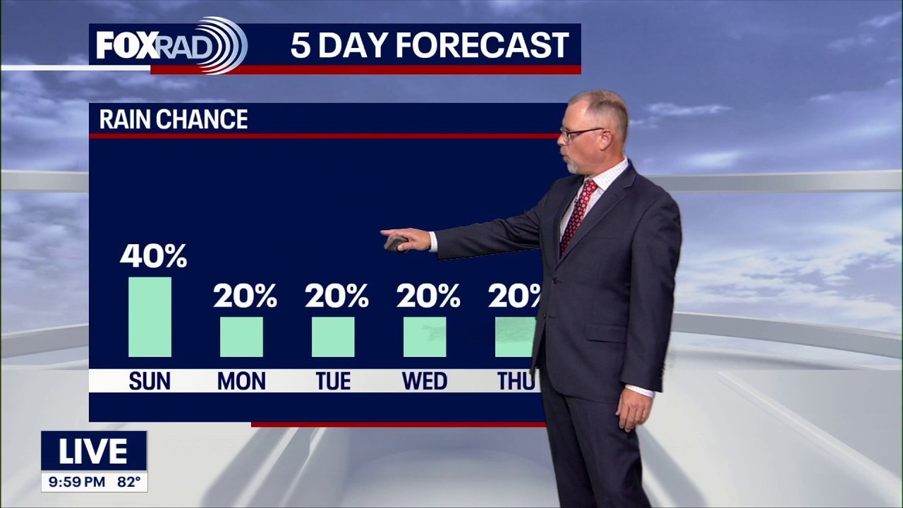
FOX 26's John Dawson gives the latest weather update for Southeast Texas as rain chances increase to finish the weekend and linger throughout the week.
FOX 26's John Dawson gives the latest weather update for Southeast Texas as rain chances increase to finish the weekend and linger throughout the week.
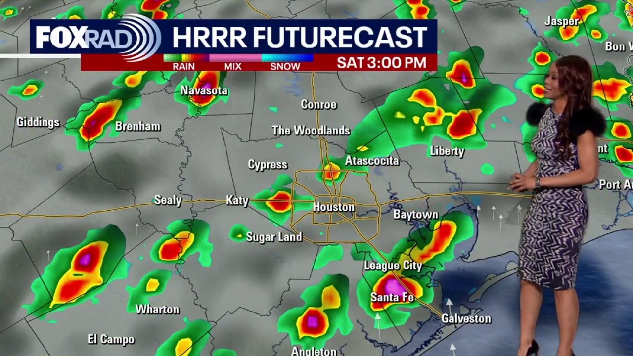
Houston weather: June 6 evening forecast
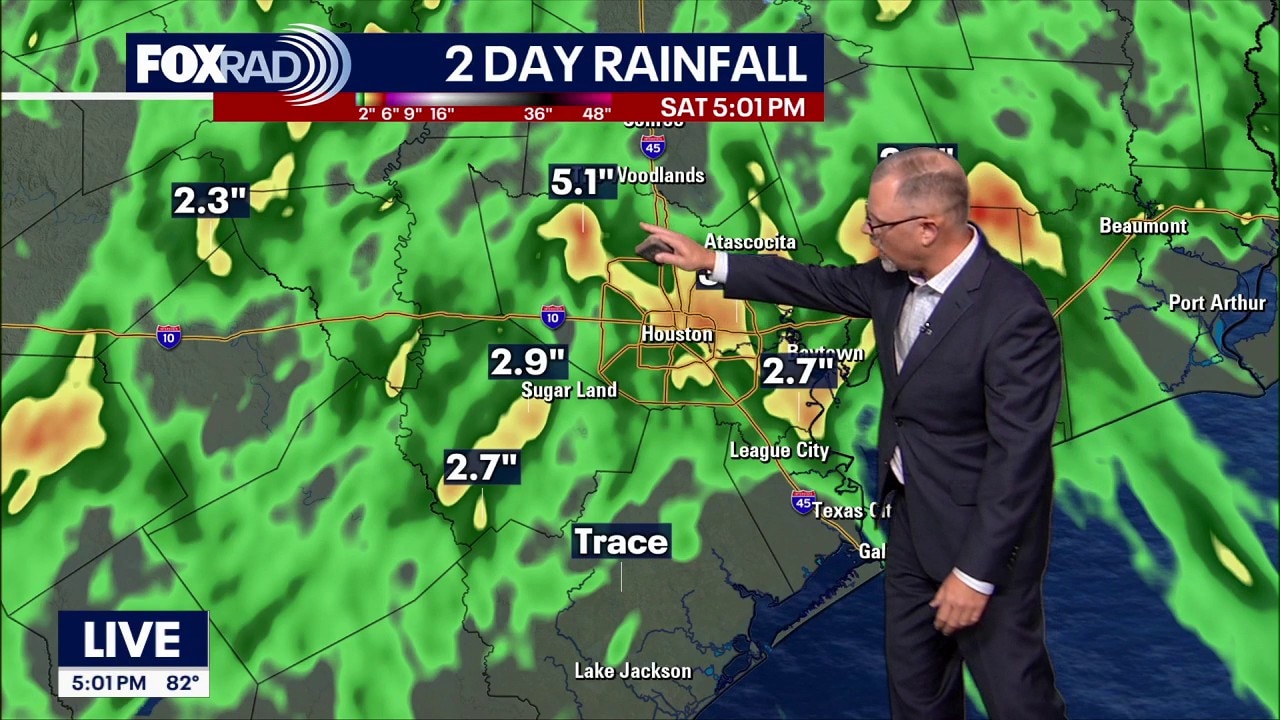
Scattered showers and strong downpours rolled across Southeast Texas Saturday afternoon.
Scattered showers and strong downpours rolled across Southeast Texas Saturday afternoon.
Houston weather: June 6 morning forecast
More scattered showers and storms are expected across Southeast Texas by this afternoon, and some could produce heavy rain in a short amount of time. The strongest downpours may lead to quick street flooding, especially in spots that have already picked up several inches of rain this week.
More scattered showers and storms are expected across Southeast Texas by this afternoon, and some could produce heavy rain in a short amount of time. The strongest downpours may lead to quick street flooding, especially in spots that have already picked up several inches of rain this week.
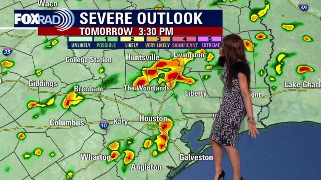
Houston weather: More storms possible this weekend
More scattered showers and storms will keep going Saturday as deep tropical moisture remains in place over Southeast Texas. Not everyone will see rain the entire time, but the strongest downpours could briefly produce heavy rain, lightning, gusty winds, and quick street flooding.
More scattered showers and storms will keep going Saturday as deep tropical moisture remains in place over Southeast Texas. Not everyone will see rain the entire time, but the strongest downpours could briefly produce heavy rain, lightning, gusty winds, and quick street flooding.
Houston weather: Rain clearing out Friday, returns for the weekend
Scattered showers and storms will keep going Saturday, then continue into Sunday and Monday.
Scattered showers and storms will keep going Saturday, then continue into Sunday and Monday.
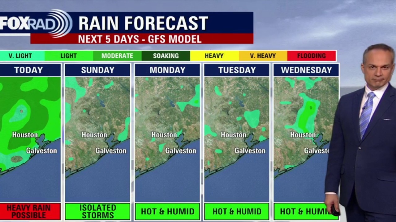
Houston weather: Heavy downpours possible Friday, Saturday
Another round of scattered showers and storms is possible today and again Saturday as deep tropical moisture remains in place over Southeast Texas. Not everyone will see rain the entire time, but the strongest downpours could briefly produce heavy rain, lightning, gusty winds, and quick street flooding.
Another round of scattered showers and storms is possible today and again Saturday as deep tropical moisture remains in place over Southeast Texas. Not everyone will see rain the entire time, but the strongest downpours could briefly produce heavy rain, lightning, gusty winds, and quick street flooding.