

Houston weather: March 12 overnight forecast
Friday morning temps dip enough for light jackets, but the cool start won't last long.
Friday morning temps dip enough for light jackets, but the cool start won't last long.

Houston weather: March 12 evening forecast
After a breezy and cooler day today, plan on temperatures getting chilly late tonight.
After a breezy and cooler day today, plan on temperatures getting chilly late tonight.
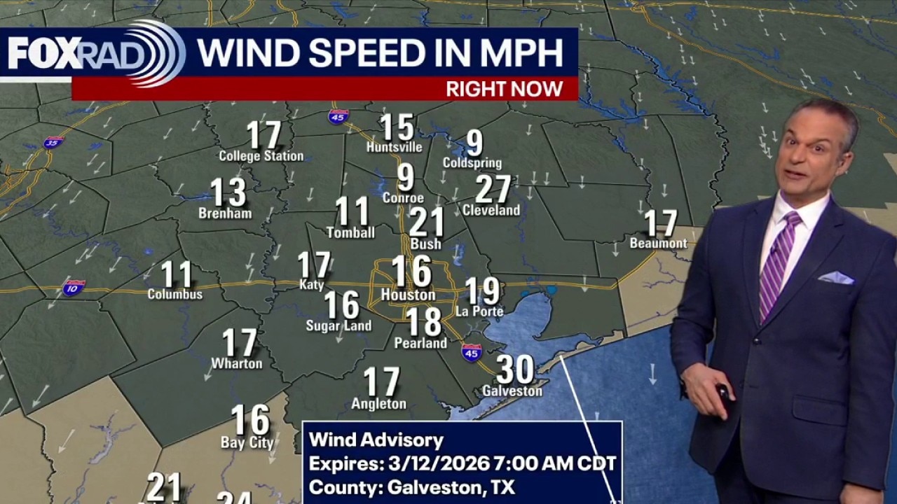
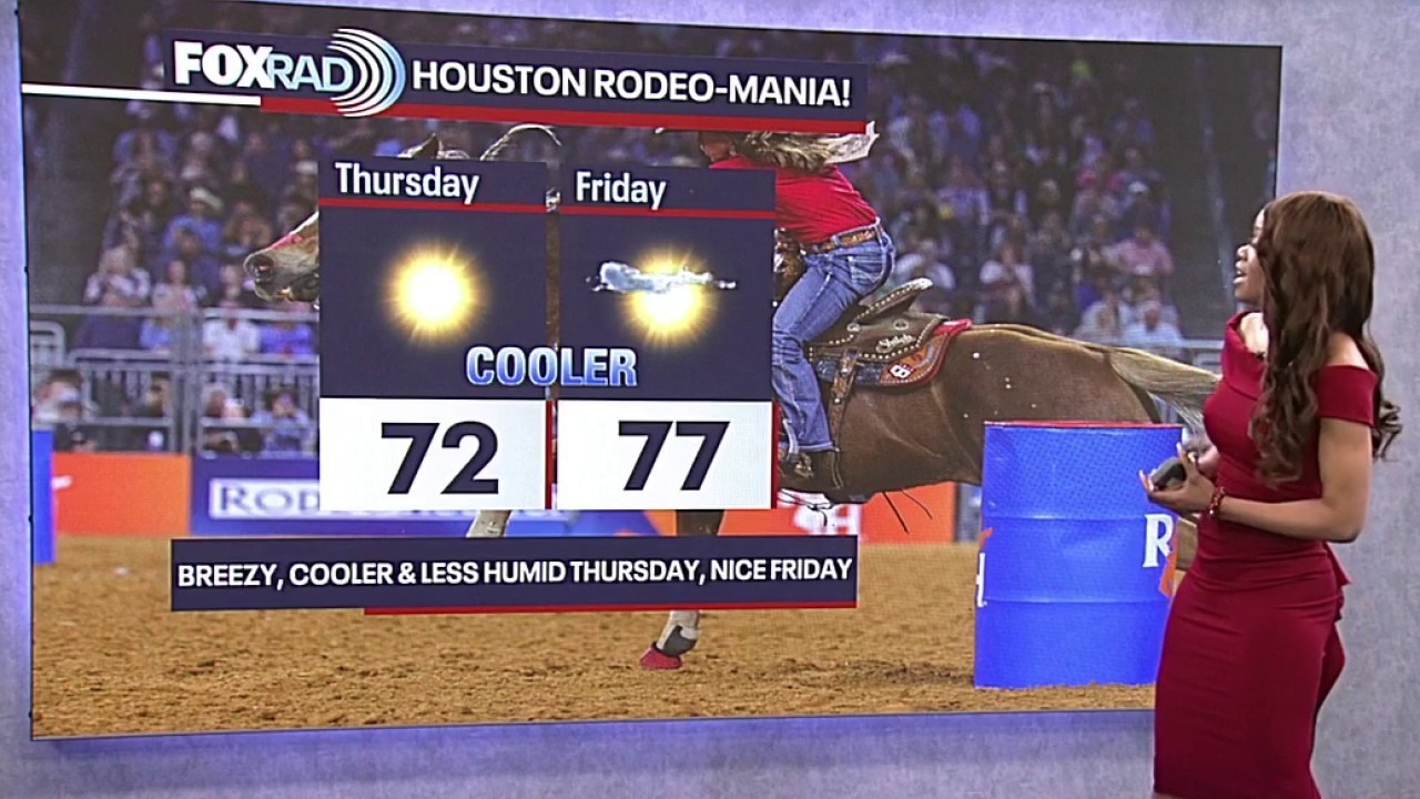
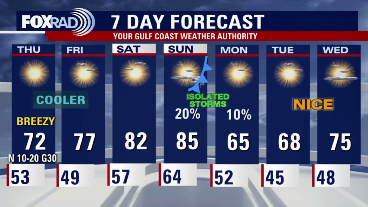
Houston weather: Breezy sunny Thursday in the 60s
Some cooler air has settled in the Houston-area and the temperature drop is noticeable with the windy morning and an expected breezy afternoon. Highs are in the 60s, a drop from the recent 80 degree afternoons we've been having.
Some cooler air has settled in the Houston-area and the temperature drop is noticeable with the windy morning and an expected breezy afternoon. Highs are in the 60s, a drop from the recent 80 degree afternoons we've been having.
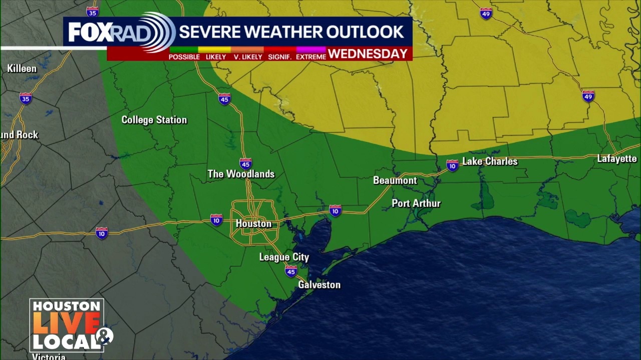
Houston weather: March 11 overnight forecast
After storms blew across Southeast Texas on Wednesday, cooler air will return to the Houston area for a few days.
After storms blew across Southeast Texas on Wednesday, cooler air will return to the Houston area for a few days.
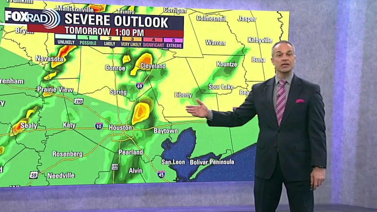
Cooler temps after Wednesday storms
In the wake of the storms on Wednesday, cooler and drier air settles in.
In the wake of the storms on Wednesday, cooler and drier air settles in.
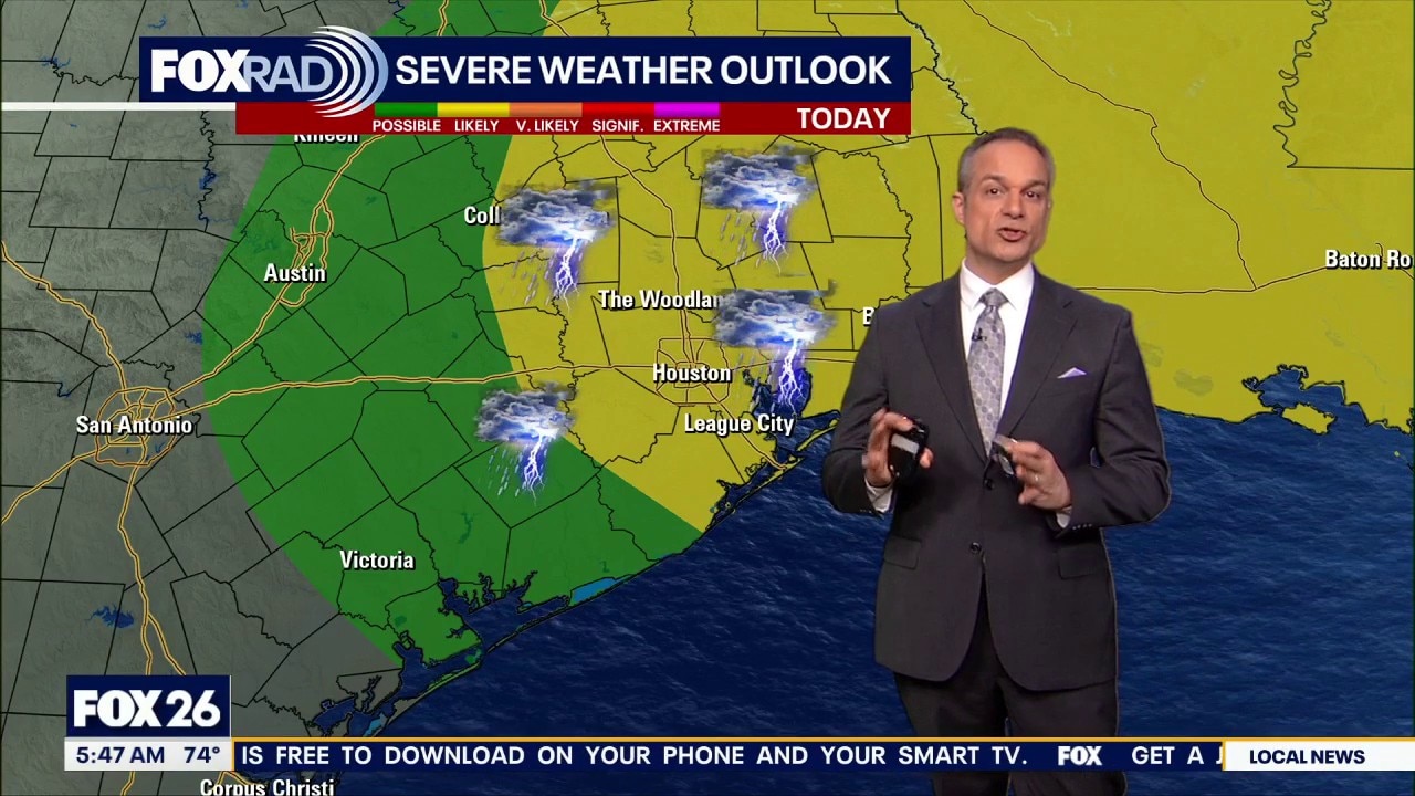
Houston weather: Severe storms Wednesday; FOX 26 Storm Alert Day
It's a FOX 26 Storm Alert Day as we can expect to see strong to severe thunderstorms on Wednesday. Damaging winds and the potential for tornadoes are a concern.
It's a FOX 26 Storm Alert Day as we can expect to see strong to severe thunderstorms on Wednesday. Damaging winds and the potential for tornadoes are a concern.

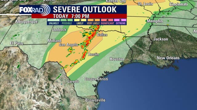
Strong storms possible in Houston Wednesday: Forecast
A strong cold front will pass through Southeast Texas Wednesday afternoon bringing a chance for strong or severe thunderstorms. Large hail, damaging winds, and tornadoes are possible, but damaging wind gusts and locally heavy rainfall are the greatest concerns.
A strong cold front will pass through Southeast Texas Wednesday afternoon bringing a chance for strong or severe thunderstorms. Large hail, damaging winds, and tornadoes are possible, but damaging wind gusts and locally heavy rainfall are the greatest concerns.

Houston weather: Pleasant Tuesday ahead of strong to severe storms Wednesday
Enjoy the temperature highs in the 80s with slight breezes as we'll have strong to severe storms on Wednesday.
Enjoy the temperature highs in the 80s with slight breezes as we'll have strong to severe storms on Wednesday.
Houston weather: Unusually warm, humid for Tuesday
It's warm and humid for Tuesday which is unusual for this time of year, however, enjoy the temperature highs in the 80s with slight breezes. We'll have strong rounds of storms on Wednesday.
It's warm and humid for Tuesday which is unusual for this time of year, however, enjoy the temperature highs in the 80s with slight breezes. We'll have strong rounds of storms on Wednesday.
Houston weather: Warm Tuesday, storms Wednesday
Most of Tuesday looks quiet, but the air will feel humid as Gulf moisture continues to stream in and isolated mid-to-late day showers are possible. A stronger system pushes in late Wednesday into Wednesday night, bringing a widespread round of showers and thunderstorms.
Most of Tuesday looks quiet, but the air will feel humid as Gulf moisture continues to stream in and isolated mid-to-late day showers are possible. A stronger system pushes in late Wednesday into Wednesday night, bringing a widespread round of showers and thunderstorms.
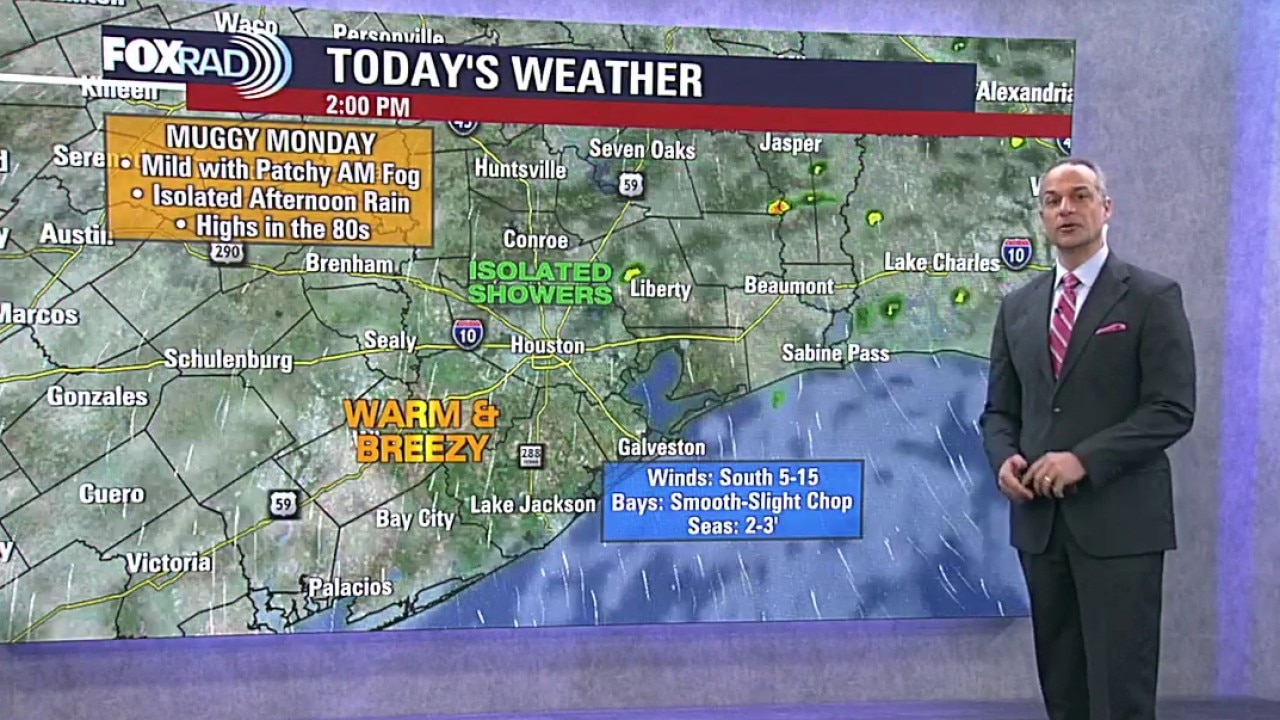
Houston weather: Warm, isolated rain chances for Monday
It's a humid and breezy start to the week on Monday with conditions feeling warm in the low 80s along with some clouds. We could see some showers on Wednesday as a stronger system pushes in.
It's a humid and breezy start to the week on Monday with conditions feeling warm in the low 80s along with some clouds. We could see some showers on Wednesday as a stronger system pushes in.
Houston weather: March 8 evening forecast
Skies remain cloudy Sunday night and fog will be around the Houston area for Monday morning. Passing showers and a rumble of thunder will be possible in the morning with a chance for a stray shower in the afternoon.
Skies remain cloudy Sunday night and fog will be around the Houston area for Monday morning. Passing showers and a rumble of thunder will be possible in the morning with a chance for a stray shower in the afternoon.

Houston weather: Second cold front to bring rain, cooler air for rodeo fans
A powerful cold front that triggered deadly tornadoes and destructive winds across the central U.S. is stalling over Southeast Texas on Sunday, shifting the primary weather threat from severe storms to localized flooding and blinding rain.
A powerful cold front that triggered deadly tornadoes and destructive winds across the central U.S. is stalling over Southeast Texas on Sunday, shifting the primary weather threat from severe storms to localized flooding and blinding rain.
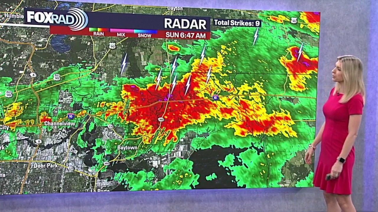
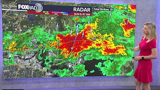
Houston weather: Sunday, March 8 morning forecast
There is a cluster of slow-moving, high-intensity rain cells currently impacting the Gulf Coast. Blinding rain and frequent lightning have been reported along the Interstate 10 corridor, specifically affecting Baytown, Channelview, and southern Liberty and Chambers counties.
There is a cluster of slow-moving, high-intensity rain cells currently impacting the Gulf Coast. Blinding rain and frequent lightning have been reported along the Interstate 10 corridor, specifically affecting Baytown, Channelview, and southern Liberty and Chambers counties.
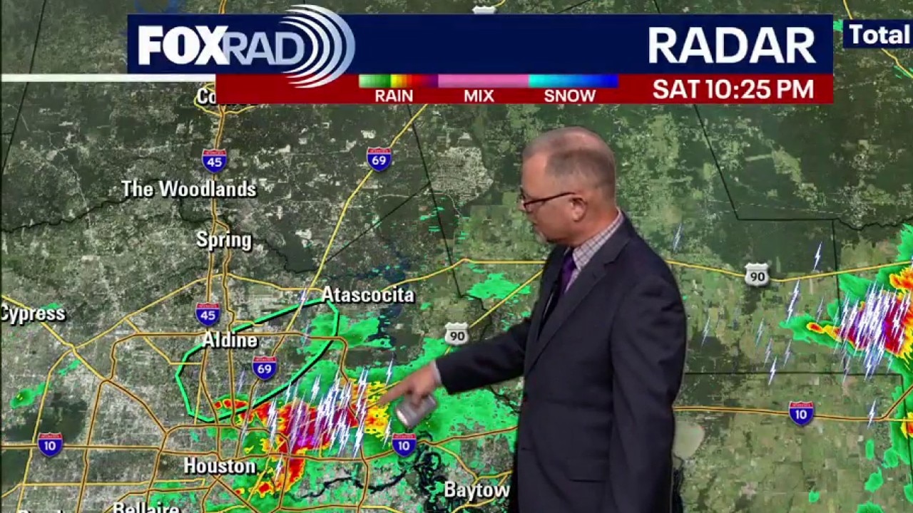
Houston weather: March 7 overnight forecast
The strongest of Saturday's storms have passed through Greater Houston. Some areas may see some more rain on Sunday.
The strongest of Saturday's storms have passed through Greater Houston. Some areas may see some more rain on Sunday.
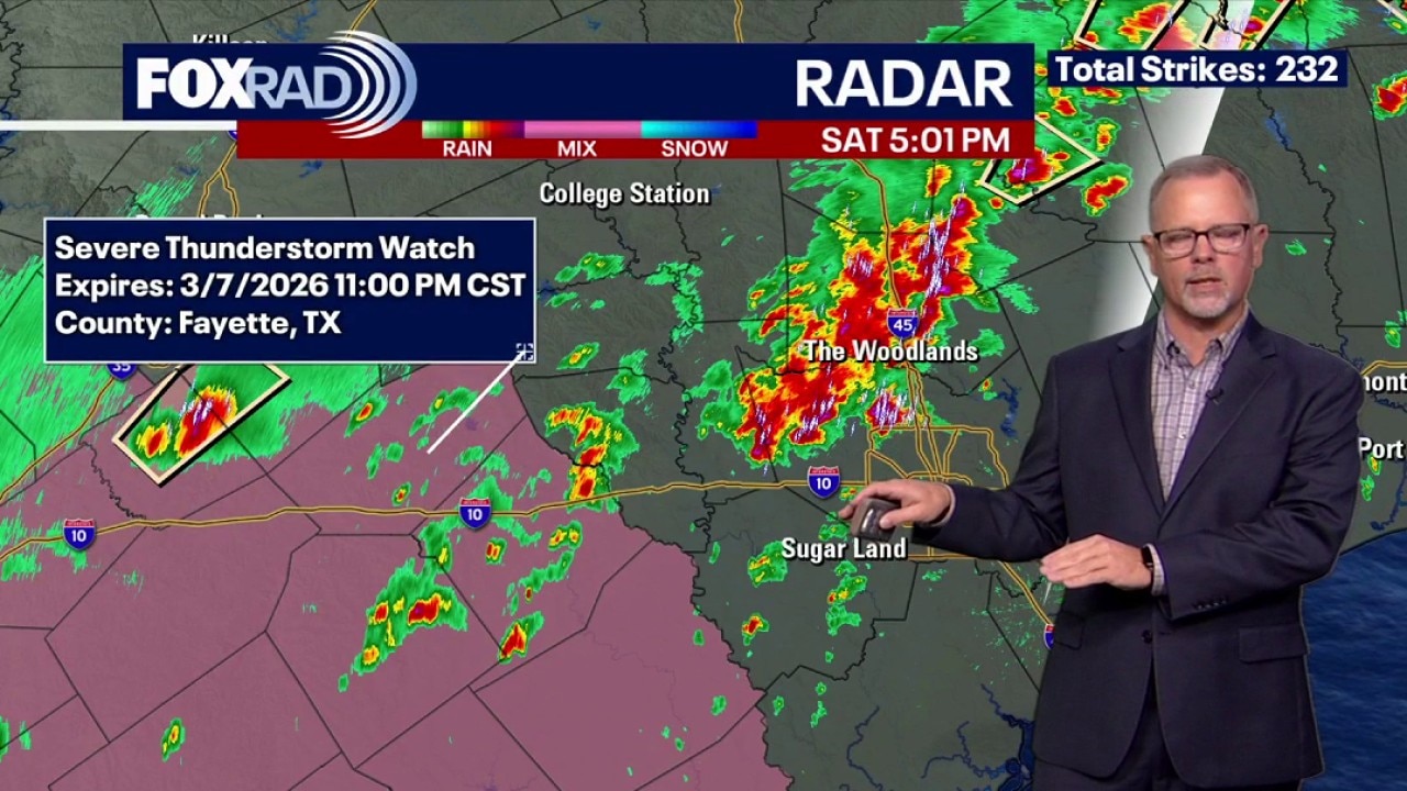
Houston weather: March 7 evening forecast
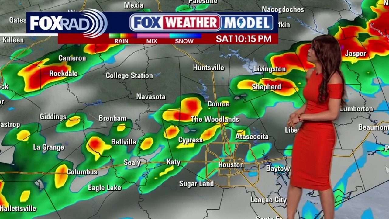
Saturday night's stronger storms will be in our southwest counites and that is where a Severe Thunderstorm Watch is in effect until 11:00pm.
Saturday night's stronger storms will be in our southwest counites and that is where a Severe Thunderstorm Watch is in effect until 11:00pm.
Houston weather: March 7 morning forecast
FOX 26 meteorologist Allison Gargaro has your morning forecast for March 7.
FOX 26 meteorologist Allison Gargaro has your morning forecast for March 7.
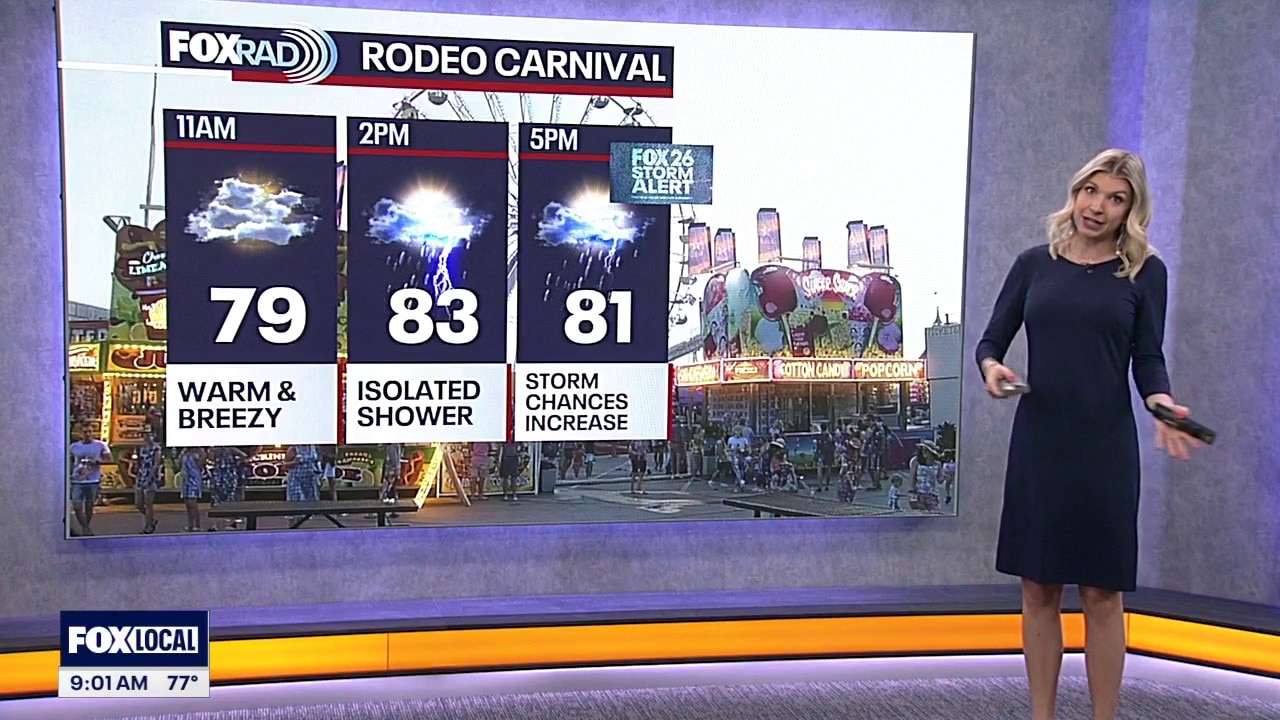
Houston weather: Strong to severe storms possible this weekend
Houston remains in an elevated 2 out of 5 risk for severe storms, including damaging winds and the possibility for some large hail Saturday. Make sure to have a plan to get indoors quickly if you are at rodeo or enjoying any other outdoor activities on Saturday. Severe storm threat is much lower on Sunday. But the risk for flooding remains elevated as rounds of heavy rain and strong storms continue to roll through the Houston area.
Houston remains in an elevated 2 out of 5 risk for severe storms, including damaging winds and the possibility for some large hail Saturday. Make sure to have a plan to get indoors quickly if you are at rodeo or enjoying any other outdoor activities on Saturday. Severe storm threat is much lower on Sunday. But the risk for flooding remains elevated as rounds of heavy rain and strong storms continue to roll through the Houston area.
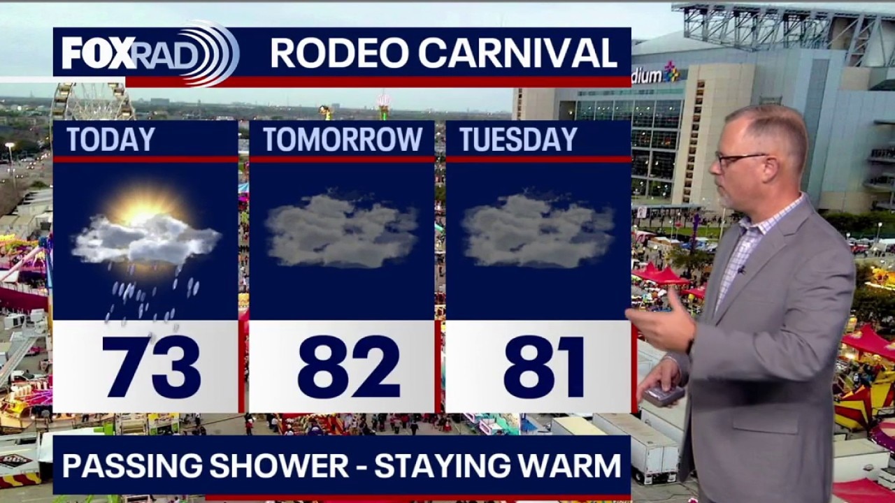
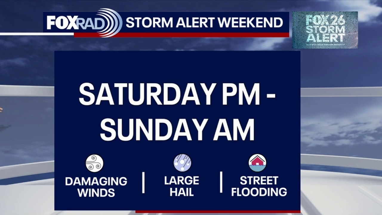
Houston weather: Latest weekend storm timeline
If you're heading to the Rodeo, prepare for a messy fairway and potential travel delays to and from NRG as early as Saturday afternoon and through Sunday afternoon.
If you're heading to the Rodeo, prepare for a messy fairway and potential travel delays to and from NRG as early as Saturday afternoon and through Sunday afternoon.

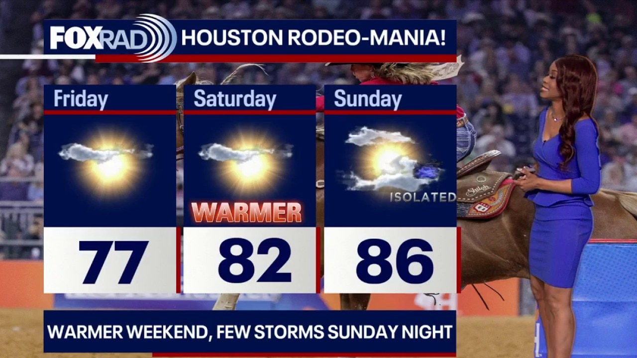
Houston weather: Humid, isolated rain possible for Friday
If you're heading out to the Houston rodeo today, it'll be warm and humid with highs in the 80s. There may be some light rain later on in the evening. There is a FOX 26 Storm Alert for this weekend as a round of heavy rain moves in Saturday evening into Sunday.
If you're heading out to the Houston rodeo today, it'll be warm and humid with highs in the 80s. There may be some light rain later on in the evening. There is a FOX 26 Storm Alert for this weekend as a round of heavy rain moves in Saturday evening into Sunday.