

Powerful coast-to-coast storm system reaches Houston Tuesday afternoon
HOUSTON - Tuesday will mark the beginning of a significant pattern change to Southeast Texas as a strong cold front approaches, putting an abrupt end to the unseasonably warm and humid conditions that have lingered around for the start of December.
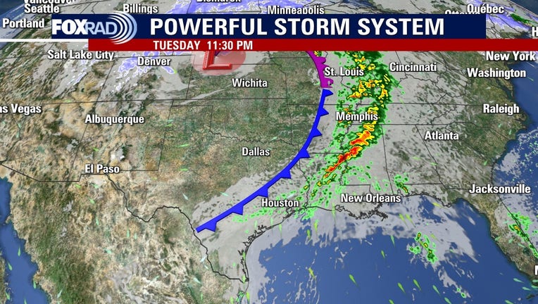
This storm system hammered the west coast over the weekend and will impact North Texas, Oklahoma, and Southwestern Kansas on Monday. As the cold front travels through the plains, Houston will enjoy a mild and quiet day to start the workweek.
CLICK HERE FOR INTERACTIVE RADAR
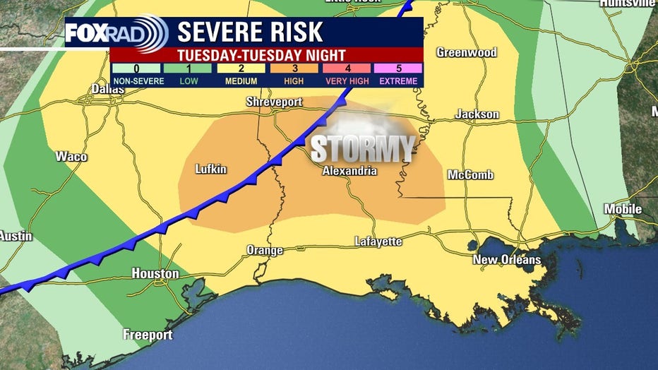
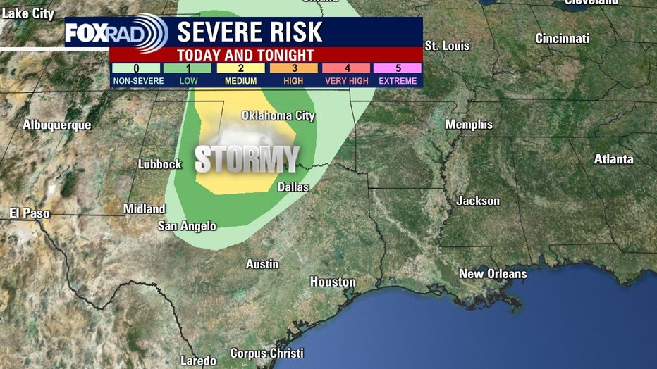
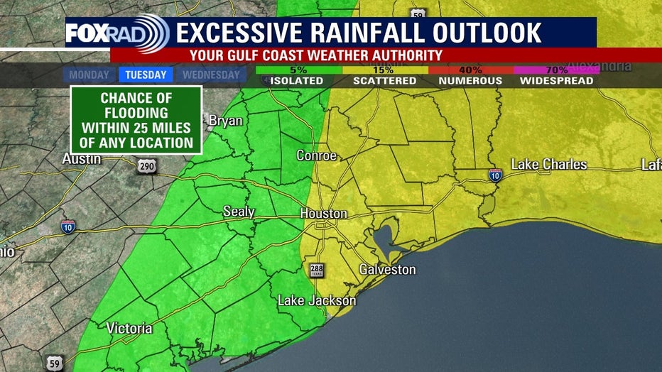
Showers and thunderstorms ahead of the front reach Southeast Texas Tuesday afternoon and continue into Tuesday night. There is a slight risk of severe storms with most of the stronger storms east of I-45.
Damaging winds, isolated tornadoes, and hail are the risks in the stronger storms. Most of the severe will take place in Louisiana and East Texas late on Tuesday, but Houston should be ready for a few strong storms.
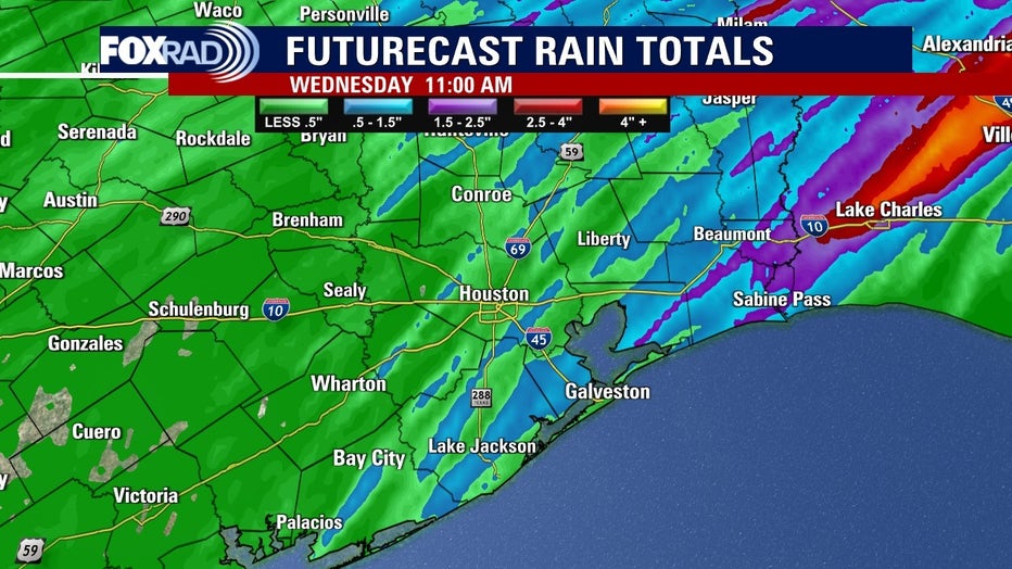
The ground is saturated in areas just north of downtown Houston from weekend rains. Parts of Montgomery, San Jacinto, and Polk counties received 5 to 7 inches of soaking rain. There could be some localized short-term flooding near heavy downpours in those areas.
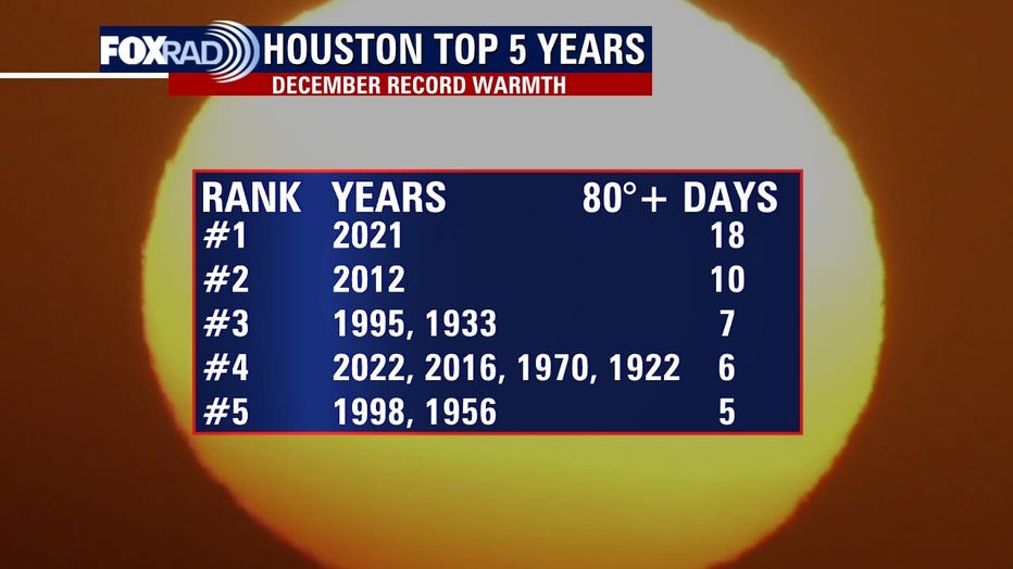
So far this December, Houston’s average monthly high temperature has been 10 degrees above normal. The average monthly low has been 13 degrees higher than usual. While this front will start a new cooler weather pattern for Houston, it is too early to say if we are completely done with 80 degree afternoons in December. This year has not had as many as last year, but still enough to make the top 5 list for 80 degree days in the last month of the year.
The FOX 26 Weather Team is closely monitoring developments. They will continue to keep you up-to-date online, on-air, and on social media.
You can also stay up-to-date 24 hours a day by downloading the free FOX 26 weather app. You'll receive weather alerts for your location, along with video weather updates.