

Tropical Storm Henri forms in the Atlantic, south of Bermuda
The U.S. National Weather Service said tropical depression #8 has turned into Tropical Storm Henri.
As of Monday night, the storm was located southeast of Bermuda with maximum sustained winds of 40 miles per hour, moving at five miles per hour. Current projections show the storm will likely not make a U.S. landfall and will stay in the ocean.
Meteorologists say Henri is pronounced "ahn-REE," the French pronunciation of Henry.
The weather service said Henri is a sign at the Atlantic remains active during the height of hurricane season as two other named storms continue to make their impacts.
Tropical Depression Grace drenched earthquake-damaged Haiti on Monday, threatening to dump up to 15 inches of rain on a landscape where people are huddling in fields and searching for survivors. The oncoming storm couldn’t come at a worse time for Haitians struggling to deal with the effects of Saturday’s 7.2 magnitude earthquake, blamed for an estimated 1,300 deaths.
RELATED: Haiti earthquake death toll climbs to 1,297 amid threat of storm
Grace was centered 70 miles southeast of Port-au-Prince, Haiti, and moving west at 12 mph. It was expected to become a tropical storm again as it passes between Cuba and Jamaica Tuesday on the way to Mexico’s Yucatan peninsula. A tropical storm watch was in effect for the entire southern coast of Haiti, most of the southern coast of Cuba and the Cayman Islands.
The hurricane center warned that flash floods and mudslides were possible, especially along Hispaniola’s southern coasts.
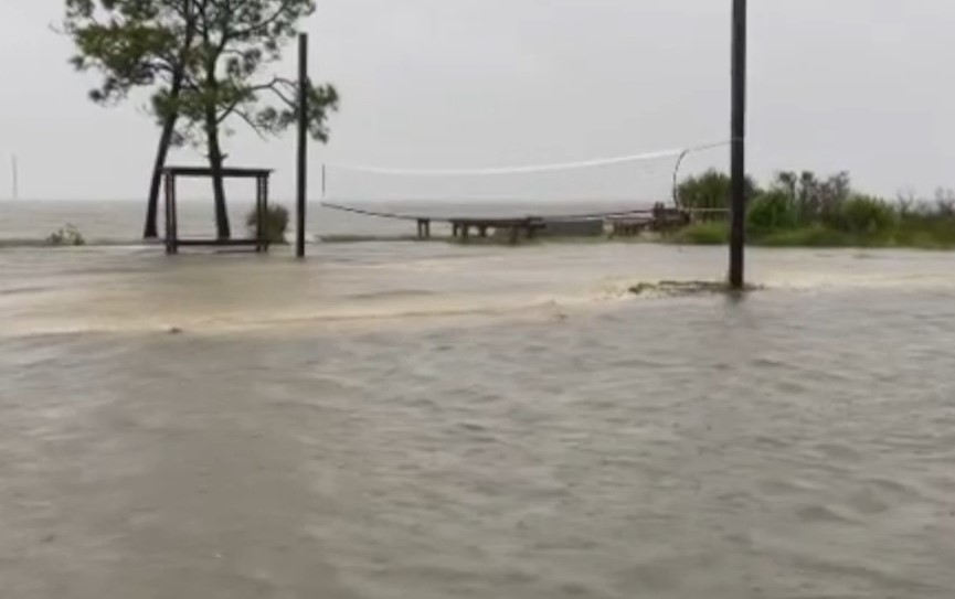
Tropical Storm Fred also grew stronger as it closed in on Florida’s coast, and a third tropical system was swirling around Bermuda.
The U.S. National Hurricane Center said Fred’s maximum sustained winds increased to 65 mph as its center moved within 35 miles of Apalachicola, Florida, moving toward the coastal city at 9 mph. Landfall was expected Monday afternoon on a path that will bring heavy rains to a swath of southeastern U.S. this week.
Fred’s main threats are rainfall and storm surge, the hurricane center said. Forecasters expected Fred to sustain 4 to 8 inches from Alabama across Florida’s Big Bend and Panhandle, and even a foot of rain in isolated spots, while the surge could push seawater of between 3 to 5 feet onto the coast between Florida’s Indian Pass and the Steinhatchee River.
RELATED: Fred to make landfall in Florida as strengthening tropical storm
Forecasters warned that Fred also could dump heavy rain across and into the mid-Atlantic states, with flash floods as some rivers overflow and even landslides in the Blue Ridge mountains.
The National Oceanic and Atmospheric Administration forecasted that the hurricane season, which runs from June through November, will see 13 to 20 named storms. Six to 10 of those storms will become hurricanes and three to five will be major hurricanes with winds of more than 110 mph (177 kilometers per hour), the agency predicted.
There have been seven names storms for the season.
Lead agency forecaster Matthew Rosencrans said the season looks to be busy because of warmer water, which fuels storms; reduced cross winds that decapitate storms; and more seeds of stormy weather coming off the coast of Africa. There is also no El Nino weather event, the natural temporary warming of the central Pacific that squelches Atlantic hurricane activity, he said.
Atlantic waters are nearly 0.68 degrees warmer than normal, which is not as hot as 2020 when they were 1 degree above normal, Rosencrans said.
Last year, there were 30 named storms — so many that meteorologists ran out of names and dipped into the Greek alphabet to identify them. There were 14 hurricanes last year, seven of them major.
The Associated Press contributed to this report. This story was reported from Los Angeles.