

Approaching front could bring severe weather to Houston-area on Friday
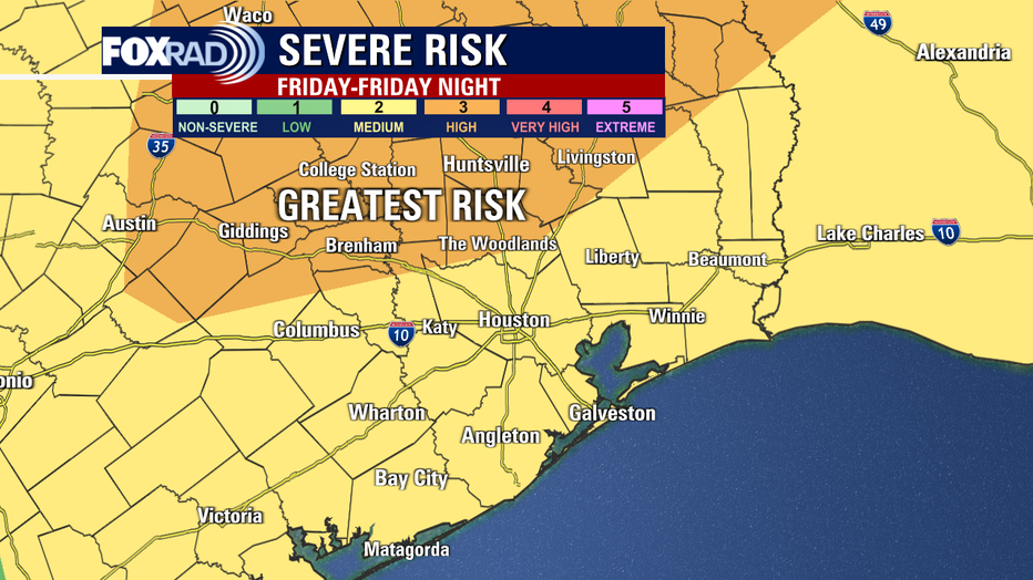
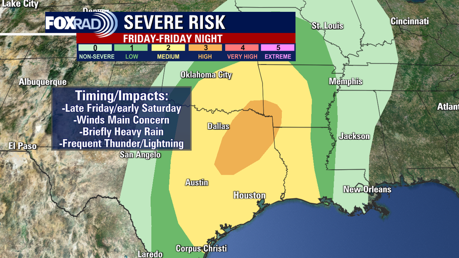
HOUSTON - The threat of severe weather is increasing from Friday through early Saturday morning across southeast Texas. The Storm Prediction Center has put northern parts of our area under a Category 3 out of 5 Enhanced Risk for severe storms for Friday evening including The Woodlands and Conroe.
The remainder of the area is under a Category 2 out 5 Slight Risk for severe storms. While timing/impacts will vary by location, here's what to expect in southeast Texas.
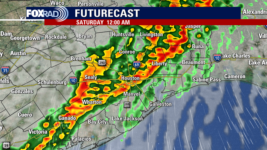
Throughout the day Friday, rain/storm chances will be on the rise. A line of strong to severe storms, with the primary threat being straight-line damaging winds looking to arrive in our northern counties by late Friday evening and the Houston-metro area around midnight until eventually pushing off shore pre-dawn.
Do keep in mind that timing with fronts is always approximate, give or take an hour or two.
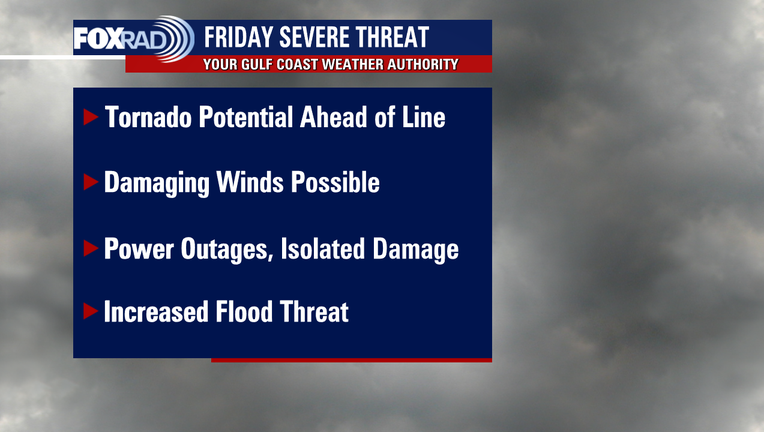
A few supercell thunderstorms could develop between 3 to 7 p.m. ahead of the main line of storms that could produce damaging winds, large hail, and possibly a brief tornado. By Friday night, a line of storms is expected to develop that will roll through between 8 pm Friday and 2 am Saturday.
The main threat with this line will be damaging winds of 60+ mph, but there will still be a low tornado risk and heavy rain could lead to some flood advisories.
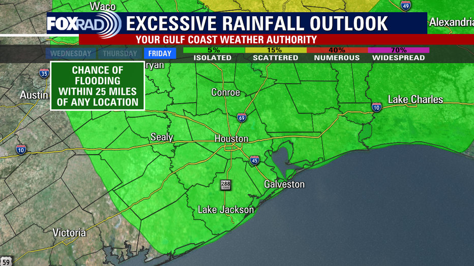
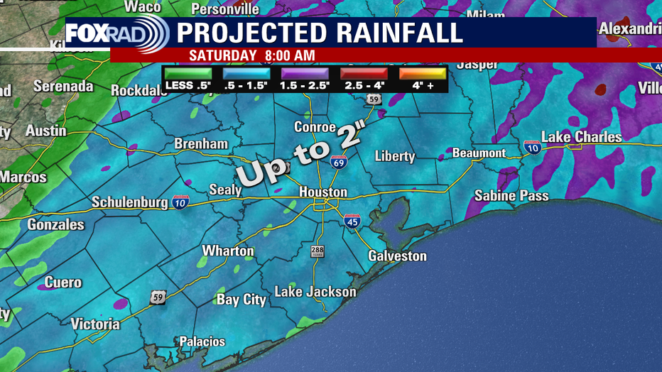
Nonetheless, the system looks to be barreling through fairly quickly so although rainfall may be brief, heavy flooding is not a primary concern.
Models are indicating the possibility of 1 to 2 inches of rain with this line that could create some street flooding. We are in the Marginal risk area for Excessive Rainfall, which means our flood threat will be higher.
Frequent thunder and lightning are likely, so don't be surprised if you're woken up. Power outages are also fairly likely so may want to plan ahead for the possibility of that. So make sure you have multiple ways to get warnings before you head out Friday night so that you will be informed of what's coming.
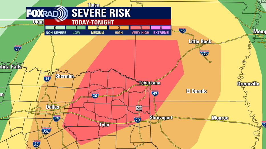
On Friday morning, the severe weather threat bumped up to Level 4/Very High for north Texas, extending into the Ark-la-tex area and Oklahoma today-tonight. Take note of the major interstates in those areas and use extreme caution/avoid traveling on them if possible going into the afternoon and evening.
Stick with us as we continue to monitor the evolution of the system and narrow down the details.
You can also download the free FOX 26 Weather App to stay in the know with the latest weather forecasts and information right down to the area you are! Click here to download.
If you do go under a Severe Thunderstorm or Tornado Warning, get to the lowest level and most interior portion of the building you are in. Stay low and try to protect your head from any potential flying debris.
Pending the outcome of Games 4 and 5 of the World Series, this could also have some travel implications on Friday pending route/layovers and time of day. In fact, delays or cancellations are possible off to our north beginning tomorrow which could jam things up down the line.
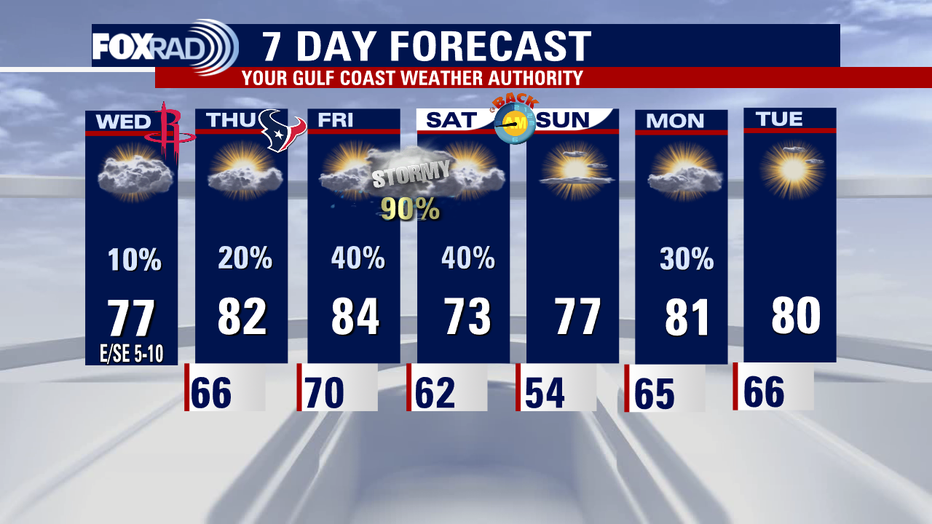
The good news? If a Game 6 (or 7) is needed in Houston over the weekend, the system will be long gone by then. Sunday is looking to be the better of the two weekend days for outdoor plans. Stay safe!