


Houston Weather: Beach safety tips from National Weather Service
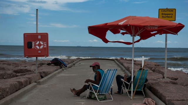
The Houston/Galveston National Weather Service Office continues its Severe Weather Awareness Week with a focus on Beach Safety.
The Houston/Galveston National Weather Service Office continues its Severe Weather Awareness Week with a focus on Beach Safety.

Houston weather: A few isolated showers possible Friday
Yee-haw! We've made it to the Friday before Spring Break and Weekend 2 at the Rodeo. A weak front is at least trying to make it, and could bring in some lightly scattered showers mainly north. Highs will likely end up cooler there, but a few spots farther south could hit 80 if we see enough afternoon clearing. After a warm and breezy weekend, a second front brings in cooler air early next week. We'll gradually warm during Spring Break with another late week front expected around St. Patrick's Day.
Yee-haw! We've made it to the Friday before Spring Break and Weekend 2 at the Rodeo. A weak front is at least trying to make it, and could bring in some lightly scattered showers mainly north. Highs will likely end up cooler there, but a few spots farther south could hit 80 if we see enough afternoon clearing. After a warm and breezy weekend, a second front brings in cooler air early next week. We'll gradually warm during Spring Break with another late week front expected around St. Patrick's Day.

Friday morning Houston-area weather forecast
A weak cold front will bring in a few changes over the next 24 hours though. Front arrives Friday morning with the best chance for rain north of I-10. Front should knock temperatures down a few degrees Friday but highs will still be near 80 degrees. Rain should move out by Friday afternoon and evening in time for rodeo plans. Front will stall out and fade over us which means temperatures stay warm over the weekend in the 80s. A stronger front will arrive Sunday night. It won't bring us much rain but it will mean a cooler start to next week which will be Spring Break week for some of you.
A weak cold front will bring in a few changes over the next 24 hours though. Front arrives Friday morning with the best chance for rain north of I-10. Front should knock temperatures down a few degrees Friday but highs will still be near 80 degrees. Rain should move out by Friday afternoon and evening in time for rodeo plans. Front will stall out and fade over us which means temperatures stay warm over the weekend in the 80s. A stronger front will arrive Sunday night. It won't bring us much rain but it will mean a cooler start to next week which will be Spring Break week for some of you.

Slightly breezy, warm Thursday evening in the 80s
Weather for Houston Rodeo events tonight should be similar to the last few nights with warm temps in the 70s and muggy conditions. A weak cold front will bring in a few changes over the next 24 hours though. Front arrives Friday morning with the best chance for rain north of I-10. Front should knock temperatures down a few degrees Friday but highs will still be near 80 degrees. Rain should move out by Friday afternoon and evening in time for rodeo plans. Front will stall out and fade over us which means temperatures stay warm over the weekend in the 80s. A stronger front will arrive Sunday night. It won't bring us much rain but it will mean a cooler start to next week which will be Spring Break week for some of you. Have a great night!
Weather for Houston Rodeo events tonight should be similar to the last few nights with warm temps in the 70s and muggy conditions. A weak cold front will bring in a few changes over the next 24 hours though. Front arrives Friday morning with the best chance for rain north of I-10. Front should knock temperatures down a few degrees Friday but highs will still be near 80 degrees. Rain should move out by Friday afternoon and evening in time for rodeo plans. Front will stall out and fade over us which means temperatures stay warm over the weekend in the 80s. A stronger front will arrive Sunday night. It won't bring us much rain but it will mean a cooler start to next week which will be Spring Break week for some of you. Have a great night!

La Niña ends, El Niño to begin: What does this mean for drought, hurricane season?
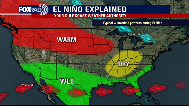
With the La Niña weather pattern moving away after three years and the El Niño forecast to take over later this year, what does this mean for drought conditions?
With the La Niña weather pattern moving away after three years and the El Niño forecast to take over later this year, what does this mean for drought conditions?

El Tiempo 9 de marzo de 2023
#FOX26 Meteor?loga Lena Maria Arango tiene su pron?stico para el fin de semana.
#FOX26 Meteor?loga Lena Maria Arango tiene su pron?stico para el fin de semana.

El Ni?o weather pattern: What is it?
As the El Ni?o forecast is to approach later this year, this short video shows what exactly occurs during this weather pattern.
As the El Ni?o forecast is to approach later this year, this short video shows what exactly occurs during this weather pattern.

Warm, pleasant Thursday afternoon in the 80s
We've got a front on the way tonight, but the big question is does it make it and where does it stall. It'll at least bring in some lightly scattered showers mainly north of I-10, and take the edge of the temperatures briefly. Then, we're right back to warm and muggy for the weekend with a hefty south breeze. Highs Sunday will be largely dependent on the timing of our next front, which will bring in much more pleasant weather for early next week.
We've got a front on the way tonight, but the big question is does it make it and where does it stall. It'll at least bring in some lightly scattered showers mainly north of I-10, and take the edge of the temperatures briefly. Then, we're right back to warm and muggy for the weekend with a hefty south breeze. Highs Sunday will be largely dependent on the timing of our next front, which will bring in much more pleasant weather for early next week.

Houston Weather: Flooding safety tips from National Weather Service
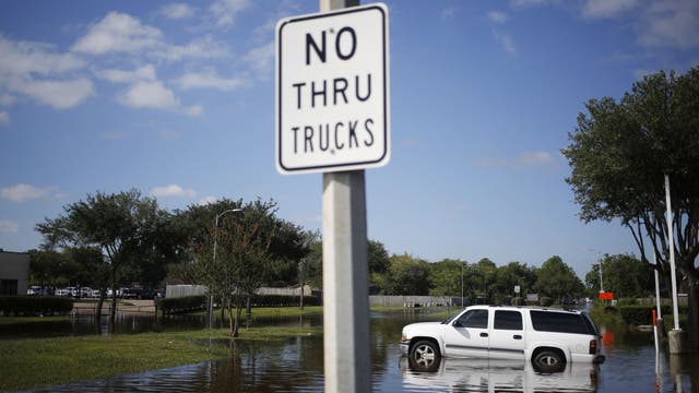
The Houston/Galveston Office of the National Weather Service continues its Severe Weather Awareness Week with a focus on flood safety.
The Houston/Galveston Office of the National Weather Service continues its Severe Weather Awareness Week with a focus on flood safety.

Houston weather: Mostly cloudy and warm with highs in the mid 80s
Highs today will approach record highs with mid 80s likely across the Houston area along with a muggy south breeze. Tomorrow, a weak cold front moves in, so there will be a chance for showers and even a few isolated storms - highs may stay in the 70s. This weekend looks pleasant with highs in the 80s again, then a stronger front Sunday night brings a bona fide cooldown for early next week with 50s and 70s for lows and highs.
Highs today will approach record highs with mid 80s likely across the Houston area along with a muggy south breeze. Tomorrow, a weak cold front moves in, so there will be a chance for showers and even a few isolated storms - highs may stay in the 70s. This weekend looks pleasant with highs in the 80s again, then a stronger front Sunday night brings a bona fide cooldown for early next week with 50s and 70s for lows and highs.

Thursday morning Houston-area weather forecast
We stay warm through the weekend with high temperatures in the 80s. There will be a weak cold front that rolls in early Friday morning. It will bring a slightly better chance for a few showers and storms Friday AM. But it will wash out and fade keeping warm air in place through Sunday. Another front Sunday night and Monday morning will be a bit stronger and finally bring more comfortable temperatures. It won't bring much rain through with only a 10-20% chance for an isolated shower. For those of you in town and on spring break next week, you will have some cooler air to enjoy.
We stay warm through the weekend with high temperatures in the 80s. There will be a weak cold front that rolls in early Friday morning. It will bring a slightly better chance for a few showers and storms Friday AM. But it will wash out and fade keeping warm air in place through Sunday. Another front Sunday night and Monday morning will be a bit stronger and finally bring more comfortable temperatures. It won't bring much rain through with only a 10-20% chance for an isolated shower. For those of you in town and on spring break next week, you will have some cooler air to enjoy.

Wednesday afternoon weather forecast with Meteorologist Lena Maria Arango
Our warm, humid pattern continues for now. Look for mostly cloudy nights with AM patchy fog/mist and partly sunny, steamy afternoons. A weak front will bring a few light showers overnight Thursday into Friday followed by a very brief wind shift so it won't offer many changes. Another fairly dry front early next week looks to bring in a larger decrease to our temperatures, leading to at least a few pleasant, seasonable Spring Break days.
Our warm, humid pattern continues for now. Look for mostly cloudy nights with AM patchy fog/mist and partly sunny, steamy afternoons. A weak front will bring a few light showers overnight Thursday into Friday followed by a very brief wind shift so it won't offer many changes. Another fairly dry front early next week looks to bring in a larger decrease to our temperatures, leading to at least a few pleasant, seasonable Spring Break days.

Houston Rodeo Weather Forecast (3-8-2023)
FOX 26 Chief Meteorologist Mike Iscovitz gives a look at the weather before stepping out at the Houston Rodeo. He says after dense morning fog today and tomorrow, we are looking warm and a bit humid again with highs in the mid-80s with a very slight rain chance.
FOX 26 Chief Meteorologist Mike Iscovitz gives a look at the weather before stepping out at the Houston Rodeo. He says after dense morning fog today and tomorrow, we are looking warm and a bit humid again with highs in the mid-80s with a very slight rain chance.

Spring-like weather continues in Houston
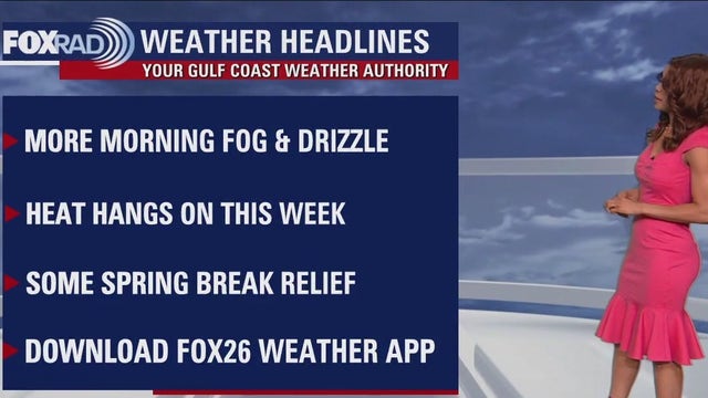
It's more of the same for the rest of the week with more heat and humidity for all of the Houston area. That means nights at the rodeo will be in the 70s mainly with plenty of humidity. Afternoons will be warm in the middle 80s the next few days. Rain chances should only be around 10% for Wednesday and Thursday. A weak cold front Friday will bring in a slightly better chance for rain & thunder. But it will lift back north and warm temps remain in place through Sunday. Another cold front is expected to move in early Monday that will bring a 30% chance for rain and finally a break from the 80s.
It's more of the same for the rest of the week with more heat and humidity for all of the Houston area. That means nights at the rodeo will be in the 70s mainly with plenty of humidity. Afternoons will be warm in the middle 80s the next few days. Rain chances should only be around 10% for Wednesday and Thursday. A weak cold front Friday will bring in a slightly better chance for rain & thunder. But it will lift back north and warm temps remain in place through Sunday. Another cold front is expected to move in early Monday that will bring a 30% chance for rain and finally a break from the 80s.

Spring-like weather continues in Houston
It's more of the same for the rest of the week with more heat and humidity for all of the Houston area. That means nights at the rodeo will be in the 70s mainly with plenty of humidity. Afternoons will be warm in the middle 80s the next few days. Rain chances should only be around 10% for Wednesday and Thursday. Weak cold front Friday will bring in a slightly better chance for rain & thunder. But it will lift back north and warm temps remain in place through Sunday. Another cold front is expected to move in early Monday that will bring a 30% chance for rain and finally a break from the 80s.
It's more of the same for the rest of the week with more heat and humidity for all of the Houston area. That means nights at the rodeo will be in the 70s mainly with plenty of humidity. Afternoons will be warm in the middle 80s the next few days. Rain chances should only be around 10% for Wednesday and Thursday. Weak cold front Friday will bring in a slightly better chance for rain & thunder. But it will lift back north and warm temps remain in place through Sunday. Another cold front is expected to move in early Monday that will bring a 30% chance for rain and finally a break from the 80s.

Tuesday evening weather forecast with Meteorologist Remeisha Shade
Houston has had temperatures that are above normal for 16 days and counting with this trend still in place through this week and weekend. Look for a bit of morning mist and fog with lows near 70, then partly sunny days with humidity and highs in the mid 80s. Average temps for this time of year are mid 50s for lows and low 70s for highs.
Houston has had temperatures that are above normal for 16 days and counting with this trend still in place through this week and weekend. Look for a bit of morning mist and fog with lows near 70, then partly sunny days with humidity and highs in the mid 80s. Average temps for this time of year are mid 50s for lows and low 70s for highs.
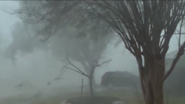

Houston Weather: Tornado safety tips from National Weather Service
The Houston/Galveston National Weather Service Office continues its Severe Weather Awareness Week with a focus on Tornadoes.
The Houston/Galveston National Weather Service Office continues its Severe Weather Awareness Week with a focus on Tornadoes.

Tuesday afternoon weather forecast with Meteorologist John Dawson
Houston has had temperatures that are above normal for 16 days and counting with this trend still in place through this week and weekend. Look for a bit of morning mist and fog with lows near 70, then partly sunny days with humidity and highs in the mid-80s. Average temps for this time of year are mid-50s for lows and low 70s for highs.
Houston has had temperatures that are above normal for 16 days and counting with this trend still in place through this week and weekend. Look for a bit of morning mist and fog with lows near 70, then partly sunny days with humidity and highs in the mid-80s. Average temps for this time of year are mid-50s for lows and low 70s for highs.


Houston Weather: Thunderstorm safety tips from National Weather Service
The Houston/Galveston Office of the National Weather Service continues its Severe Weather Awareness Week with a focus on Thunderstorms today, especially the threats of lightning, hail, and wind.
The Houston/Galveston Office of the National Weather Service continues its Severe Weather Awareness Week with a focus on Thunderstorms today, especially the threats of lightning, hail, and wind.

Houston weather: Misty with patchy fog Tuesday morning, then partly cloudy and warm
Houston has had temperatures that are above normal for 16 days and counting with this trend still in place through this week and weekend. Look for a bit of morning mist and fog with lows near 70, then partly sunny days with humidity and highs in the mid 80s. Average temps for this time of year are mid 50s for lows and low 70s for highs.
Houston has had temperatures that are above normal for 16 days and counting with this trend still in place through this week and weekend. Look for a bit of morning mist and fog with lows near 70, then partly sunny days with humidity and highs in the mid 80s. Average temps for this time of year are mid 50s for lows and low 70s for highs.