

La Niña ends, El Niño to begin: What does this mean for drought, hurricane season?

El Niño weather pattern: What is it?
As the El Niño forecast is to approach later this year, this short video shows what exactly occurs during this weather pattern.
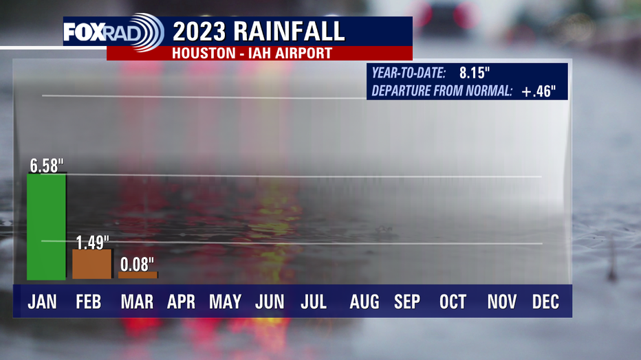
HOUSTON - Since January, we've received less than 2 inches of rainfall at Bush IAH. Still, a positive year to date because we were off to the races early in the year, but we've slowed to a trickle.
Last year, when we had a persistent drought for much of the year warm, dry conditions began in the winter which is a typical La Niña signal.
KEEP UP WITH HOUSTON-AREA WEATHER
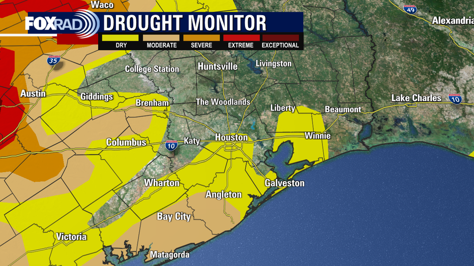
We are starting to see a moderate drought re-develop in parts of our viewing area. Unseasonable warmth makes local drought conditions worse, especially during La Niña years which are drier for us.
But we are now moving away from La Niña after three years and are currently in a neutral phase, with El Niño forecast to take over later this year.
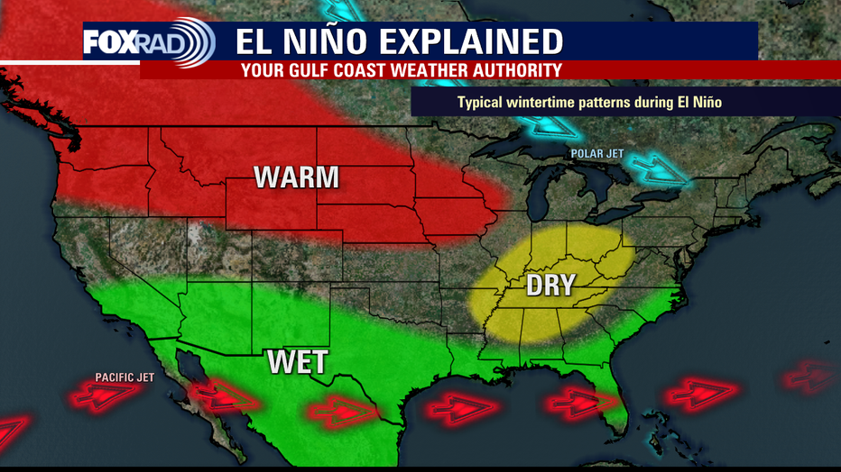
While that could potentially lead to drought improvements for some who would enter into a wetter pattern, southeast Texas included, it will exacerbate drought and heat for many others around the world.
MORE: SEVERE WEATHER AWARENESS WEEK: Flooding safety tips from the National Weather Service
While impacts of ENSO (El Niño and the Southern Oscillation) are typically felt in winter months, patterns can also influence Hurricane Season.
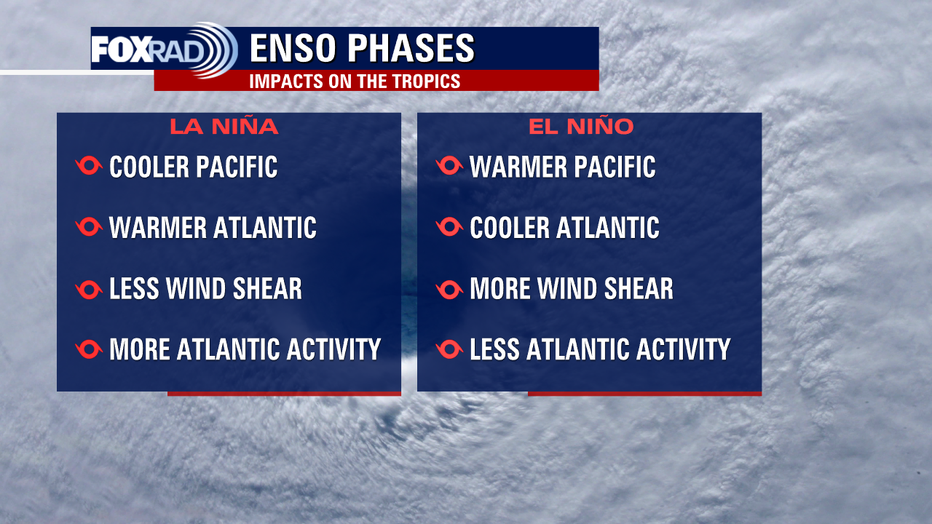
In the Atlantic, La Niña tends to increase activity while El Niño tends to suppress activity. During El Niño, while Pacific waters run warmer, Atlantic waters run cooler and that's less fuel for storms. Additionally, there tends to be an increase in wind shear which rips storms apart.
With that being said, and as we experienced last year, ENSO phases do not always paint the full picture. There are many moving parts to increases or decreases in tropical activity, but El Niño will likely help keep things at bay.