



Houston weather forecast, radar: Storms with threat for isolated tornadoes, hail, damaging winds
Houston weather forecast and radar with storms, isolated tornadoes, large hail, heavy rain and damaging winds a threat on Thursday.
Houston weather forecast and radar with storms, isolated tornadoes, large hail, heavy rain and damaging winds a threat on Thursday.

Houston weather: Severe storm, tornado outlook
A strong storm system will bring the threat for a few tornadoes, large hail, heavy rain and damaging winds to Southeast Texas on Thursday.
A strong storm system will bring the threat for a few tornadoes, large hail, heavy rain and damaging winds to Southeast Texas on Thursday.

Houston weather: Severe storm, tornado outlook
A strong storm system will bring the threat for a few tornadoes, large hail, heavy rain and damaging winds to Southeast Texas on Thursday.
A strong storm system will bring the threat for a few tornadoes, large hail, heavy rain and damaging winds to Southeast Texas on Thursday.

Houston weather: What to do in case of a tornado?
A strong storm system will bring the threat for a few tornadoes, large hail, heavy rain and damaging winds.
A strong storm system will bring the threat for a few tornadoes, large hail, heavy rain and damaging winds.


Houston weather: Heavy rain, hail, damaging winds, and isolated tornadoes expected for Southeast Texas
Thursday's tornado risk is the highest it's been since January after an EF-3 tornado left behind a 20-mile path of destruction near Pasadena and Deer Park.
Thursday's tornado risk is the highest it's been since January after an EF-3 tornado left behind a 20-mile path of destruction near Pasadena and Deer Park.

FOX 26 Houston Weather Forecast for Thursday
The NOAA Storm Prediction Center updated their severe outlook for today at 7 a.m. They have maintained their enhanced area for tornadoes, hail and damaging winds and even moved the area slightly south to include Houston and just about all the surrounding suburbs. Action should pick up by 9 a.m. and get ugly late morning through the afternoon.
The NOAA Storm Prediction Center updated their severe outlook for today at 7 a.m. They have maintained their enhanced area for tornadoes, hail and damaging winds and even moved the area slightly south to include Houston and just about all the surrounding suburbs. Action should pick up by 9 a.m. and get ugly late morning through the afternoon.

FOX 26 Houston Weather Forecast for Thursday
Thursday is a FOX 26 Storm Alert Day. Expect light rain and drizzle early this morning, but then scattered heavy downpours and some severe storms from mid morning through mid afternoon.
Thursday is a FOX 26 Storm Alert Day. Expect light rain and drizzle early this morning, but then scattered heavy downpours and some severe storms from mid morning through mid afternoon.

Houston weather: Severe weather, possibly tornadoes expected Thursday
Areas south of I-10 are under a category 2 out of 5 risk for severe storms Thursday with areas north of I-10 under an even higher category 3 out of 5 risk for severe weather. Areas in the highest risk include Katy, Conroe, The Woodlands, Huntsville and Livingston. We will likely have a tornado watch or severe thunderstorm watch issued Thursday. So be ready to get inside a sturdy building on the lowest level in case warnings are issued.
Areas south of I-10 are under a category 2 out of 5 risk for severe storms Thursday with areas north of I-10 under an even higher category 3 out of 5 risk for severe weather. Areas in the highest risk include Katy, Conroe, The Woodlands, Huntsville and Livingston. We will likely have a tornado watch or severe thunderstorm watch issued Thursday. So be ready to get inside a sturdy building on the lowest level in case warnings are issued.

FOX 26 Houston Weather Forecast
Rounds of storms will roll through Houston early Thursday and will continue through Thursday evening with the severe threat expected to shift east by Thursday night. Periods of showers/thunderstorms can be expected to develop across SE TX and Houston. There is a risk for strong and/or severe storms & locally heavy rain, mainly late morning thru early evening.
Rounds of storms will roll through Houston early Thursday and will continue through Thursday evening with the severe threat expected to shift east by Thursday night. Periods of showers/thunderstorms can be expected to develop across SE TX and Houston. There is a risk for strong and/or severe storms & locally heavy rain, mainly late morning thru early evening.

FOX 26 Houston Weather Forecast
Rounds of storms will roll through Houston early Thursday and will continue through Thursday evening with the severe threat expected to shift east by Thursday night.
Rounds of storms will roll through Houston early Thursday and will continue through Thursday evening with the severe threat expected to shift east by Thursday night.

FOX 26 Houston Weather Forecast
Stay alert Thursday as a big severe weather threat is expected to move into the SE Texas area! Strong storm system will bring the threat for a few tornadoes, large hail, heavy rain and damaging winds. Showers will increase overnight with the main window for severe storms from mid-late morning Thursday through Thursday afternoon. Areas south of I-10 are under a category 2 out of 5 risk for severe storms Thursday with areas north of I-10 under an even higher category 3 out of 5 risk for severe weather. Areas in the highest risk include Katy, Conroe, The Woodlands, Huntsville and Livingston. We will likely have a tornado watch or severe thunderstorm watch issued Thursday. So be ready to get inside a sturdy building on the lowest level in case warnings are issued. Rounds of storms will continue through Thursday evening with the severe threat expected to shift east by Thursday night. We also have a marginal risk for excessive rain that could lead to some street flooding. 1-2" of rain is expected with Thursday's system. Lower rain chances will linger through the weekend. We dry out out and cool off a bit next week. Make sure to download our FOX 26 Weather App and turn the alerts on to keep track of the severe weather threat!
Stay alert Thursday as a big severe weather threat is expected to move into the SE Texas area! Strong storm system will bring the threat for a few tornadoes, large hail, heavy rain and damaging winds. Showers will increase overnight with the main window for severe storms from mid-late morning Thursday through Thursday afternoon. Areas south of I-10 are under a category 2 out of 5 risk for severe storms Thursday with areas north of I-10 under an even higher category 3 out of 5 risk for severe weather. Areas in the highest risk include Katy, Conroe, The Woodlands, Huntsville and Livingston. We will likely have a tornado watch or severe thunderstorm watch issued Thursday. So be ready to get inside a sturdy building on the lowest level in case warnings are issued. Rounds of storms will continue through Thursday evening with the severe threat expected to shift east by Thursday night. We also have a marginal risk for excessive rain that could lead to some street flooding. 1-2" of rain is expected with Thursday's system. Lower rain chances will linger through the weekend. We dry out out and cool off a bit next week. Make sure to download our FOX 26 Weather App and turn the alerts on to keep track of the severe weather threat!
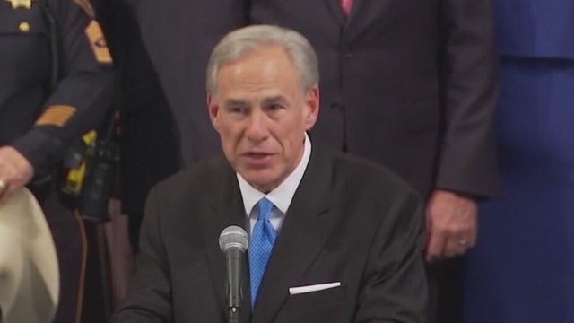

Texas Governor Abbott directs emergency resources ahead of potential thunderstorms
Governor Greg Abbott announced he has instructed the Texas Division of Emergency Management to prepare state emergency response resources as southeast Texas expects severe thunderstorms.
Governor Greg Abbott announced he has instructed the Texas Division of Emergency Management to prepare state emergency response resources as southeast Texas expects severe thunderstorms.

FOX 26 Houston Weather Forecast
Stay alert Thursday as a big severe weather threat is expected to move into the SE Texas area! Strong storm system will bring the threat of a few tornadoes, large hail, heavy rain, and damaging winds. Showers will increase overnight with the main window for severe storms from mid-late morning Thursday through Thursday afternoon. Areas south of I-10 are under a category 2 out of 5 risk for severe storms Thursday with areas north of I-10 under an even higher category 3 out of 5 risk for severe weather. Areas in the highest risk include Katy, Conroe, The Woodlands, Huntsville and Livingston. We will likely have a tornado watch or severe thunderstorm watch issued Thursday. So be ready to get inside a sturdy building on the lowest level in case warnings are issued. Rounds of storms will continue through Thursday evening with the severe threat expected to shift east by Thursday night. We also have a marginal risk of excessive rain that could lead to some street flooding. 1-2" of rain is expected with Thursday's system. Lower rain chances will linger through the weekend. We dry out and cool off a bit next week. Make sure to download our FOX 26 Weather App and turn the alerts on to keep track of the severe weather threat!
Stay alert Thursday as a big severe weather threat is expected to move into the SE Texas area! Strong storm system will bring the threat of a few tornadoes, large hail, heavy rain, and damaging winds. Showers will increase overnight with the main window for severe storms from mid-late morning Thursday through Thursday afternoon. Areas south of I-10 are under a category 2 out of 5 risk for severe storms Thursday with areas north of I-10 under an even higher category 3 out of 5 risk for severe weather. Areas in the highest risk include Katy, Conroe, The Woodlands, Huntsville and Livingston. We will likely have a tornado watch or severe thunderstorm watch issued Thursday. So be ready to get inside a sturdy building on the lowest level in case warnings are issued. Rounds of storms will continue through Thursday evening with the severe threat expected to shift east by Thursday night. We also have a marginal risk of excessive rain that could lead to some street flooding. 1-2" of rain is expected with Thursday's system. Lower rain chances will linger through the weekend. We dry out and cool off a bit next week. Make sure to download our FOX 26 Weather App and turn the alerts on to keep track of the severe weather threat!

Tropical Weather Forecast - November 29, 2023
Tomorrow ends the 2023 hurricane season and it looks like we will likely wrap up the season on a quiet note. There are currently no systems out there in the Atlantic Basin or Eastern Pacific and development is not expected. We will likely finish with 20 named storms, 7 hurricanes and 3 major hurricanes for the Atlantic Basin.
Tomorrow ends the 2023 hurricane season and it looks like we will likely wrap up the season on a quiet note. There are currently no systems out there in the Atlantic Basin or Eastern Pacific and development is not expected. We will likely finish with 20 named storms, 7 hurricanes and 3 major hurricanes for the Atlantic Basin.
Houston weather: Strong, severe storms possible on Thursday
It's cloudy, cool and dry today, but strong storms are on the way to the Houston area and Southeast Texas on Thursday.
It's cloudy, cool and dry today, but strong storms are on the way to the Houston area and Southeast Texas on Thursday.

FOX 26 Houston Weather Forecast
Today will be the literal "calm before the storm" as we expect an outbreak of strong to severe storms tomorrow. Clouds will increase gradually today with highs in the mid to upper 60s, but should remain dry. Storms are likely by tomorrow morning with severe weather possible for the morning commute and through at least early afternoon. High winds and even tornadoes will be possible. Storm chances fall on Friday with isolated showers possible followed by a nice-looking weekend.
Today will be the literal "calm before the storm" as we expect an outbreak of strong to severe storms tomorrow. Clouds will increase gradually today with highs in the mid to upper 60s, but should remain dry. Storms are likely by tomorrow morning with severe weather possible for the morning commute and through at least early afternoon. High winds and even tornadoes will be possible. Storm chances fall on Friday with isolated showers possible followed by a nice-looking weekend.

FOX 26 Houston Weather Forecast
It's been a nice weather day across Houston with some nice sunshine and dry weather. Get ready for another cool and dry night with temperatures dipping into the 40s for the Houston area. Clouds get thicker Wednesday but the rain for the most part should hold off until Wednesday night and Thursday. Thursday looks like a washout with rounds of heavy rain in the morning through the evening. A few strong to severe storms may also develop and we have a category 2 out of 5 risk for severe weather Thursday. That means storms with a few tornadoes, damaging winds and large hail could push across the area. So download our FOX 26 Weather App and stay alert for watches and warnings. A few showers stick around Friday through the weekend with temperatures getting a little cooler early next week.
It's been a nice weather day across Houston with some nice sunshine and dry weather. Get ready for another cool and dry night with temperatures dipping into the 40s for the Houston area. Clouds get thicker Wednesday but the rain for the most part should hold off until Wednesday night and Thursday. Thursday looks like a washout with rounds of heavy rain in the morning through the evening. A few strong to severe storms may also develop and we have a category 2 out of 5 risk for severe weather Thursday. That means storms with a few tornadoes, damaging winds and large hail could push across the area. So download our FOX 26 Weather App and stay alert for watches and warnings. A few showers stick around Friday through the weekend with temperatures getting a little cooler early next week.

FOX 26 Houston Weather Forecast
It's been a nice weather day across Houston with some nice sunshine and dry weather. Get ready for another cool and dry night with temperatures dipping into the 40s for the Houston area. Clouds get thicker Wednesday but the rain for the most part should hold off until Wednesday night and Thursday. Thursday looks like a washout with rounds of heavy rain in the morning through the evening. A few strong to severe storms may also develop and we have a category 2 out of 5 risk for severe weather Thursday. That means storms with a few tornadoes, damaging winds and large hail could push across the area. So download our FOX 26 Weather App and stay alert for watches and warnings. A few showers stick around Friday through the weekend with temperatures getting a little cooler early next week.
It's been a nice weather day across Houston with some nice sunshine and dry weather. Get ready for another cool and dry night with temperatures dipping into the 40s for the Houston area. Clouds get thicker Wednesday but the rain for the most part should hold off until Wednesday night and Thursday. Thursday looks like a washout with rounds of heavy rain in the morning through the evening. A few strong to severe storms may also develop and we have a category 2 out of 5 risk for severe weather Thursday. That means storms with a few tornadoes, damaging winds and large hail could push across the area. So download our FOX 26 Weather App and stay alert for watches and warnings. A few showers stick around Friday through the weekend with temperatures getting a little cooler early next week.

Tropical Weather Forecast - November 28, 2023
So far this hurricane season, we've had 20 named storms, 7 hurricanes and 3 major hurricanes for the Atlantic Basin. It looks like we will likely wrap up the season with those numbers. Hurricane season ends in two days and all is quiet in the tropics. No tropical activity is expected over the next few days.
So far this hurricane season, we've had 20 named storms, 7 hurricanes and 3 major hurricanes for the Atlantic Basin. It looks like we will likely wrap up the season with those numbers. Hurricane season ends in two days and all is quiet in the tropics. No tropical activity is expected over the next few days.

FOX 26 Houston Weather Forecast
Today is looking pretty nice, but cool with highs in the low to mid 60s. Expect increasing clouds late tomorrow with strong area of low pressure passing over Texas on Thursday. Rain and scattered heavy storms are possible with 1-2" of rain common and even isolated severe storms. Milder air and isolated showers will carry us into the weekend.
Today is looking pretty nice, but cool with highs in the low to mid 60s. Expect increasing clouds late tomorrow with strong area of low pressure passing over Texas on Thursday. Rain and scattered heavy storms are possible with 1-2" of rain common and even isolated severe storms. Milder air and isolated showers will carry us into the weekend.