

FOX 26 Houston Weather Forecast
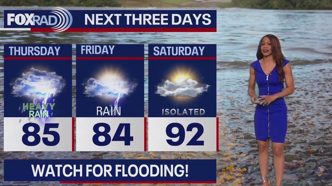
We have issued a FOX 26 Storm Alert Day for Thursday through early Friday. Risk for multiple rounds of heavy rain and a few severe storms is increasing during this time frame. FLOOD WATCH has been issued for areas near & north of I-10 including Houston from 1 p.m. Thursday until 7 a.m. Friday. Additional 2-4" of rain is possible for these areas with isolated amounts around 5 to 6". Houston is also in a 2/5 severe risk Thursday with damaging winds, hail & even a low tornado threat. Rounds of heavy rain and a few strong to severe storms will be most likely Thursday afternoon through Friday morning. Flooding continues along the Brazos, Trinity, and San Jacinto Rivers. So these areas could start to flood quickly. Make sure to avoid any flooded areas and turn around, don't drown! At least we have a pattern change to look forward to this weekend and next week when hotter and drier weather will prevail. Get the latest updates on weather where you live by downloading FOX Local and catching our extended severe weather coverage on our smart TV app FOX Local!
We have issued a FOX 26 Storm Alert Day for Thursday through early Friday. Risk for multiple rounds of heavy rain and a few severe storms is increasing during this time frame. FLOOD WATCH has been issued for areas near & north of I-10 including Houston from 1 p.m. Thursday until 7 a.m. Friday. Additional 2-4" of rain is possible for these areas with isolated amounts around 5 to 6". Houston is also in a 2/5 severe risk Thursday with damaging winds, hail & even a low tornado threat. Rounds of heavy rain and a few strong to severe storms will be most likely Thursday afternoon through Friday morning. Flooding continues along the Brazos, Trinity, and San Jacinto Rivers. So these areas could start to flood quickly. Make sure to avoid any flooded areas and turn around, don't drown! At least we have a pattern change to look forward to this weekend and next week when hotter and drier weather will prevail. Get the latest updates on weather where you live by downloading FOX Local and catching our extended severe weather coverage on our smart TV app FOX Local!

FOX 26 Houston Weather Forecast
We have issued a FOX 26 Storm Alert Day for Thursday through early Friday. The risk for multiple rounds of heavy rain and a few severe storms is increasing during this time frame. FLOOD WATCH has been issued for areas near & north of I-10 including Houston from 1 p.m. Thursday until 7 a.m. Friday. An additional 2-4" of rain is possible for these areas with isolated amounts around 5 to 6". Houston is also in a 2/5 severe risk Thursday with damaging winds, hail & even a low tornado threat. Rounds of heavy rain and a few strong to severe storms will be most likely Thursday afternoon through Friday morning. Flooding continues along the Brazos, Trinity & San Jacinto Rivers. So these areas could start to flood quickly. Make sure to avoid any flooded areas and turn around, don't drown! At least we have a pattern change to look forward to this weekend and next week when hotter and drier weather will prevail. Get the latest updates on the weather where you live by downloading Fox Local and catching our extended severe weather coverage on our smart TV app FOX Local!
We have issued a FOX 26 Storm Alert Day for Thursday through early Friday. The risk for multiple rounds of heavy rain and a few severe storms is increasing during this time frame. FLOOD WATCH has been issued for areas near & north of I-10 including Houston from 1 p.m. Thursday until 7 a.m. Friday. An additional 2-4" of rain is possible for these areas with isolated amounts around 5 to 6". Houston is also in a 2/5 severe risk Thursday with damaging winds, hail & even a low tornado threat. Rounds of heavy rain and a few strong to severe storms will be most likely Thursday afternoon through Friday morning. Flooding continues along the Brazos, Trinity & San Jacinto Rivers. So these areas could start to flood quickly. Make sure to avoid any flooded areas and turn around, don't drown! At least we have a pattern change to look forward to this weekend and next week when hotter and drier weather will prevail. Get the latest updates on the weather where you live by downloading Fox Local and catching our extended severe weather coverage on our smart TV app FOX Local!

What's going on with the sun?
The sun is active and could send more solar flares and bursts of particles our way.
The sun is active and could send more solar flares and bursts of particles our way.


2023 marks hottest summer in over 2,000 years in Northern Hemisphere, study finds
A recent study published in the journal Nature reveals alarming findings about the summer of 2023, asserting it as the hottest in the Northern Hemisphere in over 2,000 years.
A recent study published in the journal Nature reveals alarming findings about the summer of 2023, asserting it as the hottest in the Northern Hemisphere in over 2,000 years.


Houston weather: Pleasant Wednesday morning, then very warm
Wednesday is going to be another hot one. Trouble arrives again by Thursday with a good chance for heavy rain, especially north of Houston.
Wednesday is going to be another hot one. Trouble arrives again by Thursday with a good chance for heavy rain, especially north of Houston.

FOX 26 Houston Weather Forecast
Good Wednesday morning, everyone. It's going to be another hot one with highs near 90...great. Trouble arrives again by late tomorrow with a good chance for heavy rain, especially north of Houston. The storm threat will linger through early Friday, then the heat is on as we head into the low 90s for a while.
Good Wednesday morning, everyone. It's going to be another hot one with highs near 90...great. Trouble arrives again by late tomorrow with a good chance for heavy rain, especially north of Houston. The storm threat will linger through early Friday, then the heat is on as we head into the low 90s for a while.

FOX 26 Houston Weather Forecast
The rest of today and Wednesday will feature very warm and mostly dry weather with only a 5-10% chance of a shower. Our roller coaster ride continues with another storm system expected to bring more rounds of heavy rain and a few strong storms Thursday. Houston is under a low 1/5 risk for severe storms Thursday with a higher 2/5 severe threat NW around Brenham & College Station. There's a slight to moderate risk for additional street flooding Thursday through early Friday. Once again, the biggest flood risk will be north of I-10 with another 2-4" of rain expected. Houston could pick up another 1-2" of rain with lower totals expected closer to the coast. Models are finally indicating that we may break out of this super soggy weather pattern next week with hot and mainly dry weather expected much of next week. You can keep track of weather where you live and the upcoming flood threat by downloading our FOX 26 Weather App and by checking out our smart TV app FOX Local!
The rest of today and Wednesday will feature very warm and mostly dry weather with only a 5-10% chance of a shower. Our roller coaster ride continues with another storm system expected to bring more rounds of heavy rain and a few strong storms Thursday. Houston is under a low 1/5 risk for severe storms Thursday with a higher 2/5 severe threat NW around Brenham & College Station. There's a slight to moderate risk for additional street flooding Thursday through early Friday. Once again, the biggest flood risk will be north of I-10 with another 2-4" of rain expected. Houston could pick up another 1-2" of rain with lower totals expected closer to the coast. Models are finally indicating that we may break out of this super soggy weather pattern next week with hot and mainly dry weather expected much of next week. You can keep track of weather where you live and the upcoming flood threat by downloading our FOX 26 Weather App and by checking out our smart TV app FOX Local!

FOX 26 Houston Weather Forecast
The rest of today and Wednesday will feature very warm and mostly dry weather with only a 5-10% chance of a shower. Our roller coaster ride continues with another storm system expected to bring more rounds of heavy rain and a few strong storms on Thursday. We are under a low 1/5 risk for severe storms Thursday and a slight to moderate risk for additional street flooding Thursday. Once again, biggest flood risk will be north of I-10 with another 2-4" of rain expected. Houston could pick up another 1-2" of rain with lower totals expected closer to the coast. Models are finally indicating that we may break out of this super soggy weather pattern next week with hot and mainly dry weather expected much of next week. You can keep track of the weather where you live and the upcoming flood threat by downloading our FOX 26 Weather App and by checking out our smart TV app FOX Local!
The rest of today and Wednesday will feature very warm and mostly dry weather with only a 5-10% chance of a shower. Our roller coaster ride continues with another storm system expected to bring more rounds of heavy rain and a few strong storms on Thursday. We are under a low 1/5 risk for severe storms Thursday and a slight to moderate risk for additional street flooding Thursday. Once again, biggest flood risk will be north of I-10 with another 2-4" of rain expected. Houston could pick up another 1-2" of rain with lower totals expected closer to the coast. Models are finally indicating that we may break out of this super soggy weather pattern next week with hot and mainly dry weather expected much of next week. You can keep track of the weather where you live and the upcoming flood threat by downloading our FOX 26 Weather App and by checking out our smart TV app FOX Local!

Fox 26 Houston Weather Forecast
After a rough Monday that brought wind gusts up to 60 mph and 2-3? of rain, we?ll enjoy a very warm and dry Tuesday. Tomorrow also looks fairly quiet with a high near 90. Unfortunately, yet another round of rain is on the way for Thursday and Friday and 2-4? seems possible. This weekend looks very warm with highs near 90.
After a rough Monday that brought wind gusts up to 60 mph and 2-3? of rain, we?ll enjoy a very warm and dry Tuesday. Tomorrow also looks fairly quiet with a high near 90. Unfortunately, yet another round of rain is on the way for Thursday and Friday and 2-4? seems possible. This weekend looks very warm with highs near 90.

Fox 26 Houston Weather Forecast
After a rough Monday that brought wind gusts up to 60 mph and 2-3” of rain, we’ll enjoy a very warm and dry Tuesday. Tomorrow also looks fairly quiet with a high near 90. Unfortunately, yet another round of rain is on the way for Thursday and Friday and 2-4” seems possible. This weekend looks very warm with highs near 90.
After a rough Monday that brought wind gusts up to 60 mph and 2-3” of rain, we’ll enjoy a very warm and dry Tuesday. Tomorrow also looks fairly quiet with a high near 90. Unfortunately, yet another round of rain is on the way for Thursday and Friday and 2-4” seems possible. This weekend looks very warm with highs near 90.


Houston weather: Cooler Tuesday morning, then mostly sunny and warm
The Houston weather forecast for Tuesday, May 14.
The Houston weather forecast for Tuesday, May 14.

FOX 26 Houston Weather Forecast
After a rough Monday that brought wind gusts up to 60 mph and 2-3? of rain, we?ll enjoy a very warm and dry Tuesday. Tomorrow also looks fairly quiet with a high near 90. Unfortunately, yet another round of rain is on the way for Thursday and Friday and 2-4? seems possible. This weekend looks very warm with highs near 90.
After a rough Monday that brought wind gusts up to 60 mph and 2-3? of rain, we?ll enjoy a very warm and dry Tuesday. Tomorrow also looks fairly quiet with a high near 90. Unfortunately, yet another round of rain is on the way for Thursday and Friday and 2-4? seems possible. This weekend looks very warm with highs near 90.

FOX 26 Houston Weather Forecast - Severe weather rolling out
Look for quiet weather tonight and just a low chance for a few showers the next few days. However, models are hinting at more active weather with another round of heavy rain and a few strong storms possible Thursday and Friday. Watch out for more flooding possible during this time, especially north of Houston. Weekend weather looks warmer and features less rain. Keep track of weather where you live through our FOX 26 Wx App and on our Smart TV app, FOX Local.
Look for quiet weather tonight and just a low chance for a few showers the next few days. However, models are hinting at more active weather with another round of heavy rain and a few strong storms possible Thursday and Friday. Watch out for more flooding possible during this time, especially north of Houston. Weekend weather looks warmer and features less rain. Keep track of weather where you live through our FOX 26 Wx App and on our Smart TV app, FOX Local.

FOX 26 Houston Weather Forecast: Rain moving out
There's good news for your plans tonight! Severe threat has ended across Houston and surrounding areas with the Severe Thunderstorm Watch now over for all counties. Flood Watch north of Houston has also been canceled. Look for quiet weather tonight and just a low chance for a few showers the next few days. However, models are hinting at more active weather with another round of heavy rain and a few strong storms possible Thursday and Friday. Watch out for more flooding possible during this time, especially north of Houston. Weekend weather looks warmer and features less rain. Keep track of weather where you live through our FOX 26 Wx App and on our smart TV app, FOX Local.
There's good news for your plans tonight! Severe threat has ended across Houston and surrounding areas with the Severe Thunderstorm Watch now over for all counties. Flood Watch north of Houston has also been canceled. Look for quiet weather tonight and just a low chance for a few showers the next few days. However, models are hinting at more active weather with another round of heavy rain and a few strong storms possible Thursday and Friday. Watch out for more flooding possible during this time, especially north of Houston. Weekend weather looks warmer and features less rain. Keep track of weather where you live through our FOX 26 Wx App and on our smart TV app, FOX Local.

Power outages in Houston: Check Centerpoint, Entergy outages; report an outage
Check Houston area power outages for Centerpoint and Entergy, see the outage map and how to report a power outage.
Check Houston area power outages for Centerpoint and Entergy, see the outage map and how to report a power outage.


Houston airports up and running after severe weather, travel delays possible
Travelers planning to fly out of George Bush Intercontinental Airport (IAH) or Houston Hobby Airport are urged to check their flight status before heading to the airport as severe weather conditions from Monday afternoon may cause disruptions.
Travelers planning to fly out of George Bush Intercontinental Airport (IAH) or Houston Hobby Airport are urged to check their flight status before heading to the airport as severe weather conditions from Monday afternoon may cause disruptions.


Houston traffic: Here are the high water locations on Houston-area roadways
Severe thunderstorms have brought heavy rain to southeast Texas beginning midday Monday.
Severe thunderstorms have brought heavy rain to southeast Texas beginning midday Monday.

FOX 26 Houston Weather Forecast
Nothing is "off the table", so high winds and large hail are expected?and there is also a small chance for a tornado.
Nothing is "off the table", so high winds and large hail are expected?and there is also a small chance for a tornado.
Mondays with Mike: Severe thunderstorms hit Houston
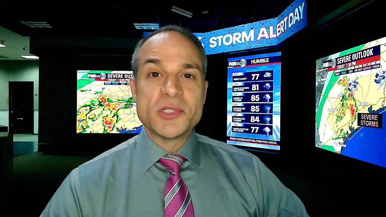
Rain totals could exceed 2-3" and the timing could bring dangerous weather during school dismissal. NOAA's Storm Prediction Center has placed much of Texas including our area under risk for large hail as indicated by the black dashed lines. Large hail would be 2" in diameter - so anything from nickel-sized to egg-sized is possible. Large hail is usually isolated in coverage, but you may want to park your car under a cover if possible. Models are in fairly good agreement as to the intensity of the storms today and the overall development.
Rain totals could exceed 2-3" and the timing could bring dangerous weather during school dismissal. NOAA's Storm Prediction Center has placed much of Texas including our area under risk for large hail as indicated by the black dashed lines. Large hail would be 2" in diameter - so anything from nickel-sized to egg-sized is possible. Large hail is usually isolated in coverage, but you may want to park your car under a cover if possible. Models are in fairly good agreement as to the intensity of the storms today and the overall development.

Canada’s wildfire season prompts air quality alerts in US
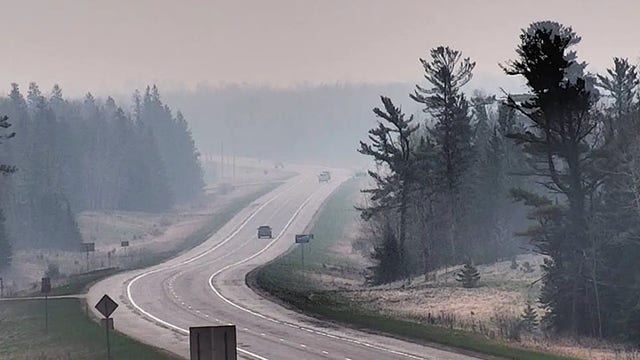
An evacuation alert was issued for Fort McMurray in Alberta as crews responded to what they described as an "out-of-control wildfire."
An evacuation alert was issued for Fort McMurray in Alberta as crews responded to what they described as an "out-of-control wildfire."