


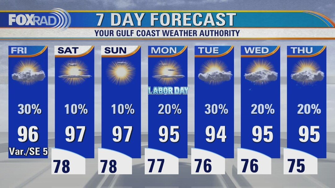
Friday evening weather forecast with Chief Meteorologist Dr. Jim Siebert
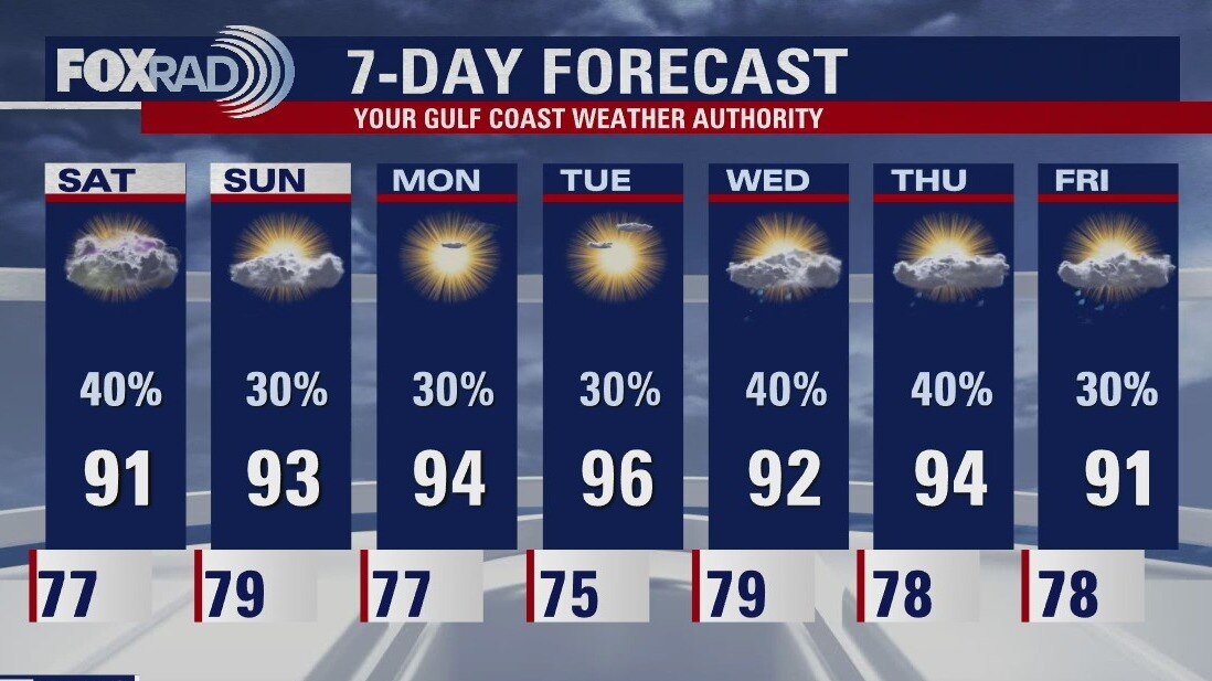
Look for fewer showers over the weekend until Labor Day when there will be a chance for showers with the heating of the day. A tropical low may form in the southern Gulf next week and looks to be heading toward Florida. We will watch it closely.
Look for fewer showers over the weekend until Labor Day when there will be a chance for showers with the heating of the day. A tropical low may form in the southern Gulf next week and looks to be heading toward Florida. We will watch it closely.
Friday weather forecast
Partly cloudy, hot and humid with isolated storms. Highs in the mid 90s.
Partly cloudy, hot and humid with isolated storms. Highs in the mid 90s.

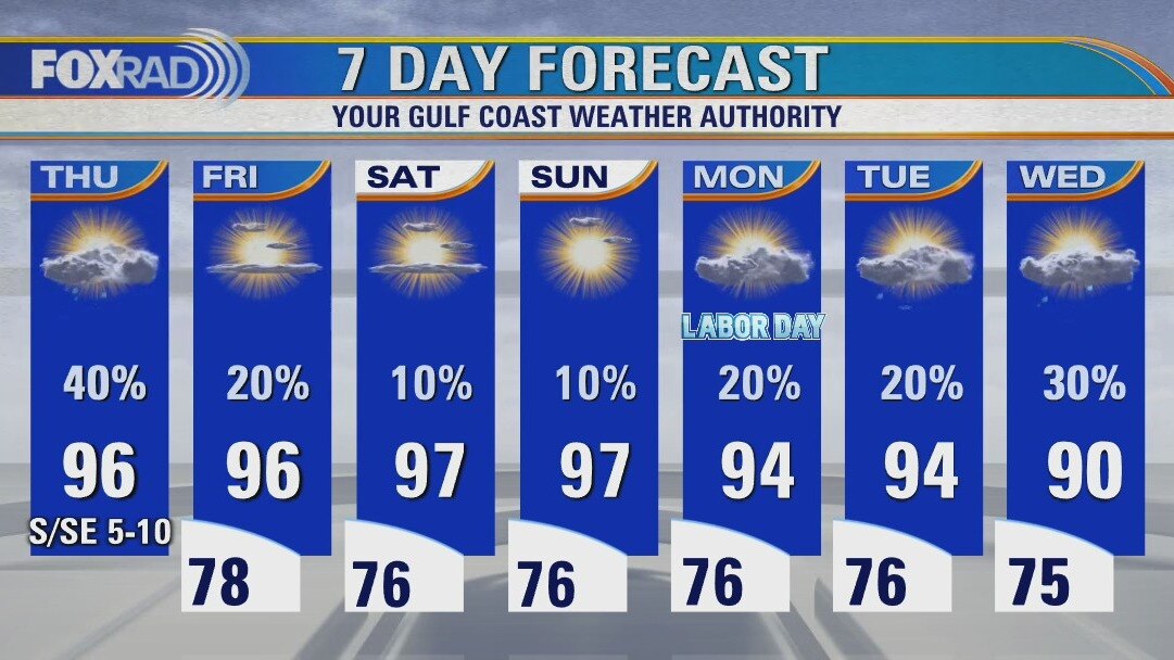
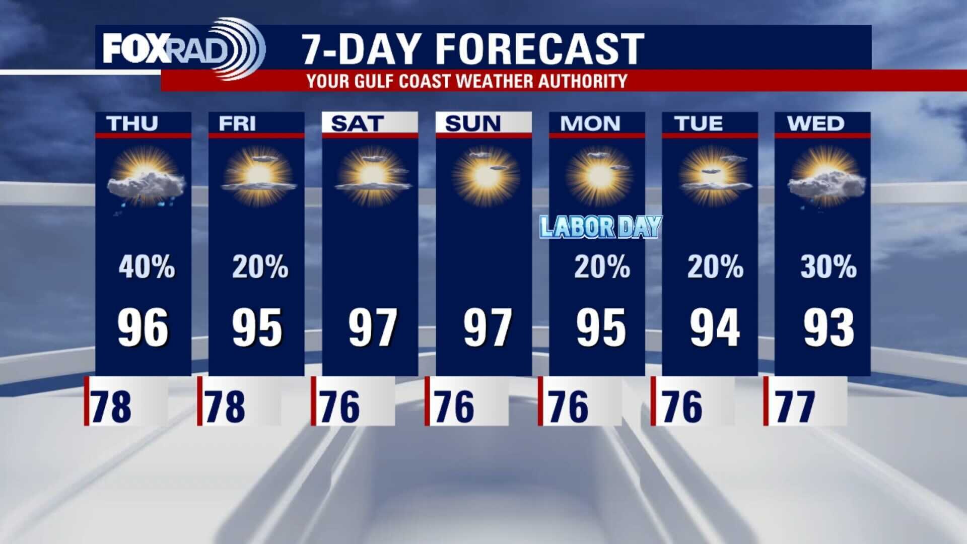
Thursday evening weather forecast
There will be some scattered showers again on Friday, but the holiday weekend will have less rain and very warm temps. Highs will reach back to 97 degrees and the heat index will feel closer to 104. At least it will be mostly sunny and the tropics look quiet for SE Texas, which is always nice.
There will be some scattered showers again on Friday, but the holiday weekend will have less rain and very warm temps. Highs will reach back to 97 degrees and the heat index will feel closer to 104. At least it will be mostly sunny and the tropics look quiet for SE Texas, which is always nice.
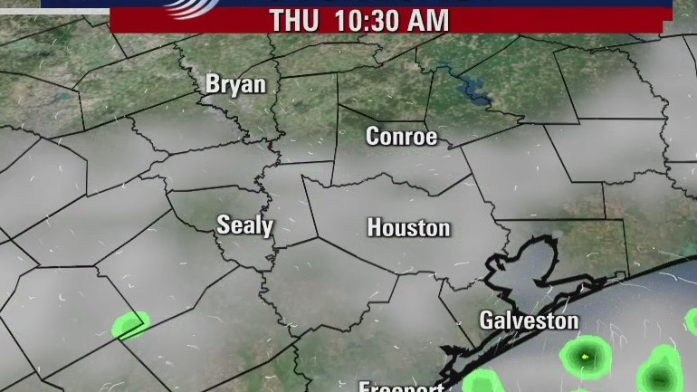
Thursday weather forecast
Our hot, humid late summer pattern is going to stick around for the next week or so. Watch for a few hit and miss storms this afternoon along with a heat index above 105. Labor Day weekend is shaping up to be a hot one with only a slight chance for showers. Late next week, we may have a shot of some tropical moisture, so we'll keep an eye on that.
Our hot, humid late summer pattern is going to stick around for the next week or so. Watch for a few hit and miss storms this afternoon along with a heat index above 105. Labor Day weekend is shaping up to be a hot one with only a slight chance for showers. Late next week, we may have a shot of some tropical moisture, so we'll keep an eye on that.
Wednesday morning weather forecast
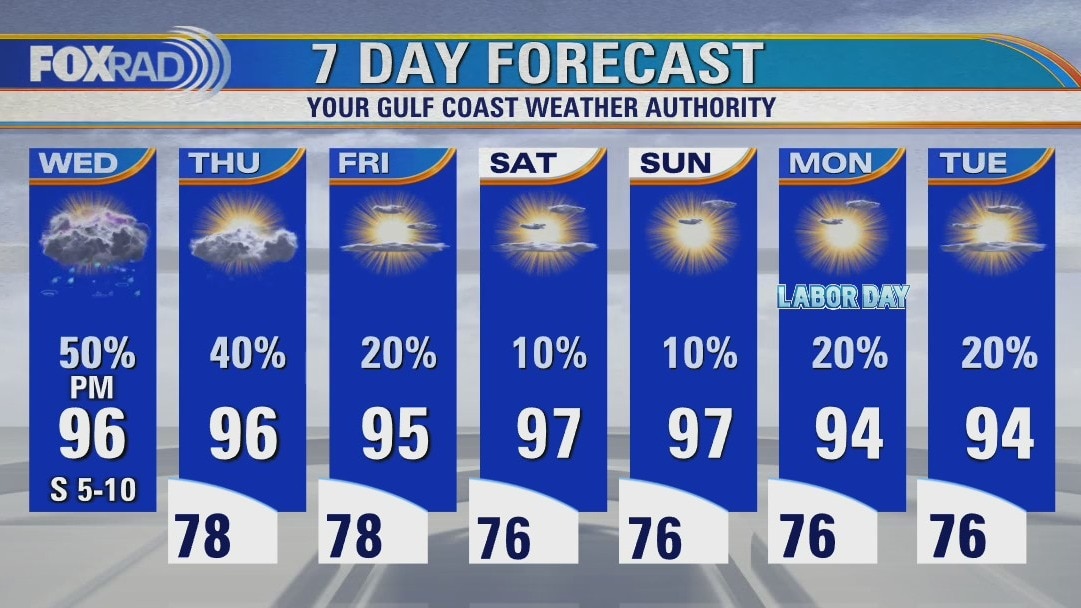
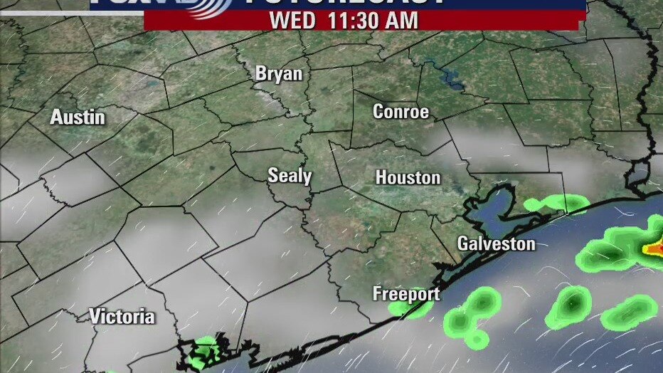
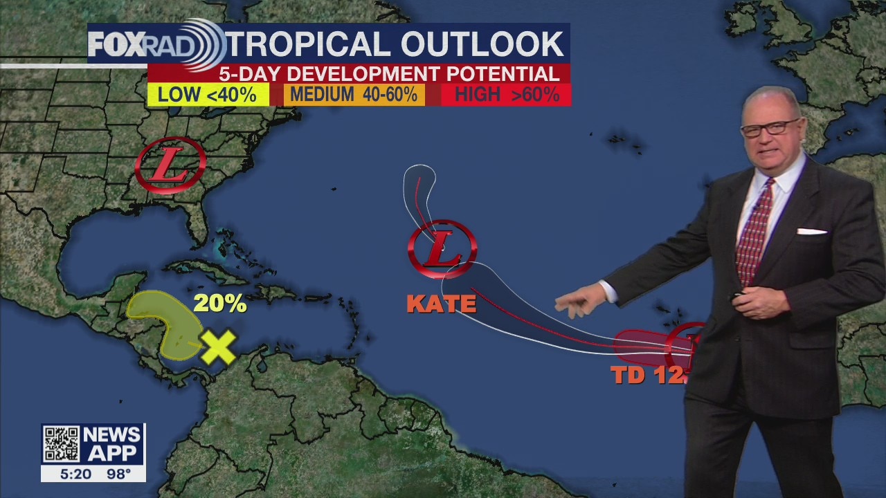
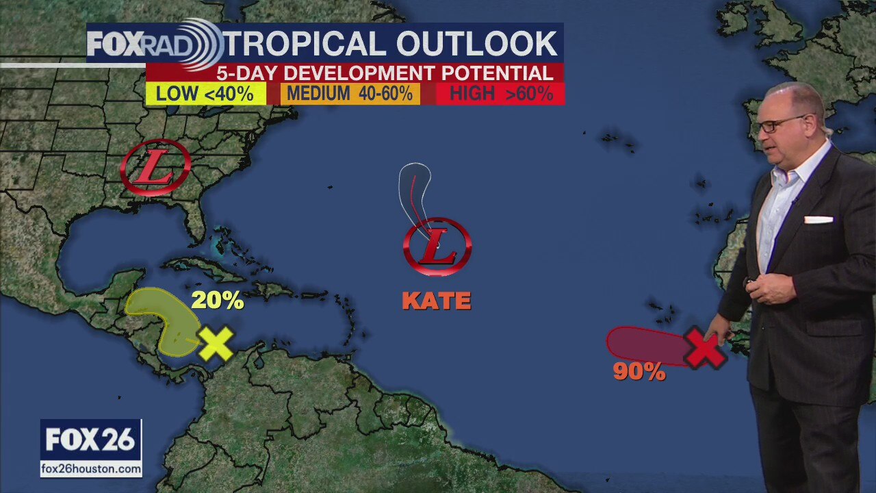
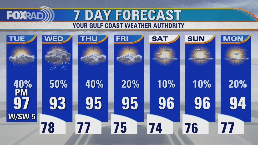
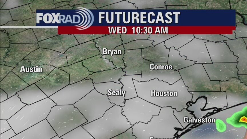
Rain chances will drop over Labor Day Weekend, but it will also be rather hot. High pressure will settle over SE Texas keeping showers away as well as anything tropical. A low may move into the far southern Gulf and stay down there by Mexico. It only has a 30% of organizing, but whatever forms will pose no threat to the Texas coastline.
Rain chances will drop over Labor Day Weekend, but it will also be rather hot. High pressure will settle over SE Texas keeping showers away as well as anything tropical. A low may move into the far southern Gulf and stay down there by Mexico. It only has a 30% of organizing, but whatever forms will pose no threat to the Texas coastline.
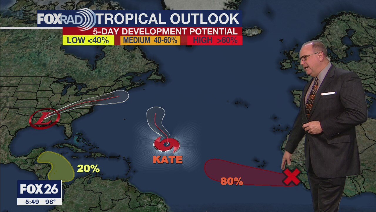
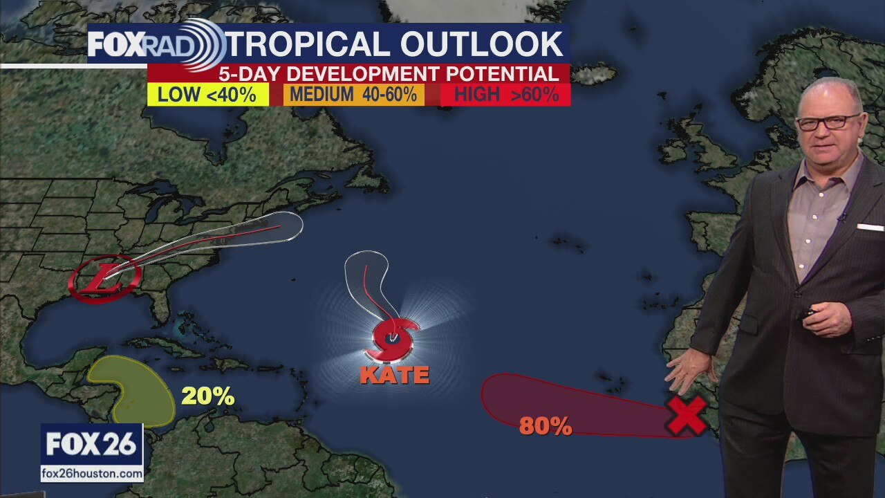
Wednesday evening weather forecast with Chief Meteorologist Dr. Jim Siebert
Rain chances will drop over Labor Day Weekend, but it will also be rather hot. High pressure will settle over SE Texas keeping showers away as well as anything tropical. A low may move into the far southern Gulf and stay down there by Mexico. It only has a 30% of organizing, but whatever forms will pose no threat to the Texas coastline.
Rain chances will drop over Labor Day Weekend, but it will also be rather hot. High pressure will settle over SE Texas keeping showers away as well as anything tropical. A low may move into the far southern Gulf and stay down there by Mexico. It only has a 30% of organizing, but whatever forms will pose no threat to the Texas coastline.
Wednesday weather forecast
Today is going to be a steamy one, but with all that humidity, storms look likely after about 2 p.m. Look for a few scattered showers and storms tomorrow followed by lower rain chance for Friday and especially the Labor Day weekend. Highs should run in the mid to upper 90s this weekend with only a slim rain chance. The tropics are quiet in our part of the world, but a new tropical storm named Larry could become a large hurricane in the central Atlantic later this week.
Today is going to be a steamy one, but with all that humidity, storms look likely after about 2 p.m. Look for a few scattered showers and storms tomorrow followed by lower rain chance for Friday and especially the Labor Day weekend. Highs should run in the mid to upper 90s this weekend with only a slim rain chance. The tropics are quiet in our part of the world, but a new tropical storm named Larry could become a large hurricane in the central Atlantic later this week.
Wednesday morning weather forecast
It will remain hot with a few scattered showers through the end of the week. The weekend looks a little drier and hotter, but we can expect plenty of sunshine for Labor Day on Monday. Not a bad start to September, but certainly very warm.
It will remain hot with a few scattered showers through the end of the week. The weekend looks a little drier and hotter, but we can expect plenty of sunshine for Labor Day on Monday. Not a bad start to September, but certainly very warm.
Tuesday Evening Weather Forecast
It will remain hot with a few scattered showers through the end of the week. The weekend looks a little drier and hotter, but we can expect plenty of sunshine for Labor Day on Monday. Not a bad start to September, but certainly very warm.
It will remain hot with a few scattered showers through the end of the week. The weekend looks a little drier and hotter, but we can expect plenty of sunshine for Labor Day on Monday. Not a bad start to September, but certainly very warm.
Tropical Weather Forecast - August 31, 2021
The remnants of Ida continue to bring rain to the eastern part of the country. There is more tropical activity in the Atlantic basin, but nothing is pointed towards the Gulf of Mexico at this time.
The remnants of Ida continue to bring rain to the eastern part of the country. There is more tropical activity in the Atlantic basin, but nothing is pointed towards the Gulf of Mexico at this time.
Tuesday weather forecast
More heat and humidity are on the way today with the heat index above 105 this afternoon. Watch for a few late afternoon or early evening storms. The chance for storms is a bit higher tomorrow before slowly dropping by the end of the week. The upcoming weekend looks sunny & hot. Tropical Depression Ida will bring heavy rain from the Florida Panhandle all the way to New York City today and Wednesday.
More heat and humidity are on the way today with the heat index above 105 this afternoon. Watch for a few late afternoon or early evening storms. The chance for storms is a bit higher tomorrow before slowly dropping by the end of the week. The upcoming weekend looks sunny & hot. Tropical Depression Ida will bring heavy rain from the Florida Panhandle all the way to New York City today and Wednesday.
Tuesday morning weather forecast
Temps will remain a bit above average on Tuesday, but there will be a few more afternoon showers in the forecast. The rest of the week looks close to normal for the end of August and the beginning of September with hot temps and some rain.
Temps will remain a bit above average on Tuesday, but there will be a few more afternoon showers in the forecast. The rest of the week looks close to normal for the end of August and the beginning of September with hot temps and some rain.
Monday Evening Weather Forecast
Temps will remain a bit above average on Tuesday, but there will be a few more afternoon showers in the forecast. The rest of the week looks close to normal for the end of August and the beginning of September with hot temps and some rain.
Temps will remain a bit above average on Tuesday, but there will be a few more afternoon showers in the forecast. The rest of the week looks close to normal for the end of August and the beginning of September with hot temps and some rain.
Tropical Weather Forecast - August 30, 2021
Your Gulf Coast Weather Authority FOX 26 Houston Chief Meteorologist Dr. Jim Siebert has the latest on weather in the Gulf of Mexico.
Your Gulf Coast Weather Authority FOX 26 Houston Chief Meteorologist Dr. Jim Siebert has the latest on weather in the Gulf of Mexico.

Hot, sunny day in Houston area
In the greater Houston area, we're looking at mostly sunny weather. Temperatures will be hot with highs in the mid to upper 90s. We can expect a few late day storms. Meanwhile, Ida has been downgraded to a tropical storm this morning and the center of circulation will pass over Jackson, MS. The greatest threat today is extremely heavy rain for Mississippi and Alabama with flask flooding likely. Areas around Southeast Louisiana received more than a foot of rain and incredible winds near along the coast south of New Orleans. In fact, a lifeboat docked at Port Fourchon, LA actually measured a wind gust to 172 mph.
In the greater Houston area, we're looking at mostly sunny weather. Temperatures will be hot with highs in the mid to upper 90s. We can expect a few late day storms. Meanwhile, Ida has been downgraded to a tropical storm this morning and the center of circulation will pass over Jackson, MS. The greatest threat today is extremely heavy rain for Mississippi and Alabama with flask flooding likely. Areas around Southeast Louisiana received more than a foot of rain and incredible winds near along the coast south of New Orleans. In fact, a lifeboat docked at Port Fourchon, LA actually measured a wind gust to 172 mph.

Monday morning weather update
The backside of Ida means a NE wind for the Houston area and that will lead to a sunny day on Monday. Humidity will be back by Tuesday and so will our normal pop-up storms. The end of the week looks a little drier with more sunshine.
The backside of Ida means a NE wind for the Houston area and that will lead to a sunny day on Monday. Humidity will be back by Tuesday and so will our normal pop-up storms. The end of the week looks a little drier with more sunshine.

Sunday evening weather update with Chief Meteorologist Dr. Jim Siebert
The backside of Hurricane Ida means a NE wind for the Houston area and that will lead to a sunny day on Monday. Humidity will be back by Tuesday and so will our normal pop-up storms. The end of the week looks a little drier with more sunshine.
The backside of Hurricane Ida means a NE wind for the Houston area and that will lead to a sunny day on Monday. Humidity will be back by Tuesday and so will our normal pop-up storms. The end of the week looks a little drier with more sunshine.

Sunday afternoon weather update with Chief Meteorologist Dr. Jim Siebert
Hurricane Ida made landfall Sunday afternoon and Chief Meteorologist Dr. Jim Siebert has the latest on its development and impact on the gulf coast.
Hurricane Ida made landfall Sunday afternoon and Chief Meteorologist Dr. Jim Siebert has the latest on its development and impact on the gulf coast.
Tropics Update-Saturday morning weather forecast
Rain will be likely on Saturday, but it's unrelated to Ida. The first of next week will still have scattered showers, but nothing overly soggy. Ida will have very little impact on SE Texas except for some elevated tides along the coast.
Rain will be likely on Saturday, but it's unrelated to Ida. The first of next week will still have scattered showers, but nothing overly soggy. Ida will have very little impact on SE Texas except for some elevated tides along the coast.

Friday evening weather forecast with Chief Meteorologist Dr. Jim Siebert
Rain will be likely on Saturday, but it's unrelated to Ida. The first of next week will still have scattered showers, but nothing overly soggy. Ida will have very little impact on SE Texas except for some elevated tides along the coast.
Rain will be likely on Saturday, but it's unrelated to Ida. The first of next week will still have scattered showers, but nothing overly soggy. Ida will have very little impact on SE Texas except for some elevated tides along the coast.