

Houston weather: Scattered storms kicking off the new week

Houston weather: Your August 3 evening forecast
With warm air and plenty of moisture in place, we expect some afternoon storms and downpours on Monday.
HOUSTON - We're in for another chance of storms to kick off the new work week.
Afternoon rain for Monday
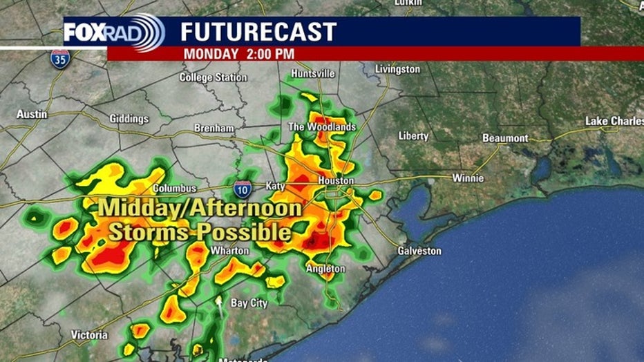
With warm air and plenty of moisture in place, we do expect some scattered afternoon storms on Monday.
Complicating the forecast is a jetstream currently running north to south across our area. This can sometimes lead to some stronger storms, but our computer models are mixed on that.
The bottom line is to stay weather-aware and to check in with your FOX 26 Weather app before you head outdoors.
Hotter weather on the way
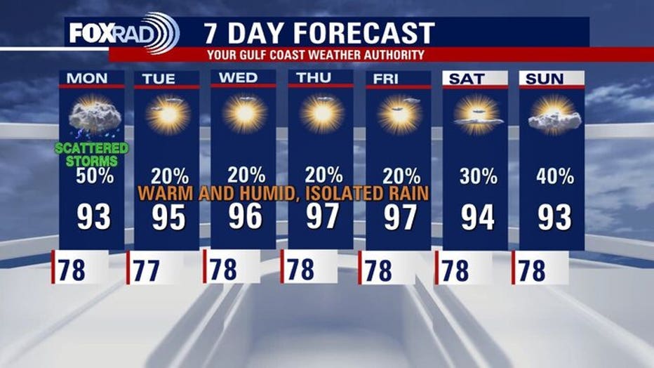
Starting on Tuesday, we should settle into a hotter pattern for much of next week.
Now, there will be a chance for some late afternoon thunderstorms, but we’ll have more sunshine and hotter high temperatures with lots of upper 90s common across the area through the end of the week.
Watching the tropics

Tropical Weather Update - August 3, 2025
Showers and thunderstorms have increased in association with a non-tropical area of low pressure located a few hundred miles east of the North Carolina coast. That National Hurricane Center has now labeled this system as Invest 95L and it looks likely with will develop into our next tropical cyclone. There are 2 other areas being watched in the Atlantic Basin at this time.
We don’t see threats to the Texas coastline from the tropics anytime soon, but action elsewhere does look like it’s picking up.
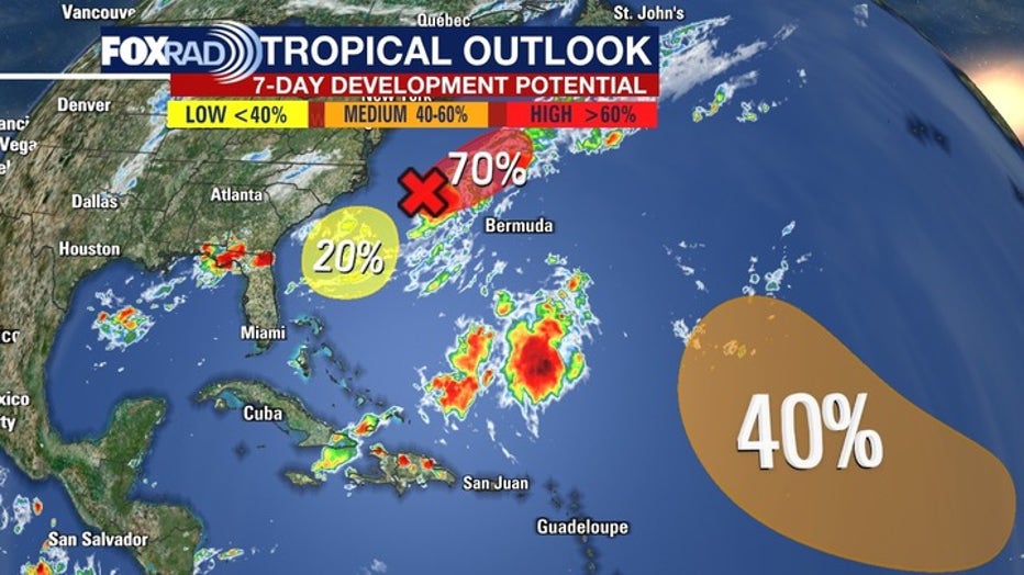
An area of low pressure off the East Coast of the United States could strengthen and become a tropical system over the next one to two days.
And another tropical wave in the Atlantic could strengthen later this week.
The Source: Your Gulf Coast Weather Authority