

Houston weather: Warm temperatures continue across the area
The summer sizzle will continue across the Houston area as we go into Wednesday. FOX 26's Remeisha Shade has the latest weather forecast.
The summer sizzle will continue across the Houston area as we go into Wednesday. FOX 26's Remeisha Shade has the latest weather forecast.
Houston weather: Hazy, humid, hot Tuesday for World Cup match
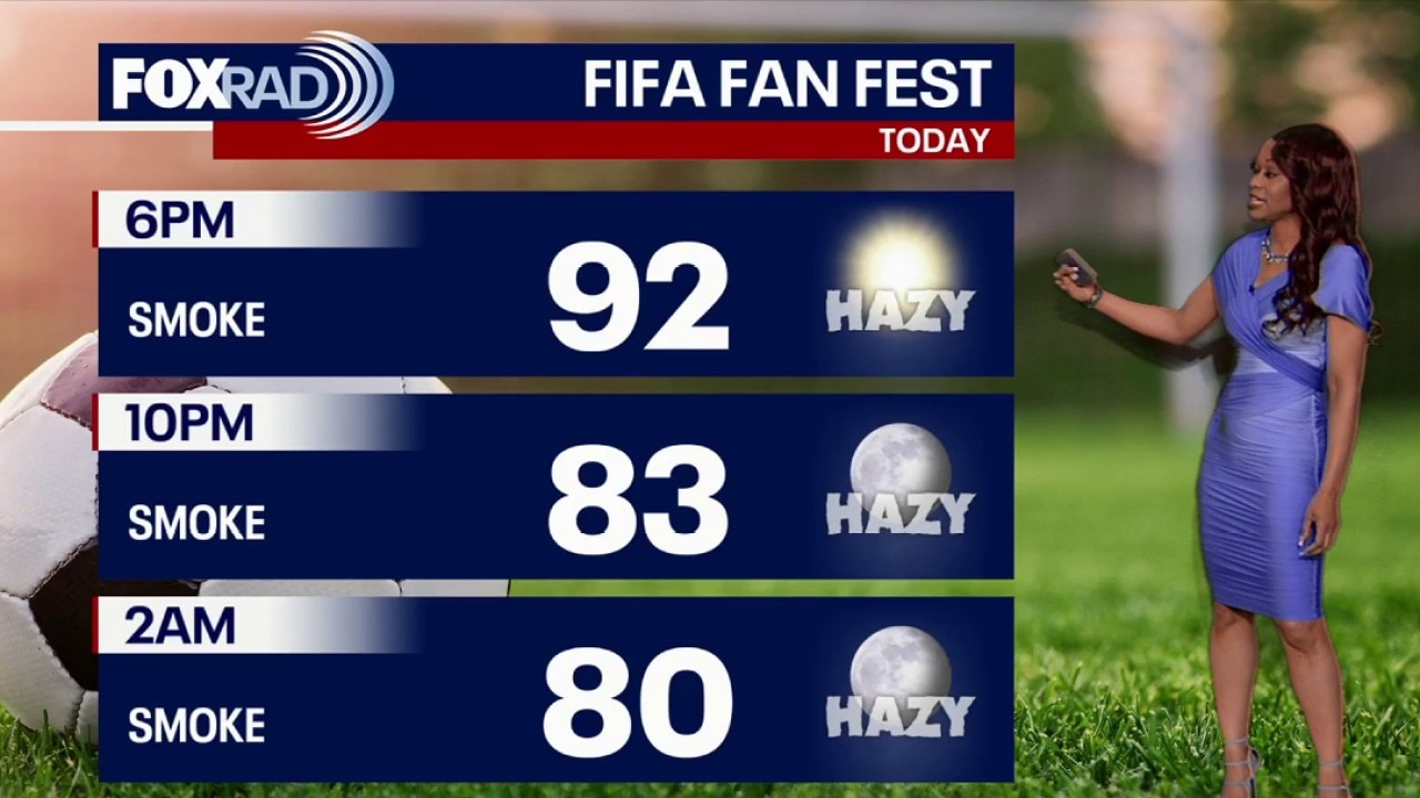
It's going to be a hazy and hot day as fans head out to Houston Stadium Tuesday for the World Cup match. With highs in the 90s and heat index values over 100, fans should drink plenty of water and stay cool.
It's going to be a hazy and hot day as fans head out to Houston Stadium Tuesday for the World Cup match. With highs in the 90s and heat index values over 100, fans should drink plenty of water and stay cool.
Houston weather: Heat returning across the area
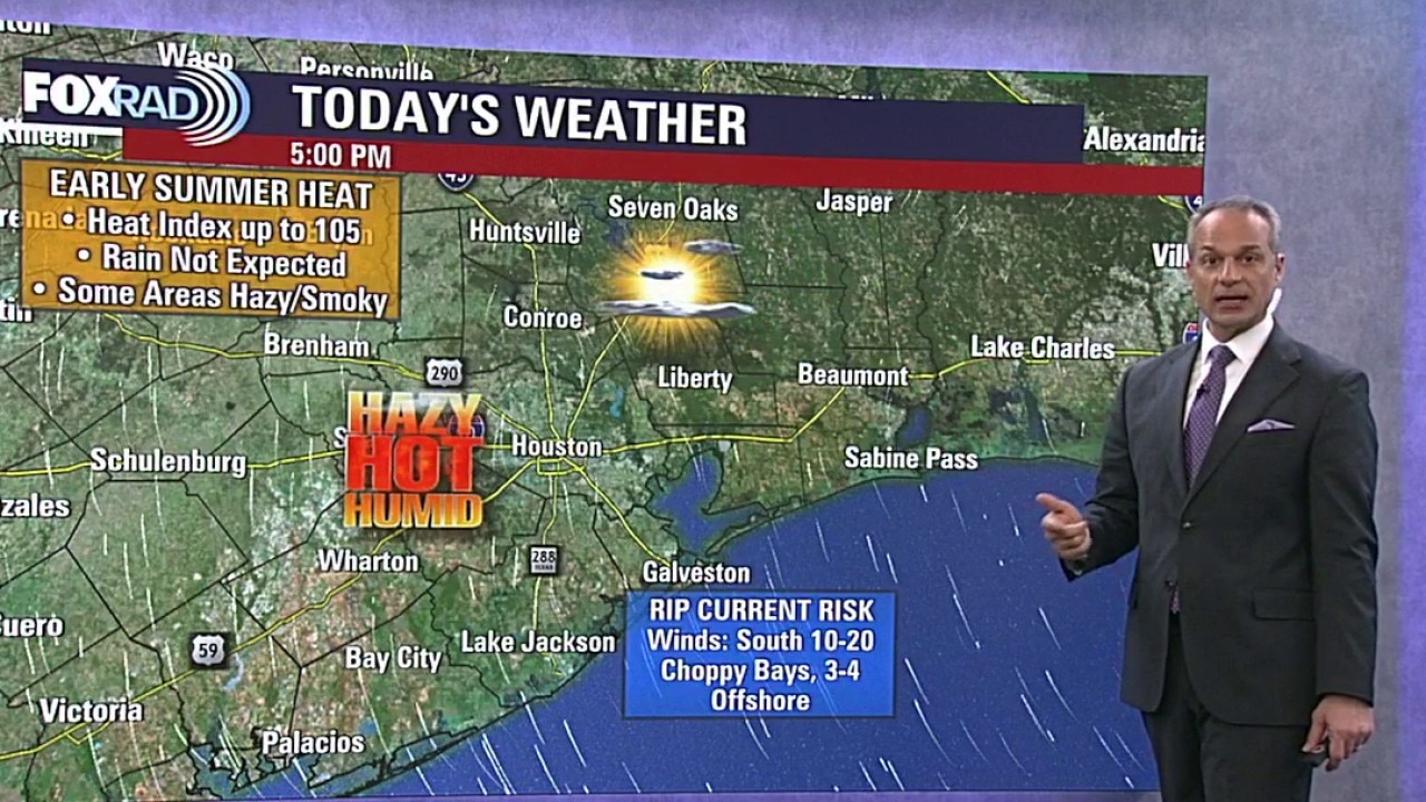
Hot and humid weather is settling in across Southeast Texas with highs in the 90s and heat index values climbing above 100 each afternoon. This is the kind of steamy pattern that will stick around for several days. So anyone outdoors should plan to drink plenty of water and take breaks from the heat.
Hot and humid weather is settling in across Southeast Texas with highs in the 90s and heat index values climbing above 100 each afternoon. This is the kind of steamy pattern that will stick around for several days. So anyone outdoors should plan to drink plenty of water and take breaks from the heat.
Houston weather: June 22 evening forecast
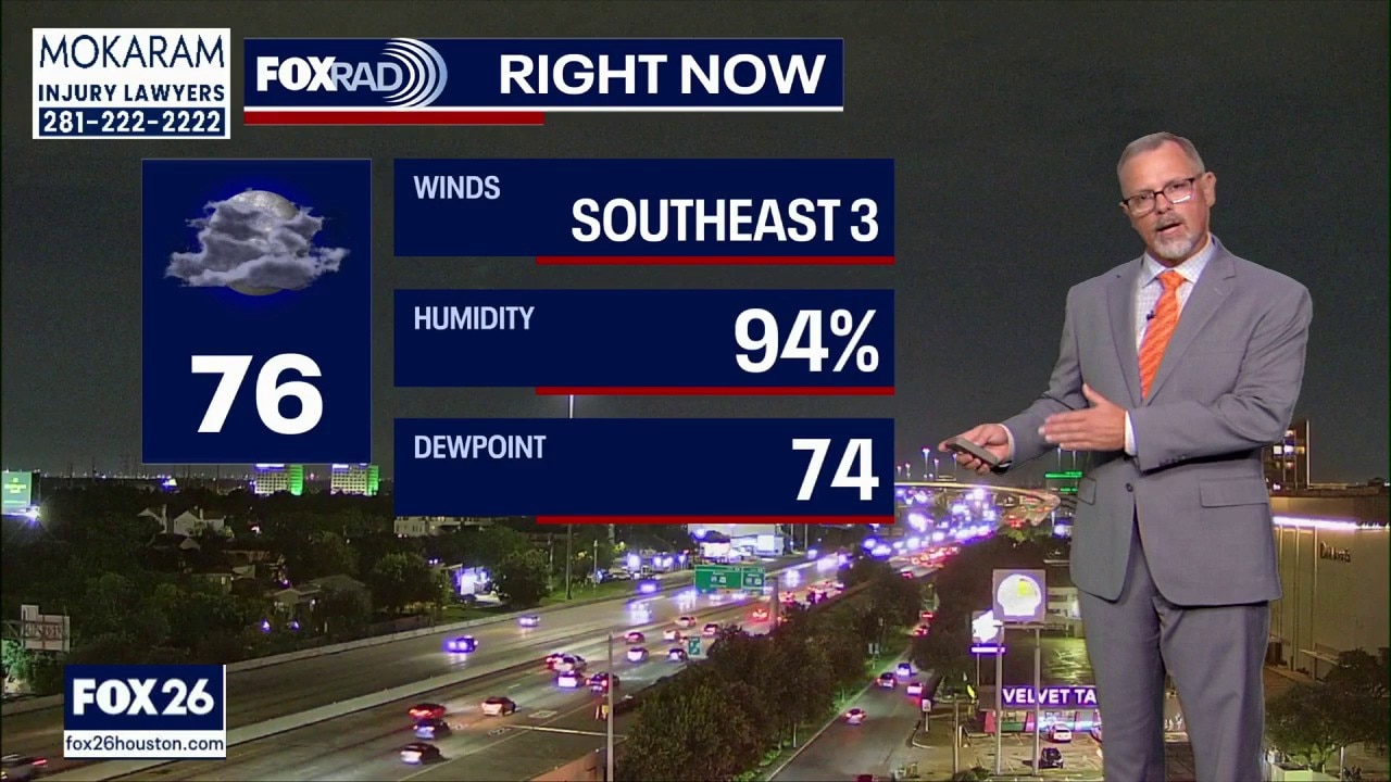
FOX 26's Remeisha Shade breaks down the latest in wind speed and weather forecasts for Southeast Texas and what to expect for the rest of the week.
FOX 26's Remeisha Shade breaks down the latest in wind speed and weather forecasts for Southeast Texas and what to expect for the rest of the week.
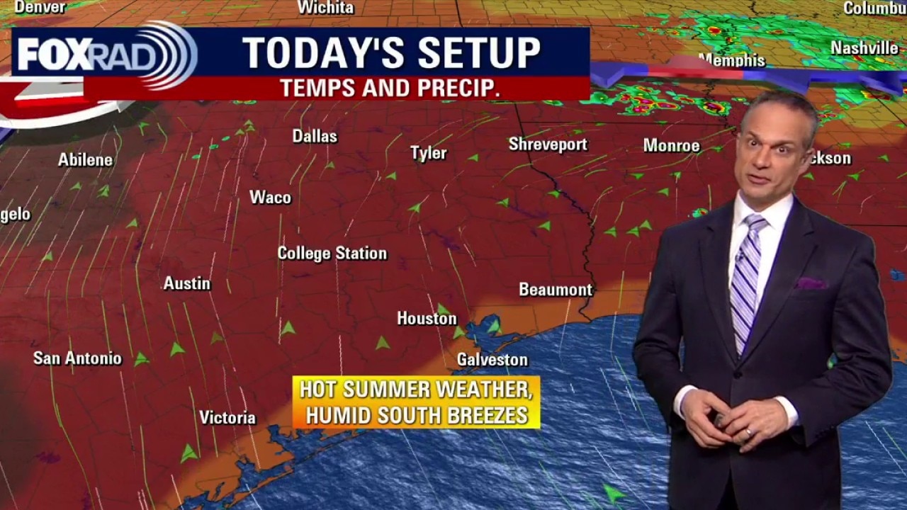
Houston weather: Humid, breezy Monday in the 90s
It's officially summer and the heat has arrived to make it known! Temperatures are in the high 90s for Monday with heat index values above 100.
It's officially summer and the heat has arrived to make it known! Temperatures are in the high 90s for Monday with heat index values above 100.

Houston weather: June 21 overnight forecast
FOX 26's John Dawson gives the latest weather forecast and what is to come for the week and what to expect for Summer Solstice.
FOX 26's John Dawson gives the latest weather forecast and what is to come for the week and what to expect for Summer Solstice.
Houston weather: June 21 evening forecast
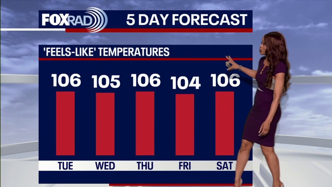
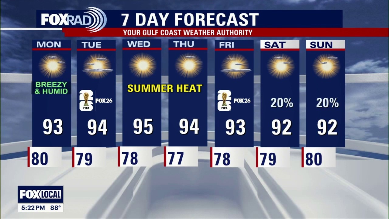
A summer pattern continues this week. You can expect afternoon highs to range from the low to mid 90s with feels-like temperatures in the triple digits each afternoon.
A summer pattern continues this week. You can expect afternoon highs to range from the low to mid 90s with feels-like temperatures in the triple digits each afternoon.
Houston weather: June 21 morning forecast
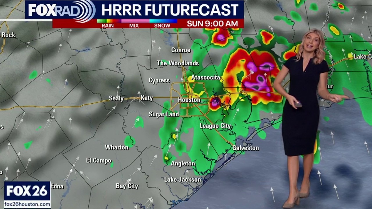
Happy Father's Day to all of the dads out there! If you have plans to celebrate your dad outside today plan to start with rain and end the day in the heat.
Happy Father's Day to all of the dads out there! If you have plans to celebrate your dad outside today plan to start with rain and end the day in the heat.
Houston weather: June 20 overnight forecast
FOX 26's John Dawson gives the latest weather forecast for the weekend as Houston braces for large amounts of humidity.
FOX 26's John Dawson gives the latest weather forecast for the weekend as Houston braces for large amounts of humidity.
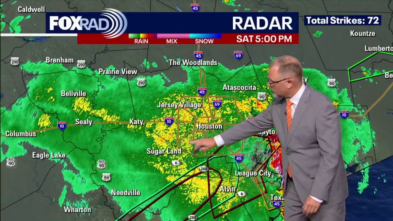
Houston weather: June 20 evening forecast
Greater Houston's heat advisory ended early Saturday as strong storms rolled through. FOX 26 meteorologist John Dawson breaks down the forecast for the rest of the evening into Father's Day Sunday.
Greater Houston's heat advisory ended early Saturday as strong storms rolled through. FOX 26 meteorologist John Dawson breaks down the forecast for the rest of the evening into Father's Day Sunday.
Houston weather: June 20 morning forecast
A hot and humid Saturday is on tap. A heat advisory is in effect until 10 p.m. Saturday. FOX 26 meteorologist Allison Gargaro has the details.
A hot and humid Saturday is on tap. A heat advisory is in effect until 10 p.m. Saturday. FOX 26 meteorologist Allison Gargaro has the details.
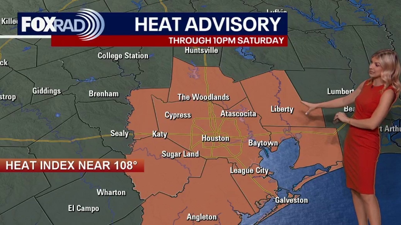
Houston weather: Heat advisory in effect on Saturday
A Heat Advisory continues across Southeast Texas today through 10 PM Saturday as heat index values climb well above 100. Juneteenth events will feel especially steamy, so anyone spending time outside should take breaks, drink plenty of water, and watch for signs of heat stress.
A Heat Advisory continues across Southeast Texas today through 10 PM Saturday as heat index values climb well above 100. Juneteenth events will feel especially steamy, so anyone spending time outside should take breaks, drink plenty of water, and watch for signs of heat stress.
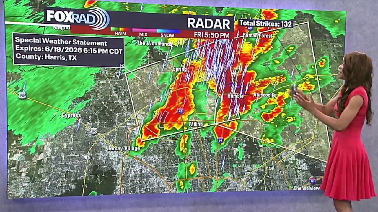
Houston weather: Heat, rain chances Friday night, through the weekend
Rain chances were rolling through for some in Greater Houston, and the rain and heat are expected to continue for the weekend.
Rain chances were rolling through for some in Greater Houston, and the rain and heat are expected to continue for the weekend.
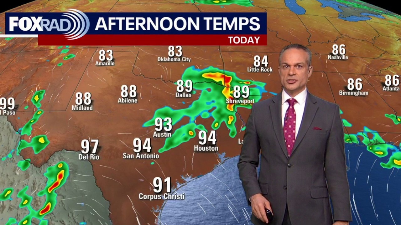
Houston weather: Hot and humid Friday; heat advisory for second day
A heat advisory is still in effect for Friday with temperatures in the 90s and heat index values reaching into the 100s. There is a possibility of late-day storms.
A heat advisory is still in effect for Friday with temperatures in the 90s and heat index values reaching into the 100s. There is a possibility of late-day storms.
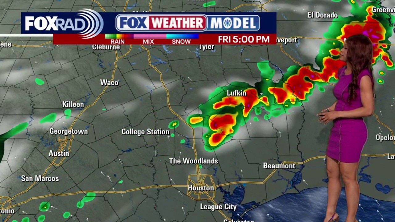
Houston weather: More heat to continue on Friday
Rain chances are lower than earlier this week, but storms could develop north of Houston late Friday, with spotty showers and storms possible around the area on Saturday. Any storms that develop could briefly bring heavy rain, lightning, and gusty winds before the steamy weather quickly returns.
Rain chances are lower than earlier this week, but storms could develop north of Houston late Friday, with spotty showers and storms possible around the area on Saturday. Any storms that develop could briefly bring heavy rain, lightning, and gusty winds before the steamy weather quickly returns.
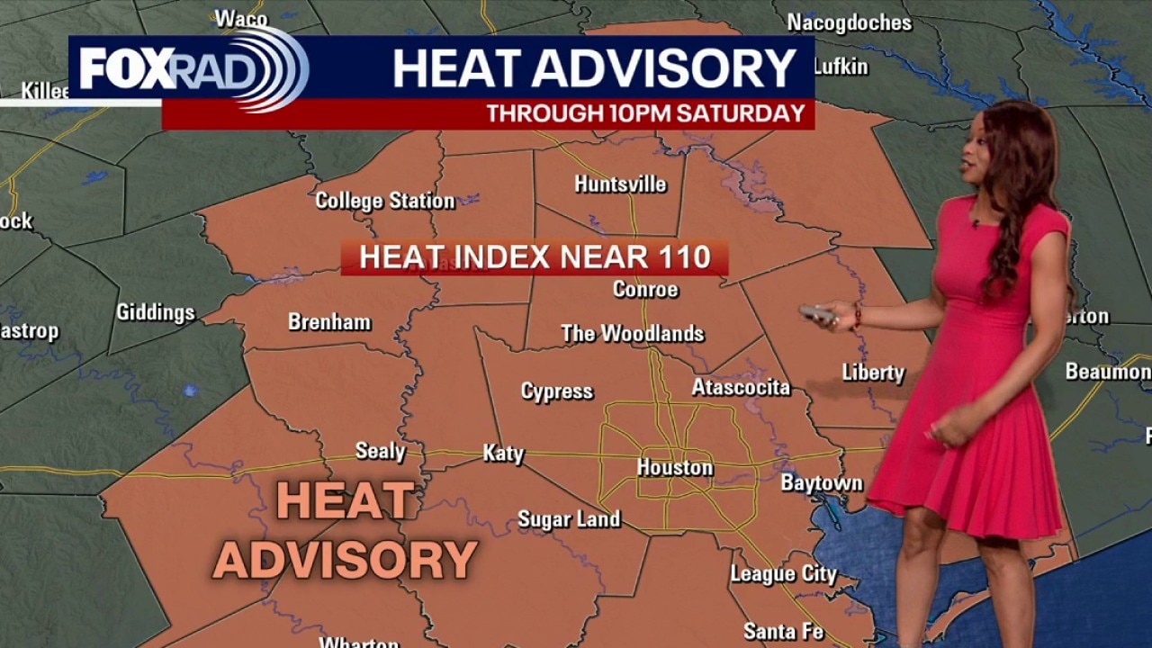
Houston weather: Heat Advisory extends to Saturday
Juneteenth events will feel especially steamy, so anyone spending time outside should take breaks, drink plenty of water, and watch for signs of heat stress.
Juneteenth events will feel especially steamy, so anyone spending time outside should take breaks, drink plenty of water, and watch for signs of heat stress.
Houston weather: Heat index in 100s, heat advisory in effect
There is a heat advisory for the Houston-area on Thursday as we leave most of the rain behind and see sunny and hot conditions. The heat index will near 110 with highs in the 90s.
There is a heat advisory for the Houston-area on Thursday as we leave most of the rain behind and see sunny and hot conditions. The heat index will near 110 with highs in the 90s.
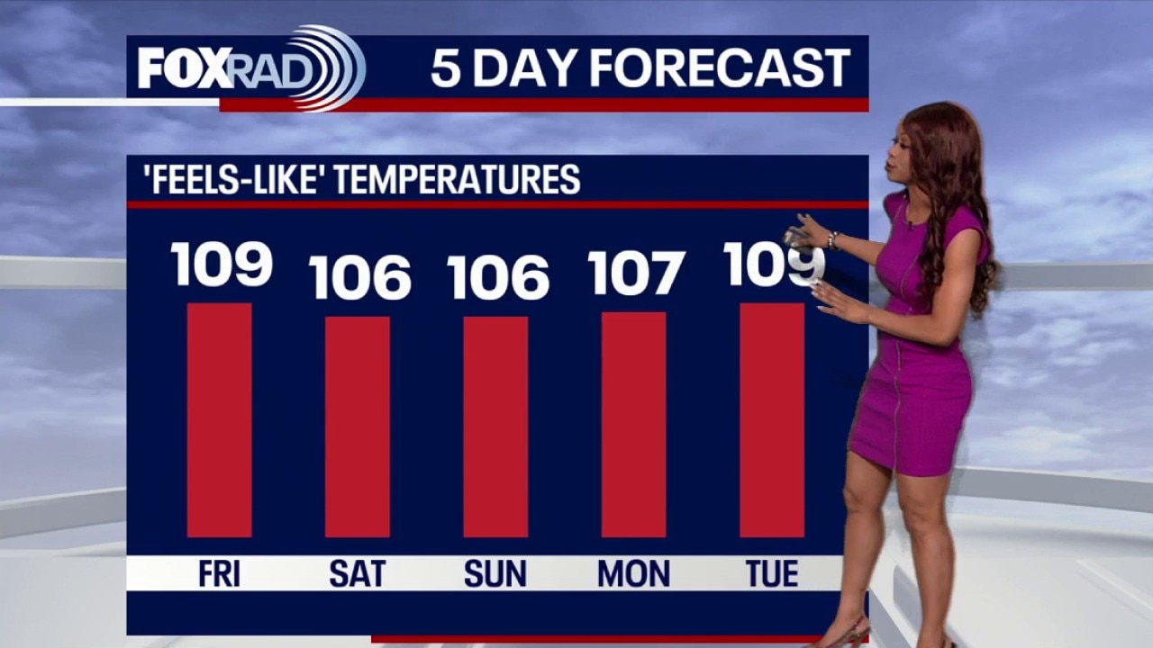
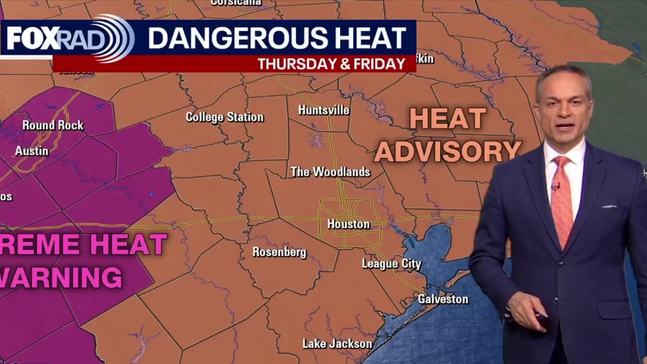
Houston weather: Warm weather on the way after recent rains
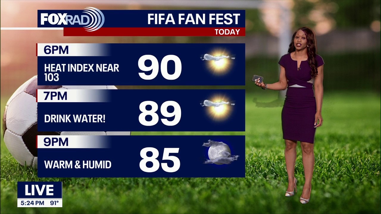
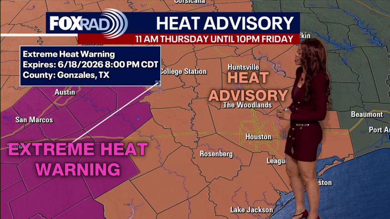
Get ready for hotter and drier days ahead. As rain chances become very limited and the heat increases, Heat Advisory has been issued for Houston Thursday and Friday. When you add in the humidity, feels like temps could be anywhere from 107 to 114! Please be careful in the heat at Fifa Fan Fest & other outdoor events. Drink plenty of water and take breaks in the shade.
Get ready for hotter and drier days ahead. As rain chances become very limited and the heat increases, Heat Advisory has been issued for Houston Thursday and Friday. When you add in the humidity, feels like temps could be anywhere from 107 to 114! Please be careful in the heat at Fifa Fan Fest & other outdoor events. Drink plenty of water and take breaks in the shade.

Houston weather: Flood risk drops; heat risk rising
The heavy rain chances from Tropical Storm Arthur has moved out of Houston toward Louisiana, but we now have a Heat Advisory set to start Thursday.
The heavy rain chances from Tropical Storm Arthur has moved out of Houston toward Louisiana, but we now have a Heat Advisory set to start Thursday.
Houston weather: Windy, isolated downpours for Wednesday
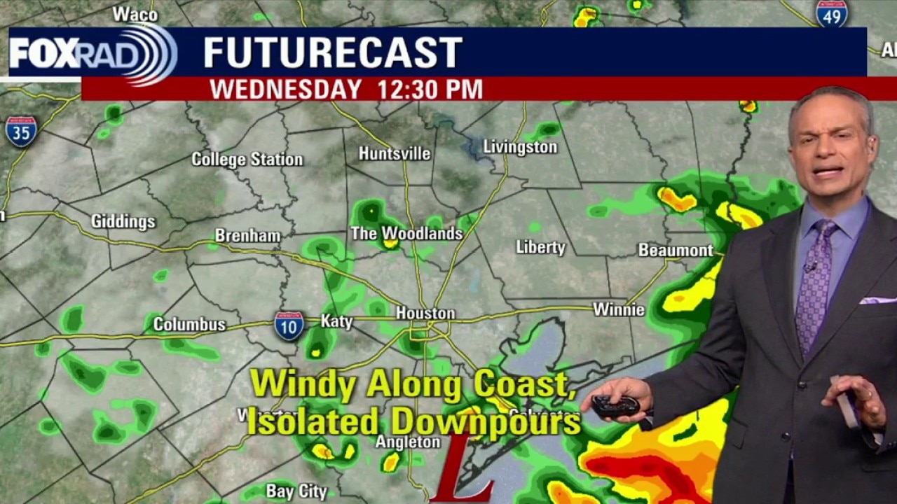
Prepare for windy and rainy conditions along the Texas coast throughout the afternoon. A flood watch remains in effect until Thursday morning.
Prepare for windy and rainy conditions along the Texas coast throughout the afternoon. A flood watch remains in effect until Thursday morning.