

Houston weather: Heat dome building Tuesday, storm chances for Friday

Houston weather: Sunny, hot Tuesday in the 90s
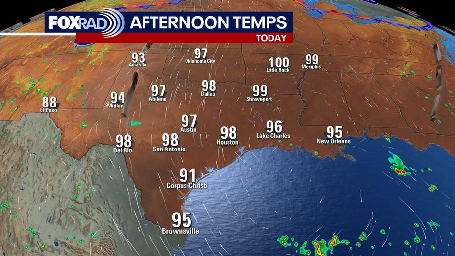
It's gonna be hot and steamy for today and the next couple days with highs in the upper 90s and heat index values in the 100s. Overnight lows will remain in the upper 70s to low 80s. Storm chances increase for Friday and Saturday.
HOUSTON - Tuesday is going to be hot and steamy, along with the next couple of days with highs in the upper 90s and heat index values in the 100s.
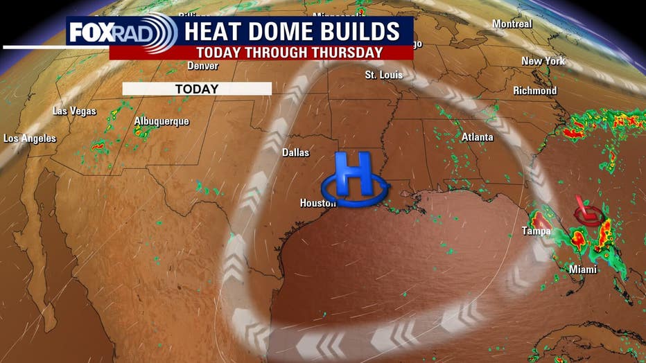
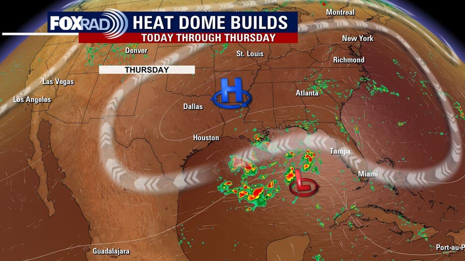
Heat dome dominates until Friday
Dangerous heat will persist for the next three days, with daytime highs upper 90s and heat index values well into the triple digits. Overnight lows will remain in the upper 70s to low 80s.
Stay safe in the heat by staying hydrated, getting in the AC when possible, and limiting outdoor exertion during peak heat hours.
Increased storm chances Friday & Saturday
Tropical moisture will increase on Friday and Saturday, bringing increased chances for showers and thunderstorms. Much of this moisture can actually be traced back to a similar system that soaked Louisiana and parts of Texas last week and has looped all the way around an area of high pressure.
Tropics remain fairly quiet
The National Hurricane Center has lowered the chance of development for the tropical wave in the Atlantic to near zero. Even if it does decide to flare up, it should remain far south of the US.
Otherwise, we’ll closely monitor the aforementioned tropical moisture late this week as it has a slight chance for becoming a tropical depression.
The Source: Your Gulf Coast Weather Authority