

Houston weather: Super soggy May weather pattern brings more threats for flooding
HOUSTON - Our springtime May showers have turned into numerous heavy downpours that have led to some pretty significant flooding issues over the last week.
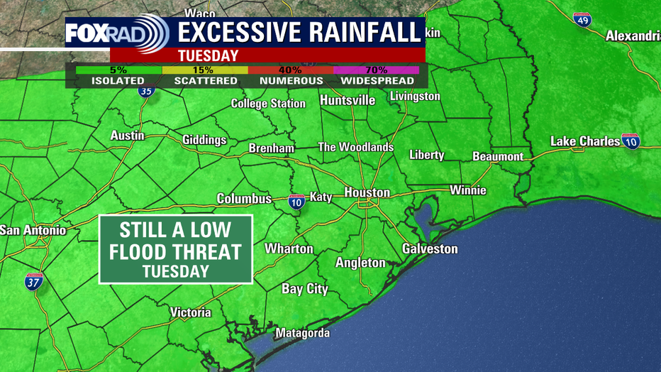
After being inundated with another round of heavy rain over the weekend and on Monday, the flood threat remains elevated.
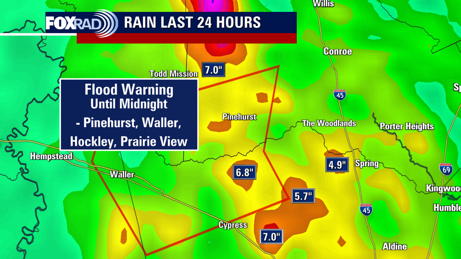
Flood Warning is in place until midnight for northwest Harris, southwest Montgomery, and northeast Waller Counties. This was issued due to ongoing flooding of rivers, creeks & streams in the area around Tomball, Prairie View, Pinehurst, Hockley, Waller, Magnolia & Stagecoach. Watch out for high water & avoid walking or driving through it!
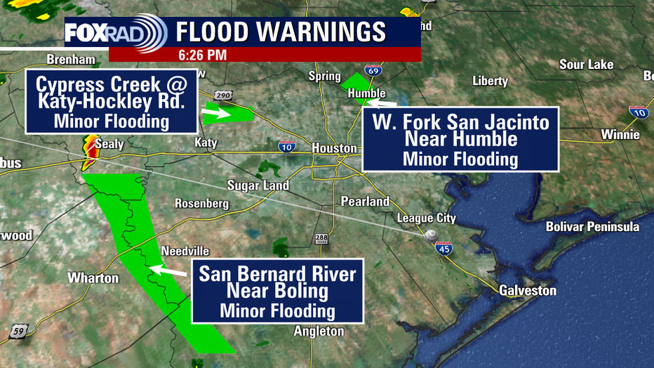
There's also numerous River Flood Warnings, including the San Bernard River Near Boling, West Fork of the San Jacinto near Humble, & the Lavaca River near Edna. There's also flooding reported at the Cypress Creek at Katy-Hockley Road & Lake Creek at Sendera Ranch Road. Minor to moderate flooding is occurring at these locations so be careful if you live or work around these areas!
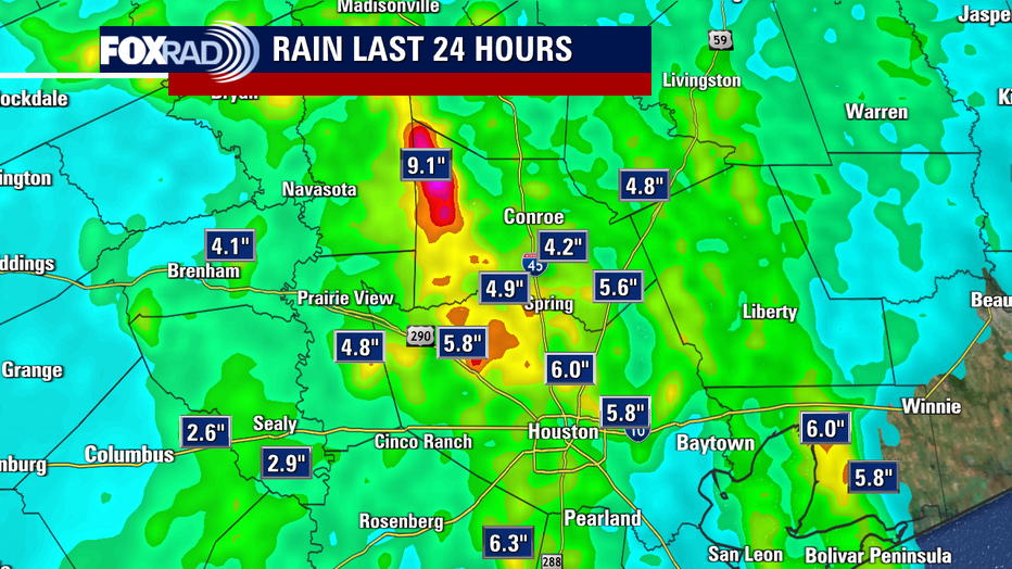
Houston and surrounding areas have picked up anywhere from two to around nine inches of additional rain in just the last 24 hours! Some of the hardest hit areas have been around Cypress, Spring, Aldine and northwest Montgomery County.
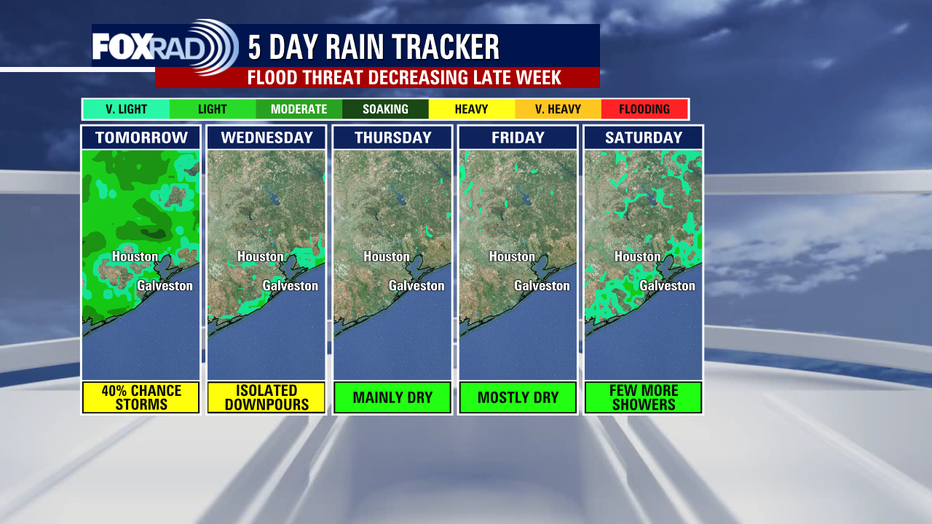
We should get a break from most of the heavy rain for much of Monday night and Tuesday morning. However, spotty storms that could dump more heavy rain return Tuesday and Wednesday afternoon. Then we should FINALLY get a break from this super soggy pattern for a few days as we heat up and rain chances fall to only 10% by the end of the work week.
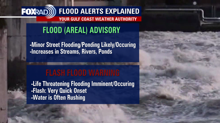
Be careful while out and about with some spots still flooded and make sure to grab our FOX 26 Weather App to stay up to date on the latest weather changes no matter where you are!