

Houston weather: Overnight Storm Alert, dry week ahead
Houston weather: May 10 overnight forecast
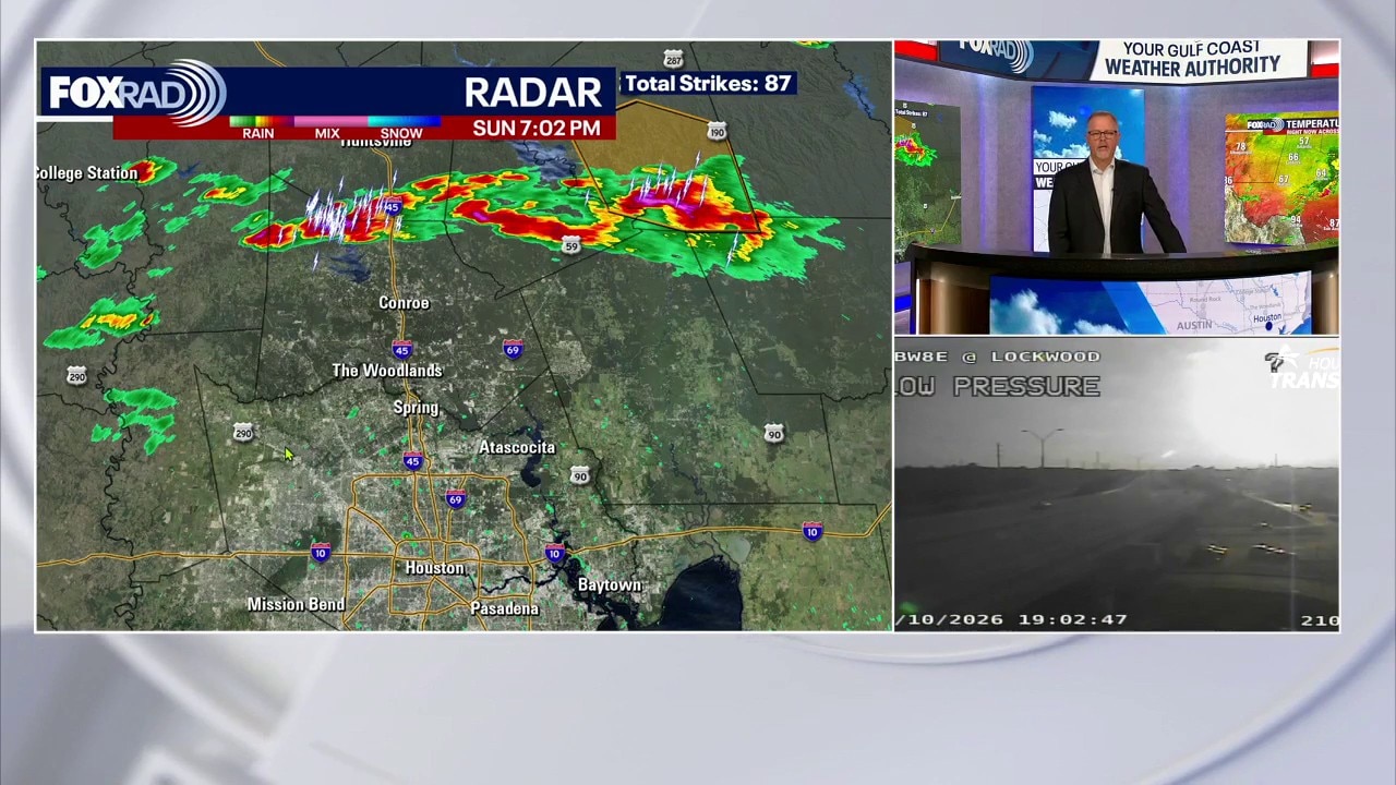
FOX 26's John Dawson breaks down the latest severe weather expected to travel through Southeast Texas and linger for more severe thunderstorm warnings.
HOUSTON - Overnight thunderstorms could bring severe weather across southeast Texas early Monday morning.
Severe thunderstorms happening across southeast Texas
FOX 26's John Dawson gives the latest on severe weather coverage in southeast Texas as several counties move from severe weather watch to warning.
Severe thunderstorm watch is in effect for 15 counties in Southeast Texas until 5 a.m. on May 11, 2026. Two of the Houston-area counties include Galveston County and Harris County.
Turning hot with strong storms late Sunday
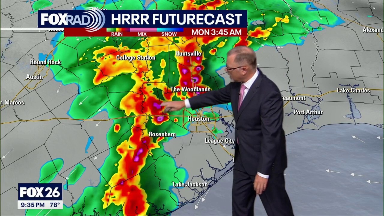
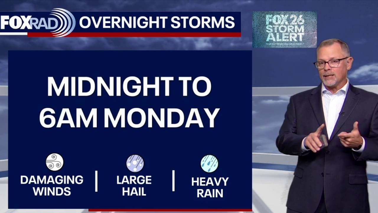
Models are now showing a big line of potential strong to severe storms rolling through Sunday night into early Monday morning along and ahead of a cold front. Be alert, especially after sunset on Sunday for some rough weather if you plan to be out.
Tomball, Katy, Spring and Livingston and cities northwest are under a 2/5 risk for damaging wind gusts and hail as the line of storms move through overnight.

It is expected to clear out of the region by around 8am Monday morning. Stay weather aware and stick with us on FOX Local for weather updates overnight.
Click here for details on severe weather alerts.
FOX 26 Storm Alert overnight
Houston weather: May 10 evening forecast
Overnight thunderstorms could bring severe weather across southeast Texas early Monday morning.
A strong line of storms will be moving into the area beginning as early as midnight and should be moving off the coast by 7am.
Damaging wind gusts, hail and heavy rain are the main weather threats. We also can't rule out an isolated tornado (the greatest risk for tornadoes is across central Texas).

Even though the bulk of the severe weather will be while you are sleeping, we ask that you have a way of receiving severe weather alerts and download the FOX Local app to stay up-to-date on timing in your neighborhood.

Drier, brighter days ahead
Next week brings a shift toward a more stable setup with plenty of sunshine and fewer rain chances.
Expect a stretch of warm, mostly rain-free weather with highs eventually climbing to the upper 80s to low 90s.
The Source: Your Gulf Coast Weather Authority