

Houston weather: Wind advisory for much of Monday; Freeze warning
Houston weather: High winds, dry air for Monday
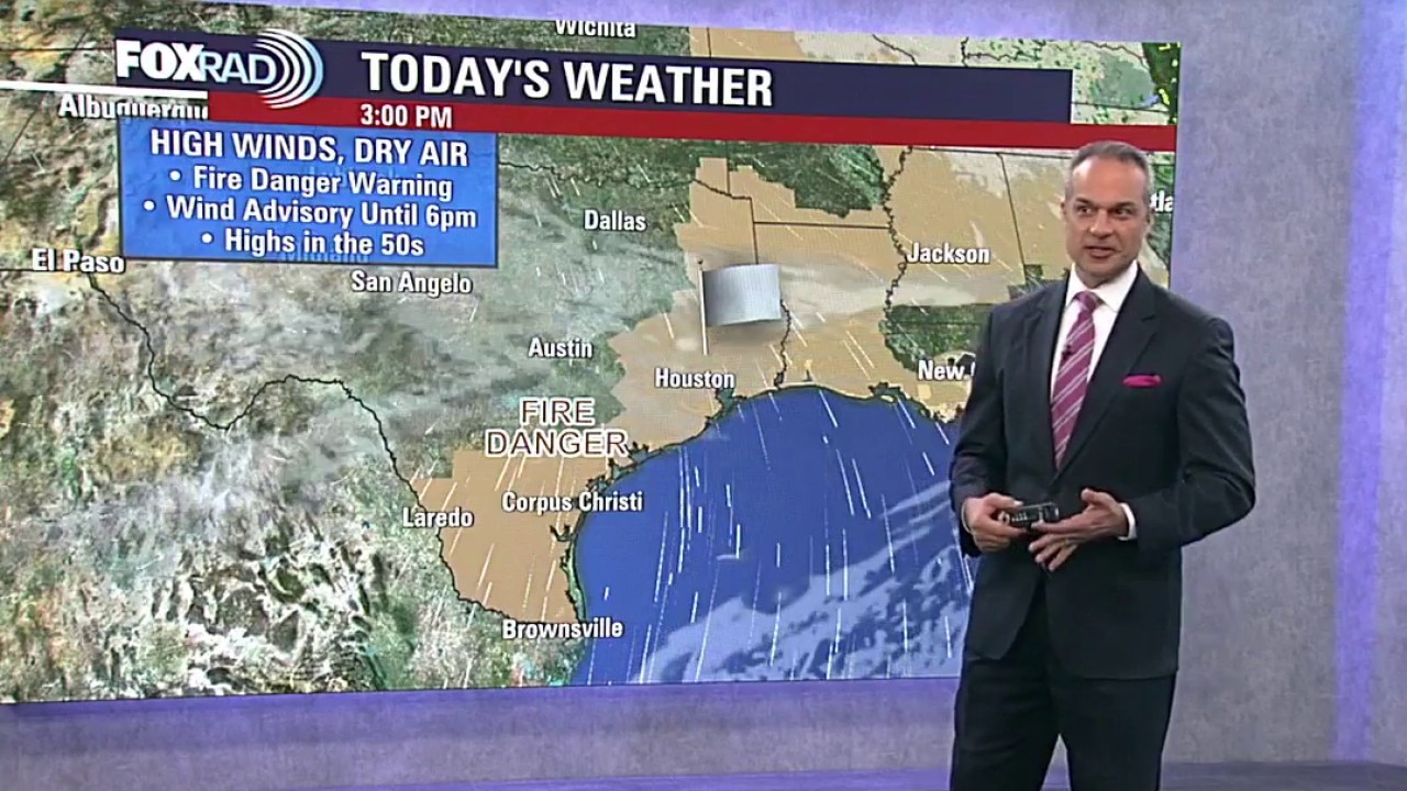
A wind advisory is in effect Monday as strong winds from the north sweep into the area. Expect dry air and highs in the 50s.
HOUSTON - A wind advisory is in effect Monday as strong winds from the north sweep into the area. Expect dry air and highs in the 50s.
Freeze Warning
The National Weather Service has issued a Freeze Warning for areas north of the Houston metro including Conroe, Splendora, Magnolia, Navasota, Brenham, Huntsville, Livingston and Liberty. Overnight temperatures could briefly dip to 32 degrees or colder, which is unusual for this time of year.

A freeze is not guaranteed, but residents with gardens or sensitive plants should consider covering them overnight as a precaution.
Very windy, much cooler today
A wind advisory remains in effect through this evening as strong north winds continue to sweep cooler air across Southeast Texas.

Expect a very windy and chilly day at the Rodeo and some rides might actually be temporarily closed due to high winds.

Cold night ahead
Winds gradually ease tonight and temperatures fall quickly under clear skies. Some inland spots could get close to freezing by early morning, while the Houston metro could drop into the upper 30s. We'll rebound nicely with highs in the mid 60s by the afternoon.

Sunny, much warmer days return
After the chilly start Tuesday, sunshine sticks around and temperatures begin to rebound.

The rest of the week looks dry with calmer winds and a dramatic warm-up with upper 80s possible by the end of the week!
The Source: Your Gulf Coast Weather Authority