


Houston weather forecast for Tuesday
Cool this morning, then partly cloudy with a slight chance for showers. Highs in the upper 60s.
Cool this morning, then partly cloudy with a slight chance for showers. Highs in the upper 60s.

Tuesday morning Houston-area forecast
We heat back up to near 80 by Thursday ahead of another storm system. This system will likely bring in a round of showers and storms late Thursday through early Friday. So the first part of St. Patrick's Day could be a bit stormy. We turn much cooler this weekend with highs only in the 50s and 60s with overnight temps in the 40s. So don't put the jackets and sweaters away just yet!
We heat back up to near 80 by Thursday ahead of another storm system. This system will likely bring in a round of showers and storms late Thursday through early Friday. So the first part of St. Patrick's Day could be a bit stormy. We turn much cooler this weekend with highs only in the 50s and 60s with overnight temps in the 40s. So don't put the jackets and sweaters away just yet!

Monday evening Houston-area weather forecast
Much cooler air has spilled into SE Texas for the first day of Spring Break for some of you! Temperatures are running about 10-20 degrees cooler today compared to yesterday. We should be partly cloudy and chilly tonight with overnight lows in the 40s and 50s. Look for a stray shower near the coast this evening with a low chance for a sprinkle or shower Tuesday. We heat back up to near 80 by Thursday ahead of another storm system. This system will likely bring in a round of showers and storms late Thursday through early Friday. So the first part of St. Patrick's Day could be a bit stormy. We turn much cooler this weekend with highs only in the 50s and 60s with overnight temps in the 40s. So don't put the jackets and sweaters away just yet! Enjoy your night!
Much cooler air has spilled into SE Texas for the first day of Spring Break for some of you! Temperatures are running about 10-20 degrees cooler today compared to yesterday. We should be partly cloudy and chilly tonight with overnight lows in the 40s and 50s. Look for a stray shower near the coast this evening with a low chance for a sprinkle or shower Tuesday. We heat back up to near 80 by Thursday ahead of another storm system. This system will likely bring in a round of showers and storms late Thursday through early Friday. So the first part of St. Patrick's Day could be a bit stormy. We turn much cooler this weekend with highs only in the 50s and 60s with overnight temps in the 40s. So don't put the jackets and sweaters away just yet! Enjoy your night!
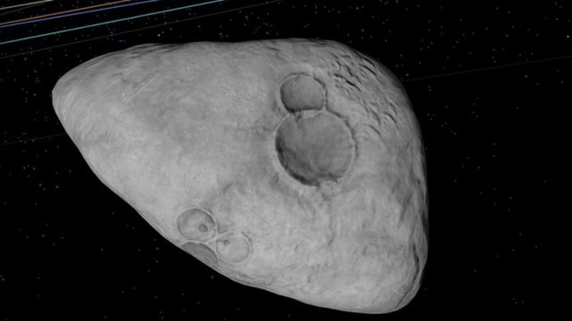

Mondays with Mike: NASA discovers Asteroid that could hit Earth; Cyclone Freddy; Pi Day Eve
FOX 26 Chief Meteorologist Mike Iscovitz talks about NASA's discovery of a new asteroid that could hit Earth, how Cyclone Freddy set an all-time record, and Pi Day Eve.
FOX 26 Chief Meteorologist Mike Iscovitz talks about NASA's discovery of a new asteroid that could hit Earth, how Cyclone Freddy set an all-time record, and Pi Day Eve.
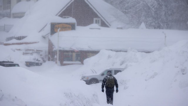

When can you expect the last snow of the season?
In some areas, the season's average last snowfall might be later than you think. Many parts of the U.S. can still see snow well into the spring.
In some areas, the season's average last snowfall might be later than you think. Many parts of the U.S. can still see snow well into the spring.

Houston weather: Cool and breezy Monday morning; afternoon highs near 70
A complete change in our weather pattern is in place for spring break - now, the temperatures aren't going to be frigid, but after three weeks of unusually warm weather, it's finally cooling down. Expect a couple of cooler days to start the week, then a breezy and slight warmer mid-week followed by a line of storms late Thursday and into St. Patrick's Day. We could feel actually chilly air by the weekend. Also, Tuesday is called "Pi Day" because it is 3/14 which is the first three numbers to Pi - the mathematical ratio of a circle's radius and circumference.
A complete change in our weather pattern is in place for spring break - now, the temperatures aren't going to be frigid, but after three weeks of unusually warm weather, it's finally cooling down. Expect a couple of cooler days to start the week, then a breezy and slight warmer mid-week followed by a line of storms late Thursday and into St. Patrick's Day. We could feel actually chilly air by the weekend. Also, Tuesday is called "Pi Day" because it is 3/14 which is the first three numbers to Pi - the mathematical ratio of a circle's radius and circumference.

Sunday evening/Monday morning weather forecast
The Spring Break forecast looks a bit cooler than last week for Southeast Texas. Gone are the 80 degrees afternoons! Look for 60s and 70s for the highs with several chilly mornings. The highest rain chances will be at the end of the week with a cold front pushing through Houston Thursday night.
The Spring Break forecast looks a bit cooler than last week for Southeast Texas. Gone are the 80 degrees afternoons! Look for 60s and 70s for the highs with several chilly mornings. The highest rain chances will be at the end of the week with a cold front pushing through Houston Thursday night.

Mostly cloudy, warm Sunday evening in the 70s
The Spring Break forecast looks a bit cooler than last week for Southeast Texas. Gone are the 80 degrees afternoons! Look for 60s and 70s for the highs with several chilly mornings. Highest rain chances will be at the end of the week with a cold front pushing through Houston Thursday night.
The Spring Break forecast looks a bit cooler than last week for Southeast Texas. Gone are the 80 degrees afternoons! Look for 60s and 70s for the highs with several chilly mornings. Highest rain chances will be at the end of the week with a cold front pushing through Houston Thursday night.

Houston weather: What to expect weather wise for Spring Break, Rodeo
Everybody in Houston is ready for Spring Break 2023. Here is meteorologist John Dawson with what you can expect from the weather.
Everybody in Houston is ready for Spring Break 2023. Here is meteorologist John Dawson with what you can expect from the weather.

El Tiempo 12 de Marzo de 2023
#FOX26 Meteor?loga Lena Maria Arango tiene su pron?stico para la semana laboral
#FOX26 Meteor?loga Lena Maria Arango tiene su pron?stico para la semana laboral

Houston rodeo forecast for Sunday, March 12
Warm and breezy for Go Tejano Day at the Houston Livestock Show and Rodeo, but Meteorologist Lena Maria Arango says cooler air arrives by tomorrow!
Warm and breezy for Go Tejano Day at the Houston Livestock Show and Rodeo, but Meteorologist Lena Maria Arango says cooler air arrives by tomorrow!

Houston Sunday morning weather forecast
No matter what you fancy from the weather, the 7 day forecast features a little something for everyone. The weekend ends much how it started, warm and breezy but a noticeably dramatic cooldown will get ushered in for the next few days by a front set to arrive today. Don't expect much rain with this one, aside from a few isolated light showers north and east. Wednesday is my pick of the week personally, things look to get messy toward the end of the week and for my cool weather fans you're going to love next weekend. We'll be trending closer to our wintertime norms!
No matter what you fancy from the weather, the 7 day forecast features a little something for everyone. The weekend ends much how it started, warm and breezy but a noticeably dramatic cooldown will get ushered in for the next few days by a front set to arrive today. Don't expect much rain with this one, aside from a few isolated light showers north and east. Wednesday is my pick of the week personally, things look to get messy toward the end of the week and for my cool weather fans you're going to love next weekend. We'll be trending closer to our wintertime norms!
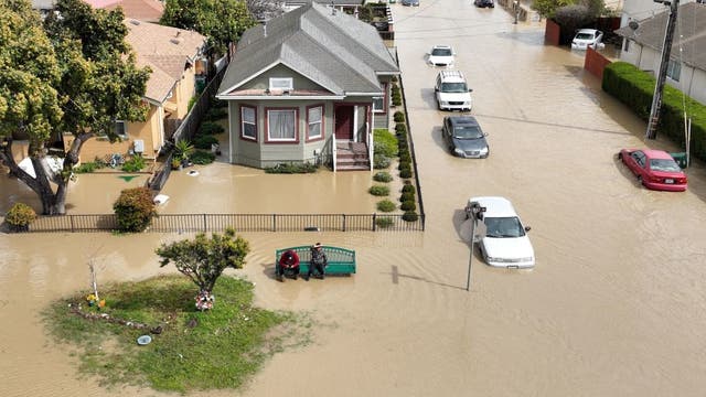

Storm breaches California river’s levee, thousands evacuate
A Northern California agricultural community was forced to evacuate early Saturday after the Pajaro River’s levee was breached by flooding from a new atmospheric river that pummeled the state.
A Northern California agricultural community was forced to evacuate early Saturday after the Pajaro River’s levee was breached by flooding from a new atmospheric river that pummeled the state.
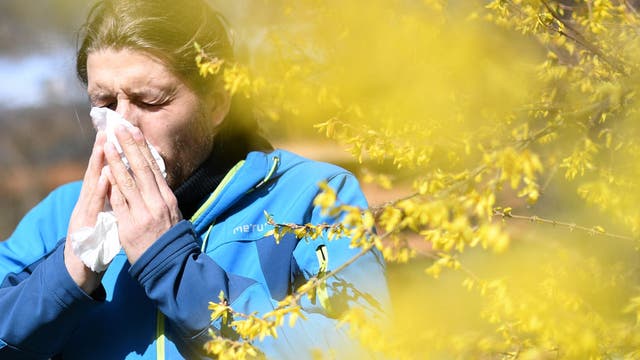

Allergy season is starting earlier, lasting longer and getting worse, study says
A new study from Climate Central found that plants are leafing and blooming earlier, and the overall growing season is lasting longer across much of the U.S.
A new study from Climate Central found that plants are leafing and blooming earlier, and the overall growing season is lasting longer across much of the U.S.

Expect a warm Saturday evening In the 80s
One more day in the 80s to end the weekend here in Southeast Texas. Spring Break in Houston starts cooler than last week with afternoon high temperatures only in the 60s. Rain chances will hold off until the end of the week when another cold front arrives with some showers and storms.
One more day in the 80s to end the weekend here in Southeast Texas. Spring Break in Houston starts cooler than last week with afternoon high temperatures only in the 60s. Rain chances will hold off until the end of the week when another cold front arrives with some showers and storms.
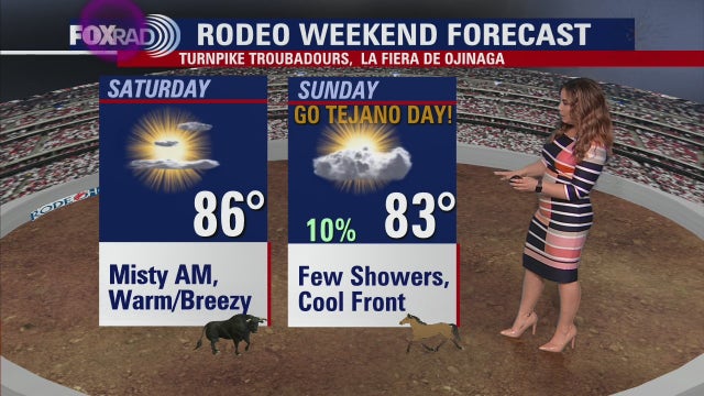

Houston weather: Gusty winds expected for Saturday's Rodeo activities
Headed to the Rodeo this weekend? Meteorologist Lena Maria Arango says hold on to your cowboy hats! In addition to gusty winds, rodeo goers can look for warm and humid air over the weekend, but Spring Breakers can giddy up for a cool-down early next week!"
Headed to the Rodeo this weekend? Meteorologist Lena Maria Arango says hold on to your cowboy hats! In addition to gusty winds, rodeo goers can look for warm and humid air over the weekend, but Spring Breakers can giddy up for a cool-down early next week!"

Houston weather: Gusty winds expected for Saturday's Rodeo activities
Headed to the Rodeo this weekend? Meteorologist Lena Maria Arango says hold on to your cowboy hats! In addition to gusty winds, rodeo goers can look for warm and humid air over the weekend, but Spring Breakers can giddy up for a cool-down early next week!"
Headed to the Rodeo this weekend? Meteorologist Lena Maria Arango says hold on to your cowboy hats! In addition to gusty winds, rodeo goers can look for warm and humid air over the weekend, but Spring Breakers can giddy up for a cool-down early next week!"

Saturday morning Houston-area weather forecast
A few areas of fog are possible early Saturday. Onshore flow returns this weekend and that means it will be quite warm with temps in the middle 80s during the afternoon. It will be windy at times also with gusts near 30 mph. More significant cold front should arrive Sunday afternoon. Rain chance with it will only be around 10% but cooler air moves in for Spring Break next week with highs Monday only near 70! A stronger front moves in late next week that could bring a better chance for rain and storms. Have a fantastic weekend!
A few areas of fog are possible early Saturday. Onshore flow returns this weekend and that means it will be quite warm with temps in the middle 80s during the afternoon. It will be windy at times also with gusts near 30 mph. More significant cold front should arrive Sunday afternoon. Rain chance with it will only be around 10% but cooler air moves in for Spring Break next week with highs Monday only near 70! A stronger front moves in late next week that could bring a better chance for rain and storms. Have a fantastic weekend!

Quiet, pleasant Friday evening in the 70s
TGIF! We've made it to another weekend and the weather will be heating up again before a noticeable cooldown early next week. Weather for rodeo plans tonight should be quiet with only a 10% chance for a shower and pleasant temperatures in the 70s early falling to the 60s late. A few areas of fog are possible early Saturday. Onshore flow returns this weekend and that means it will be quite warm with temps in the middle 80s during the afternoon. It will be windy at times also with gusts near 30 mph. More significant cold front should arrive Sunday afternoon. Rain chance with it will only be around 10% but cooler air moves in for Spring Break next week with highs Monday only near 70! A stronger front moves in late next week that could bring a better chance for rain and storms. Have a fantastic weekend!
TGIF! We've made it to another weekend and the weather will be heating up again before a noticeable cooldown early next week. Weather for rodeo plans tonight should be quiet with only a 10% chance for a shower and pleasant temperatures in the 70s early falling to the 60s late. A few areas of fog are possible early Saturday. Onshore flow returns this weekend and that means it will be quite warm with temps in the middle 80s during the afternoon. It will be windy at times also with gusts near 30 mph. More significant cold front should arrive Sunday afternoon. Rain chance with it will only be around 10% but cooler air moves in for Spring Break next week with highs Monday only near 70! A stronger front moves in late next week that could bring a better chance for rain and storms. Have a fantastic weekend!

Warm, slightly cloudy Friday afternoon in the 70s
We've made it to the Friday before Spring Break and weekend 2 at the Rodeo. A weak front is at least trying to make it, and could bring in some lightly scattered showers mainly north. Highs will likely end up cooler there, but a few spots farther south could hit 80 if we see enough afternoon clearing. After a warm and breezy weekend, a second front brings in cooler air early next week. We'll gradually warm during Spring Break with another late week front expected around St. Patrick's Day
We've made it to the Friday before Spring Break and weekend 2 at the Rodeo. A weak front is at least trying to make it, and could bring in some lightly scattered showers mainly north. Highs will likely end up cooler there, but a few spots farther south could hit 80 if we see enough afternoon clearing. After a warm and breezy weekend, a second front brings in cooler air early next week. We'll gradually warm during Spring Break with another late week front expected around St. Patrick's Day