


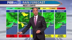
Houston weather: Warm Thursday with isolated afternoon storms
After days of heavy storms and severe weather, the next two days will be very warm and humid with only isolated rain. Heat index values could reach the low to mid 90s. Beginning this Mother's Day weekend and continuing through next week, we're back in a pattern with a daily round of scattered downpours and highs in the mid 80s.


Houston weather: Heavy rain showers decrease Wednesday evening
Flood Watch is ending tonight but the ground remains saturated and any additional rain could lead to a few more flooding problems. So still exercise caution as you travel around the area and avoid any flooded roads from recent heavy rainfall. Some parts of SE Texas picked up anywhere from 2-7" of rain over the last 24 hours! There will be a few showers and storms around, especially early tonight. But overall, coverage of rain tonight and the next few days will be much lower. Threat for excessive rain is decreasing and we should get more dry time for Thursday & Friday with only a 30% chance for showers and storms. Temperatures are heating up with plenty of humidity. Plan on warm and steamy weather for Mother's day weekend with spotty storms around, especially during the afternoon and evening. Unsettled pattern will keep going through the middle of next week. Download our FOX 26 Weather App for instant access to radar, alerts and other tools & info to help keep you safe during inclement weather.


Watch: Rare funnel cloud hovers over Montana mountains
The rare funnel was spotted near the town of St. Ignatius, about 300 miles northwest of Yellowstone.


Spain plans to ban outdoor work during extreme heat
Second Deputy Prime Minister Yolanda Díaz said that the government will modify occupational risk legislation to prohibit outdoor work when the weather agency issues red or orange alerts.


Houston weather: Flood watch in effect Wednesday afternoon, storms still possible
Coverage of storms for the rest of today will be much less widespread than this morning, but do still expect pulses of downpours through the afternoon and early evening. The end of the work week is trending drier which will be a nice break, but scattered showers and storms remain in the forecast through Mother's Day weekend and beyond so our soggy weather pattern continues for now.


Flood watch in effect through Wednesday evening, storms likely to continue through morning
Severe storms and very heavy rain will impact the Houston-Galveston area through mid-morning with some improvement expected after midday. Our weather is likely to get much warmer with only isolated storms Thursday with a slightly higher rain chance returning from Friday through the Mother's Day weekend.


Houston weather: Additional rain possible across the area on Wednesday
Models are showing another big round of heavy rain and storms possible Wednesday morning through early afternoon. We remain under a moderate risk for excessive rainfall that could lead to additional flooding through Wednesday evening. Always remember, turn around, don't drown. Unsettled pattern sticks around for the next week with chances for showers and storms daily. That means parts of Mother's Day on Sunday could be a little soggy. Make sure to download our FOX 26 weather app to keep track of any alerts and flood threat. You'll also find many other useful features. Stay safe and make sure to avoid any flooded areas!


Flood Watch: Emergency crews on stand-by as Houston braces for heavy rain
Harris County Pct 4 Constables say their emergency response crews and boats are on standby for the next several days.


Houston-weather: Unsettled rain pattern to continue for the next several days
Areal Flood Watch continues for most of SE Texas including the Houston area until 7 PM Wednesday. Some parts of Harris & Montgomery counties picked up around 2-5" of rain today from storms that produced torrential rainfall in a short period of time. Showers & storms should be less widespread this evening and tonight but flood threat will remain elevated. Look for patchy fog possible tonight with a few more showers and storms. Then models are showing another big round of heavy rain and storms possible Wednesday morning through early afternoon. We remain under a moderate risk for excessive rainfall that could lead to additional flooding through Wednesday evening. Always remember, turn around, don't drown. Unsettled pattern sticks around for the next week with chances for showers and storms daily. That means parts of Mother's Day on Sunday could be a little soggy. Make sure to download our FOX 26 weather app to keep track of any alerts and flood threat. You'll also find many other useful features. Stay safe and make sure to avoid any flooded areas!


Houston Weather: School districts canceling after-school activities
The Houston-area is under a flood advisory through Wednesday and as the heavy rain continues its downpour, some school districts are canceling extracurricular activities.

Houston weather: Flood watch in effect for Tuesday and Wednesday
A flood watch was issued for Houston for Tuesday and Wednesday.


Houston Weather: Flood watch through Wednesday, bringing heavy rain over weekend
A flood watch is in effect across our area today and tomorrow. Downpours produced up to 4" of rain in NW Harris Co. yesterday and there's a good chance for additional heavy rain through tomorrow and scattered storms daily through the weekend. Remember to never drive through high water because it's very dangerous and at the very least, it can total your car, so stay alert for weather warnings.


Houston weather: Flood advisory warning in effect through Tuesday, Wednesday
Your Gulf Coast Weather Authority brings team coverage as we track the severe weather and flood advisory across the Houston area.


Jeep trapped in Houston floodwaters during severe weather
During our FOX 26 live stream of severe weather coverage, our cameras caught a jeep that managed to get stuck in the heavy flood waters.


Houston resident seen walking in knee-high flood waters on northeast side
While FOX 26 was examining the flood waters in Houston, our cameras found a resident walking trudging through.


Tuesday morning weather forecast with Chief Meteorologist Mike Iscovitz
A flood watch is in effect across our area today and tomorrow. Downpours produced up to 4" of rain in NW Harris Co. yesterday and there's a good chance for additional heavy rain through tomorrow and scattered storms daily through the weekend. Remember to never drive through high water because it's very dangerous and at the very least, it can total your car, so stay alert for weather warnings.


Houston weather: Flooding possible across the area on Tuesday
Southeast Texas started the week with some storms and Tuesday will see even more heavy downpours. Rounds of rain will continue for the week and if some of them hit the same area repeated, Houston may see some flooding. The humid and warm weather continues into Mother's Day Weekend.


Monday evening weather forecast with Meteorologist John Dawson
Southeast Texas started the week with some storms and Tuesday will see even more heavy downpours. Rounds of rain will continue for the week and if some of them hit the same area repeated, Houston may see some flooding. The humid and warm weather continues into Mother's Day Weekend.


Monday afternoon weather forecast with Chief Meteorologist Mike Iscovitz
Our computer models are all over the place and that makes this a tough forecast, but with that said, it is likely that we'll be in for several round of rain over the next several days. The highest chance for heavy rain looks to be tomorrow and possibly Wednesday. Temps will remain very warm with very high humidity.


Mondays with Mike: Extreme's new song, flooding concerns as heavy storms enter forecast
It's that time of the day when FOX 26 Chief Meteorologist Mike Iscovitz shares his thoughts in our ongoing digital series.