

Saturday evening weather forecast with Meteorologist John Dawson
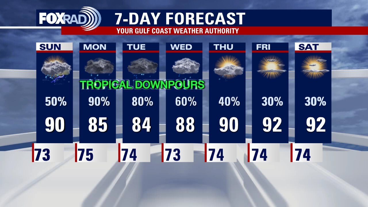
The tropical disturbance in the Gulf is slowly organizing and heading towards Southeast Texas. Current models has whatever forms heading east of Houston bringing stronger impacts into Louisiana. Rounds of heavy rain are expected to soak parts of Houston on Monday and Tuesday.
The tropical disturbance in the Gulf is slowly organizing and heading towards Southeast Texas. Current models has whatever forms heading east of Houston bringing stronger impacts into Louisiana. Rounds of heavy rain are expected to soak parts of Houston on Monday and Tuesday.
Saturday Morning Weather
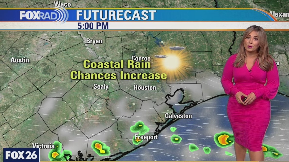
Fox 26 Meteorologist Lena Maria Arango takes a look at today's forecast, the tropical forecast and the week ahead.
Fox 26 Meteorologist Lena Maria Arango takes a look at today's forecast, the tropical forecast and the week ahead.
Saturday morning weather forecast
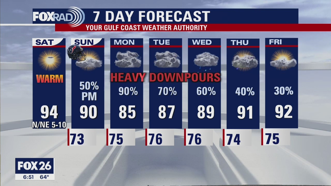
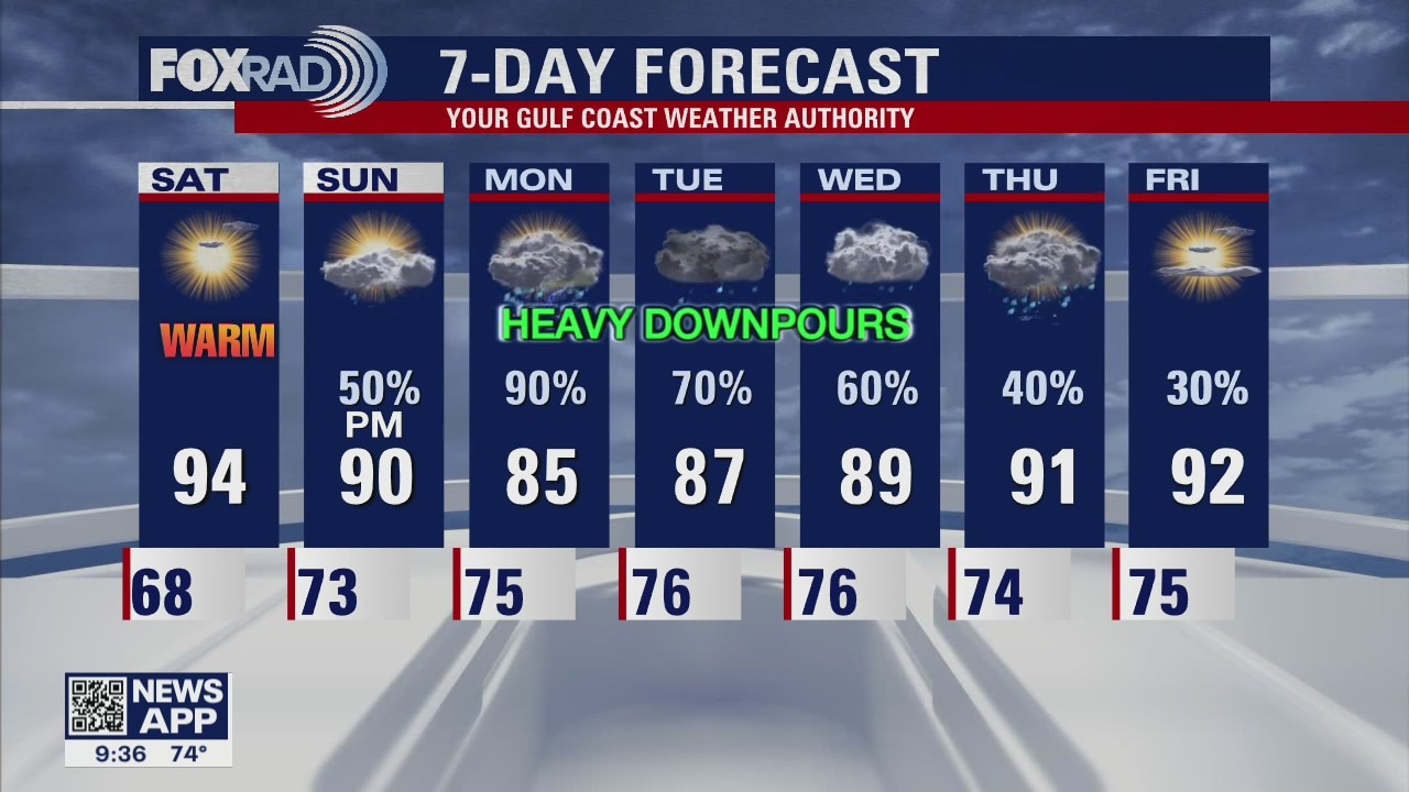
Confidence continues to increase for heavy rain around the Houston area on Monday and Tuesday. Exact location is not known but we also think the downpours could carry over into Wednesday as well. But look for a fantastic start to the weekend with mostly sunny skies and warm afternoon temperatures on Saturday. We will watch the Gulf on Sunday for more development as we prepare for rain that evening.
Confidence continues to increase for heavy rain around the Houston area on Monday and Tuesday. Exact location is not known but we also think the downpours could carry over into Wednesday as well. But look for a fantastic start to the weekend with mostly sunny skies and warm afternoon temperatures on Saturday. We will watch the Gulf on Sunday for more development as we prepare for rain that evening.

Friday evening weather forecast with FOX 26 Meteorologist John Dawson
Confidence continues to increase for heavy rain around the Houston area on Monday and Tuesday. The exact location is not known but we also think the downpours could carry over into Wednesday as well. But look for a fantastic start to the weekend with mostly sunny skies and warm afternoon temperatures on Saturday. We will watch the Gulf on Sunday for more development as we prepare for rain that evening.
Confidence continues to increase for heavy rain around the Houston area on Monday and Tuesday. The exact location is not known but we also think the downpours could carry over into Wednesday as well. But look for a fantastic start to the weekend with mostly sunny skies and warm afternoon temperatures on Saturday. We will watch the Gulf on Sunday for more development as we prepare for rain that evening.
Hot, dry Friday
Another hot, dry day on the way with highs in the middle 90s. Tomorrow morning will be our last cool start before a pattern shift starts to take place. Humidity increases Saturday, but most remain dry especially inland. Watch out for scattered showers and storms Sunday. We are closely monitoring a disturbance that looks to bring us a good dose of tropical moisture Monday through the middle of the week.
Another hot, dry day on the way with highs in the middle 90s. Tomorrow morning will be our last cool start before a pattern shift starts to take place. Humidity increases Saturday, but most remain dry especially inland. Watch out for scattered showers and storms Sunday. We are closely monitoring a disturbance that looks to bring us a good dose of tropical moisture Monday through the middle of the week.
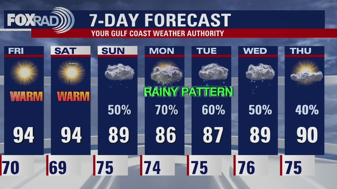
Friday morning weather forecast
The dry weather continues for now across Southeast Texas but changes are coming at the end of the weekend. Showers are likely starting Sunday and a tropical wave should arrive Monday bringing several rounds of rain. Enjoy the outdoors now because next week will see a lot more rain around the Houston area.
The dry weather continues for now across Southeast Texas but changes are coming at the end of the weekend. Showers are likely starting Sunday and a tropical wave should arrive Monday bringing several rounds of rain. Enjoy the outdoors now because next week will see a lot more rain around the Houston area.
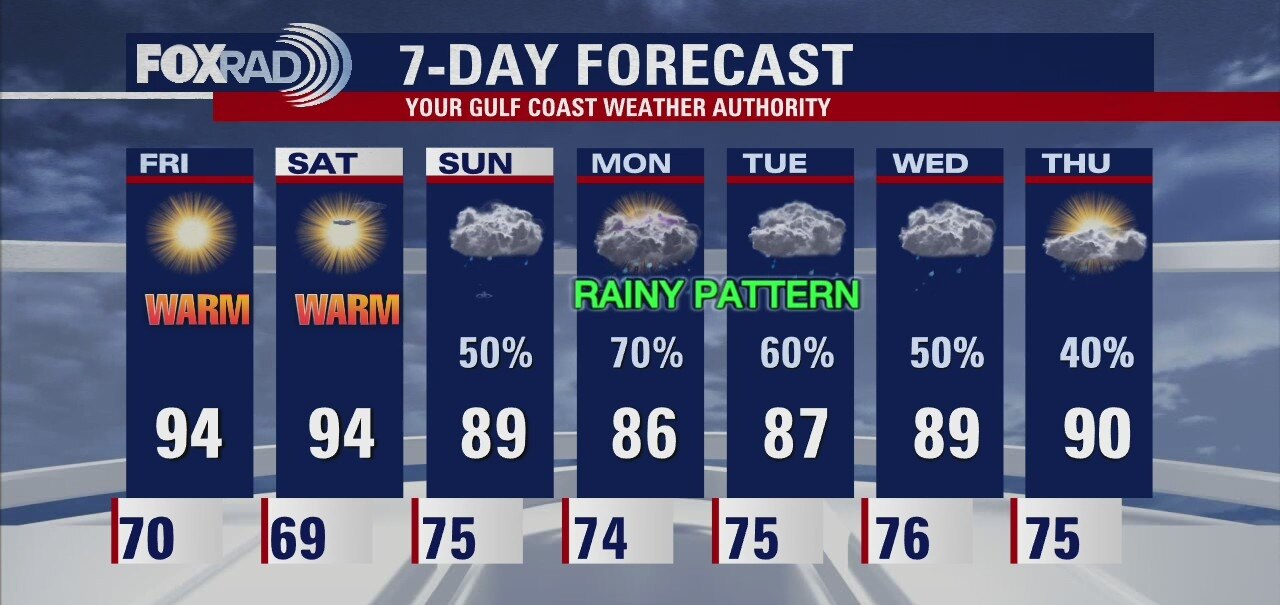
Thursday evening weather forecast with Meteorologist John Dawson
The dry weather continues for now across Southeast Texas but changes are coming at the end of the weekend. Showers are likely starting Sunday and a tropical wave should arrive Monday bringing several rounds of rain. Enjoy the outdoors now because next week will see a lot more rain around the Houston area.
The dry weather continues for now across Southeast Texas but changes are coming at the end of the weekend. Showers are likely starting Sunday and a tropical wave should arrive Monday bringing several rounds of rain. Enjoy the outdoors now because next week will see a lot more rain around the Houston area.
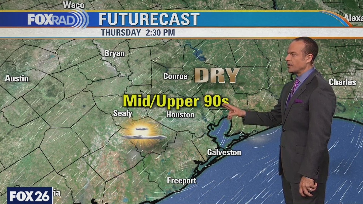
Sunny, warm and dry day
After another mild morning, expect more hot sunshine today. Friday looks similar, but changes begin this weekend with humidity returning on Saturday. By Sunday, showers are likely and a tropical wave slated to arrive on Monday could bring a round of heavy rain.
After another mild morning, expect more hot sunshine today. Friday looks similar, but changes begin this weekend with humidity returning on Saturday. By Sunday, showers are likely and a tropical wave slated to arrive on Monday could bring a round of heavy rain.
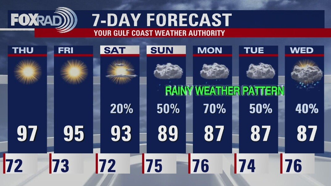
Thursday morning weather forecast
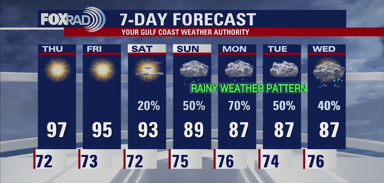
Slightly drier air will move into SE Texas over the next few days and that will help the afternoon highs to be hot for September. Rain will come back into the forecast by the beginning of next week and temps will drop back down into the 80s.
Slightly drier air will move into SE Texas over the next few days and that will help the afternoon highs to be hot for September. Rain will come back into the forecast by the beginning of next week and temps will drop back down into the 80s.
Wednesday evening weather forecast with Chief Meteorologist Dr. Jim Siebert
Tropical Storm Mindy formed quickly and will sweep across Florida and Georgia. The storm will have no impact on SE Texas. We can look for some extra moisture and rain by early next week.
Tropical Storm Mindy formed quickly and will sweep across Florida and Georgia. The storm will have no impact on SE Texas. We can look for some extra moisture and rain by early next week.
Sunny & hot day ahead
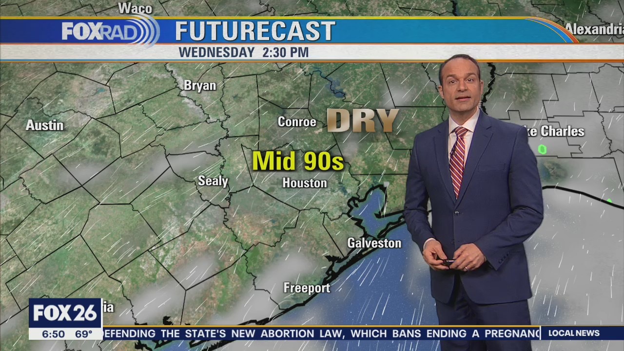
Following the coolest morning in nearly four months, today will be sunny and very warm, but with low humidity. This pattern will continue through Friday with a slight increase in humidity on Saturday. Watch for showers for Sunday and then a chance for heavy rain on Monday
Following the coolest morning in nearly four months, today will be sunny and very warm, but with low humidity. This pattern will continue through Friday with a slight increase in humidity on Saturday. Watch for showers for Sunday and then a chance for heavy rain on Monday
Wednesday morning weather forecast
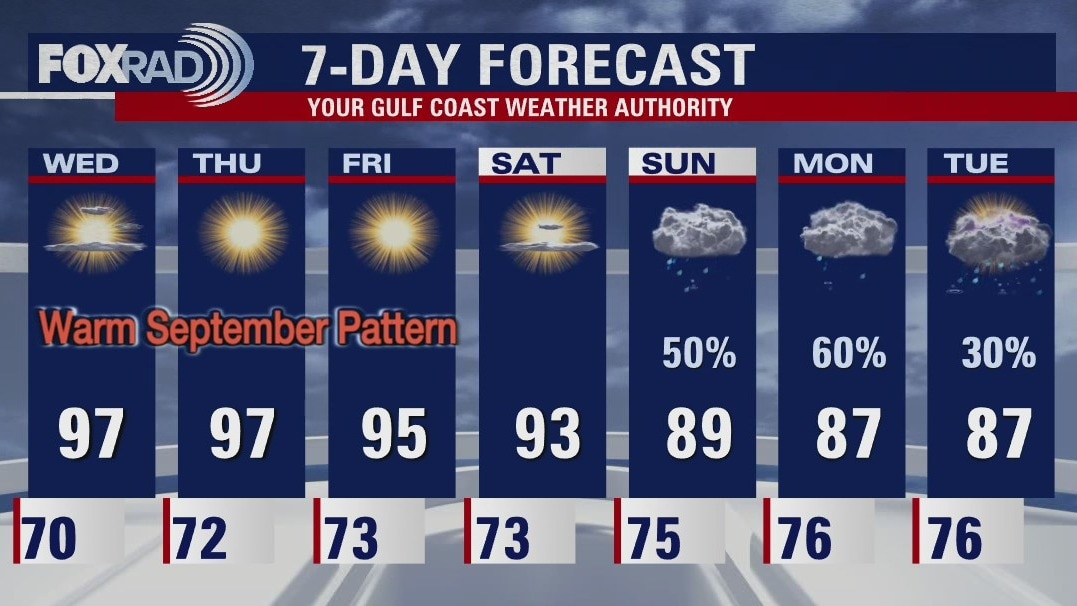
Slightly drier air will move into SE Texas over the next few days and that will help the afternoon highs to be hot for September. Rain will come back into the forecast by the beginning of next week and temps will drop back down into the 80s.
Slightly drier air will move into SE Texas over the next few days and that will help the afternoon highs to be hot for September. Rain will come back into the forecast by the beginning of next week and temps will drop back down into the 80s.
Tuesday evening weather forecast
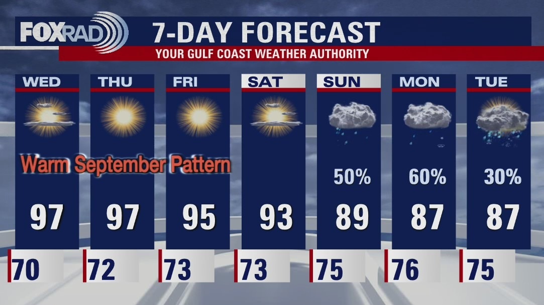
Slightly drier air will move into SE Texas over the next few days and that will help the afternoon highs to be hot for September. Rain will come back into the forecast by the beginning of next week and temps will drop back down into the 80s.
Slightly drier air will move into SE Texas over the next few days and that will help the afternoon highs to be hot for September. Rain will come back into the forecast by the beginning of next week and temps will drop back down into the 80s.
Tropical Weather Forecast - Sept. 7, 2021
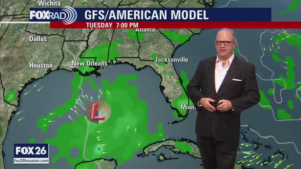
The area of low pressure in the southern Gulf of Mexico looks to have a difficult time organizing, and whatever forms will head towards Florida. We are also tracking Larry out in the Atlantic.
The area of low pressure in the southern Gulf of Mexico looks to have a difficult time organizing, and whatever forms will head towards Florida. We are also tracking Larry out in the Atlantic.
Tuesday weather forecast
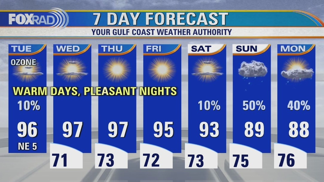
Mostly sunny and hot with less humidity. Highs in the mid 90s.
Mostly sunny and hot with less humidity. Highs in the mid 90s.
Tuesday morning weather forecast
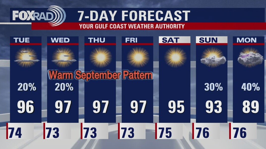
A weak front will help drop the humidity a little and there will be less rain in the forecast for most of the week. Highs will be close to 97, which is a bit warm for Sept. The low that may form in the southern Gulf will head towards Florida.
A weak front will help drop the humidity a little and there will be less rain in the forecast for most of the week. Highs will be close to 97, which is a bit warm for Sept. The low that may form in the southern Gulf will head towards Florida.
Monday evening weather forecast
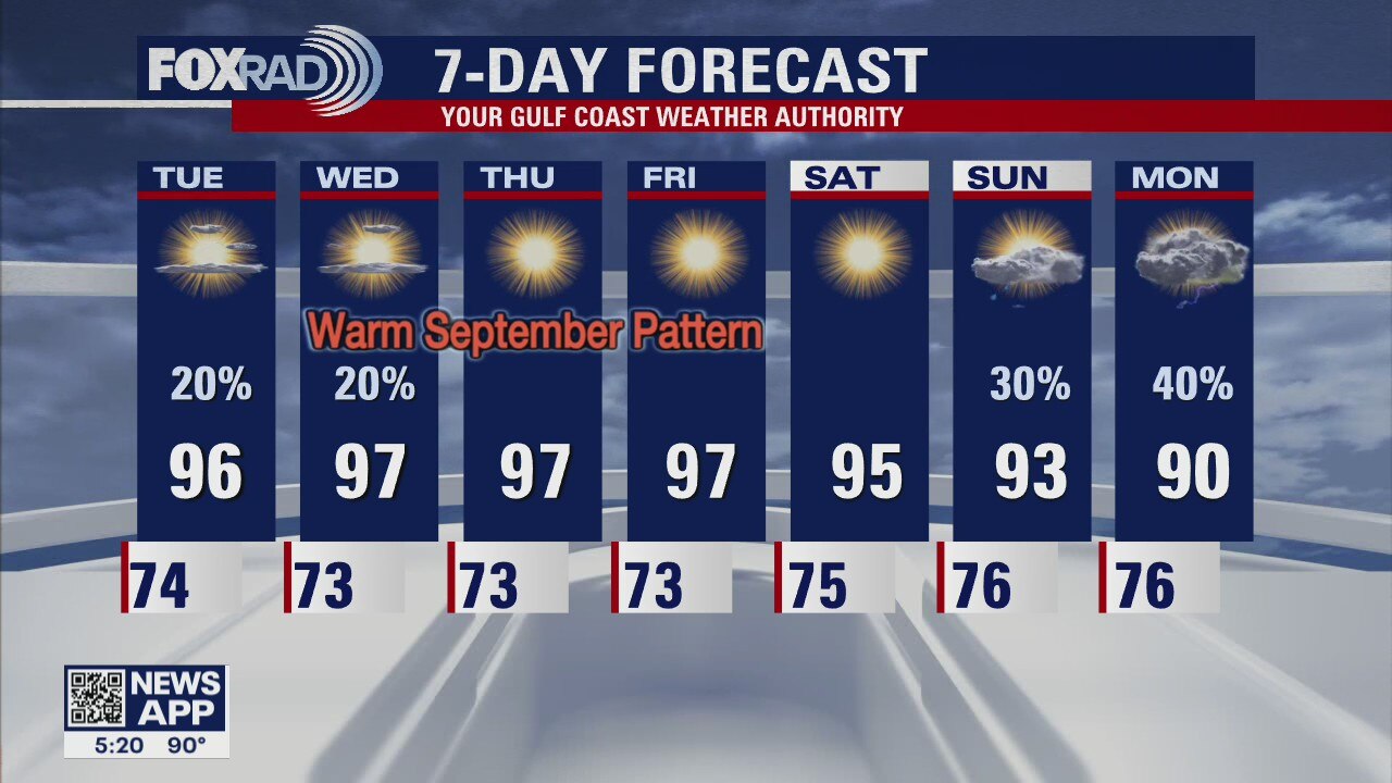
A weak front will help drop the humidity a little and there will be less rain in the forecast for most of the week. Highs will be close to 97, which is a bit warm for Sept. The low that may form in the southern Gulf will head towards Florida.
A weak front will help drop the humidity a little and there will be less rain in the forecast for most of the week. Highs will be close to 97, which is a bit warm for Sept. The low that may form in the southern Gulf will head towards Florida.
Monday weather forecast
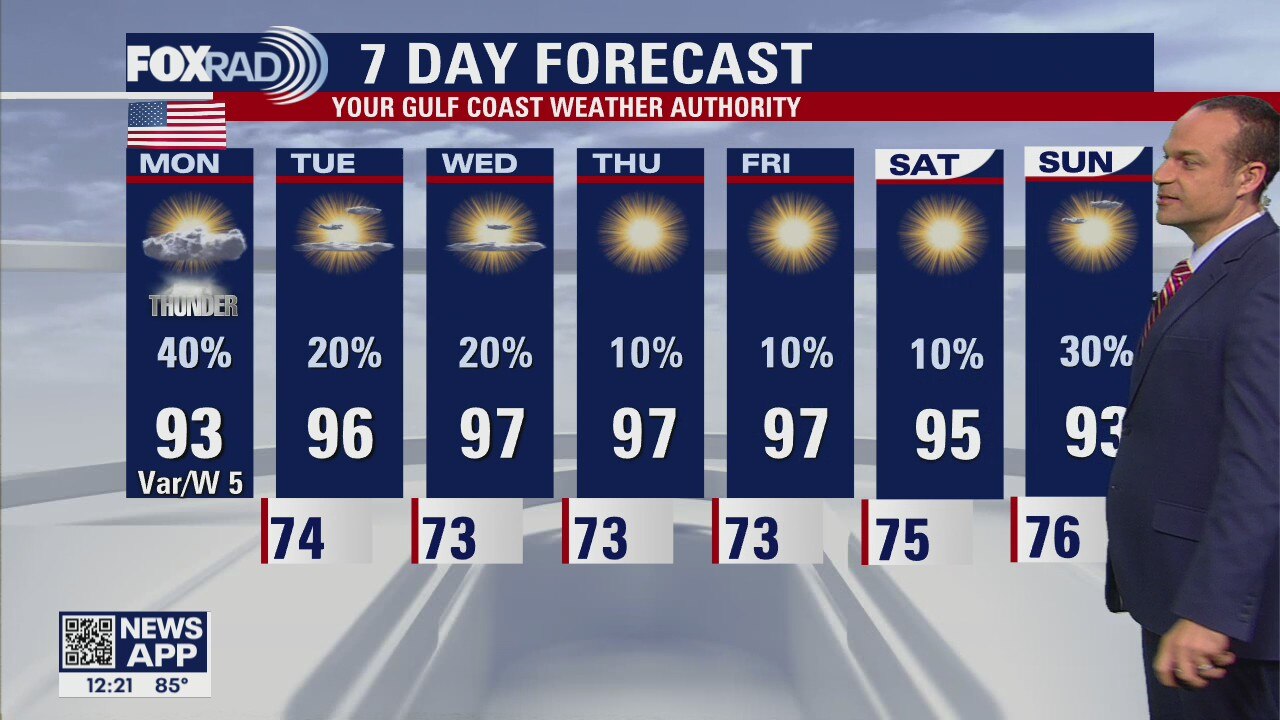
Happy Labor Day, everyone. If you have outdoor plans today, you will have some chances. Following early morning rain, look for a lull, then likely scattered late afternoon storms. After today, we will begin a transition to slightly drier air (especially north) which means more comfortable mornings and hot afternoons with somewhat less humidity.
Happy Labor Day, everyone. If you have outdoor plans today, you will have some chances. Following early morning rain, look for a lull, then likely scattered late afternoon storms. After today, we will begin a transition to slightly drier air (especially north) which means more comfortable mornings and hot afternoons with somewhat less humidity.
Monday weather forecast
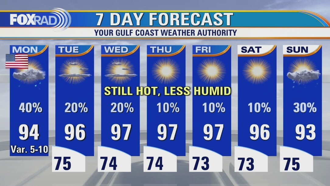
Happy Labor Day, everyone. If you have outdoor plans today, you will have some chances. Following early morning rain, look for a lull, then likely scattered late afternoon storms. After today, we will begin a transition to slightly drier air (especially north) which means more comfortable mornings and hot afternoons with somewhat less humidity.
Happy Labor Day, everyone. If you have outdoor plans today, you will have some chances. Following early morning rain, look for a lull, then likely scattered late afternoon storms. After today, we will begin a transition to slightly drier air (especially north) which means more comfortable mornings and hot afternoons with somewhat less humidity.
Sunday evening weather with Meteorologist John Dawson
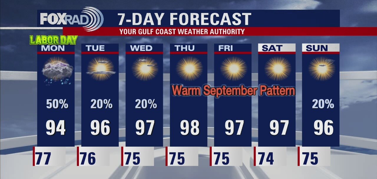
Scattered storms could find their way into your outdoor Labor Day plans. Don't cancel anything, but some of us will see a few storms on Monday. Houston can expect things to become slightly drier and stay warm as we move through the week.
Scattered storms could find their way into your outdoor Labor Day plans. Don't cancel anything, but some of us will see a few storms on Monday. Houston can expect things to become slightly drier and stay warm as we move through the week.