

Saturday Morning Forecast with Meteorologist Lena Maria
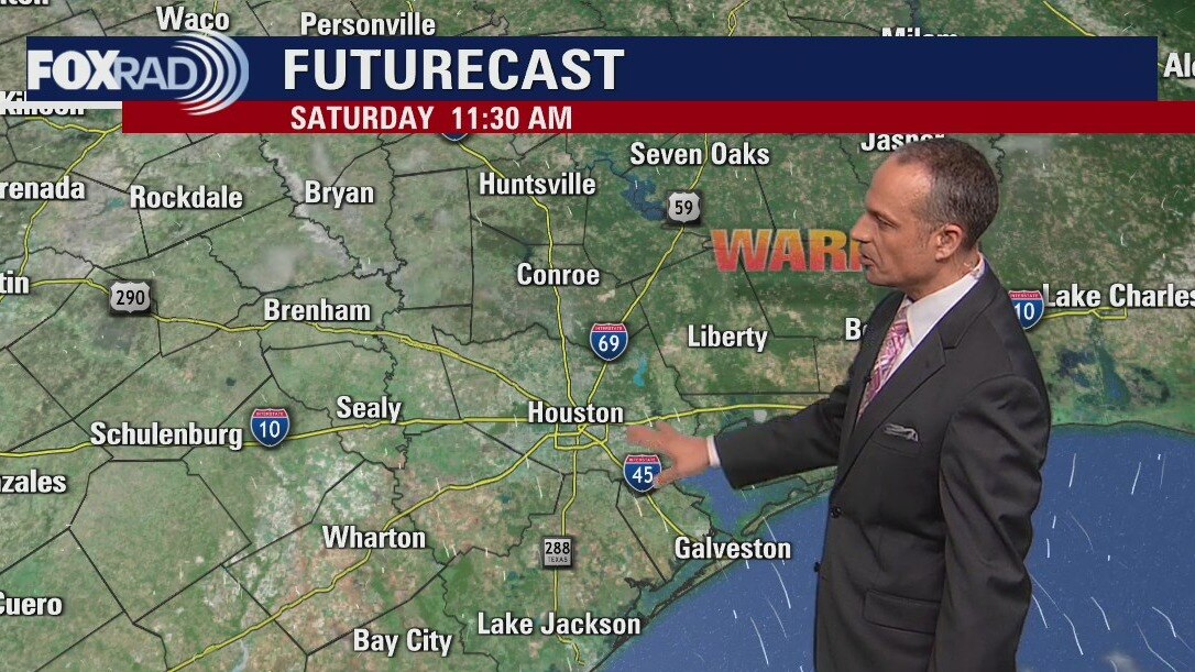
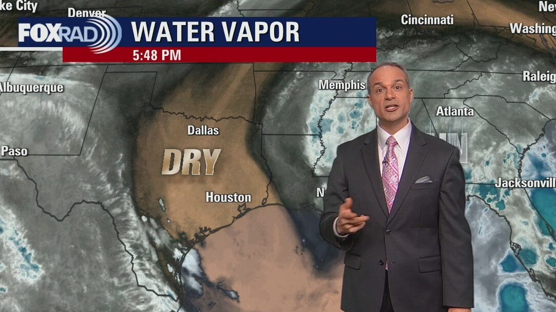
A mostly sunny and dry weekend awaits us, with gradually warming temperatures. Next week? More of the same. A dry front will usher in slightly lower humidity, with pleasant weather persisting though rain chances may increase some toward the tail end of the week. The Atlantic looks more like the beginning of Hurricane Season than the peak, but... we'll take it. Only one named storm churning, no where near land and Hurricane Earl will begin to dissipate over the course of the weekend.
A mostly sunny and dry weekend awaits us, with gradually warming temperatures. Next week? More of the same. A dry front will usher in slightly lower humidity, with pleasant weather persisting though rain chances may increase some toward the tail end of the week. The Atlantic looks more like the beginning of Hurricane Season than the peak, but... we'll take it. Only one named storm churning, no where near land and Hurricane Earl will begin to dissipate over the course of the weekend.
Saturday morning weather forecast
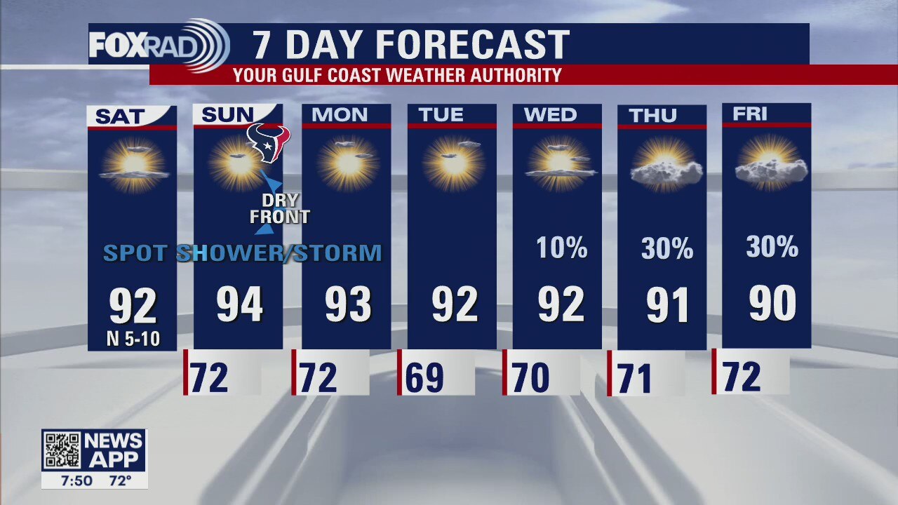
Our weather is shaping up nicely for this weekend with plenty of sunshine and slightly less humidity. For the Texans opener at NRG stadium on Sunday, expect very warm conditions with highs in the mid 90s, although there is a chance for storms that day, it looks like most of them will be south of Houston. Beyond that next week is shaping up very nicely with slightly more pleasant low temperatures in the upper 60s and low 70s.
Our weather is shaping up nicely for this weekend with plenty of sunshine and slightly less humidity. For the Texans opener at NRG stadium on Sunday, expect very warm conditions with highs in the mid 90s, although there is a chance for storms that day, it looks like most of them will be south of Houston. Beyond that next week is shaping up very nicely with slightly more pleasant low temperatures in the upper 60s and low 70s.
Friday evening weather forecast
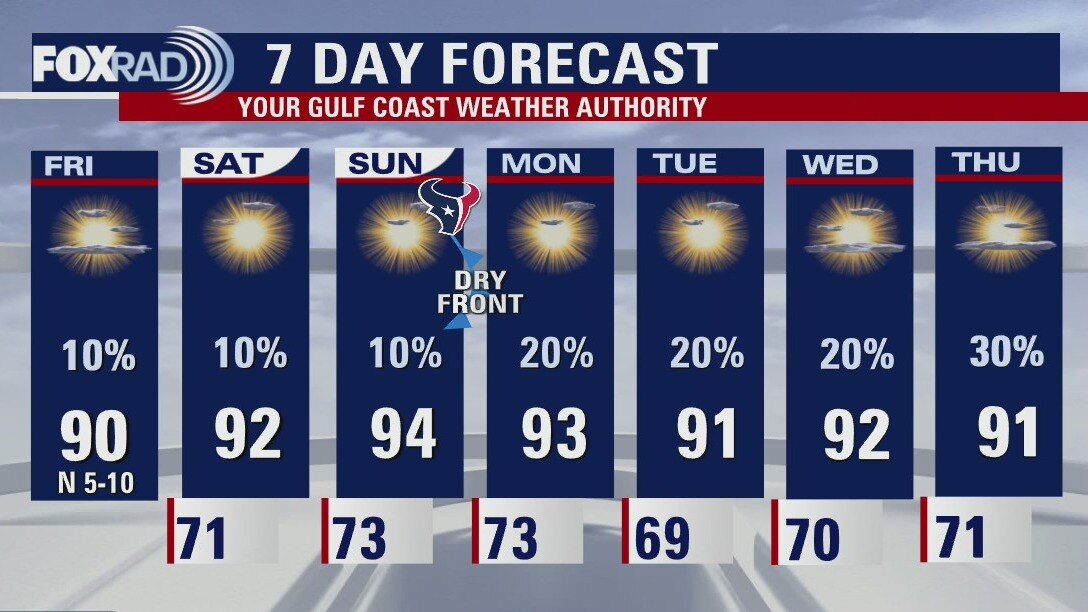
Our weather is shaping up nicely for this weekend with plenty of sunshine and slightly less humidity. For the Texans opener at NRG stadium on Sunday, expect very warm conditions with highs in the mid 90s, although there is a chance for storms that day, it looks like most of them will be south of Houston. Beyond that next week is shaping up very nicely with slightly more pleasant low temperatures in the upper 60s and low 70s.
Our weather is shaping up nicely for this weekend with plenty of sunshine and slightly less humidity. For the Texans opener at NRG stadium on Sunday, expect very warm conditions with highs in the mid 90s, although there is a chance for storms that day, it looks like most of them will be south of Houston. Beyond that next week is shaping up very nicely with slightly more pleasant low temperatures in the upper 60s and low 70s.
Mostly sunny, dry day; spot shower/storm possible this afternoon
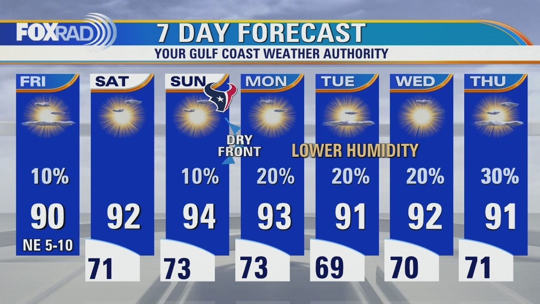
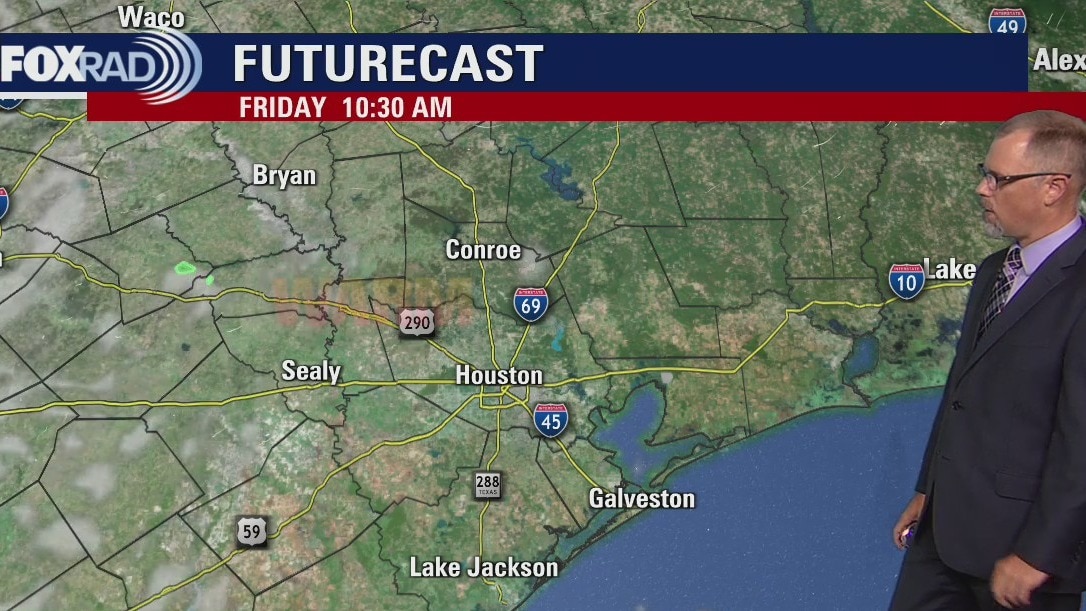
A pretty blissful weather pattern awaits us over the next 7 days. While most days we can't rule out a stray shower or storm, conditions are trending much drier. Things are looking fantastic for the weekend and for the Texans home opener tailgate! A weak front will arrive toward the end of the weekend, and though it won't do much to our temperatures or drive up rain chances it will bring in some lower humidity. We continue to have no tropical concerns locally at the moment, and lets hope that it stays that way!
A pretty blissful weather pattern awaits us over the next 7 days. While most days we can't rule out a stray shower or storm, conditions are trending much drier. Things are looking fantastic for the weekend and for the Texans home opener tailgate! A weak front will arrive toward the end of the weekend, and though it won't do much to our temperatures or drive up rain chances it will bring in some lower humidity. We continue to have no tropical concerns locally at the moment, and lets hope that it stays that way!
Mostly sunny, dry day; spot shower/storm possible this afternoon
A pretty blissful weather pattern awaits us over the next seven days. While most days we can't rule out a stray shower or storm, conditions are trending much drier. Things are looking fantastic for the weekend and for the Texans home opener tailgate! A weak front will arrive toward the end of the weekend, and though it won't do much to our temperatures or drive up rain chances it will bring in some lower humidity. We continue to have no tropical concerns locally at the moment, and lets hope that it stays that way!
A pretty blissful weather pattern awaits us over the next seven days. While most days we can't rule out a stray shower or storm, conditions are trending much drier. Things are looking fantastic for the weekend and for the Texans home opener tailgate! A weak front will arrive toward the end of the weekend, and though it won't do much to our temperatures or drive up rain chances it will bring in some lower humidity. We continue to have no tropical concerns locally at the moment, and lets hope that it stays that way!
Friday morning weather forecast
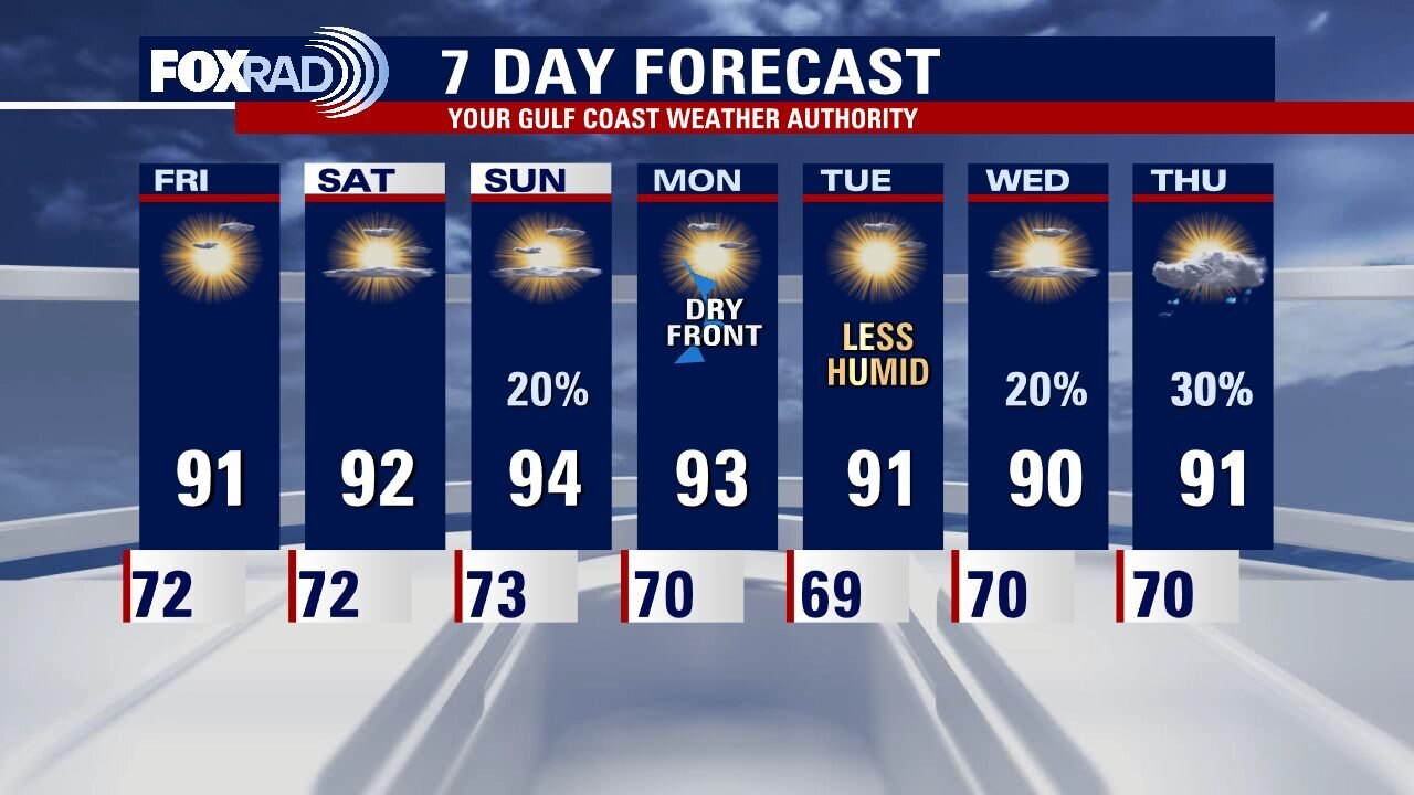
Houston will see a normal September pattern rolling into the weekend. Look for mild mornings and afternoons in the mid to lower 90s. A weak cold front arrives in Southeast Texas early on Monday and should lead to an even drier morning on Tuesday. Look for some isolated showers to return to the forecast mid-week.
Houston will see a normal September pattern rolling into the weekend. Look for mild mornings and afternoons in the mid to lower 90s. A weak cold front arrives in Southeast Texas early on Monday and should lead to an even drier morning on Tuesday. Look for some isolated showers to return to the forecast mid-week.
Thursday evening weather forecast with Meteorologist John Dawson
Houston will see a normal September pattern rolling into the weekend. Look for mild mornings and afternoons in the mid to lower the 90s. A weak cold front arrives to Southeast Texas early on Monday and should lead to an even drier morning on Tuesday. Look for some isolated showers to return to the forecast mid-week.
Houston will see a normal September pattern rolling into the weekend. Look for mild mornings and afternoons in the mid to lower the 90s. A weak cold front arrives to Southeast Texas early on Monday and should lead to an even drier morning on Tuesday. Look for some isolated showers to return to the forecast mid-week.
Mostly sunny and warm Thursday with only isolated showers expected
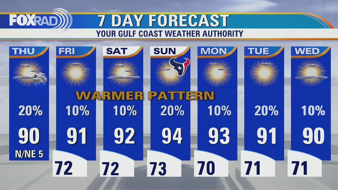
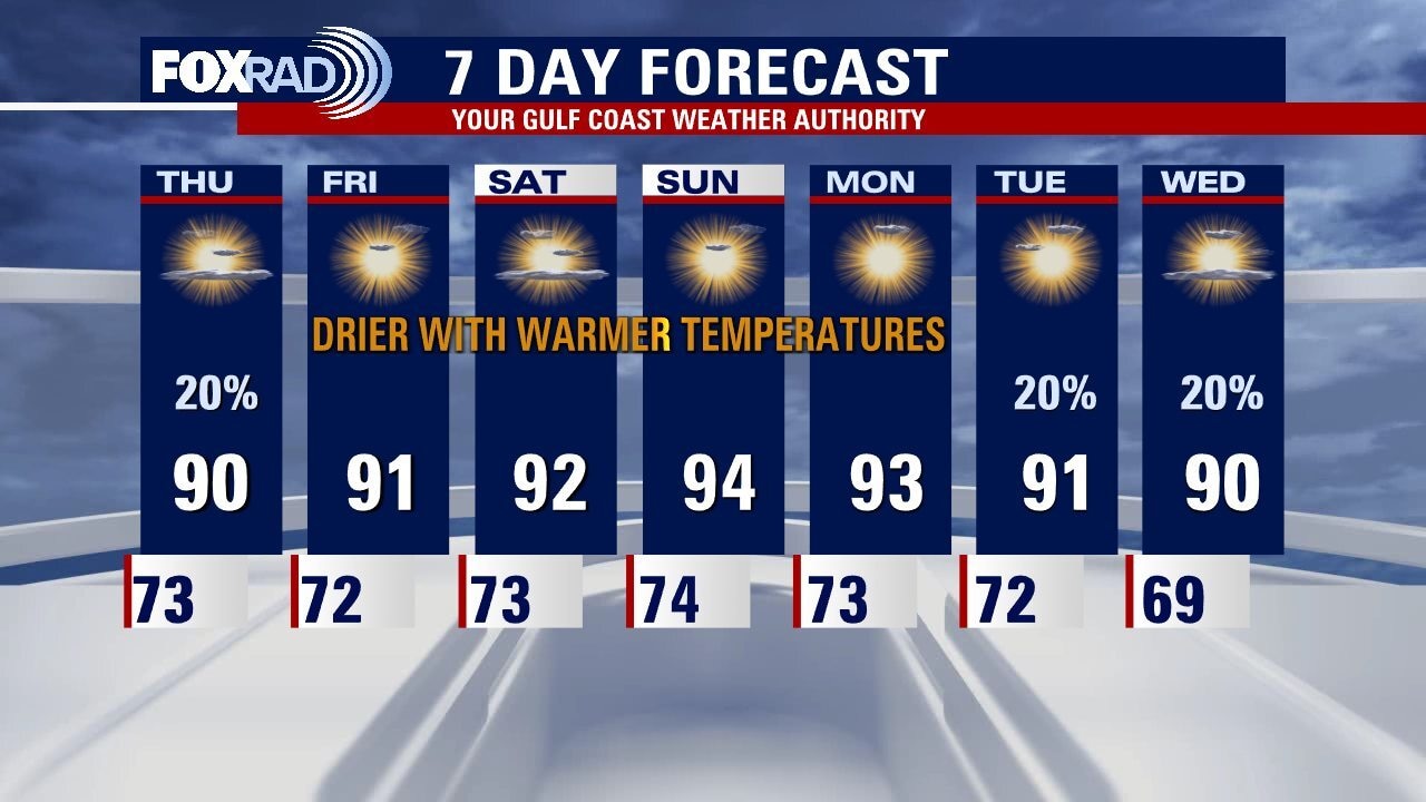
Other than a few isolated showers and storms, our overall pattern is looking warmer and sunnier with afternoon highs back into the low 90s. Some spots could hit the mid 90s this weekend. Daily rain chances are around 10-20% through early next week. Hurricane Earl and Tropical Storm Danielle are in the Atlantic and are not threats to the United States. The next tropical system is gaining strength in the eastern Atlantic and could become Fiona soon, but will also not be a threat to the US or Texas.
Other than a few isolated showers and storms, our overall pattern is looking warmer and sunnier with afternoon highs back into the low 90s. Some spots could hit the mid 90s this weekend. Daily rain chances are around 10-20% through early next week. Hurricane Earl and Tropical Storm Danielle are in the Atlantic and are not threats to the United States. The next tropical system is gaining strength in the eastern Atlantic and could become Fiona soon, but will also not be a threat to the US or Texas.
Wednesday night leading into Thursday morning weather forecast
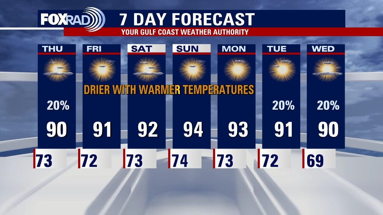
Overall a pleasant early September forecast for Houston. We are leaving the rainy pattern that has hung around Southeast Texas over the last several weeks. Isolated showers are possible on Thursday. Expect the weekend to be slightly warmer with a bit less humidity around as well. Check out the FOX26 YouTube Channel for the latest on the active tropics.
Overall a pleasant early September forecast for Houston. We are leaving the rainy pattern that has hung around Southeast Texas over the last several weeks. Isolated showers are possible on Thursday. Expect the weekend to be slightly warmer with a bit less humidity around as well. Check out the FOX26 YouTube Channel for the latest on the active tropics.
Wednesday evening weather forecast with Meteorologist John Dawson
Overall a pleasant early September forecast for Houston. We are leaving the rainy pattern that has hung around Southeast Texas over the last several weeks. Isolated showers are possible on Thursday. Expect the weekend to be slightly warmer with a bit less humidity around as well. Check out the FOX26 YouTube Channel for the latest on the active tropics.
Overall a pleasant early September forecast for Houston. We are leaving the rainy pattern that has hung around Southeast Texas over the last several weeks. Isolated showers are possible on Thursday. Expect the weekend to be slightly warmer with a bit less humidity around as well. Check out the FOX26 YouTube Channel for the latest on the active tropics.
Wednesday afternoon weather forecast with Meteorologist Lena Maria
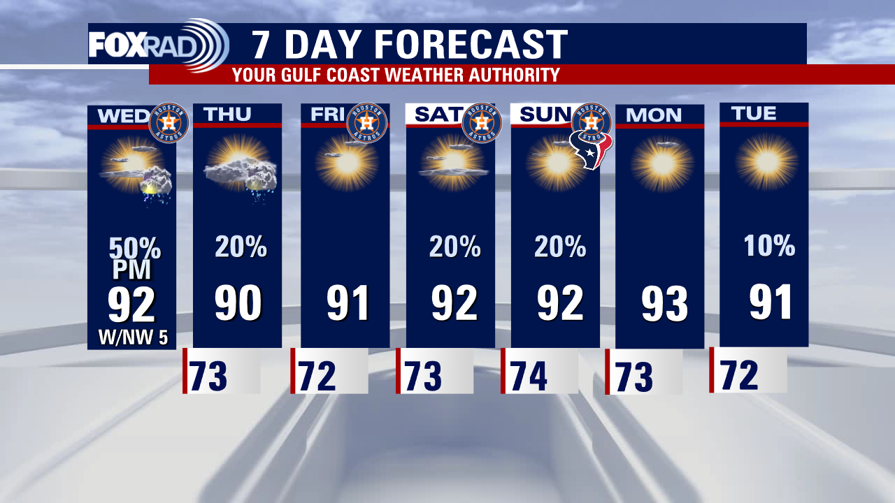
A broken line of storms will approach from the north this afternoon/evening. While many of us will stay sunny & dry, with only dark clouds passing by off in the distance a few stronger storms cannot be ruled out. Impacts look to be limited to brief downpours & gusty winds. Timing-wise, storms may begin firing up to the north as early as 1 or 2 p.m. Stay weather aware for the bus stop hour/after-school activities, through the PM commute/sunset!
A broken line of storms will approach from the north this afternoon/evening. While many of us will stay sunny & dry, with only dark clouds passing by off in the distance a few stronger storms cannot be ruled out. Impacts look to be limited to brief downpours & gusty winds. Timing-wise, storms may begin firing up to the north as early as 1 or 2 p.m. Stay weather aware for the bus stop hour/after-school activities, through the PM commute/sunset!
Mostly sunny & pleasant start Wednesday, with a few PM storms
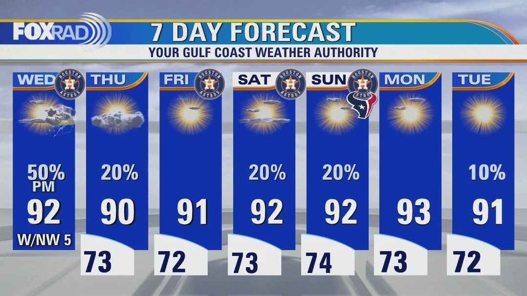
A weak front will bring a broken line of scattered storms through this afternoon and evening, and a couple may be accompanied by brief downpours and gusty winds. Some precip may linger into tomorrow, but for the most part high pressure will take over bringing in more sunshine and only isolated rain chances. Temperatures look to hover right around average for this time of year, with a touch lower humidity. Overall a very pleasant week awaits!
A weak front will bring a broken line of scattered storms through this afternoon and evening, and a couple may be accompanied by brief downpours and gusty winds. Some precip may linger into tomorrow, but for the most part high pressure will take over bringing in more sunshine and only isolated rain chances. Temperatures look to hover right around average for this time of year, with a touch lower humidity. Overall a very pleasant week awaits!
Wednesday morning weather forecast
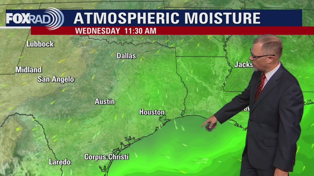
Wednesday brings the highest rain chances for the week with scattered storms late in the day across Southeast Texas. The pattern starts to trend toward more sunshine and only isolated rain chances for the end of the week. Expect a few showers around for the weekend with more dry conditions returning for the start of next week.
Wednesday brings the highest rain chances for the week with scattered storms late in the day across Southeast Texas. The pattern starts to trend toward more sunshine and only isolated rain chances for the end of the week. Expect a few showers around for the weekend with more dry conditions returning for the start of next week.
Tuesday evening weather forecast
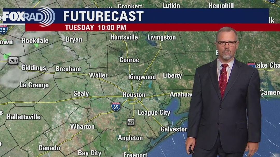
Wednesday brings the highest rain chances for the week with scattered storms late in the day across Southeast Texas. The pattern starts to trend toward more sunshine and only isolated rain chances for the end of the week. Expect a few showers around for the weekend with more dry conditions returning for the start of next week.
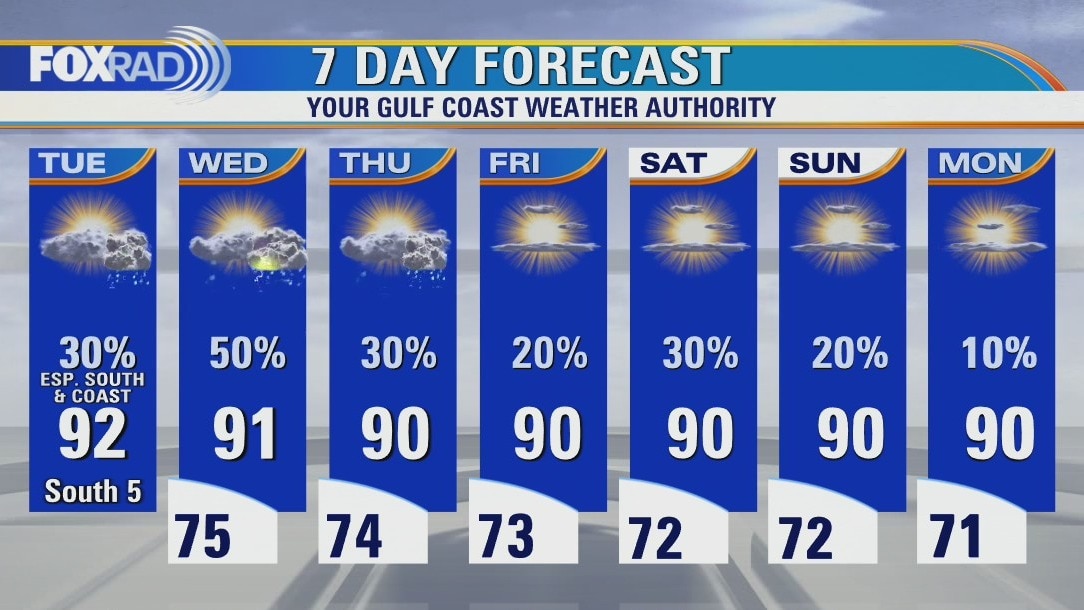
Wednesday brings the highest rain chances for the week with scattered storms late in the day across Southeast Texas. The pattern starts to trend toward more sunshine and only isolated rain chances for the end of the week. Expect a few showers around for the weekend with more dry conditions returning for the start of next week.
Partly cloudy and warm with scattered late afternoon storms possible
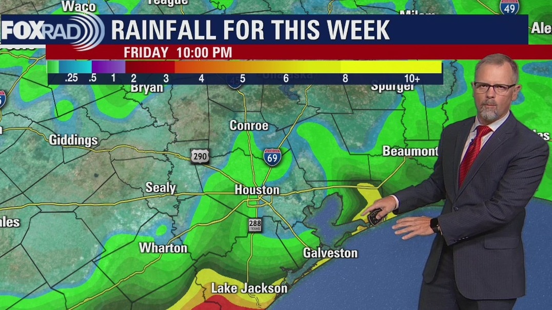
As everyone returns to work and school today, our weather begins with very quiet conditions. Coastal showers may begin by midday and there could be a few scattered storms from Houston southward this afternoon. Wednesday brings the highest rain chances for the week with scattered late day storms likely. Beyond that system, our pattern should trend toward more sunshine and only isolated showers. So far, there aren't any tropical threats on the horizon for Texas.
As everyone returns to work and school today, our weather begins with very quiet conditions. Coastal showers may begin by midday and there could be a few scattered storms from Houston southward this afternoon. Wednesday brings the highest rain chances for the week with scattered late day storms likely. Beyond that system, our pattern should trend toward more sunshine and only isolated showers. So far, there aren't any tropical threats on the horizon for Texas.
Tuesday morning weather forecast
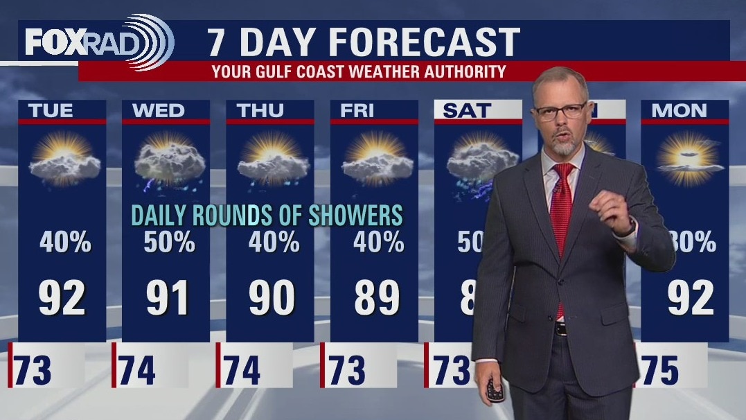
Showers on Tuesday should be mostly along the coast, but Southeast Texas keeps daily rain chances around for all week. Another stalling front will keep the forecast unsettled for Houston towards the end of the week. Expect afternoon high temperatures to remain at seasonal or just below seasonal averages with the extra cloud cover in the skies.
Showers on Tuesday should be mostly along the coast, but Southeast Texas keeps daily rain chances around for all week. Another stalling front will keep the forecast unsettled for Houston towards the end of the week. Expect afternoon high temperatures to remain at seasonal or just below seasonal averages with the extra cloud cover in the skies.
Monday evening weather forecast
Showers on Tuesday should be mostly along the coast, but Southeast Texas keeps daily rain chances around for all week. Another stalling front will keep the forecast unsettled for Houston towards the end of the week. Expect afternoon high temperatures to remain at seasonal or just below seasonal averages with the extra cloud cover in the skies.
Showers on Tuesday should be mostly along the coast, but Southeast Texas keeps daily rain chances around for all week. Another stalling front will keep the forecast unsettled for Houston towards the end of the week. Expect afternoon high temperatures to remain at seasonal or just below seasonal averages with the extra cloud cover in the skies.
Mostly cloudy, warm and humid with showers likely near the coast
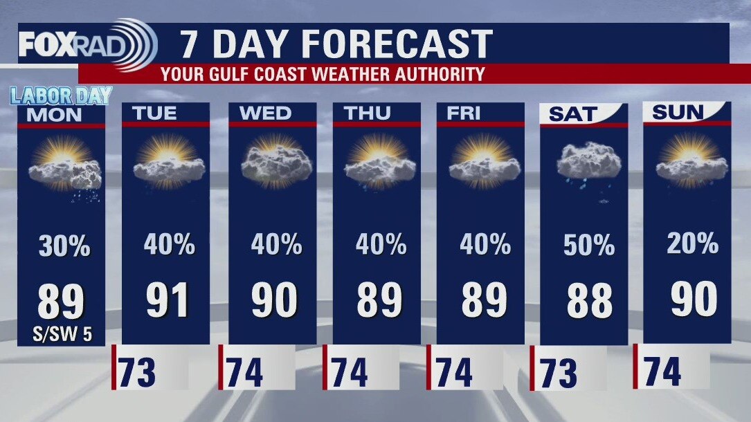
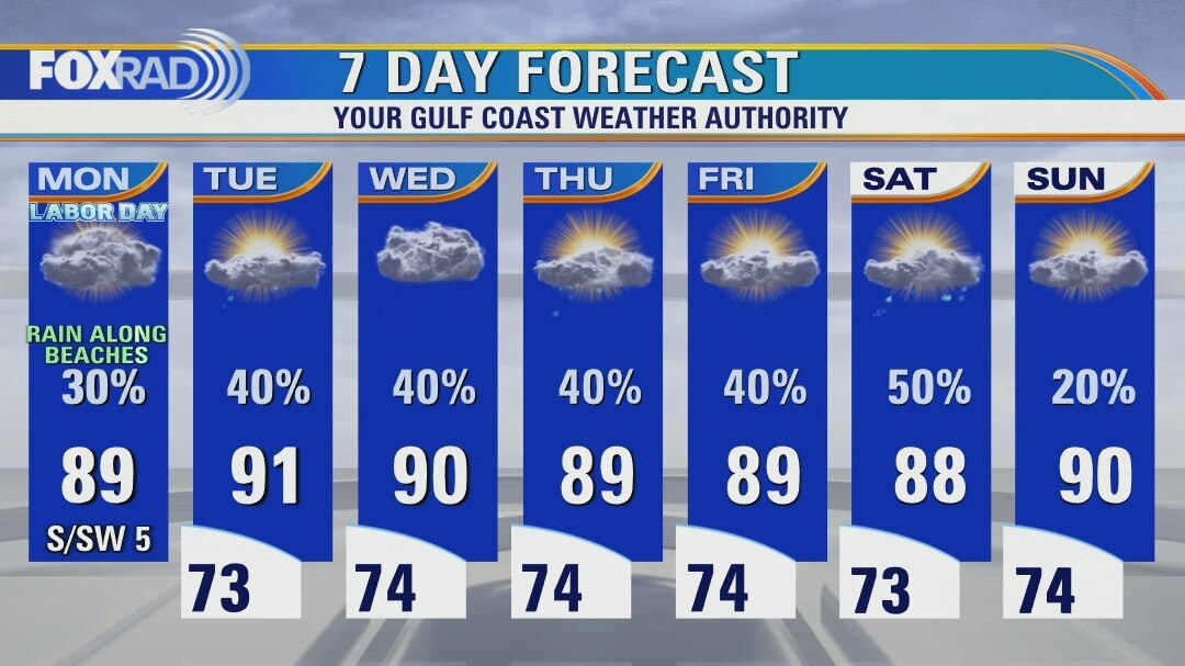
Labor Day looks mainly cloudy and warm, but with off and on showers near the beaches through the day. A few late-day storms are possible inland as well. The rest of the week, we expect scattered storms each day with temperatures at or slightly below normal. There are two tropical systems in the Atlantic, Danielle and Earl, but neither will get anywhere near Texas.
Labor Day looks mainly cloudy and warm, but with off and on showers near the beaches through the day. A few late-day storms are possible inland as well. The rest of the week, we expect scattered storms each day with temperatures at or slightly below normal. There are two tropical systems in the Atlantic, Danielle and Earl, but neither will get anywhere near Texas.
Mostly cloudy, warm and humid with showers likely near the coast
Labor Day looks mainly cloudy and warm, but with off and on showers near the beaches through the day. A few late-day storms are possible inland as well. The rest of the week, we expect scattered storms each day with temperatures at or slightly below normal. There are two tropical systems in the Atlantic, Danielle and Earl, but neither will get anywhere near Texas.
Labor Day looks mainly cloudy and warm, but with off and on showers near the beaches through the day. A few late-day storms are possible inland as well. The rest of the week, we expect scattered storms each day with temperatures at or slightly below normal. There are two tropical systems in the Atlantic, Danielle and Earl, but neither will get anywhere near Texas.
Sunday night leading into Labor Day weather forecast
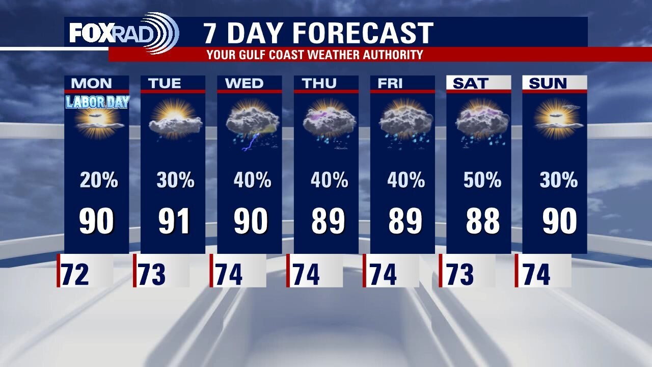
Rain chances are decreasing as we move toward the end of Labor Day Weekend. Most of the showers and storms will slide south of Houston on Monday with only isolated showers expected for most of Southeast Texas. Scattered showers remain in the forecast for most of the upcoming week with afternoon highs around 90�
Rain chances are decreasing as we move toward the end of Labor Day Weekend. Most of the showers and storms will slide south of Houston on Monday with only isolated showers expected for most of Southeast Texas. Scattered showers remain in the forecast for most of the upcoming week with afternoon highs around 90�