

Houston weather: Flood Watch extended for some; floods, storms still a threat

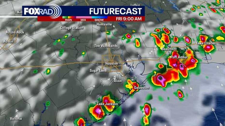
Houston weather: Break from Thursday showers; rain returns Friday
Some counties close to the Gulf are under a Flood Warning until 9 p.m. Thursday. Waves of rain are expected again Friday and Saturday.
Street flooding still a threat
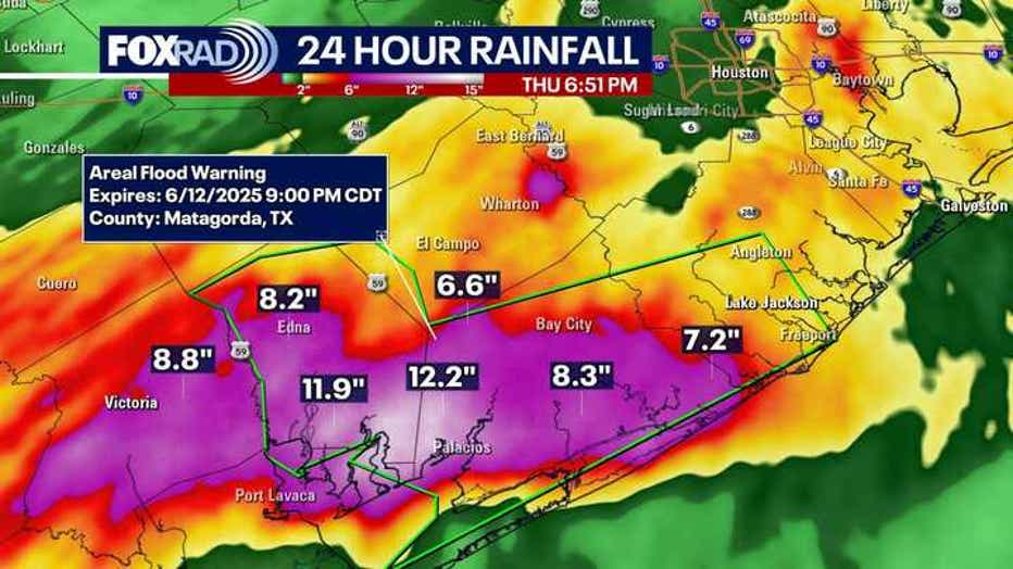
HOUSTON - This morning, the National Weather Service placed several areas under Flash Flood Warnings and Flood Advisories with rainfall totals ranging from 5-10 inches.
One of the hardest hit areas was Palacios in Matagorda county, where radar estimated close to 10 inches of rain had fallen since early this morning!
A few brief tornadoes, an EF-1 & EF-0 were also reported between 3-4 a.m. in Wharton County that caused some roof and tree damage.
Featured

Two tornadoes reported in Wharton County early Thursday morning
Two tornadoes (an EF-0 and an EF-1) were reported between 3-3:30 a.m. in Wharton County.
Spotty showers and a few storms will persist through early evening, mainly south, leading to the threat of street flooding continuing.
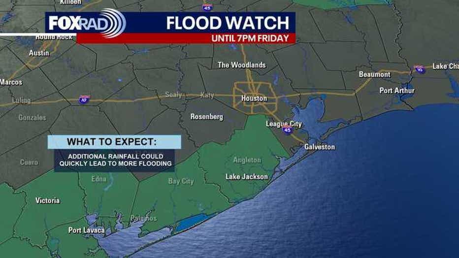
A Flood Watch has been extended for a few southwestern counties, including Matagorda, Jackson, Wharton and Brazoria counties, until 7 PM Friday.
Severe storms also possible
In addition to dropping heavy rain, some of the stronger cells could produce hail or high winds and even an isolated funnel cloud or tornado, although that is not the primary threat for now.
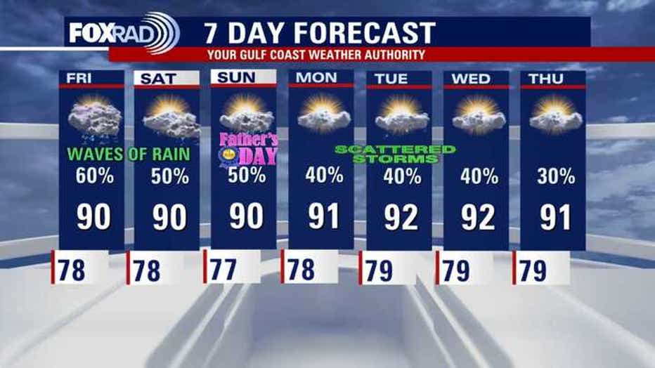
Our current pattern favors at least an isolated chance for severe storms and/or heavy rain through Sunday or Monday with steamy air in between.
7-Day Forecast
Tropics remain quiet for us
Still no tropical activity in the Gulf and Caribbean - in the Pacific, Barbara and Cosme have fallen apart west of Mexico.
A new storm, to be named Dalila, is expected to be upgraded over the next two days near the Acapulco area. It is now being called Potential Tropical Cyclone Four-E with the chance for tropical storms winds impacting the western Mexican coast.
The Source: Information in this article is from the FOX 26 Houston weather team.