

Houston weather: Severe thunderstorms possible
Warm, humid Sunday with late-day storms
HOUSTON - Another disturbance is bringing scattered showers and storms to Houston and surrounding areas. A few of these storms could be on the strong to severe side with hail, gusty winds and frequent lightning.
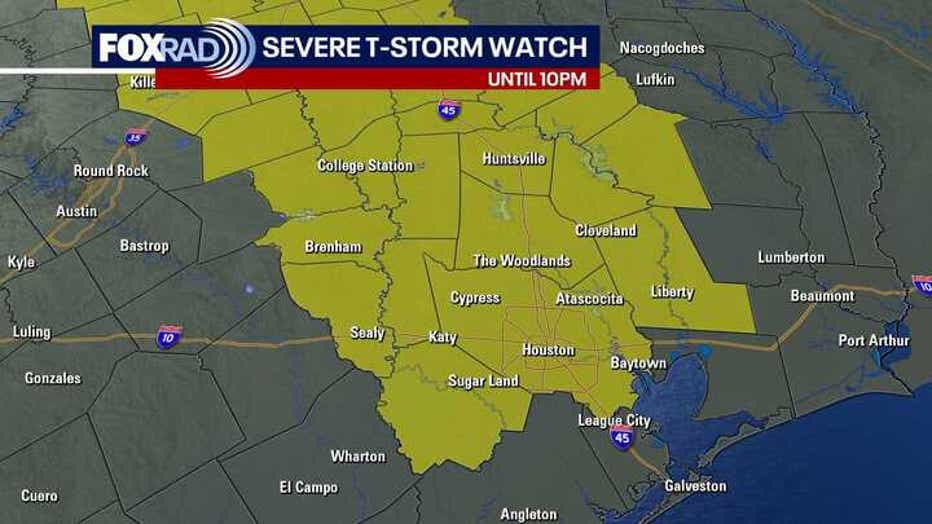
A severe thunderstorm watch has been issued for Houston and the majority of the area until 10 PM. It does exclude the coastal communities.
MORE: Weather alerts for SE Texas

Houston weather: Sunday severe storms slightly weaken
FOX 26 meteorologist Remeisha Shade tracked the storms approaching the northern Houston area Sunday, June 1, 2025.
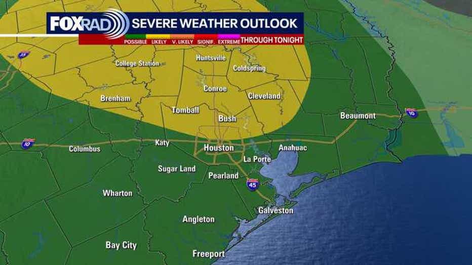
The Storm Prediction Center has Southeast Texas under a Level 1 and/or 2 (out of 5) risk for a severe thunderstorm with the highest risk north.
Also, keep in mind that ozone levels are elevated today. So an air quality alert continues through this evening. If you have respiratory issues, you may want to limit your amount of time outdoors.
Hotter next week with limited rain
Weather for the first week of June looks like typical close to summer weather with temperatures in the low to middle 90s and a few chances for showers and storms.
Heat index values will likely be near 100. So be careful in the heat by staying hydrated and taking breaks in the shade if you have to work outside.
Atlantic Hurricane Season begins today

Tropical Update: Sunday, June 1, 2025
Meteorologist Remeisha Shade provides FOX 26 Houston's first tropical update for the 2025 Atlantic Hurricane Season.
The 2025 Atlantic Hurricane Season begins today.
All is looking quiet for now with Saharan dust moving across the Atlantic Ocean.
NOAA is predicting 13-19 named storms, 6-10 hurricanes and 3-5 major hurricanes.
Now is the time to prepare.
Tropical Storm Alvin formed in the eastern Pacific Ocean on Thursday and has now fallen apart and become Post-Tropical near Cabo San Lucas.
The Source: Your Gulf Coast Weather Authority