

Tropical wave in the Atlantic: NHC increases chance of formation

The National Hurricane Center has increased the chances of development for a tropical wave in the Atlantic. It could become a tropical depression later this week.
Watching for tropical development in the Atlantic

By the numbers:
On Monday afternoon, the NHC increased the chances of formation to 60% over the next seven days. It has a low, 10% chance of formation over the next 48 hours.
Timeline:
The tropical wave is located over the eastern tropical Atlantic. The NHC says conditions appear conducive for gradual development. It could become a tropical depression by the end of the week.
The system is expected to move west or west-northwest at 20 mph across the Atlantic. It is expected to approach the area of the Leeward Islands on Friday.
We continue to monitor the latest weather models, and will update you once we know more.
Hurricane Erin in the Atlantic
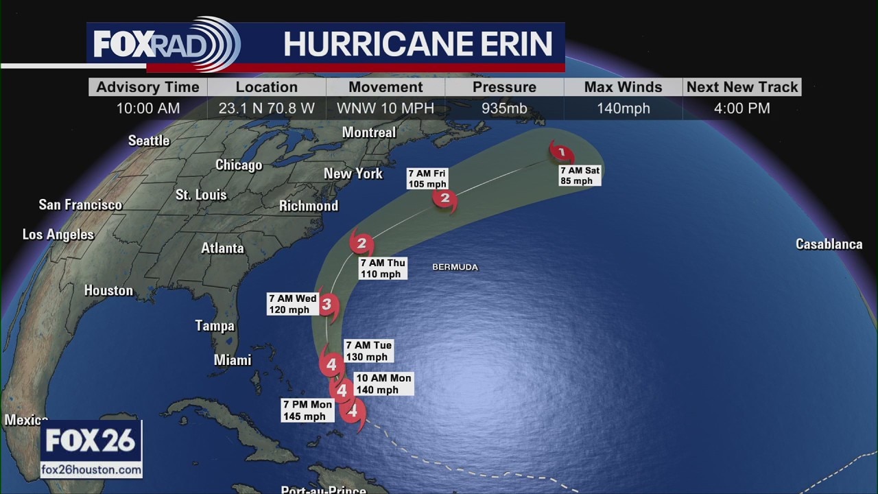
Hurricane Erin update Monday: Path, impacts
FOX 26 Meteorologist Allison Gargaro has the latest on Hurricane Erin, which is churning across the Atlantic as a Category 4 storm. She has more on where Erin is going and who will be impacted. (NOTE: This report was from 11 a.m. Monday.)
Dig deeper:
Erin also continues to churn across the Atlantic as a major Category 4 hurricane. The outer rain bands and strong winds are hitting Turks and Caicos as well as the eastern Bahamas today. Those locations are under tropical storm watches and warnings. Hurricane Erin is set to make a curve off to the northwest and then off to the northeast later on this week.
Thankfully, we will not be seeing any interaction with land, but the East Coast of the U.S. will have indirect impacts. From Florida all the way up the eastern seaboard, there will be the potential for dangerous rip currents and large surf. Folks who live in the Outer Banks of North Carolina need to be on high alert as coastal flooding and rough surf will be possible beginning on Wednesday.
The Source: The information in this article comes from the National Hurricane Center and the FOX 26 weather team.