

Houston weather: Very warm Tuesday in the 90s, scattered storms Wednesday

Houston weather: Humid, breezy Tuesday in the 80s
It's mostly sunny, warm and breezy Tuesday and as we move into the afternoon, an isolated storm is possible. Our afternoon high temperatures will rise from the low 90s today to the mid and possibly upper 90s by late this week into the weekend.
HOUSTON - It's mostly sunny, warm and breezy Tuesday and as we move into the afternoon, an isolated storm is possible.
Early summer heat building
Our afternoon high temperatures will rise from the low 90s today to the mid and possibly upper 90s by late this week into the weekend. Along with the heat, watch for one or two storms late today, then our highest rain chances arriving tomorrow afternoon.
Beyond that, look for a daily isolated shower of storms with heat index values above 100. We will also watch for possible air quality issues beginning Thursday.
Saharan dust plume to soon over Gulf Coast
A few times each year, mostly from May to August, a "Saharan Air Layer" will make its way across the Atlantic Ocean and move over the Caribbean and sometimes reach Texas. It looks like the latest plume of Saharan dust could arrive in Texas as early as Thursday and reach its peak Friday and Saturday.
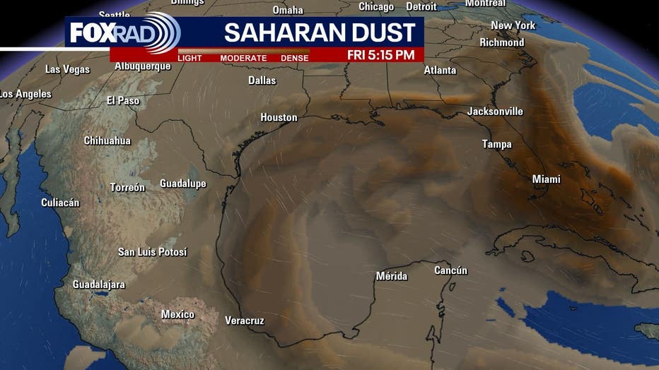
The dust is more noticeable at sunrise and sunset, but can also appear as haze during the day. It doesn't always affect air quality at the surface, but when it does, it can cause allergy-like symptoms, so check back for updates on air quality levels.
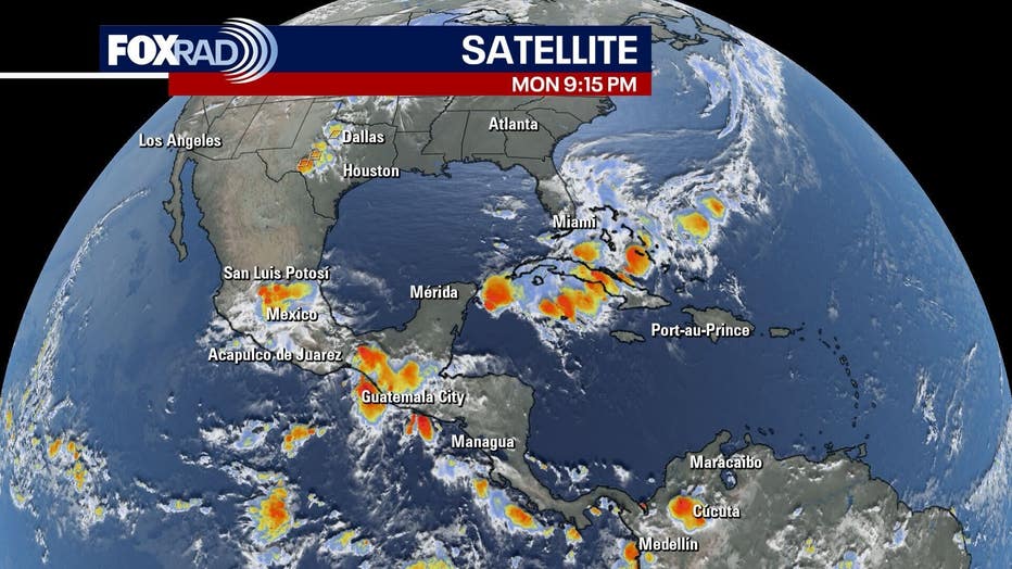
Tropics pretty quiet, but heavy rain hits Florida
An upper-level area of low pressure could mix down to the surface and create a small tropical low anywhere from Florida to North Carolina. The chance is slim, and it would have no effect on Texas.
The Source: Your Gulf Coast Weather Authority