

Houston weather: Spotty rain Thursday evening as Saharan dust approaches

Houston weather: Saharan dust coming in this weekend
Beginning Friday and extending through Sunday or possibly Monday, expect a mixture of hazy skies and very warm afternoons as temps rise into the mid and possibly upper 90s.
Steamy Thursday with few late-day storms
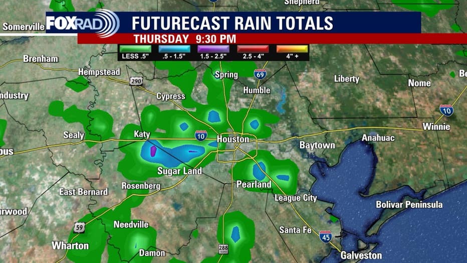
HOUSTON - Like Wednesday, there is enough moisture and instability in our atmosphere to generate a few storms after around 1pm through 7pm or so.
Lightning and brief heavy rain will be possible, but the overall coverage is likely to be less widespread than yesterday.
Look for highs in the low 90s with a heat index near 100 by early afternoon.
Saharan dust and summer heat
Beginning tomorrow and extending through Sunday or possibly Monday, expect a mixture of hazy skies and very warm afternoons as temps rise into the mid and possibly upper 90s.
We'll keep an eye on air quality, but for now just be mindful that dust and light smoke could drop the air quality into the "unhealthy for sensitive groups" category.
Stormy weather ahead next week
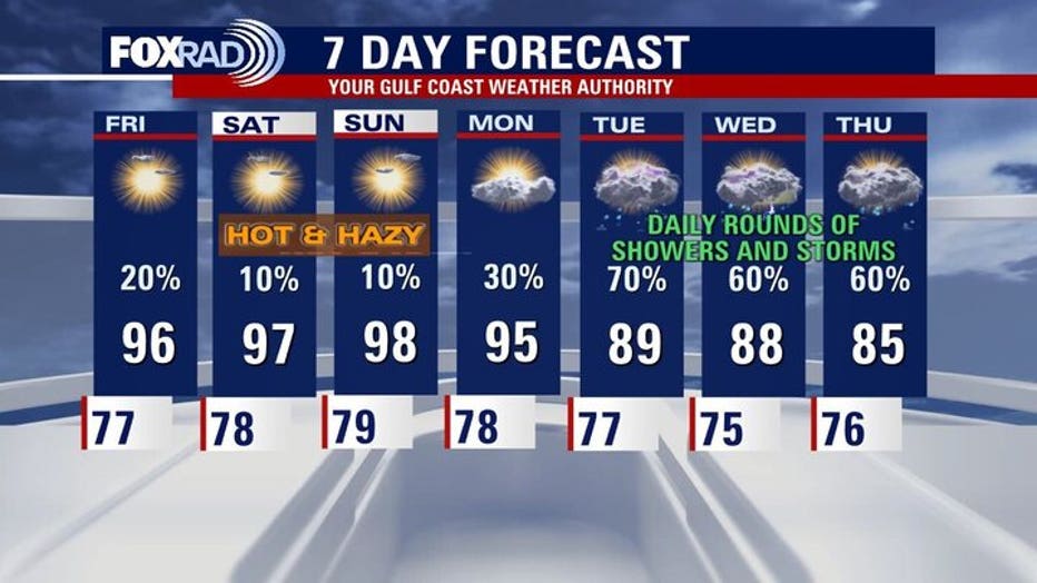
A bumpy jet stream pattern will arrive next week, so expect off and on rounds of showers and storms with a few heavy ones and even a chance for occasional severe storms. We'll have a better idea of timing as we get closer.
The unsettled weather could begin Monday, but it looks very likely that Tuesday - Friday will be pretty active.
The Source: Your Gulf Coast Weather Authority