

Houston weather: Hazy skies, isolated storms expected Monday
Isolated downpours start the week

Houston weather: Isolated Monday storms and Saharan dust
Monday morning should start to show some hazy in the skies as Saharan dust thickens across southeast Texas. Houston could still see a few afternoon downpours as a bit of that plume of tropical moisture from the weekend is still hanging around.
HOUSTON - Monday morning should start to show some hazy in the skies as Saharan dust thickens across southeast Texas.
Houston could still see a few afternoon downpours as a bit of that plume of tropical moisture from the weekend is still hanging around. Rain chances will be slightly higher near the coast and cities south of I-10.
Blanket of Saharan dust on the way
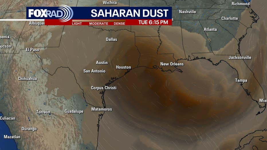
Yet another plume of Saharan dust will be noticeable next week.
Air quality could be affected, but it will primarily give us more colorful sunrises and sunsets.
Dust will also sometimes lower rain chances by warming the middle parts of the atmosphere.
You can still expect the heat and humidity across SE Texas along with the haze.
Tropical Storm Barry
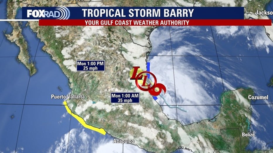
Tropical Storm Barry is making landfall in the eastern coast of Mexico.
This system will be short-lived as the track brings heavy rain and possible flash flooding and mudslides in areas with steep terrain.
Watching the Gulf next week
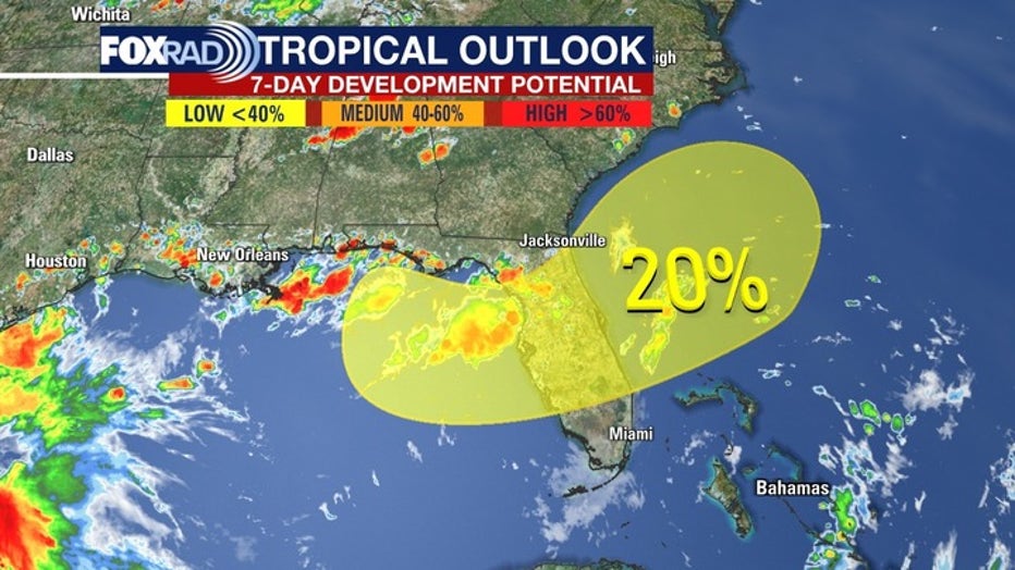
The latest Tropical Outlook from the National Hurricane Center gives a 20% of a tropical cyclone forming near Florida at the end of this week.
There are many uncertainties, but with it being a holiday weekend, there will be much to watch as this unfolds over the next several days.
No matter how this develops, heavy rains will be expected next weekend near Florida.
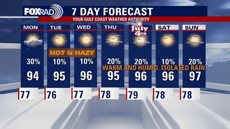
7-Day Forecast
The Source: Information in this article comes from the FOX 26 weather team.