

Saturday morning Houston-area weather forecast
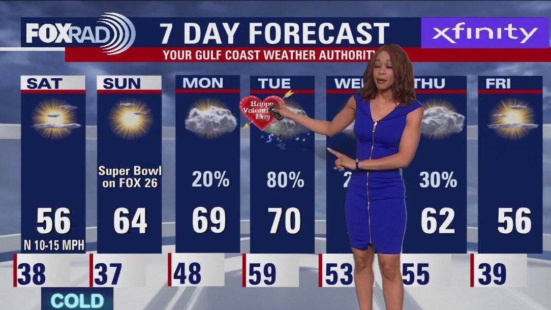
Temperatures inland, especially north of Houston could get close to freezing early Saturday morning. So protect any sensitive plants and crank up the heat a bit tonight if you are sensitive to the cold. Super Bowl Sunday looks pleasant by the afternoon with temps in the low 60s and dry weather for watch parties. Few showers will return Monday but a much better chance for widespread rain is back on Valentine's Day Tuesday. Have a great weekend and don't forget to download the FOX 26 weather app!
Temperatures inland, especially north of Houston could get close to freezing early Saturday morning. So protect any sensitive plants and crank up the heat a bit tonight if you are sensitive to the cold. Super Bowl Sunday looks pleasant by the afternoon with temps in the low 60s and dry weather for watch parties. Few showers will return Monday but a much better chance for widespread rain is back on Valentine's Day Tuesday. Have a great weekend and don't forget to download the FOX 26 weather app!
Lots of wind Friday evening with temps in the 50s
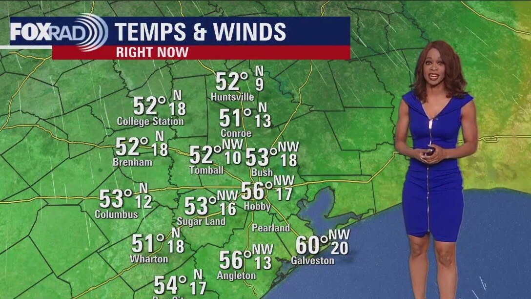
Plan on chilly weather for much of the weekend but no rain to ruin your outdoor plans! Mardi Gras in Galveston kicks off this evening and will feature numerous parades and a lot of excitement! Grab the jackets for tonight with temperatures expected to be in the 30s and wind gusts will be around 30-35 mph. Wind Advisory continues until 9 PM for the Brazoria, Galveston & Matagorda Islands. It also includes the Bolivar Peninsula. Temperatures inland, especially north of Houston could get close to freezing early Saturday morning. So protect any sensitive plants and crank up the heat a bit tonight if you are sensitive to the cold. Super Bowl Sunday looks pleasant by the afternoon with temps in the low 60s and dry weather for watch parties. Few showers will return Monday but a much better chance for widespread rain is back on Valentine's Day Tuesday. Have a great weekend and don't forget to download the FOX 26 weather app!
Plan on chilly weather for much of the weekend but no rain to ruin your outdoor plans! Mardi Gras in Galveston kicks off this evening and will feature numerous parades and a lot of excitement! Grab the jackets for tonight with temperatures expected to be in the 30s and wind gusts will be around 30-35 mph. Wind Advisory continues until 9 PM for the Brazoria, Galveston & Matagorda Islands. It also includes the Bolivar Peninsula. Temperatures inland, especially north of Houston could get close to freezing early Saturday morning. So protect any sensitive plants and crank up the heat a bit tonight if you are sensitive to the cold. Super Bowl Sunday looks pleasant by the afternoon with temps in the low 60s and dry weather for watch parties. Few showers will return Monday but a much better chance for widespread rain is back on Valentine's Day Tuesday. Have a great weekend and don't forget to download the FOX 26 weather app!


Earthquake that devastated Turkey, Syria created massive ruptures in the Earth’s surface, photos show
One of the longest ruptures discovered by scientists in the Mediterranean is nearly 200 miles long.
One of the longest ruptures discovered by scientists in the Mediterranean is nearly 200 miles long.

Family sues funeral home, sons body left to 'literally rot' during Winter Storm with no embalming
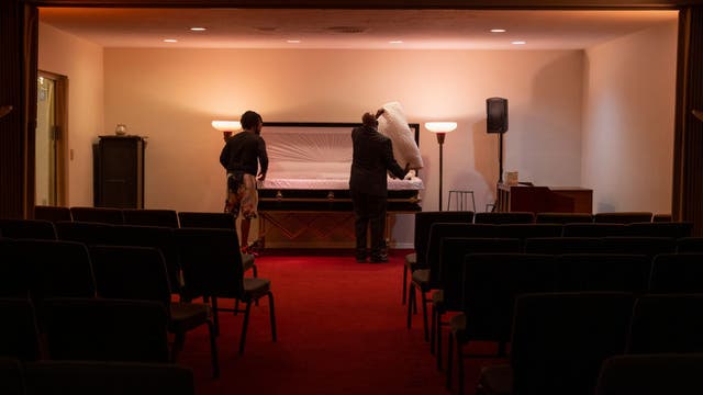
A Houston area funeral home is being sued by a family after their deceased son's body was treated horrifically at the funeral home and left to rot.
A Houston area funeral home is being sued by a family after their deceased son's body was treated horrifically at the funeral home and left to rot.
Breezy, chilly Friday afternoon in the 50s
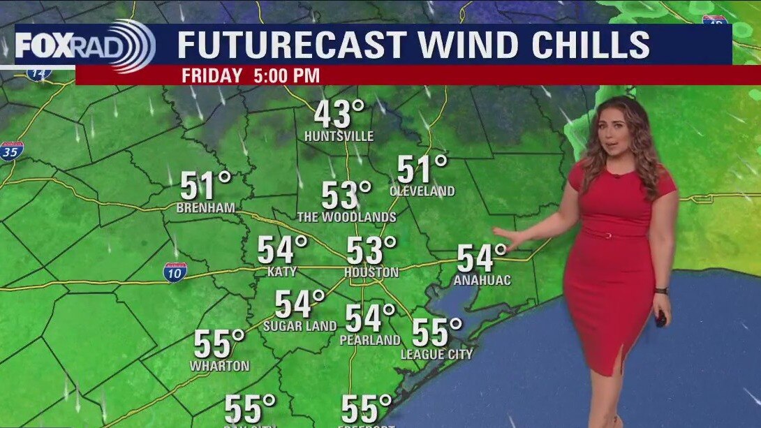
Windy today, chilly through Sunday morning but no raining on the Mardi Gras Parades. Super Bowl Sunday includes an increase in clouds late, with temperatures on the thermometer rising through the week. Valentines Day Plans may hit a snag in the road with some showers and storms, followed by lower rain chances and a cool down.
Windy today, chilly through Sunday morning but no raining on the Mardi Gras Parades. Super Bowl Sunday includes an increase in clouds late, with temperatures on the thermometer rising through the week. Valentines Day Plans may hit a snag in the road with some showers and storms, followed by lower rain chances and a cool down.

Houston weather: Windy and chilly Friday; highs in the upper 50
Chilly winds are going to kick in today, so expect a bit of a blustery day much cooler than yesterday. For the weekend - lots going on with the Super Bowl on Fox 26 as well as the start of Galveston Mardi Gras. Days will stay below average in the 50s Saturday and 60s Sunday and overnight lows should reach the 30s. Next week, watch for a round of storms on Valentine's Day.
Chilly winds are going to kick in today, so expect a bit of a blustery day much cooler than yesterday. For the weekend - lots going on with the Super Bowl on Fox 26 as well as the start of Galveston Mardi Gras. Days will stay below average in the 50s Saturday and 60s Sunday and overnight lows should reach the 30s. Next week, watch for a round of storms on Valentine's Day.
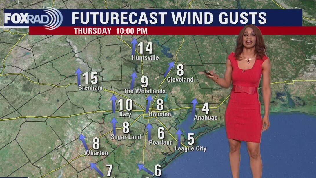
Warm, light winds Thursday evening in the 70s
The weekend is getting closer and there's lots of fun things to do around Houston & Galveston. So we need the weather to cooperate! There's the kickoff of Mardi Gras in Galveston Friday and of course, it's Super Bowl Weekend with lots of local watch parties and events surrounding that Sunday. Weather should be dry this weekend but it will be colder thanks to a cold front rolling in tonight. That front won't bring rain but it will bring in some chilly air and windy weather for Friday. Look for gusts near 30 mph & make sure to secure any lightweight or loose objects in your yard. Temps should only climb to the 50s Friday afternoon and dip to near-freezing Friday night. So make sure your pets are warm & your plants are protected. We climb to near 60 Saturday and Sunday afternoon with a decent amount of sunshine anticipated.
The weekend is getting closer and there's lots of fun things to do around Houston & Galveston. So we need the weather to cooperate! There's the kickoff of Mardi Gras in Galveston Friday and of course, it's Super Bowl Weekend with lots of local watch parties and events surrounding that Sunday. Weather should be dry this weekend but it will be colder thanks to a cold front rolling in tonight. That front won't bring rain but it will bring in some chilly air and windy weather for Friday. Look for gusts near 30 mph & make sure to secure any lightweight or loose objects in your yard. Temps should only climb to the 50s Friday afternoon and dip to near-freezing Friday night. So make sure your pets are warm & your plants are protected. We climb to near 60 Saturday and Sunday afternoon with a decent amount of sunshine anticipated.

El Tiempo 9 de febrero de 2023
#FOX26 Meteor�loga Lena Maria Arango tiene su pron�stico para el fin de semana.
#FOX26 Meteor�loga Lena Maria Arango tiene su pron�stico para el fin de semana.
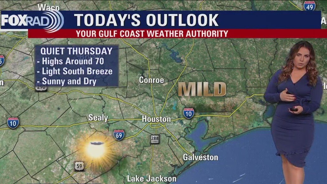
Sunny, dry, and breezy Thursday afternoon in the 70s
After a chilly start, Thursday afternoon will be beautiful, mild and dry. As we kick off Mardi Gras Tomorrow, beads won't be the only things flying. Plan for wind gusts to 30, perhaps 30mph that will have things feeling much colder than the thermometer reads. Secure light/loose objects and keep plants and pets in mind, as a few locations may get down near freezing. You'll also want layers for yourself, especially after dark for weekend festivities. By Sunday, gulf breezes return increasing humidity, temps and cloud cover early next week. A few showers may be in the mix Monday, Tuesday will have to get watched a little more closely for the potential for storms.
After a chilly start, Thursday afternoon will be beautiful, mild and dry. As we kick off Mardi Gras Tomorrow, beads won't be the only things flying. Plan for wind gusts to 30, perhaps 30mph that will have things feeling much colder than the thermometer reads. Secure light/loose objects and keep plants and pets in mind, as a few locations may get down near freezing. You'll also want layers for yourself, especially after dark for weekend festivities. By Sunday, gulf breezes return increasing humidity, temps and cloud cover early next week. A few showers may be in the mix Monday, Tuesday will have to get watched a little more closely for the potential for storms.


Survivors of Turkey, Syria earthquake struggle to stay warm and fed
Turkish authorities said the death toll had risen to more than 16,100 in the country, with more than 64,000 injured. Survivors gathered around campfires and clamored for food and water in the cold temperatures.
Turkish authorities said the death toll had risen to more than 16,100 in the country, with more than 64,000 injured. Survivors gathered around campfires and clamored for food and water in the cold temperatures.
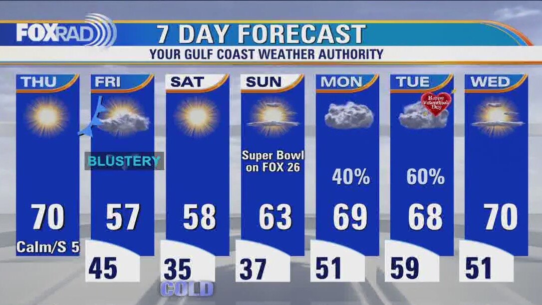
Houston weather: Cold Thursday morning, then sunny with highs near 70
Yesterday's cold front has ushered in cooler and drier conditions, but after a cold morning, this afternoon looks great. A second cold front is expected tonight which will cause blustery weather on Friday. This Super Bowl weekend looks cool, but quiet. Watch for lows close to freezing on Saturday morning with cool, dry days through Sunday.
Yesterday's cold front has ushered in cooler and drier conditions, but after a cold morning, this afternoon looks great. A second cold front is expected tonight which will cause blustery weather on Friday. This Super Bowl weekend looks cool, but quiet. Watch for lows close to freezing on Saturday morning with cool, dry days through Sunday.
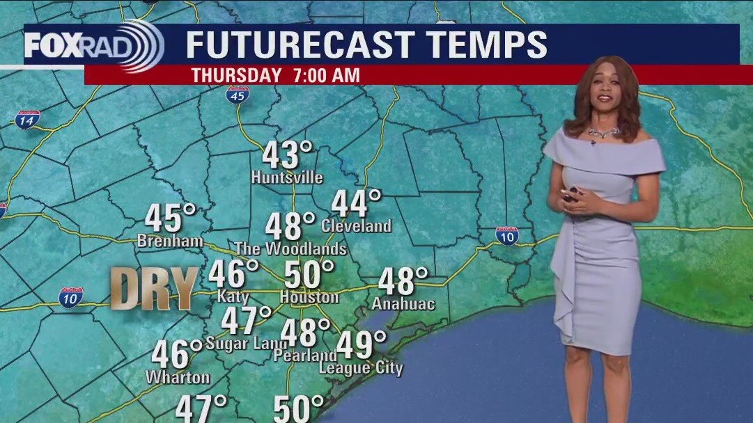
Thursday morning Houston-area weather forecast
A strong cold front has pushed across SE Texas bringing with it a big drop in temperatures. Another cold front is set to arrive Thursday night but should come through dry. Temps get up to near 70 ahead of that front Thursday before it turns colder heading into the weekend.
A strong cold front has pushed across SE Texas bringing with it a big drop in temperatures. Another cold front is set to arrive Thursday night but should come through dry. Temps get up to near 70 ahead of that front Thursday before it turns colder heading into the weekend.
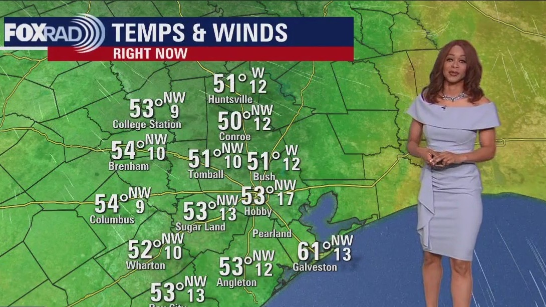
Cool, breezy Wednesday evening in the 50s
A strong cold front has pushed across SE Texas bringing with it a big drop in temperatures. Temperatures have dropped close to 30 degrees today and it gets even colder tonight with most areas dipping to the 40s. Another cold front is set to arrive Thursday night but should come through dry. Temps get up to near 70 ahead of that front Thursday before it turns colder heading into the weekend. Friday will be much cooler and breezy with wind gusts over 30 mph possible. Coldest temperatures are expected Saturday morning as we get close to freezing. We heat up again next week ahead of another storm system that will bring showers Monday and the chance for rain & a few storms that could impact date plans on Valentine's Day.
A strong cold front has pushed across SE Texas bringing with it a big drop in temperatures. Temperatures have dropped close to 30 degrees today and it gets even colder tonight with most areas dipping to the 40s. Another cold front is set to arrive Thursday night but should come through dry. Temps get up to near 70 ahead of that front Thursday before it turns colder heading into the weekend. Friday will be much cooler and breezy with wind gusts over 30 mph possible. Coldest temperatures are expected Saturday morning as we get close to freezing. We heat up again next week ahead of another storm system that will bring showers Monday and the chance for rain & a few storms that could impact date plans on Valentine's Day.
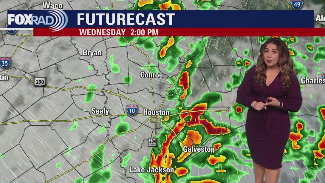
Windy, rainy Wednesday afternoon in the 70s
Cold front is slowly progressing across our area, keeping showers and storms in the forecast through mid-afternoon followed by falling temperatures. A reinforcing dry front will blow into the area Friday, turning things, and chilly for the start of Mardi Gras and Super Bowl Weekend locally especially in the mornings. May want to consider an umbrella for your Valentine, rain chances return early next week.
Cold front is slowly progressing across our area, keeping showers and storms in the forecast through mid-afternoon followed by falling temperatures. A reinforcing dry front will blow into the area Friday, turning things, and chilly for the start of Mardi Gras and Super Bowl Weekend locally especially in the mornings. May want to consider an umbrella for your Valentine, rain chances return early next week.
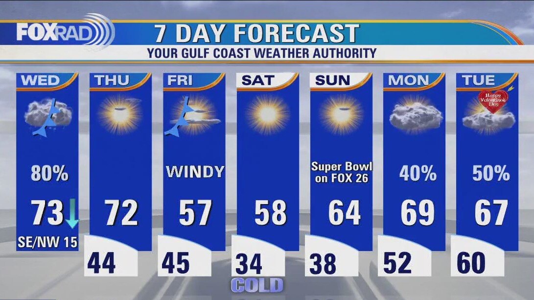
Houston weather: Cold front moving through Wednesday
A cold front will move through today, so showers and a few storms are expected along with cooler air sliding in from west to east through the day. This means that temperatures could fall from the mid 70s at midday to the 50s by late afternoon. The forecast for Thursday through Super Bowl Sunday looks pretty nice with sunny, dry days and chilly nights. Two things to note - Friday looks windy and chilly and overnight lows this weekend are expected to reach the 30s, so a very light freeze is possible.
A cold front will move through today, so showers and a few storms are expected along with cooler air sliding in from west to east through the day. This means that temperatures could fall from the mid 70s at midday to the 50s by late afternoon. The forecast for Thursday through Super Bowl Sunday looks pretty nice with sunny, dry days and chilly nights. Two things to note - Friday looks windy and chilly and overnight lows this weekend are expected to reach the 30s, so a very light freeze is possible.
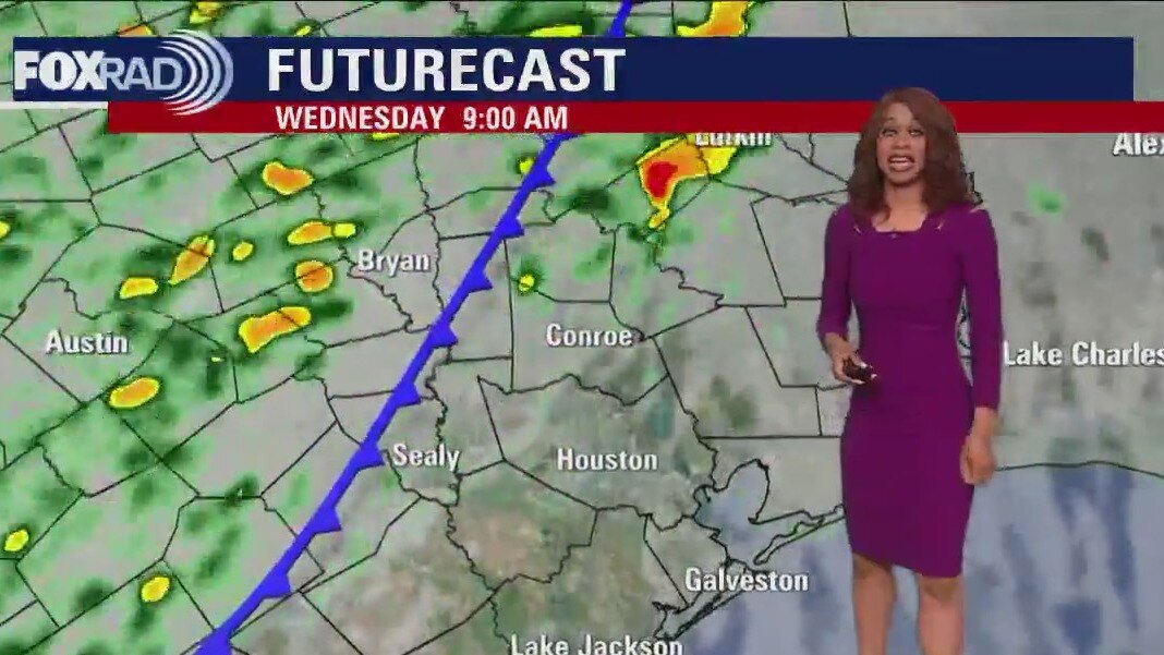
Wednesday morning Houston-area weather forecast
Expect a round of storms Wednesday morning with cold front reaching Houston around midday. Best chance for storms appears to be from around 4 a.m. until noon. A few storms could still be strong to severe Wednesday with a limited Category 1 out of 5 threat for severe storms, including damaging winds and hail. Tornado risk is only around 2%, which means it's possible but unlikely. Few heavy downpours could also accompany the front. We should dry out as we go through Wednesday afternoon. A secondary front will come through dry late Thursday, but bring in even cooler air for the big Super Bowl weekend.
Expect a round of storms Wednesday morning with cold front reaching Houston around midday. Best chance for storms appears to be from around 4 a.m. until noon. A few storms could still be strong to severe Wednesday with a limited Category 1 out of 5 threat for severe storms, including damaging winds and hail. Tornado risk is only around 2%, which means it's possible but unlikely. Few heavy downpours could also accompany the front. We should dry out as we go through Wednesday afternoon. A secondary front will come through dry late Thursday, but bring in even cooler air for the big Super Bowl weekend.

Has there ever been a tropical storm in February? It happened once, 71 years ago, off East Coast
The only known tropical storm to ever roam the Atlantic Basin in February began its initial stages of development on Groundhog Day 1952.
The only known tropical storm to ever roam the Atlantic Basin in February began its initial stages of development on Groundhog Day 1952.

FOX 26 News at 5 p.m. - The News Edge Early Edition
Cold front is still set to move through Wednesday but the timing is a bit slower. Expect scattered showers tonight and a round of storms Wednesday morning with cold front reaching Houston around midday. Best chance for storms appears to be from around 4 a.m. until noon. Temperatures will stay mild tonight near 60 and briefly climb to near 70 tomorrow ahead of the front. A few storms could still be strong to severe Wednesday with a limited Category 1 out of 5 threat for severe storms, including damaging winds and hail. Tornado risk is only around 2% which means it's possible but unlikely. Few heavy downpours could also accompany the front. We should dry out as we go through Wednesday afternoon. A secondary front will come through dry late Thursday but bring in even cooler air for the big Super Bowl weekend.
Cold front is still set to move through Wednesday but the timing is a bit slower. Expect scattered showers tonight and a round of storms Wednesday morning with cold front reaching Houston around midday. Best chance for storms appears to be from around 4 a.m. until noon. Temperatures will stay mild tonight near 60 and briefly climb to near 70 tomorrow ahead of the front. A few storms could still be strong to severe Wednesday with a limited Category 1 out of 5 threat for severe storms, including damaging winds and hail. Tornado risk is only around 2% which means it's possible but unlikely. Few heavy downpours could also accompany the front. We should dry out as we go through Wednesday afternoon. A secondary front will come through dry late Thursday but bring in even cooler air for the big Super Bowl weekend.


Pasadena tornado: Texas Governor submits request for presidential disaster declaration
If the presidential disaster declaration is granted - Harris, Jefferson, Liberty and Orange County residents will be eligible for federal resources.
If the presidential disaster declaration is granted - Harris, Jefferson, Liberty and Orange County residents will be eligible for federal resources.


Here’s a look at the world’s deadliest earthquakes since 2000
A devastating earthquake that impacted Turkey and Syria and killed thousands is the latest to wreak havoc globally. One of the worst since 2000 was an earthquake in Haiti, which left more than 300,000 people dead in 2010.
A devastating earthquake that impacted Turkey and Syria and killed thousands is the latest to wreak havoc globally. One of the worst since 2000 was an earthquake in Haiti, which left more than 300,000 people dead in 2010.