

Fox 26 Morning News Weekends 6:00 a.m.
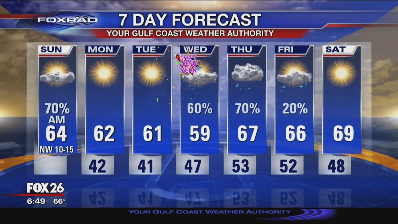
A cold front continues pushing south, toward the Gulf of Mexico with showers and storms ahead of it. This afternoon, skies will clear and temperatures will be much cooler to start the work week. Next rain chance comes on New Year's Day.
A cold front continues pushing south, toward the Gulf of Mexico with showers and storms ahead of it. This afternoon, skies will clear and temperatures will be much cooler to start the work week. Next rain chance comes on New Year's Day.
FoxRad Forecast 12/28
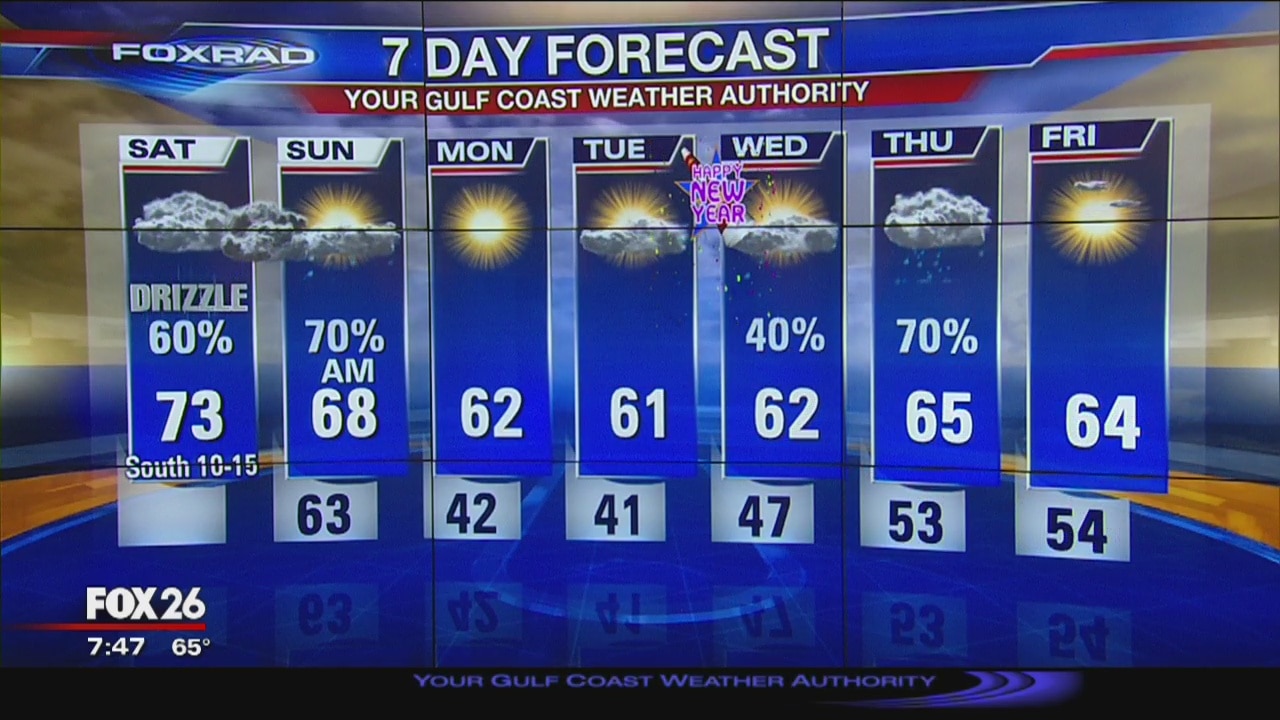
Saturday is starting off foggy and clouds will stick around until a front moves through early Sunday. Rain and storms are possible. Sunday afternoon will be dry, though. Next rain chance comes Wednesday into Thursday.
Saturday is starting off foggy and clouds will stick around until a front moves through early Sunday. Rain and storms are possible. Sunday afternoon will be dry, though. Next rain chance comes Wednesday into Thursday.

Friday afternoon weather forecast
FOX 26 Meteorologist Stephen Morgan says temperatures should warm quickly into the low and mid-70s. The weekend will begin mild and end cooler. A cold front will be pushing through the area late Saturday into Sunday. Rain and storm chances will increase as we head into the overnight hours Saturday. After the front passes, temperatures will be more seasonable with highs in the low 60s and lows in the low 40s. More rain is looking likely during the 2nd half of New Year's Day.
FOX 26 Meteorologist Stephen Morgan says temperatures should warm quickly into the low and mid-70s. The weekend will begin mild and end cooler. A cold front will be pushing through the area late Saturday into Sunday. Rain and storm chances will increase as we head into the overnight hours Saturday. After the front passes, temperatures will be more seasonable with highs in the low 60s and lows in the low 40s. More rain is looking likely during the 2nd half of New Year's Day.
Friday morning weather forecast
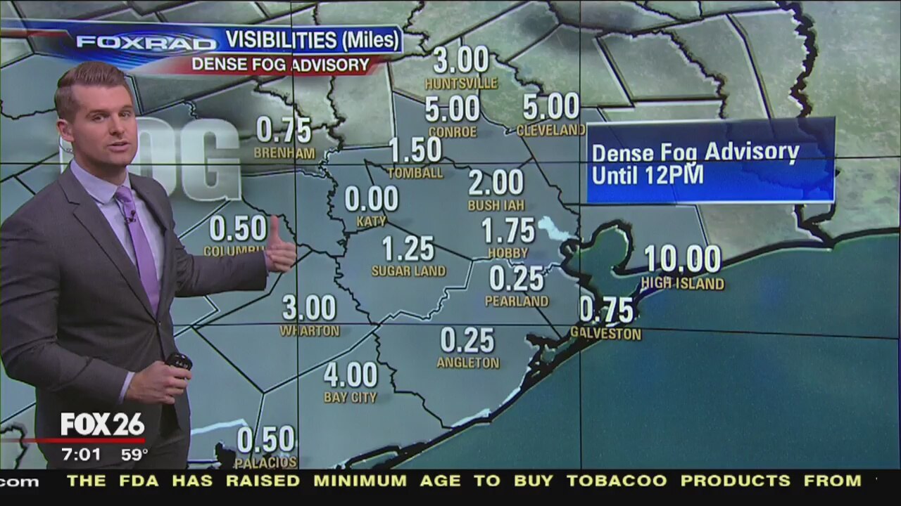
FOX 26 Meteorologist Stephen Morgan says we are waking up with another dense fog advisory for most of the viewing area until noon. Once that fog dissipates, temperatures should warm quickly into the low and mid-70s. The weekend will begin mild and end cooler. A cold front will be pushing through the area late Saturday into Sunday. Rain and storm chances will increase as we head into the overnight hours Saturday. After the front passes, temperatures will be more seasonable with highs in the low 60s and lows in the low 40s. More rain is looking likely during the 2nd half of New Year's Day.
FOX 26 Meteorologist Stephen Morgan says we are waking up with another dense fog advisory for most of the viewing area until noon. Once that fog dissipates, temperatures should warm quickly into the low and mid-70s. The weekend will begin mild and end cooler. A cold front will be pushing through the area late Saturday into Sunday. Rain and storm chances will increase as we head into the overnight hours Saturday. After the front passes, temperatures will be more seasonable with highs in the low 60s and lows in the low 40s. More rain is looking likely during the 2nd half of New Year's Day.

Thursday Night Weather Update
Best shot for rain looks to be Saturday night into Sunday morning. Highs behind the front will drop back to normal reaching the low to mid 60s.
Best shot for rain looks to be Saturday night into Sunday morning. Highs behind the front will drop back to normal reaching the low to mid 60s.
Thursday Evening Weather Update
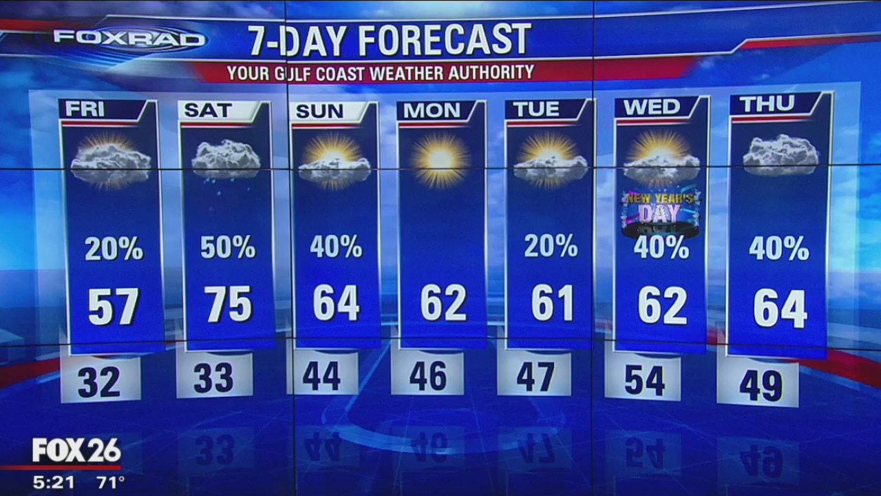
Best chances for rain look to be Saturday night into Sunday morning.
Best chances for rain look to be Saturday night into Sunday morning.

Thursday morning weather forecast
There is a Dense Fog Advisory in effect for the entire viewing area until 9 a.m. this morning. FOX 26 Meteorologist Stephen Morgan says that's the biggest issue this morning with several observation stations reporting visibilities less than a half-mile. After the fog dissipates, we'll see temperatures warm well into the upper 60s and low/mid-70s. We are still tracking the threat for rain as we work our way through the weekend. The best shot for rain looks to be Saturday night into Sunday morning. Highs, behind the front, will drop back to normal reaching the low to mid-60s.
There is a Dense Fog Advisory in effect for the entire viewing area until 9 a.m. this morning. FOX 26 Meteorologist Stephen Morgan says that's the biggest issue this morning with several observation stations reporting visibilities less than a half-mile. After the fog dissipates, we'll see temperatures warm well into the upper 60s and low/mid-70s. We are still tracking the threat for rain as we work our way through the weekend. The best shot for rain looks to be Saturday night into Sunday morning. Highs, behind the front, will drop back to normal reaching the low to mid-60s.

Christmas Night Weather Update
Look for more clouds towards the end of the week with a cold front over the weekend bringing us some rain.
Look for more clouds towards the end of the week with a cold front over the weekend bringing us some rain.
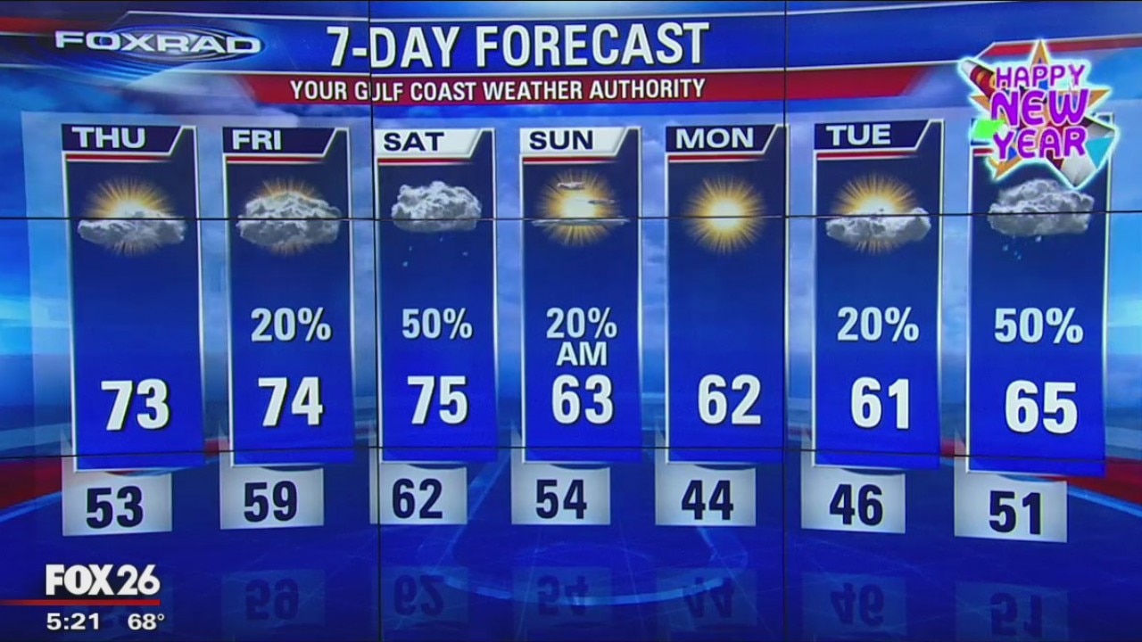
Christmas Evening Weather Update
Look for more clouds towards the end of the week with a cold front over the weekend bringing us some rain.
Look for more clouds towards the end of the week with a cold front over the weekend bringing us some rain.

Christmas Day Morning Forecast
Meteorologist Stephen Morgan gives you a look at what to expect Christmas Day.
Meteorologist Stephen Morgan gives you a look at what to expect Christmas Day.
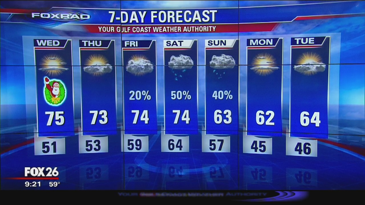
Gulf Coast Authority Weather Update with Mereorologist John Dawson
Warm for Christmas Day. Look for more clouds towards the end of the week with a cold front over the weekend bringing us some rain.
Warm for Christmas Day. Look for more clouds towards the end of the week with a cold front over the weekend bringing us some rain.
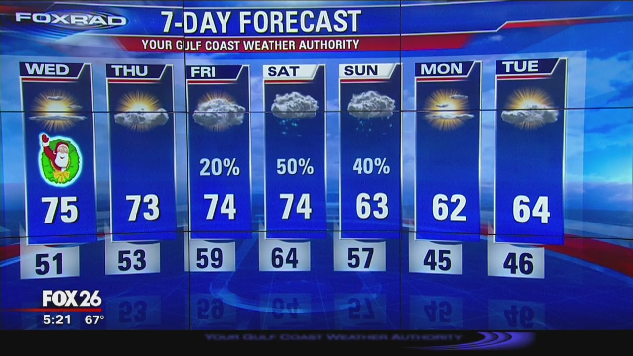
Gulf Coast Weather Authority 5 p.m. Forecast
Our unseasonably warm weather will continue into Christmas with temperatures rising, once again, into the low and mid-70s. Our next rain chance arrives late Friday, but a better shot comes on Saturday and Sunday as a cold front sweeps through the area.
Our unseasonably warm weather will continue into Christmas with temperatures rising, once again, into the low and mid-70s. Our next rain chance arrives late Friday, but a better shot comes on Saturday and Sunday as a cold front sweeps through the area.
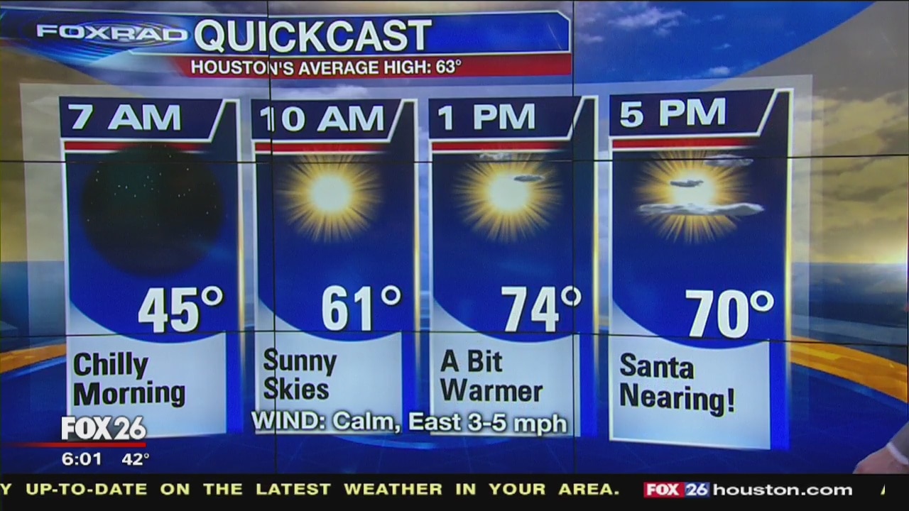
Tuesday morning weather forecast
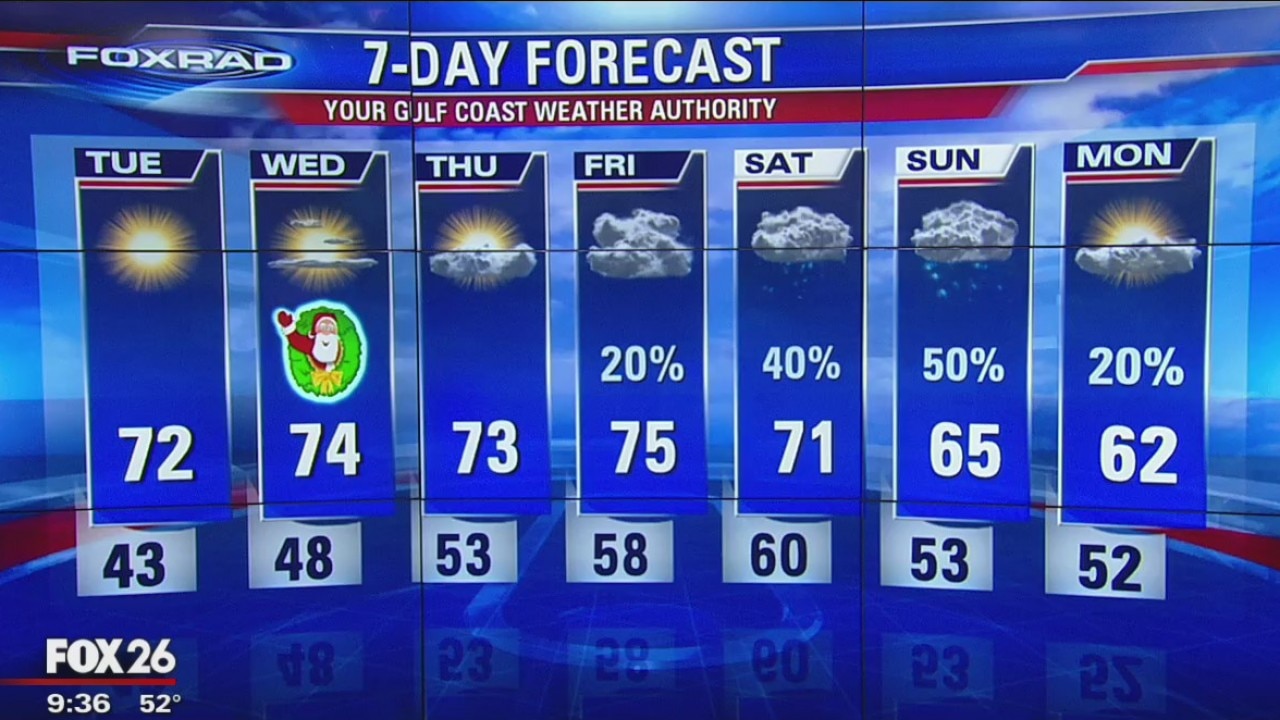
FOX 26 Meteorologist Stephen Morgan says after warming to 71? on Monday in Houston, Tuesday will feel like another Spring-like afternoon. Our unseasonably warm weather will continue into Christmas with temperatures rising, once again, into the low and mid-70s. Our next rain chance arrives late Friday, but a better shot comes on Saturday and Sunday as a cold front sweeps through the area.
FOX 26 Meteorologist Stephen Morgan says after warming to 71? on Monday in Houston, Tuesday will feel like another Spring-like afternoon. Our unseasonably warm weather will continue into Christmas with temperatures rising, once again, into the low and mid-70s. Our next rain chance arrives late Friday, but a better shot comes on Saturday and Sunday as a cold front sweeps through the area.
Monday Night Weather Update
Look for Christmas Eve Day to have highs in the lower 70s and Christmas Day in the mid 70s. The quiet weather continues until the weekend with a front bringing rain and cooler temperatures.
Look for Christmas Eve Day to have highs in the lower 70s and Christmas Day in the mid 70s. The quiet weather continues until the weekend with a front bringing rain and cooler temperatures.

Monday Evening Weather Update
Lows will dip into the 40s essentially every morning. Rain chances will begin to go up as we near the weekend, with multiple opportunities for showers this coming weekend.
Lows will dip into the 40s essentially every morning. Rain chances will begin to go up as we near the weekend, with multiple opportunities for showers this coming weekend.
Monday afternoon weather forecast
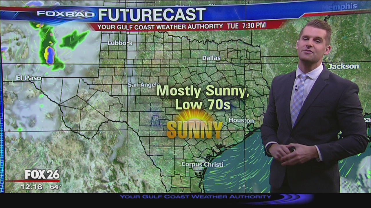
FOX 26 Meteorologist says our pattern of dry weather will continue as we head toward Christmas. Temperatures will gradually warm throughout the week, with highs in the mid-70s for Christmas. Lows will dip into the 40s essentially every morning. Rain chances will begin to go up as we near the weekend, with multiple opportunities for showers this coming weekend.
FOX 26 Meteorologist says our pattern of dry weather will continue as we head toward Christmas. Temperatures will gradually warm throughout the week, with highs in the mid-70s for Christmas. Lows will dip into the 40s essentially every morning. Rain chances will begin to go up as we near the weekend, with multiple opportunities for showers this coming weekend.
Monday morning weather forecast
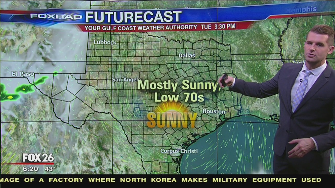
Meteorologist Stephen Morgan says our pattern of dry weather will continue as we head toward Christmas. Temperatures will gradually warm throughout the week, with highs in the mid-70s for Christmas. Lows will dip into the 40s essentially every morning. Rain chances will begin to go up as we near the weekend, with multiple opportunities for showers this coming weekend.
Meteorologist Stephen Morgan says our pattern of dry weather will continue as we head toward Christmas. Temperatures will gradually warm throughout the week, with highs in the mid-70s for Christmas. Lows will dip into the 40s essentially every morning. Rain chances will begin to go up as we near the weekend, with multiple opportunities for showers this coming weekend.

Evening Gulf Coast Weather Authority Forecast with John Dawson
We are recovering from a cold weekend and a warmer week is ahead.
We are recovering from a cold weekend and a warmer week is ahead.
FoxRad Forecast 12/22
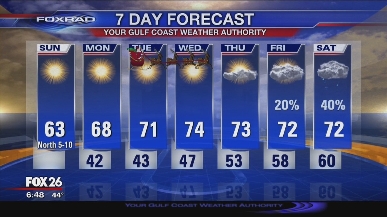
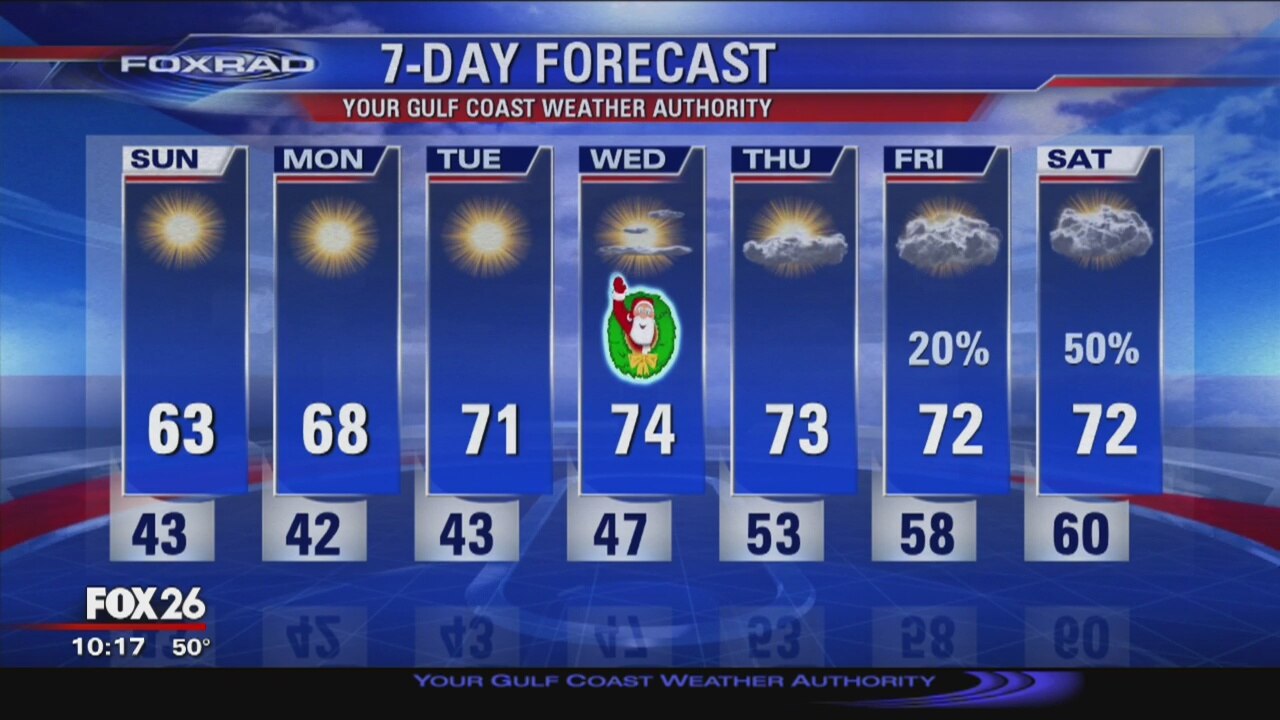
After a chilly start to Sunday, the sun will help warm us into the low 60s. A warming trend will continue as we head through Christmas. Next rain chance doesn't arrive until Friday into Saturday.
After a chilly start to Sunday, the sun will help warm us into the low 60s. A warming trend will continue as we head through Christmas. Next rain chance doesn't arrive until Friday into Saturday.
Evening Gulf Coast Weather with Meteorologist John Dawson
The weather was slightly wet this Saturday, but expect a brighter ending tomorrow!
The weather was slightly wet this Saturday, but expect a brighter ending tomorrow!