

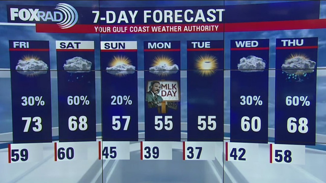
Thursday Evening Weather Update
A much stronger cold front arrives on Saturday afternoon and chilly, breezy weather will affect the Houston Marathon and the MLK Day holiday.
A much stronger cold front arrives on Saturday afternoon and chilly, breezy weather will affect the Houston Marathon and the MLK Day holiday.
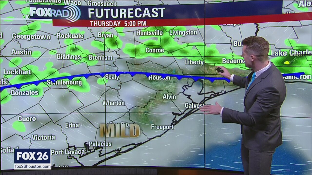
Thursday afternoon weather forecast
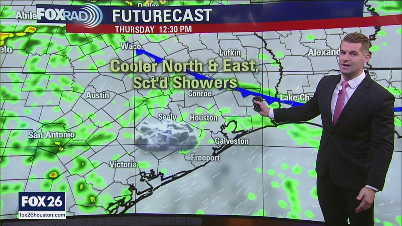
A weak cold front will move in this afternoon and is expected to stall around I-10 or so. Scattered showers and storms are possible with highs in the upper 60s north and upper 70s south of Houston. A much stronger cold front arrives on Saturday afternoon and chilly, breezy weather will affect the Houston Marathon and the MLK Day holiday.
A weak cold front will move in this afternoon and is expected to stall around I-10 or so. Scattered showers and storms are possible with highs in the upper 60s north and upper 70s south of Houston. A much stronger cold front arrives on Saturday afternoon and chilly, breezy weather will affect the Houston Marathon and the MLK Day holiday.

Thursday morning weather forecast
A weak cold front will move in this afternoon and is expected to stall around I-10 or so. Scattered showers and storms are possible with highs in the upper 60s north and upper 70s south of Houston. A much stronger cold front arrives on Saturday afternoon and chilly, breezy weather will affect the Houston Marathon and the MLK Day holiday.
A weak cold front will move in this afternoon and is expected to stall around I-10 or so. Scattered showers and storms are possible with highs in the upper 60s north and upper 70s south of Houston. A much stronger cold front arrives on Saturday afternoon and chilly, breezy weather will affect the Houston Marathon and the MLK Day holiday.
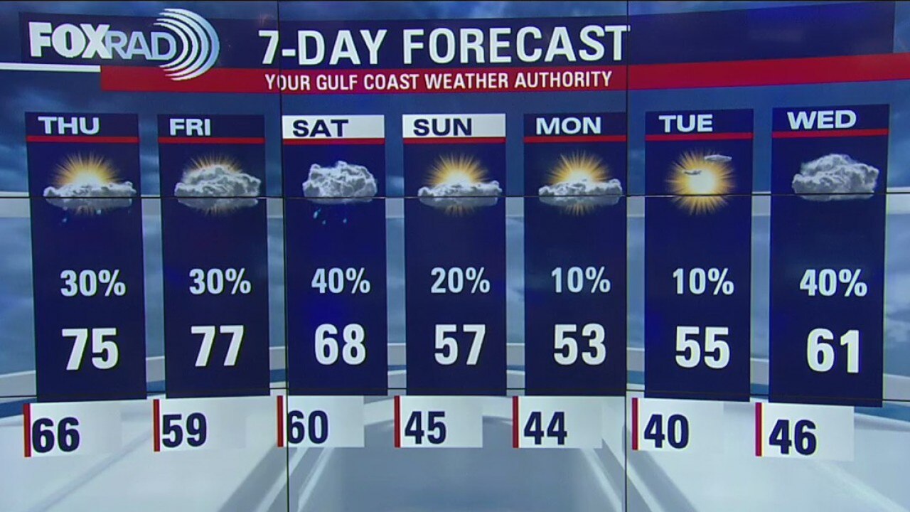
Wednesday Night Weather Update
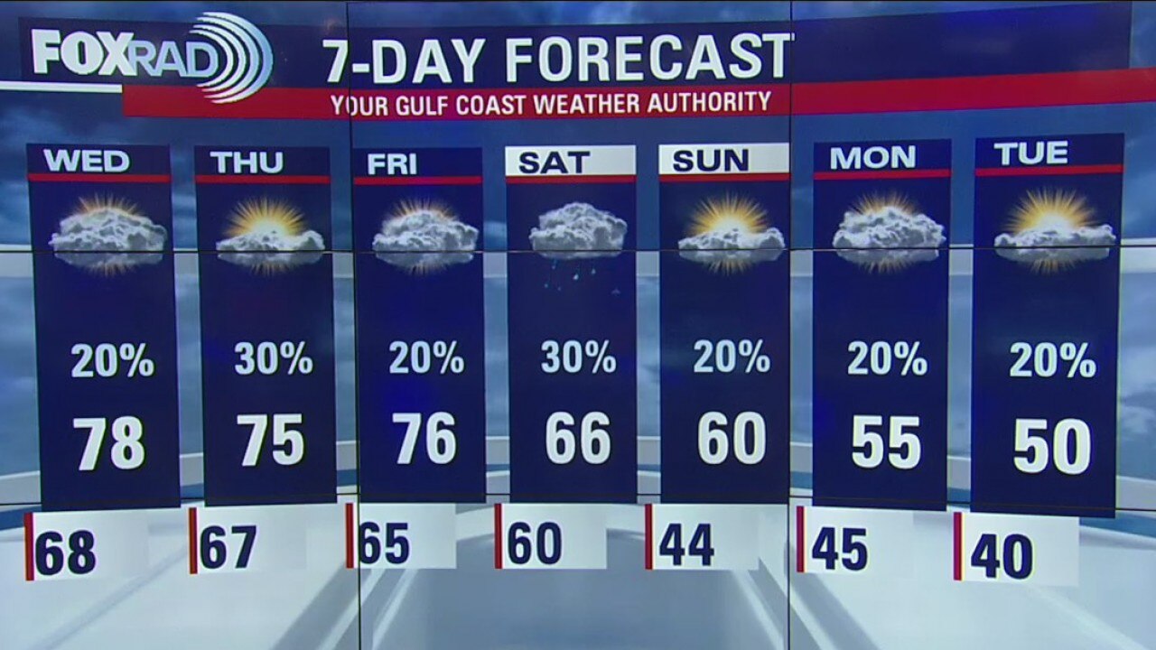
A short-lived front could cool down areas northeast of Houston tomorrow, but overall we?ll remain warm until a late Saturday cold front. The MLK Day holiday looks chilly.
A short-lived front could cool down areas northeast of Houston tomorrow, but overall we?ll remain warm until a late Saturday cold front. The MLK Day holiday looks chilly.
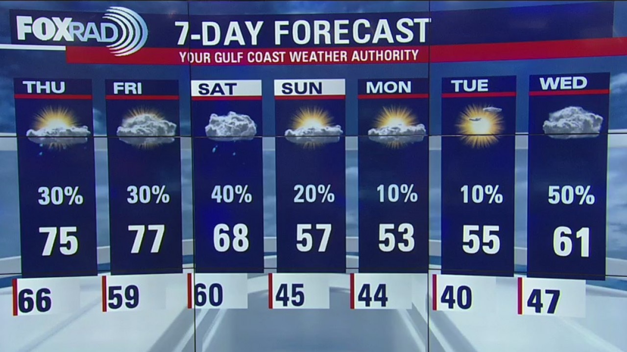
Wednesday Evening Weather Update
A short-lived front could cool down areas northeast of Houston tomorrow, but overall we?ll remain warm until a late Saturday cold front.
A short-lived front could cool down areas northeast of Houston tomorrow, but overall we?ll remain warm until a late Saturday cold front.
Wednesday afternoon weather forecast
Unseasonably warm and humid weather will continue today and record highs are possible. The record for today is 79 in Houston and 75 for Galveston and both are in jeopardy. A short-lived front could cool down areas northeast of Houston tomorrow, but overall we’ll remain warm until a late Saturday cold front. The Martin Luther King Day holiday looks chilly.
Unseasonably warm and humid weather will continue today and record highs are possible. The record for today is 79 in Houston and 75 for Galveston and both are in jeopardy. A short-lived front could cool down areas northeast of Houston tomorrow, but overall we’ll remain warm until a late Saturday cold front. The Martin Luther King Day holiday looks chilly.

Wednesday morning weather forecast
Unseasonably warm and humid weather will continue today and record highs are possible. The record for today is 79 in Houston and 75 for Galveston and both are in jeopardy. A short-lived front could cool down areas northeast of Houston tomorrow, but overall we?ll remain warm until a late Saturday cold front. The Martin Luther King Day holiday looks chilly.
Unseasonably warm and humid weather will continue today and record highs are possible. The record for today is 79 in Houston and 75 for Galveston and both are in jeopardy. A short-lived front could cool down areas northeast of Houston tomorrow, but overall we?ll remain warm until a late Saturday cold front. The Martin Luther King Day holiday looks chilly.
Tuesday Night Weather Update
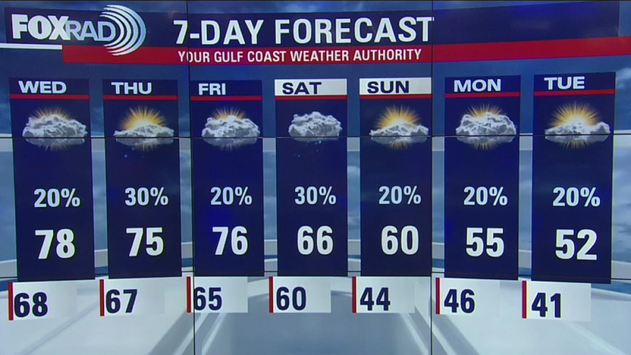
We are in a stable weather pattern of soggy conditions. Fog, warm temps and an occasional shower will take us up to Friday and that's when a front will arrive. The weekend will be cooler and it will be even more so next week.
We are in a stable weather pattern of soggy conditions. Fog, warm temps and an occasional shower will take us up to Friday and that's when a front will arrive. The weekend will be cooler and it will be even more so next week.
Tuesday Evening Weather Update
Temperatures will remain mild throughout the rest of the week.
Temperatures will remain mild throughout the rest of the week.
Tuesday afternoon weather forecast
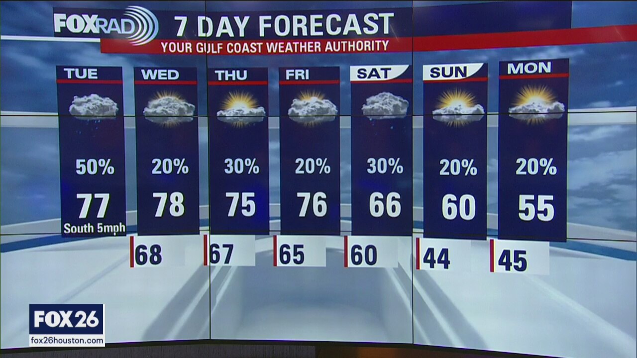
Temperatures will warm throughout the day, even with clouds, into the mid 70s. We won't be cooling off all that much this evening and fog will likely develop again tonight.
Temperatures will warm throughout the day, even with clouds, into the mid 70s. We won't be cooling off all that much this evening and fog will likely develop again tonight.
Tuesday morning weather forecast
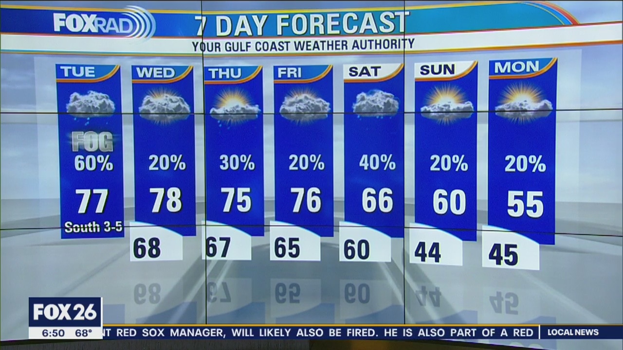
We were dreary on Monday and Tuesday is looking the same, just with more fog and slightly milder temperatures. A dense fog advisory remains in effect for the entire viewing area until 10AM. Patches of drizzle will be around throughout the day with a chance for showers, even an isolated thunderstorm. Temperatures will warm throughout the day, even with clouds, into the mid 70s. We won't be cooling off all that much this evening and fog will likely develop again tonight.
We were dreary on Monday and Tuesday is looking the same, just with more fog and slightly milder temperatures. A dense fog advisory remains in effect for the entire viewing area until 10AM. Patches of drizzle will be around throughout the day with a chance for showers, even an isolated thunderstorm. Temperatures will warm throughout the day, even with clouds, into the mid 70s. We won't be cooling off all that much this evening and fog will likely develop again tonight.

Monday Night Weather Update
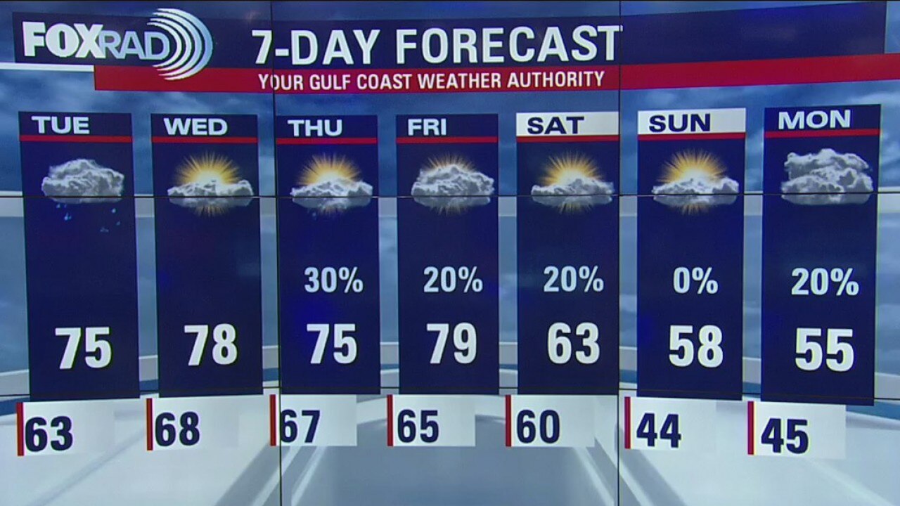
Afternoon highs will reach the mid to upper 70s for the rest of the week, and rain will taper off after tomorrow.
Afternoon highs will reach the mid to upper 70s for the rest of the week, and rain will taper off after tomorrow.
Monday Evening Weather Update
Following a chilly weekend, gulf moisture and milder air will return this week and bring showers with it.
Following a chilly weekend, gulf moisture and milder air will return this week and bring showers with it.
Monday afternoon weather forecast
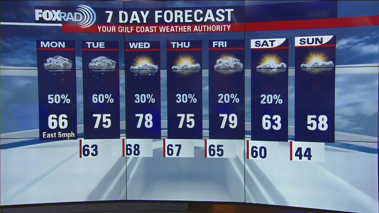
Following a chilly weekend, gulf moisture and milder air will return this week and bring showers with it. Afternoon highs will reach the mid to upper 60s today and the mid to upper 70s for the rest of the week. The rainiest days should be today and Tuesday.
Following a chilly weekend, gulf moisture and milder air will return this week and bring showers with it. Afternoon highs will reach the mid to upper 60s today and the mid to upper 70s for the rest of the week. The rainiest days should be today and Tuesday.
Monday morning weather forecast
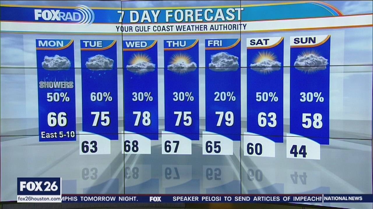
Following a chilly weekend, gulf moisture and milder air will return this week and bring showers with it. Afternoon highs will reach the mid to upper 60s today and the mid to upper 70s for the rest of the week. The rainiest days should be today and Tuesday.
Following a chilly weekend, gulf moisture and milder air will return this week and bring showers with it. Afternoon highs will reach the mid to upper 60s today and the mid to upper 70s for the rest of the week. The rainiest days should be today and Tuesday.
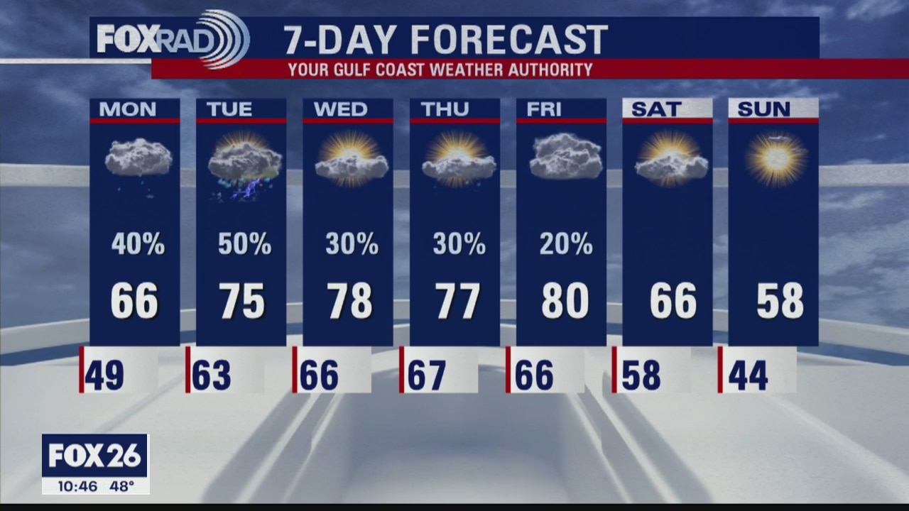
Your Evening Gulf Coast Weather Forecast
Cloudy, warm and humid weather expected for most of this week. We?ll have patchy fog most mornings. Look for a cold front at the end of the week to help clear things out for next weekend.
Cloudy, warm and humid weather expected for most of this week. We?ll have patchy fog most mornings. Look for a cold front at the end of the week to help clear things out for next weekend.
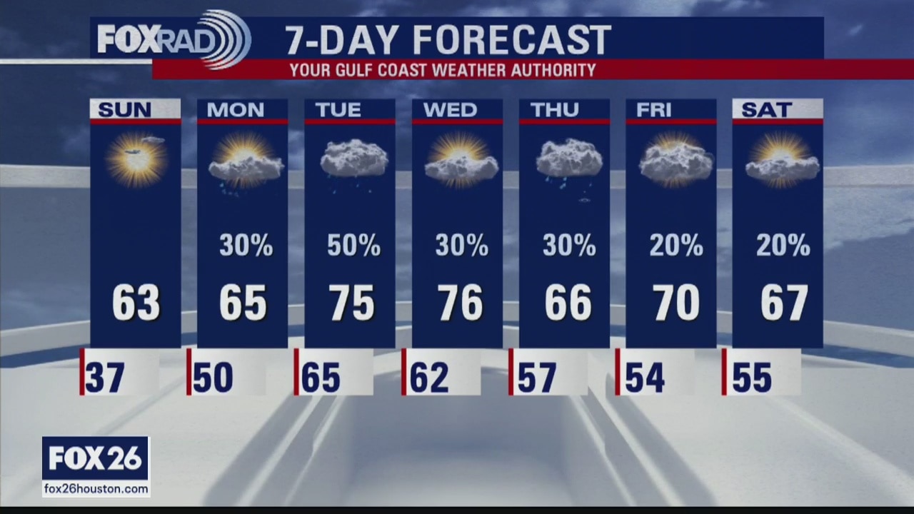
Your 5 p.m. Gulf Coast Weather Forecast
Cloudy, windy and warm with highs in the upper 70s. Scattered showers are possible through early afternoon, then isolated strong storms during the late afternoon and a line of severe storms overnight.
Cloudy, windy and warm with highs in the upper 70s. Scattered showers are possible through early afternoon, then isolated strong storms during the late afternoon and a line of severe storms overnight.

Fox 26 Morning News Weekends 5:00 a.m.
After a night of storms, the weekend is looking dry just cool. Strong northwest winds will dominate our weather on Saturday with temps only reaching the mid 50s this afternoon. Rain chances begin to increase on Monday.
After a night of storms, the weekend is looking dry just cool. Strong northwest winds will dominate our weather on Saturday with temps only reaching the mid 50s this afternoon. Rain chances begin to increase on Monday.
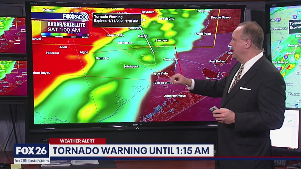
Severe Weather Update
Chief Meteorologist Dr. Jim Siebert gives you the latest on storms rolling through the Houston area.
Chief Meteorologist Dr. Jim Siebert gives you the latest on storms rolling through the Houston area.

Continuing coverage of Friday night storms
Dr. Jim Siebert brings you the latest as a Tornado Warning in Harris County expires.
Dr. Jim Siebert brings you the latest as a Tornado Warning in Harris County expires.