

Getting close to triple digits again
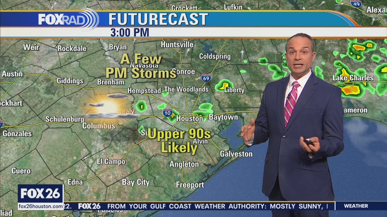
August began with a very "normal" day as highs reached our exact average temperature of 96 with a typical coverage of scattered showers. Now, today and tomorrow are looking a bit hotter with highs closer to 100 and fewer storms, especially Wednesday. The overall pattern favors the return of more cloud cover and higher chances of rain heading into Friday and Saturday.
August began with a very "normal" day as highs reached our exact average temperature of 96 with a typical coverage of scattered showers. Now, today and tomorrow are looking a bit hotter with highs closer to 100 and fewer storms, especially Wednesday. The overall pattern favors the return of more cloud cover and higher chances of rain heading into Friday and Saturday.

Tuesday morning weather forecast
The first week of August is looking like you would expect it to look in Houston. It's nice to see some "normal" temperatures in the forecast. Wednesday will be the driest, but hottest, day of the week if you are planning for outdoor activities. Expect higher rain chances around for next weekend.
The first week of August is looking like you would expect it to look in Houston. It's nice to see some "normal" temperatures in the forecast. Wednesday will be the driest, but hottest, day of the week if you are planning for outdoor activities. Expect higher rain chances around for next weekend.
Monday evening weather forecast
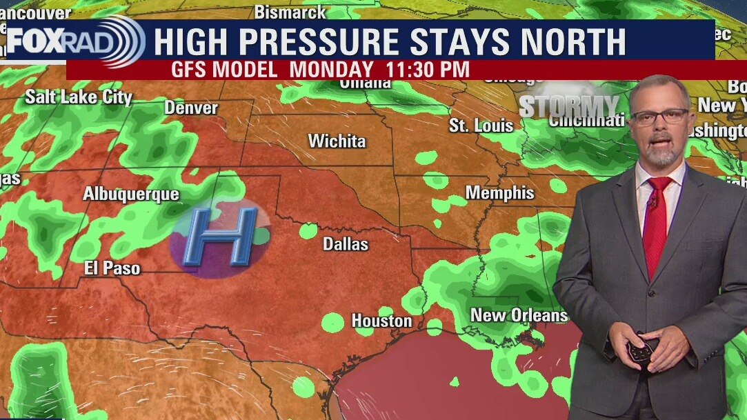
The first week of August is looking like you would expect it to look in Houston. It's nice to see some "normal" temperatures in the forecast. Wednesday will be the driest, but hottest, day of the week if you are planning for outdoor activities. Expect higher rain chances around for next weekend.
The first week of August is looking like you would expect it to look in Houston. It's nice to see some "normal" temperatures in the forecast. Wednesday will be the driest, but hottest, day of the week if you are planning for outdoor activities. Expect higher rain chances around for next weekend.
"Normal" looking week with some storms
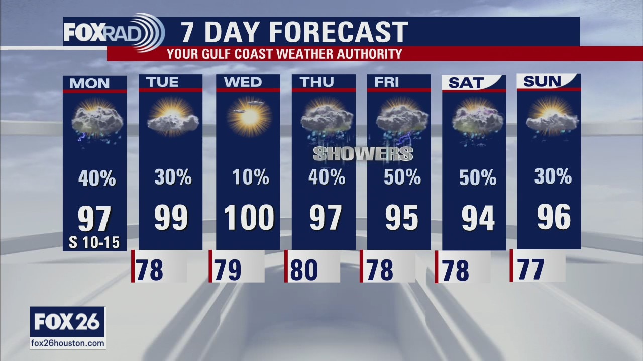
This week looks pretty "normal", which is a good thing after the warmest July on record for Houston, Galveston, and College Station. Hit and miss storms are likely this afternoon with maximum temps in the mid to upper 90s. Most days this week bring a chance for scattered storms with the highest chance on Friday and the lowest chance on Wednesday.
This week looks pretty "normal", which is a good thing after the warmest July on record for Houston, Galveston, and College Station. Hit and miss storms are likely this afternoon with maximum temps in the mid to upper 90s. Most days this week bring a chance for scattered storms with the highest chance on Friday and the lowest chance on Wednesday.
Partly cloudy, hot and humid Monday with scattered afternoon storms
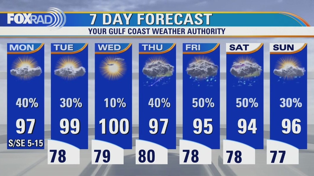
This week looks pretty "normal", which is a good thing after the warmest July on record for Houston, Galveston and College Station. Hit and miss storms are likely this afternoon with maximum temps in the mid to upper 90s. Most days this week bring a chance for scattered storms with the highest chance on Friday and the lowest chance on Wednesday.
This week looks pretty "normal", which is a good thing after the warmest July on record for Houston, Galveston and College Station. Hit and miss storms are likely this afternoon with maximum temps in the mid to upper 90s. Most days this week bring a chance for scattered storms with the highest chance on Friday and the lowest chance on Wednesday.
Sunday night leading into Monday morning weather forecast
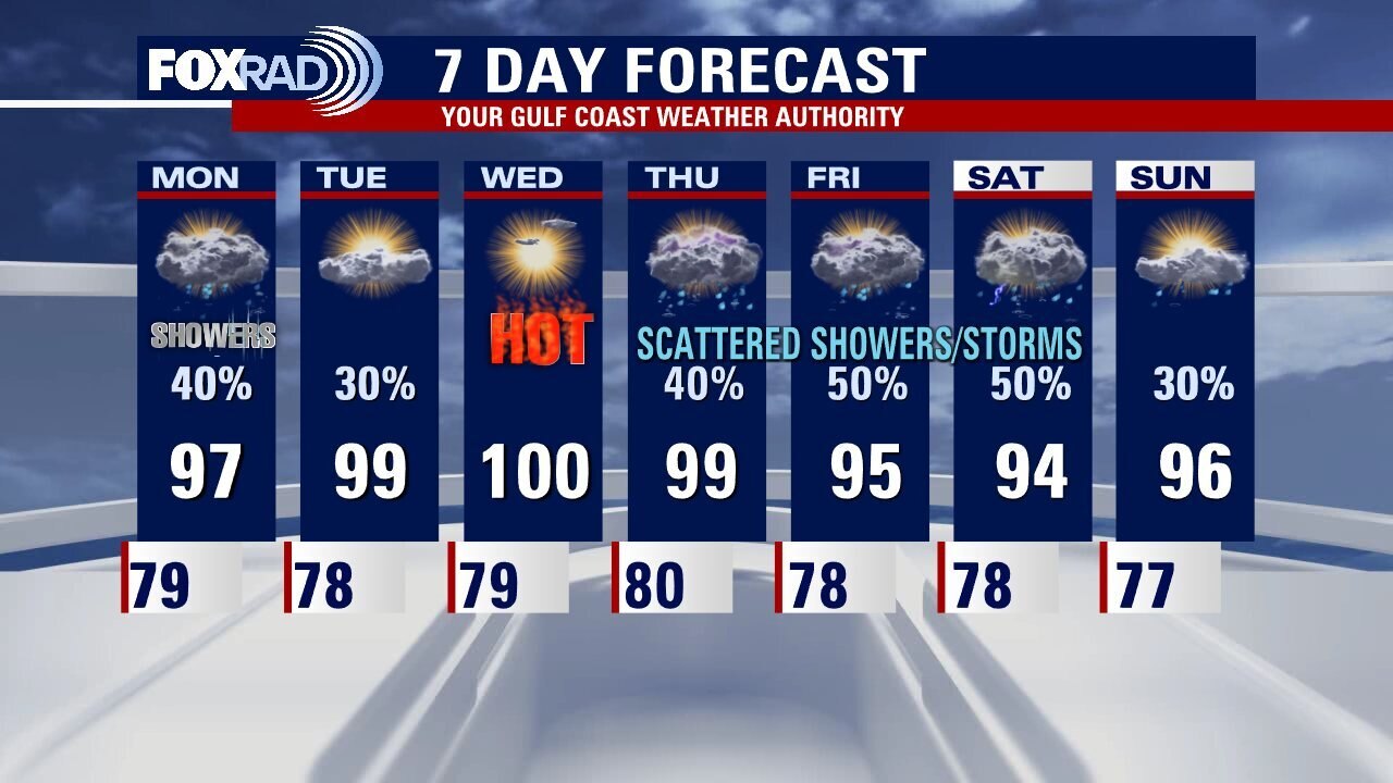
Monday could bring some scattered downpours around the Houston area but a ridge of high pressure builds back in and takes control as we move through the week. That will make Wednesday the hottest day of the week with less chance for rain. Some Gulf moisture, along with less stability in Southeast Texas will bring higher chances for rain and slightly cooler temperatures for the end of the week and start of the weekend.
Monday could bring some scattered downpours around the Houston area but a ridge of high pressure builds back in and takes control as we move through the week. That will make Wednesday the hottest day of the week with less chance for rain. Some Gulf moisture, along with less stability in Southeast Texas will bring higher chances for rain and slightly cooler temperatures for the end of the week and start of the weekend.

Sunday Morning Forecast with Meteorologist Lena Maria Arango
Saharan Dust will lead to hazy, dry conditions today with some cloudy intervals and only a very isolated shower or storm popping up. The Monday morning commute could be fairly soggy, especially south of I-10 with showers and storms spreading inland throughout the afternoon. As a ridge of high pressure builds, we'll get hotter and drier midweek with areas north and west topping out in the triple digits but the metro should stay in the upper 90s. An inverted trough looks to push westward through the Gulf late week, bringing us better rain chances and a decrease in temperatures with rounds of showers and storms each day.
Saharan Dust will lead to hazy, dry conditions today with some cloudy intervals and only a very isolated shower or storm popping up. The Monday morning commute could be fairly soggy, especially south of I-10 with showers and storms spreading inland throughout the afternoon. As a ridge of high pressure builds, we'll get hotter and drier midweek with areas north and west topping out in the triple digits but the metro should stay in the upper 90s. An inverted trough looks to push westward through the Gulf late week, bringing us better rain chances and a decrease in temperatures with rounds of showers and storms each day.
Tropical Weather Forecast - July 30, 2022
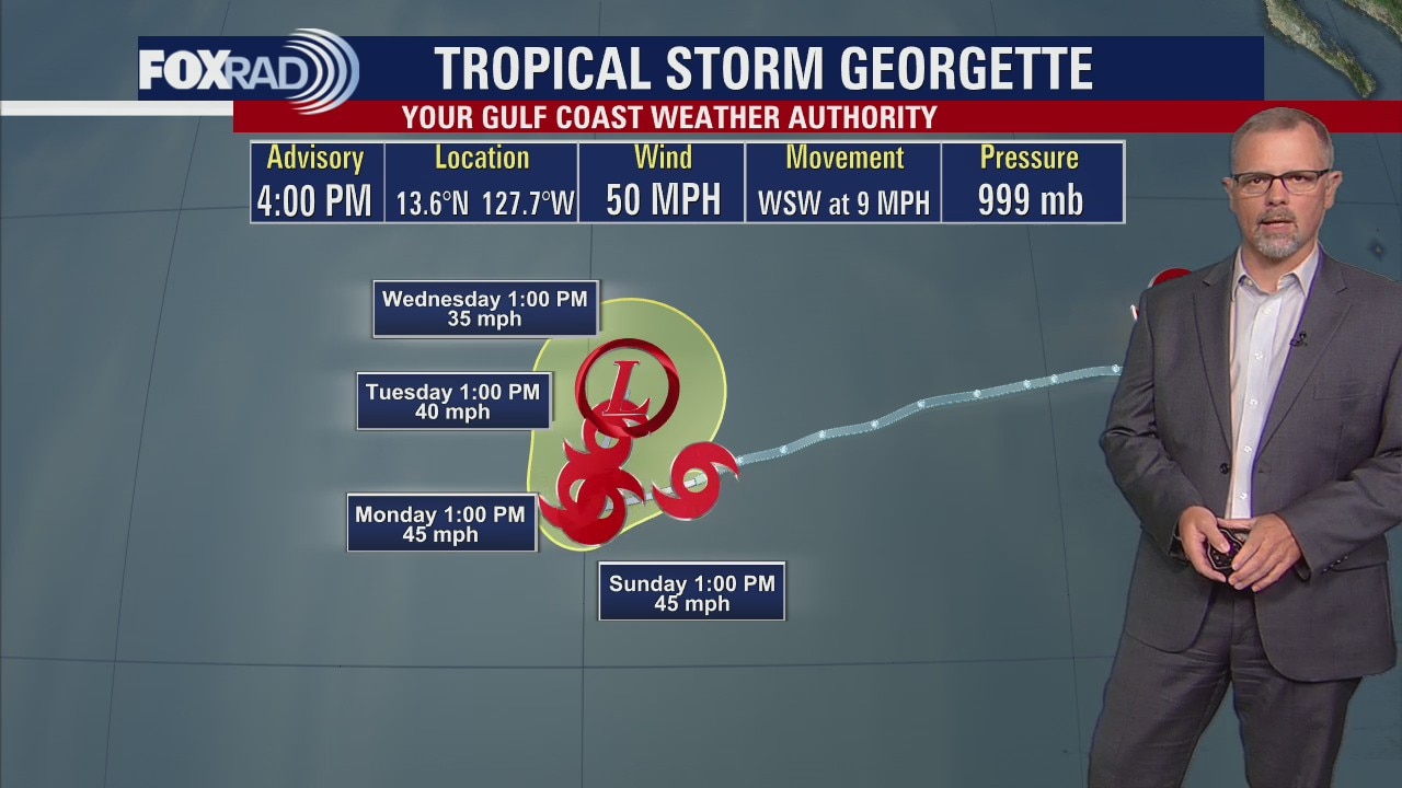
The Atlantic remains quiet except for some Saharan Dust. The Pacific Basin still has a hurricane and tropical storm to discuss.
The Atlantic remains quiet except for some Saharan Dust. The Pacific Basin still has a hurricane and tropical storm to discuss.
Saturday Morning Forecast with Meteorologist Lena Maria Arango
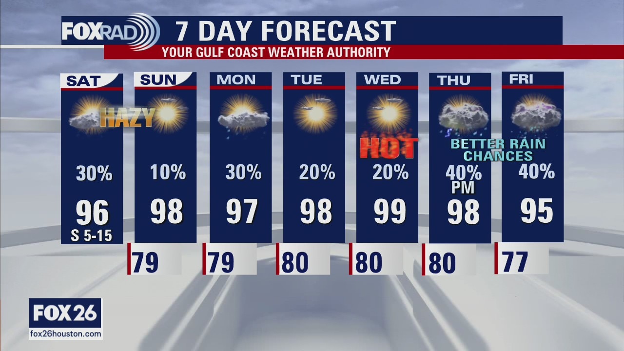
Saturday will be the soggier of the two weekend days, with Saharan Dust moving in by Sunday. Expect more sun, warmer temps, and slightly hazy skies from the presence of that dust on Sunday. Next week starts above average, with minimal rain chances as another heat dome builds. Thankfully, it's short-lived. The heat will peak on Wednesday, and then another disturbance looks to arrive by the end of the week with promising rain chances that will bring our temperatures back closer to normal heading into the weekend.
Saturday will be the soggier of the two weekend days, with Saharan Dust moving in by Sunday. Expect more sun, warmer temps, and slightly hazy skies from the presence of that dust on Sunday. Next week starts above average, with minimal rain chances as another heat dome builds. Thankfully, it's short-lived. The heat will peak on Wednesday, and then another disturbance looks to arrive by the end of the week with promising rain chances that will bring our temperatures back closer to normal heading into the weekend.
Saturday morning weather forecast
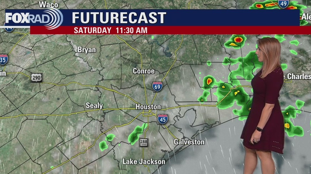
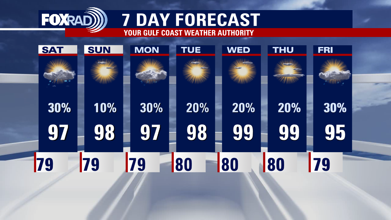
Temperatures will be trending a touch hotter this weekend, with highs climbing into the upper 90s and feels like temperatures soaring into the 102-107 range. A few isolated showers and thunderstorms will be possible but the coverage looks to be very spotty both Saturday and Sunday. Daily scattered storm chances continue into next week with temperatures staying toasty.
Temperatures will be trending a touch hotter this weekend, with highs climbing into the upper 90s and feels like temperatures soaring into the 102-107 range. A few isolated showers and thunderstorms will be possible but the coverage looks to be very spotty both Saturday and Sunday. Daily scattered storm chances continue into next week with temperatures staying toasty.
Friday evening weather forecast with Meteorologist Adrienne Vonn
Temperatures will be trending a touch hotter this weekend, with highs climbing into the upper 90s and feels like temperatures soaring into the 102-107 range. A few isolated showers and thunderstorms will be possible but the coverage looks to be very spotty both Saturday and Sunday. Daily scattered storm chances continue into next week with temperatures staying toasty.
Temperatures will be trending a touch hotter this weekend, with highs climbing into the upper 90s and feels like temperatures soaring into the 102-107 range. A few isolated showers and thunderstorms will be possible but the coverage looks to be very spotty both Saturday and Sunday. Daily scattered storm chances continue into next week with temperatures staying toasty.
Friday afternoon weather forecast with Meteorologist Lena Maria Arango
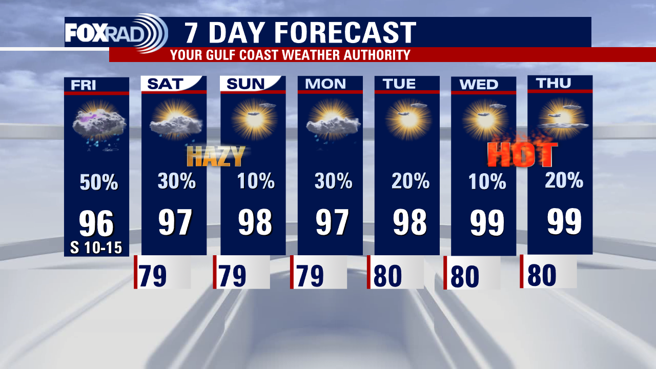
Decent shots at rain continue today, hopefully, the third time is a charm if you haven't picked up anything within the last two days! We'll also continue to enjoy slightly cooler temperatures. Over the weekend, some light Saharan dust will move in at upper levels which will decrease rain chances and cause some hazy milky skies. Another ridge of high pressure looks to build next week that will suppress rain chances with temperatures once again on the rise. Though we may get close to triple digits and heat advisory criteria in some spots, most of us look to stay below that for an extended period.
Decent shots at rain continue today, hopefully, the third time is a charm if you haven't picked up anything within the last two days! We'll also continue to enjoy slightly cooler temperatures. Over the weekend, some light Saharan dust will move in at upper levels which will decrease rain chances and cause some hazy milky skies. Another ridge of high pressure looks to build next week that will suppress rain chances with temperatures once again on the rise. Though we may get close to triple digits and heat advisory criteria in some spots, most of us look to stay below that for an extended period.
Partly cloudy, hot and humid Friday with scattered afternoon storms
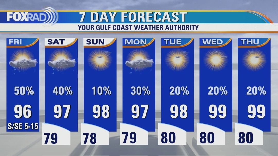
Following two days of some nice scattered downpours, we'll have a good chance for more today. Some isolated amounts of 1-2" are likely, but away from downpours, look for typical summer mugginess. For the weekend, chances for rain are higher on Saturday, then highs could hit the upper 90s on Sunday. In general a very warm, humid pattern should return for most of next week.
Following two days of some nice scattered downpours, we'll have a good chance for more today. Some isolated amounts of 1-2" are likely, but away from downpours, look for typical summer mugginess. For the weekend, chances for rain are higher on Saturday, then highs could hit the upper 90s on Sunday. In general a very warm, humid pattern should return for most of next week.
Friday morning weather forecast
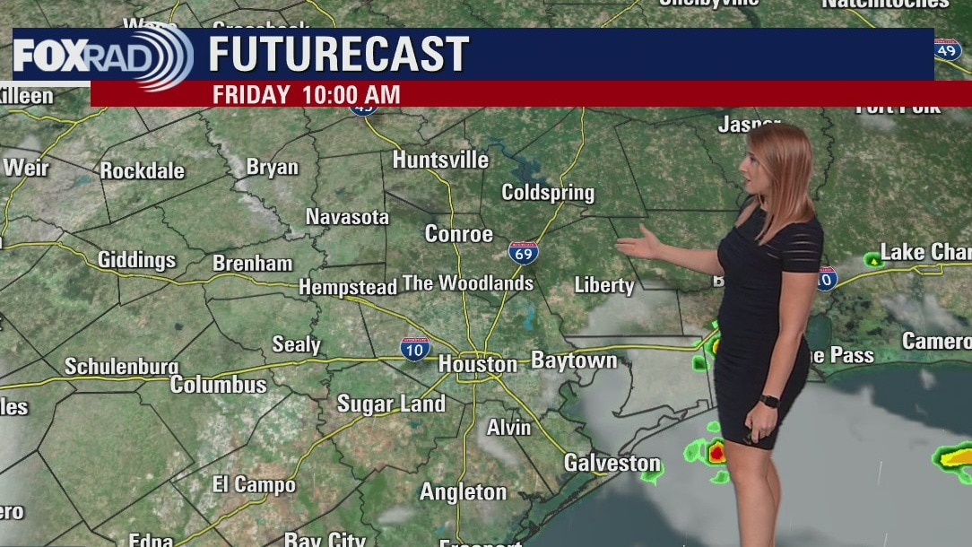
We are wrapping up the week with a few afternoon scattered showers and storms. The weekend is trending drier with temperatures heating up into the upper 90s and feels like temperatures soaring over 100. Hit and miss storms will be possible heading into next week with temperatures staying toasty.
We are wrapping up the week with a few afternoon scattered showers and storms. The weekend is trending drier with temperatures heating up into the upper 90s and feels like temperatures soaring over 100. Hit and miss storms will be possible heading into next week with temperatures staying toasty.

Thursday evening weather forecast with Meteorologist Adrienne Vonn
We are wrapping up the week tomorrow with a few afternoon scattered showers and storms. The weekend is trending drier with temperatures heating up into the upper 90s and feels like temperatures soaring over 100. Hit and miss storms will be possible heading into next week with temperatures staying toasty.
We are wrapping up the week tomorrow with a few afternoon scattered showers and storms. The weekend is trending drier with temperatures heating up into the upper 90s and feels like temperatures soaring over 100. Hit and miss storms will be possible heading into next week with temperatures staying toasty.
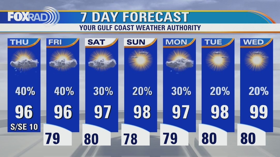
Hot and humid Thursday with isolated afternoon storms
The big area of high pressure known as a heat dome has finally shifted a bit and a broad area of low pressure is overhead, so this is good news. Due to the pattern change, we'll have a decent chance for scattered showers and storm each day and today should bring a few nice downpours. Aside from the hit and miss storms, we expect normal late-July heat with highs in the mid to upper 90s.
The big area of high pressure known as a heat dome has finally shifted a bit and a broad area of low pressure is overhead, so this is good news. Due to the pattern change, we'll have a decent chance for scattered showers and storm each day and today should bring a few nice downpours. Aside from the hit and miss storms, we expect normal late-July heat with highs in the mid to upper 90s.
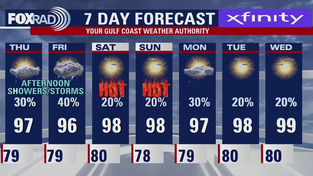
Thursday morning weather forecast
There is plenty of "hot" in the forecast but it is still nice to see Houston not expecting triple digits for the next 7 days. Look for scattered showers/storms to wrap up the work week with a couple hot and humid days for this weekend.
There is plenty of "hot" in the forecast but it is still nice to see Houston not expecting triple digits for the next 7 days. Look for scattered showers/storms to wrap up the work week with a couple hot and humid days for this weekend.

Wednesday evening weather forecast with Meteorologist John Dawson
There is plenty of "hot" in the forecast but it is still nice to see Houston not expecting triple digits for the next 7 days. Look for scattered showers/storms to wrap up the work week with a couple hot and humid days for this weekend.
There is plenty of "hot" in the forecast but it is still nice to see Houston not expecting triple digits for the next 7 days. Look for scattered showers/storms to wrap up the work week with a couple hot and humid days for this weekend.
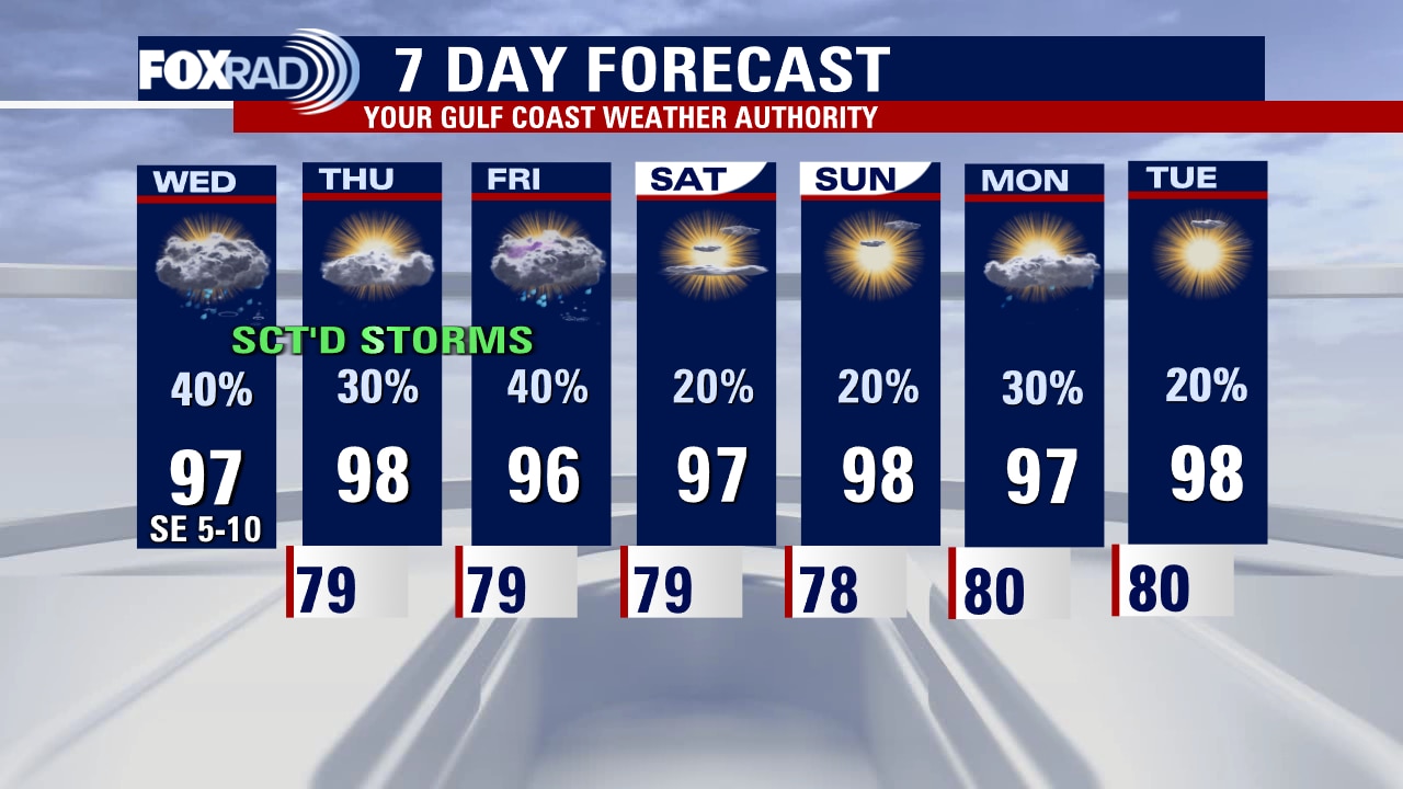
Wednesday afternoon weather forecast with Meteorologist Lena Maria Arango
The extended forecast features no triple digits and decent shots at rain -- with our best bet being today. Plan for scattered showers and storms to be around through the end of the work week, with a plume of Saharan dust trending us drier for the weekend. We look to stay below heat advisory criteria for the next week, though feels like values will still be above 100. The Tropical Atlantic remains very quiet, as the drought worsens across the state.
The extended forecast features no triple digits and decent shots at rain -- with our best bet being today. Plan for scattered showers and storms to be around through the end of the work week, with a plume of Saharan dust trending us drier for the weekend. We look to stay below heat advisory criteria for the next week, though feels like values will still be above 100. The Tropical Atlantic remains very quiet, as the drought worsens across the state.
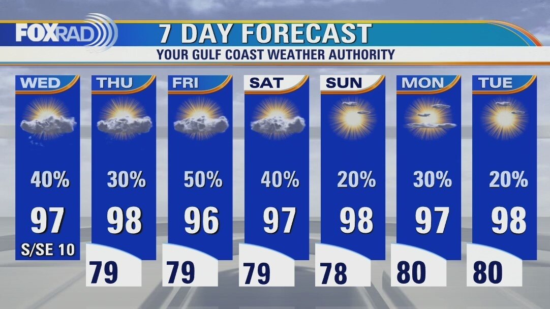
Isolated Wednesday morning showers, then hot with scattered late day storms
An upper-level disturbance in the gulf (not a tropical system) should help give us a wider coverage of rain today with a few decent downpours possible. The good news for our ongoing heat wave and drought is that there is a chance for at least hit and miss storms each of the next several days. There still is very little tropical activity in the Atlantic, Caribbean or Gulf.
An upper-level disturbance in the gulf (not a tropical system) should help give us a wider coverage of rain today with a few decent downpours possible. The good news for our ongoing heat wave and drought is that there is a chance for at least hit and miss storms each of the next several days. There still is very little tropical activity in the Atlantic, Caribbean or Gulf.