

Weather in Houston: Tropical Storm Warnings in effect for Brazoria, Matagorda County islands, coasts

Tropical Weather Update - Heavy rainfall expected south of Houston-area
FOX 26 Meteorologist Remeisha Shade has the latest on Potential Tropical Cyclone 1 as well as the latest rainfall forecast for the entire Houston area.
HOUSTON - Tropical Storm Warnings have been issued after the National Hurricane Center classified an area of low pressure as a potential tropical cyclone on Monday afternoon.
As of the 4 p.m. update on Tuesday afternoon, the Potential Tropical Cyclone #1 has 40 mile per hour winds and is moving north at six miles per hour.
The storm, which is currently located in the southwestern Gulf of Mexico will dump heavy amounts of rain across the area and cause dangerous winds along the coast.
As a result, the National Weather Service has issued a tropical storm warning for the Brazoria Islands, including Surfside Beach, along with Matagorda County, including Matagorda, Palacios, and Sargent.
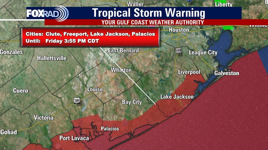
Strong tropical storm-force winds are expected within these areas within the next 36 hours.
Storm surge will also be an issue along the coast as there is a potential for the warned areas to see storm surge between two to four feet above ground within surge prone areas.
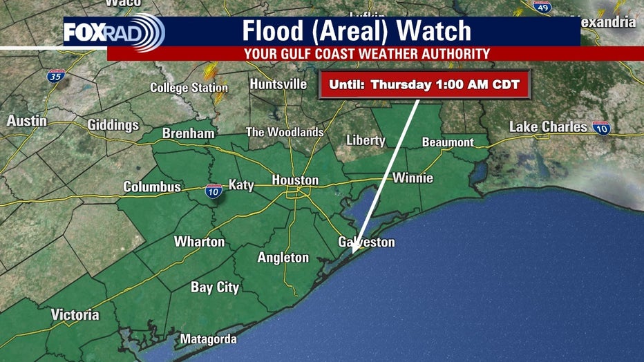
A coastal flood watch is in effect for Gulf-facing beaches from Matagorda Peninsula to Bolivar Peninsula, with significant flooding possible from Monday night through late Wednesday night.
Stay tuned to local weather updates and heed any warnings from authorities as the situation develops. Be sure to download the free FOX 26 Weather App and stay tuned to our smart TV app, FOX Local, on most TV's.