

See the photos: Before and after satellite images show aftermath of deadly earthquakes in Venezuela
Deadly doublet earthquakes strike Venezuela
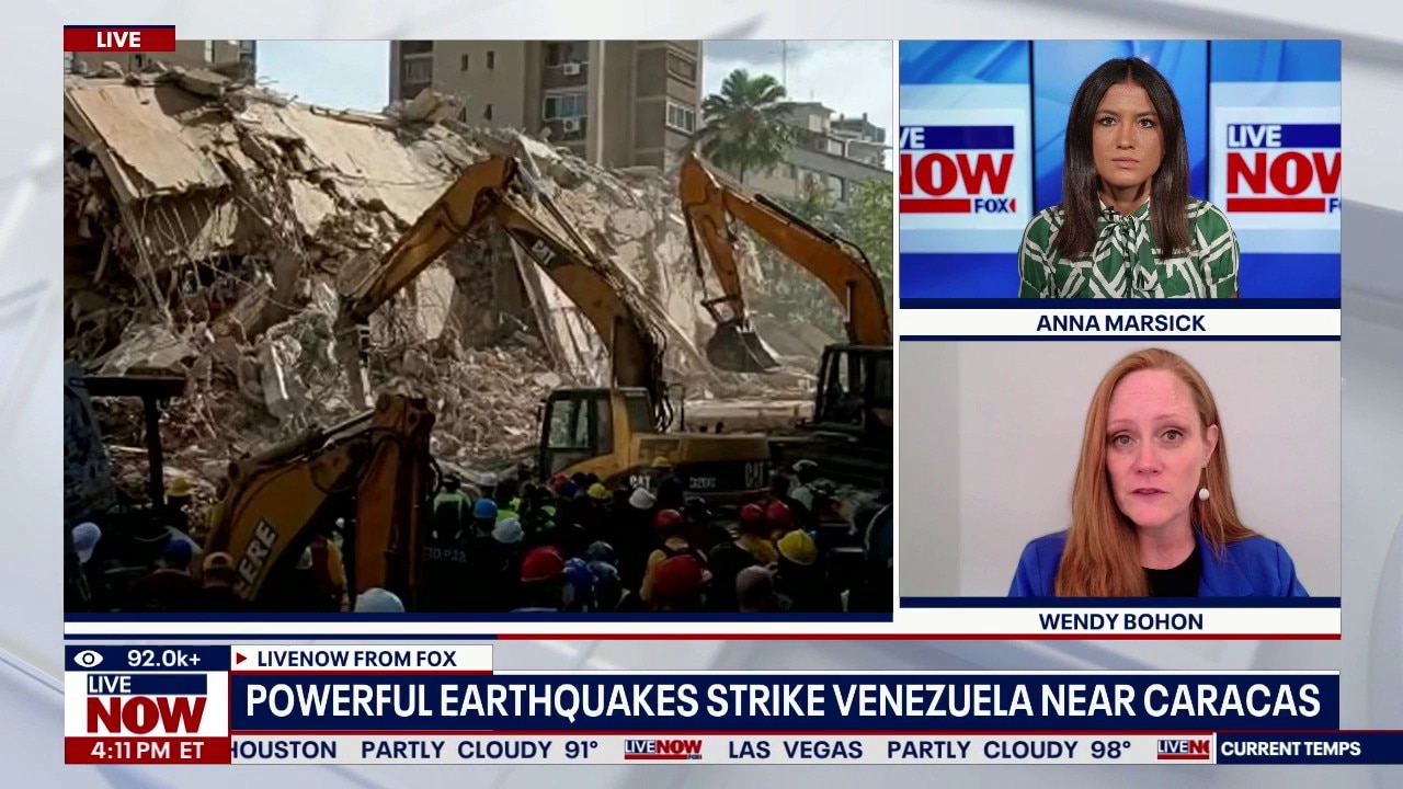
At least 188 people were killed and more than 940 injured after two major earthquakes struck Venezuela on Wednesday. The back-to-back earthquakes are called "doublet earthquakes," and they’re very rare. LiveNOW’s Anna Marsick spoke about the series of quakes and the situation in Venezuela with geologist Wendy Bohon.
After two massive earthquakes struck Venezuela back-to-back late Wednesday, satellite images of the aftermath show the devastation they left behind.
Deadly earthquakes strike Venezuela
The backstory:
On Wednesday evening, a 7.2 magnitude quake struck Venezuela, followed by a magnitude 7.5 just 39 seconds later.
The quakes toppled buildings in Venezuela’s capital, Caracas, and beyond.
By the numbers:
The death toll climbed to at least 920 and more than 51,000 missing on Friday.
The number of injured was estimated to be more than 3,300 as of midday and authorities said they had rescued 243 people.
The coastal region of La Guaira, which is north of Caracas, experienced some of the heaviest damage and casualties, officials said.
The International Organization for Migration said that up to 6.76 million people in Venezuela could be affected by the quakes, some 2 million of them in Caracas alone.
The Source: Information for this article was taken from The Associated Press and FOX Weather and satellite images from Vantor. This story was reported from San Jose.