

Tropical Depression Five in the Gulf: Tracker, warnings and watches, rain forecasts
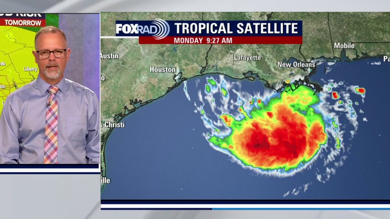
Update on Potential Tropical Cyclone 5
Meteorologist John Dawson is monitoring potential Tropical Cyclone 5 in the Gulf that could bring severe weather and heavy rain to the Houston-area on Tuesday.
HOUSTON - Though Monday will be hot and dry, we're expecting heavy rain on Tuesday as a tropical disturbance moves into the Gulf.
Tropical Depression Five
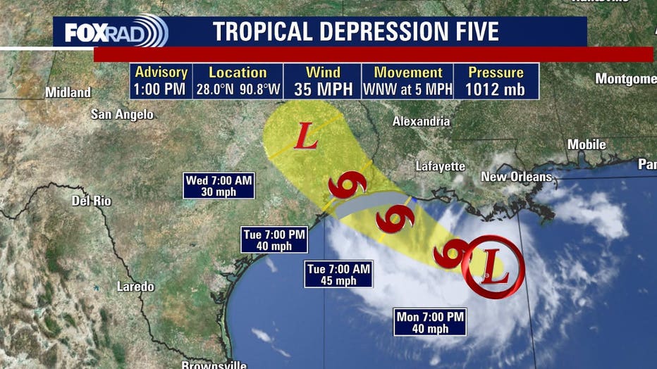
The disturbance has been upgraded to a Tropical Depression Five in the northern Gulf as of 1 p.m. Monday.
It is moving towards the west north-west at 5 mph and is expected to continue the general motion for the next day or two.
The Air Force Hurricane Hunters have data indicating the maximum sustained winds near 35 mph with higher gusts. According to the National Hurricane Center, the system is forecast to become a tropical storm.
Warnings and watches
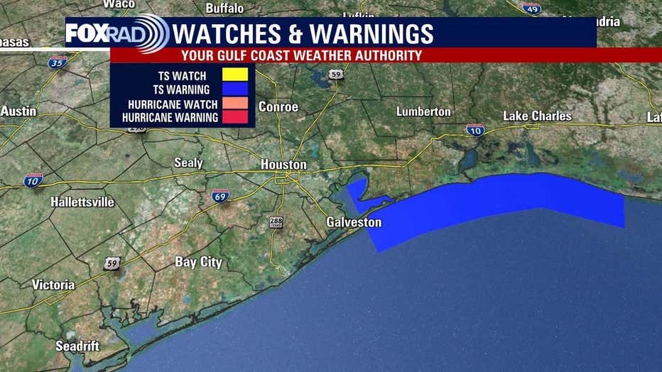
A Tropical Storm Warning has been issued from Port Bolivar, Texas to the Vermilion/Cameron Parish line in Louisiana.
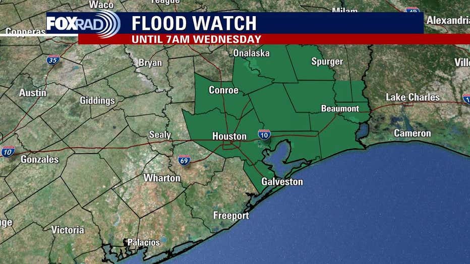
The National Weather Service states a flood watch is in effect from Monday night through Wednesday morning. The watch covers a portion of southeast Texas, including: Bolivar Peninsula, Chambers, Coastal Galveston, Coastal Harris, Galveston Island, Inland Galveston, Inland Harris, Montgomery, Northern Liberty, Polk, San Jacinto and Southern Liberty.
Gulf low takes aim
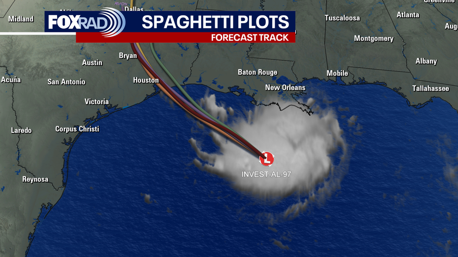
A developing tropical low is moving west-northwest across the Gulf. It could become a short-lived tropical depression or storm before nearing the Upper Texas Coast on Tuesday.
Wet Tuesday ahead
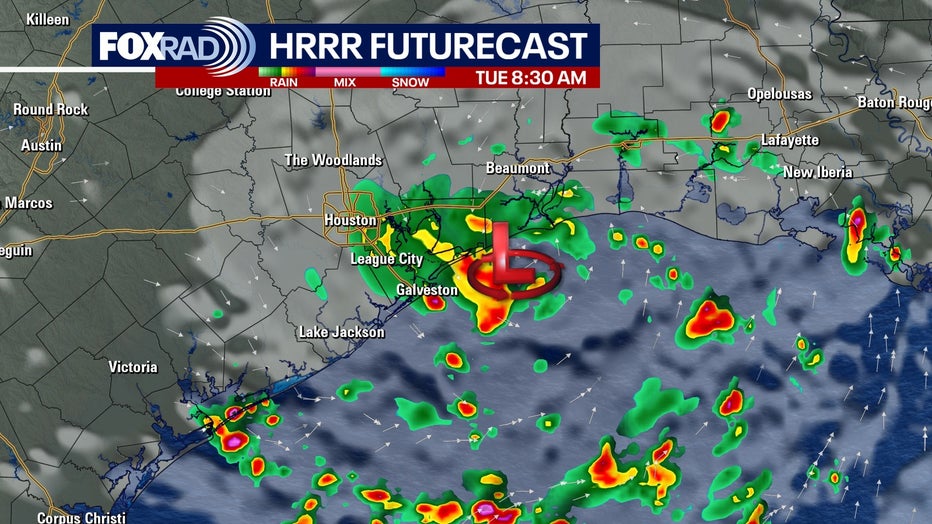
The system is expected to make landfall near Galveston Tuesday, bringing widespread showers and storms.
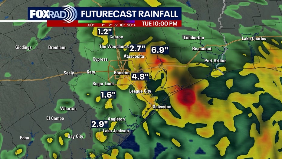
Heavy downpours could lead to street flooding, especially near and east of Houston.
Rain is the main risk
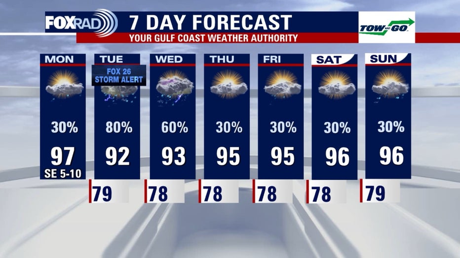
Heavy rainfall and localized flooding will be the biggest concern. Some gusty winds are possible near the coast and east of the center, but widespread damaging wind impacts are not expected.
The Source: Your Gulf Coast Weather Authority