

Houston weather: Warming trend following Thursday Thunderstorm Watch
HOUSTON - Stay up-to-date on the latest weather where you live by downloading the free FOX Local app.
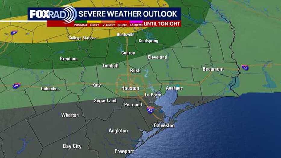
Complicated storm setup in Texas today
Strong storms from the DFW area early today and some of the leftover energy have sparked late-day storms for our area.
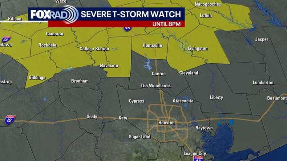
A Severe Thunderstorm Watch remains in effect until 8 PM that includes Grimes, Walker, San Jacinto, Polk and Trinity counties. A few of these storms will be capable of damaging winds near 60 miles per hour, large hail, frequent lightning and very heavy rain.
The best chance for storms should stay north of Houston, so just stay weather-aware with FOX Local. Otherwise, expect a warm and humid evening with temps overnight dropping to the 70s.
Warming trend kicks in
Afternoon highs will rise from the mid 80s today to near 90 this weekend.
The nice part is that both Saturday and Sunday look mostly sunny. Don't forget sunscreen because the late April sun is equal in intensity to the late August sun.
As temperatures heat up this weekend, rain chances go all the way down to 10%. This means plenty of dry time for your beach and pool plans.
Storms possible next week
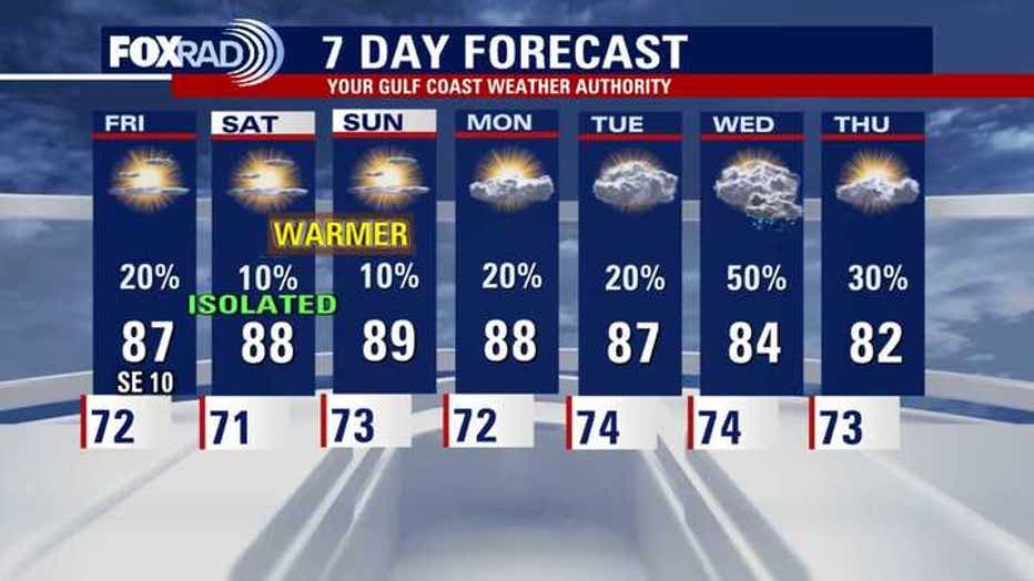
Keep an eye on the middle of next week as both the American GFS model and the Euro are showing stormy weather potential on Wednesday. We'll keep you updated if the timing changes.

Houston weather: Strong Thursday storms up north, followed by warming trend
Severe Thunderstorm Watch remains in effect until 8 PM that includes Grimes, Walker, San Jacinto, Polk and Trinity counties.
The Source: The information in this article comes from the FOX 26 Weather Team.