

Houston weather: Warm afternoons, pleasant nights on the way for the next few days
WARM AFTERNOONS AND PLEASANT NIGHTS
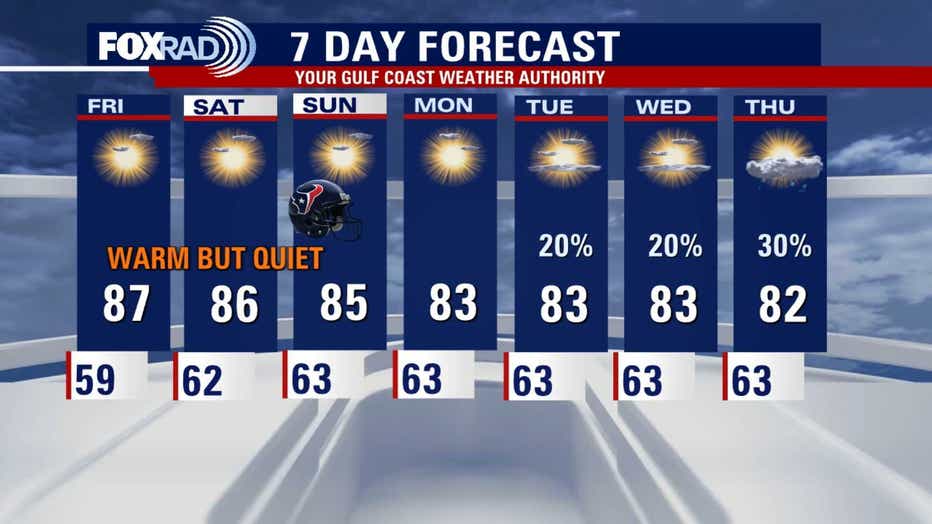
HOUSTON - After another pleasant morning in the 50s & 60s Friday, we'll warm into the mid to upper 80s for the afternoon, with low 80s near the coast under plenty of sunshine. Ragweed pollen is running high, so allergy sufferers take note. An Air Quality Alert, aka Ozone Action Day, is in
effect through Thursday evening. The alert is not major and is mainly a caution for those with heart and lung conditions to limit their time outdoors due to high ozone levels.
AWESOME WEEKEND
The weekend looks great with warm highs, dry air, and minimal rain chances: Mid to upper 80s Saturday, mid 80s Sunday are likely with just a few clouds. Mornings stay mild in the low to mid 60s, so it is looking great for your Texans tailgate.
WATCHING HALLOWEEN RAIN CHANCES
Showers will return next week ahead of another weak front, with rain chances climbing by next Friday into Halloween Saturday. It is still too early to nail down trick-or-treat timing, so stay tuned. For now, the highest chance for storms appears to be Friday, but we'll adjust the outlook as we get closer.
POST-TROPICAL CYCLONE JOSEPHINE IN THE ATLANTIC
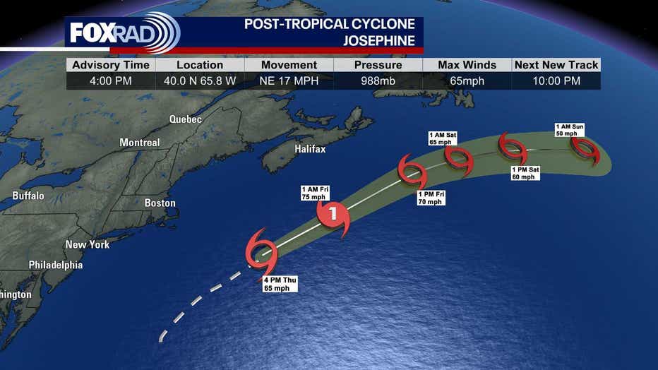
Subtropical Cyclone Josephine in the Western Atlantic has become Post-Tropical but is still packing strong winds. It is still bringing the threat for some minor coastal flooding and gusty winds to parts of the Northeast United States but is moving away quickly. The rest of the Atlantic basin continues to be quiet, with nothing tropical expected in the Gulf for at least a week.
The Source: Information from Your Gulf Coast Weather Authority Team